Showing posts with label Kayaking. Show all posts

19 March, 2017

Paddling the Barwon - Part 1

Several times over the years, I have been asked for advice on paddling on the Barwon; what are the conditions like? Where are the best spots to paddle? Where to launch? How deep/shallow is the water? So I thought it might be a good idea to give a brief description of the sections I have paddled to date and to add a few photos for demonstration purposes.
Before paddling however, it is worth knowing what conditions are like on the day. Below is a table listing some potentially helpful websites:

Information:
paddling conditions (Inverleigh to Barwon Heads)
rapid grades (if any)
current river heights
some river access points
safety information including weather conditions, fire danger
estimated paddle times*
tips on safe paddling practises
Weather information and river heights
Event details and river closures
Barwon Heads tide times

Victorian duck hunting dates and locations
* paddling times may vary depending on river height in some sections

Over the past four years at one time or another I have paddled most sections of the river from about 1km upstream of Bell's Bridge, Inverleigh, downstream to Barwon Heads. At this point, I have not attempted to paddle further upstream and am not sure how far the river remains navigable by kayak. Below is a brief description of each section I paddled as I have found it at the time.
Inverleigh to Pollocksford
From Bell's Bridge for about 2km downstream to a small weir the river is relatively clear of obstructions and easy to paddle with no rapids.
Above the weir, November, 2014
Below the weir conditions vary, with rocky, reed-lined sections interspersed with long stretches of clear water. During periods of low flow, regular portage is necessary, sometimes for a few hundred metres.
April, 2016
We did not encounter any significant rapids. Higher water levels would reduce the portage required but increase the number and size of rapids encountered (grade II to III according to the Waterways Guide). The guide also estimates a travel time of around 4-5 hours. With low water levels (April, 2016) we took 6 hours to cover the distance from Bell's Bridge to Murgheboluc - around 8km short of Pollocksford.
With the exception of a vaguely-remembered paddle around 30 years ago, I have not paddled the section between Murgheboluc and Pollocksford, but expect it would be similar to the section immediately upstream.
The surrounding countryside is privately-owned farmland with a fringe of eucalypts lining the river.
Pollocksford to Merrawarp Rd
We paddled this section of the river - also with low water levels - in early 2013. Once again there were minimal to no rapids, however there were significant obstructions in the form of several dozen fallen trees which either impeded our progress or required us to carry the 'yaks either over or around them, significantly slowing our pace.
Low water levels downstream of Pollocksford, February, 2013
With higher water levels, many of the trees would be submerged, making for easier paddling, but I imagine some portage would still be required. Water levels varied between ankle-deep shallows and deep sections which were easy to paddle.
Lots of obstructions, February, 2013
I have regularly paddled the lower 2.5km of this section which is an easy paddle with minimal obstructions at any time of year. A further kilometre or more upstream of this is also a relatively easy
paddle, however low water levels do increase the number of obstructions. On the occasion we paddled this stretch we took about six hours to complete the trip.
February, 2013
During periods of low water flow, the river surface at some points can become clogged with Azolla, a surface-growing species of water fern, which can impede paddling. As with the previous section, the surrounding land is privately-owned land which has been cleared for farming purposes.
Azolla bloom above Merrawarp Rd, March, 2015
Merrawarp Rd to Baum's Weir
I have paddled this section of the river many times. Even when the river height is low, this section provides easy paddling with minimal obstructions in the form of fallen trees and branches - many of which are submerged. No portage is required at any stage.
Below Merrawarp Rd, February, 2015
Once again, during periods of low water flow Azolla blooms covering several hundred metres or more may slow paddling speed. As a general rule, I would take about an hour to paddle between the weir and the bridge.
It is not uncommon to see people fishing either from the bank or from kayaks on this section of the river and for some distance upstream of the Merrawarp Rd Bridge. Once again, the land to either side is mostly given to farming, with the Barrabool Hills rising above the south bank as you approach the Geoff Thom Bridge on the Geelong Ring Road.
Under the Barrabool Hills, September, 2014
From this point, the river enters the outskirts of Geelong and bare hills give way to houses and parkland.
Baum's Weir to Fyansford
Between the weir and Fyansford, the river flows over a basalt (bluestone) base and is generally shallow and rocky for a distance of about 1.5km. Much of the water is diverted into the water race constructed for the Barwon Paper Mill in the 1870s. Whilst the mill no longer uses it as a power supply, the water still runs via the race making levels on the river bed too low for convenient paddling at most times.
Bunyip Pool looking upstream, November, 2013
The exception is during periods of flooding when more experienced paddlers often brave the torrent which pours down over the weir and through Buckley Falls in order to ride the rapids. A second smaller weir also dams the flow of the river immediately upstream of the Bunyip Pool.
In flood. Looking upriver from the Bunyip Pool, January, 2011
I have not currently tackled this section, in part because there is pedestrian access along both banks throughout this section which is predominantly parkland.
Fyansford to Breakwater
This section of the river is wide and free of obstructions, its water level being regulated by the breakwater. Above Queen's Park there is little traffic however, below this point and particularly through the "rowing mile" the river is heavily used during much of the year for rowing, water skiing, dragon boating, canoeing and of course kayaking.
The Barwon above Queen's Park, September, 2014
During the summer months the river though Geelong is often closed to the public so that competitive water sports can be conducted. It is advisable to check opening times before paddling to avoid disappointment.

The "rowing mile" September, 2014
I would generally take around 1.5 hours to cover this distance. The land to either side is public property with a walking/cycling track forming a continuous circuit (about 18.5km) around this section of the river. In some sections houses and in others some industrial buildings overlook the river.
Breakwater to Tait's Point
Continuing downriver, portage is necessary to cross the breakwater  or it may be a convenient point to start or finish a paddle. About 1.75km downstream of the break is Goat Island where the river divides briefly around a small piece of land about 250m in length. The island is crossed by the Ovoid Sewer Aqueduct. Built between 1913 and 1916 to carry Geelong's sewage to an outfall at Black Rock, the now decommissioned pipe is in a dangerous state of disrepair and passage underneath - either on land or water - is prohibited, with buoy lines crossing both river channels either side of the aqueduct.
Near the Geelong Water Ski Club, January, 2013
A further 1.75km below the aqueduct are the club rooms of the Geelong Water Ski Club who hold events on this section of the river which may therefore also be subject to closure at certain times.
About 8km downstream of the breakwater is a second break, commonly called the Lower Breakwater for obvious reasons. Portage is necessary here also, however access to the west bank is relatively easy both above and below the break through gaps in the reeds at the river's edge.
River above the Lower Breakwater, January, 2013
From the Lower Break, the river continues through a formed channel for almost 2km before flowing into a branch at the western end of Lake Connewarre. Whilst finding the lake is easy when paddling down river, I recommend using a GPS and marking a waypoint or two at the mouth of the river channel (I do this at home using Google Earth as a guide), to make sure you can find the channel again coming back upstream. There are numerous nooks and crannies which can make finding the river channel quite tricky when heading upriver.
The Lower Breakwater, January, 2013
By this point, the river which at Breakwater flowed through light industrial and semi-rural farmland has become both tidal and saline. The tree cover found above Geelong is mostly absent and thanks to the breakwaters, the river is wider and deeper. Downstream of St Alban's Park, the river channel becomes mostly lined with reeds which block much of the view of the banks to either side. To the left is Reedy Lake which is not naturally accessible from the river and to the right is more farmland.
Below the Lower Break, the river channel is completely reed-lined with swamp to either side.
After entering the channel and the reeds, it is less than a kilometre across the narrow western-most branch of the lake to Tait's Point. The water level in the lake is naturally quite shallow in places depending on tides, meaning some portage through shallow water may be unavoidable. The lake bed is soft and muddy which further complicates the issue. I have it on good authority however, that a seal was seen as far upriver as the Lower Break, meaning that it is - under some circumstances at least - possible to cross the lake without resorting to lugging your vessel. In total I take about 3 hours to paddle this section.
Approaching Tait's Point, February, 2015
This part of the river also includes both the Lake Connewarre Wildlife Reserve and the Lake Connewarre State Game Reserve, meaning that game hunting is allowed along some parts of the river, Reedy Lake, Hospital Swamp and Lake Connewarre during duck hunting season (generally from the 3rd Saturday in March to the 3rd Saturday in June).
Tait's Point to Barwon Heads
The lowest section of the Barwon is quite different to the upper reaches, being a marine environment, with quite different bird life in evidence. Between Tait's Point and the river channel at the south east corner of the lake, the water level continues to be quite shallow in places.
Lake Connewarre, February, 2015
Where the lake flows once again into the river, there are numerous sandbars and small channels which make it difficult at ground level to see which is the correct path to take. Once again I would suggest pre-loading some waypoints into a GPS device to make it easier to find the river mouth at the bottom end of the lake.
Sandbar near the bottom of Lake Connewarre, February, 2015
Once back in the channel, the land to either side is flat, swampy and saline and the banks are increasingly lined with mangroves, however there are no obstructions and the water level is suitable for paddling. See also the above comments about duck hunting season.
Mangroves on the bank, October, 2014
More of a concern along this length of the river can be tide and wind conditions which can make paddling in either direction hard work. Check weather reports prior to going out.
Closer to Barwon Heads, there will be increased traffic as this part of the river is popular with those fishing from small motor boats and with occasional jet skiers. Once past the boat ramp on River Parade, there are channel markers along the river for the boating traffic. Outside the channel, the river rapidly becomes too shallow even for kayaks, with sandbars and mudflats blocking passage, particularly at low tide.
Once at Barwon Heads (a trip of around 2.75 hours), whilst it is possible to paddle past the bridge, caution should be exercised as the current can be strong, particularly with an outgoing tide. As you approach the river mouth, the water can also be quite choppy in windy weather.
Barwon Heads Bridge, October, 2014
In the second part to this post is a list of access points from which small craft such as kayaks and canoes can be launched. The post can be found at Paddling the Barwon - Part 2.


27 January, 2017

A nice day for a paddle

For the first time in a while, I dragged out the kayak and headed upstream to a part of the river I have not visited too frequently over the past four years. A small group of us hit the water at Merrawarp Rd in Ceres and headed upstream for a distance of about 5km. The first 2km was fairly plain sailing - well, paddling - and I have done it many times.
Thereafter things became a little more complicated, with a number of obstructions - mostly fallen trees - and a short section of rocky rapids which hardly warranted the name, but still required some portage on the way upstream.
Negotiating the "rapids" on the way upstream
A little unusually for this time of year, water levels were higher than on my previous visits, which made life significantly easier than in the past. As always, the birds were abundant and the weather was perfect for paddling; mild with no breeze to speak of in the early stages.
As I was with a group (and as it turned out, short of batteries), most of the photos were of the scenic landscape variety but nonetheless, provide a picture of a section of the Barwon not seen by most of us.


09 May, 2016

An Inverleigh Odyssey

This post is an opportunity to show some photos of a part of the Barwon River that not many people other than neighbouring property owners get to see.
Thirty years or so ago, I paddled down the Barwon River from Inverleigh to Pollocksford with my father, brother and a school friend. I remember it taking quite a bit longer than expected. The overly optimistic aim had been to reach Geelong, but it soon became apparent that this wasn't going to happen. I have vague memories of rapids, several near misses, one capsize (not me), some tricky portage and a looming old building set on a high point on the north bank of the river. I'd always wondered what it was.
Fast forward a few decades and with my trusty kayak in tow it was time to repeat my voyage down the Barwon from Inverleigh. Thanks to my blog research, I now knew exactly what the old building was and was keen to take a closer look. With perfect weather for a paddle, we (hubby and I) took to the water a little below Bell's Bridge at Inverleigh and headed down river.
Looking upriver to the confluence of the Barwon (left) and Leigh (right) Rivers
Barwon River about 1km below the confluence with the Leigh River
This first section as I already knew was an easy, unobstructed paddle to the confluence of the Barwon and Leigh Rivers and from there, a further 1km of clear, easy to navigate water to a small weir. From this point, things get trickier and are very dependent on the water level. When we paddled this stretch in the 1980s, there was some portage involved as well as rapids and some reasonably fast-flowing water, however this time the water level was significantly lower, meaning there were no rapids to paddle through and significantly more portage.
Section of columnar basalt near the riverbank, formed as lava cooled and
contracted causing fracture lines, probably around 2-3 million years ago
And the portage began below the weir with a roughly 1.5km section which was in general very shallow and contained lots of obstructions (mainly rocks and reeds), meaning long sections of portage or dragging through calf-deep water on slippery rocks, interspersed with short paddled sections of no more than 100m or so - if that. This would probably be easier with higher water levels, but would also involve rapids.
Looking downriver below the weir
Below the weir
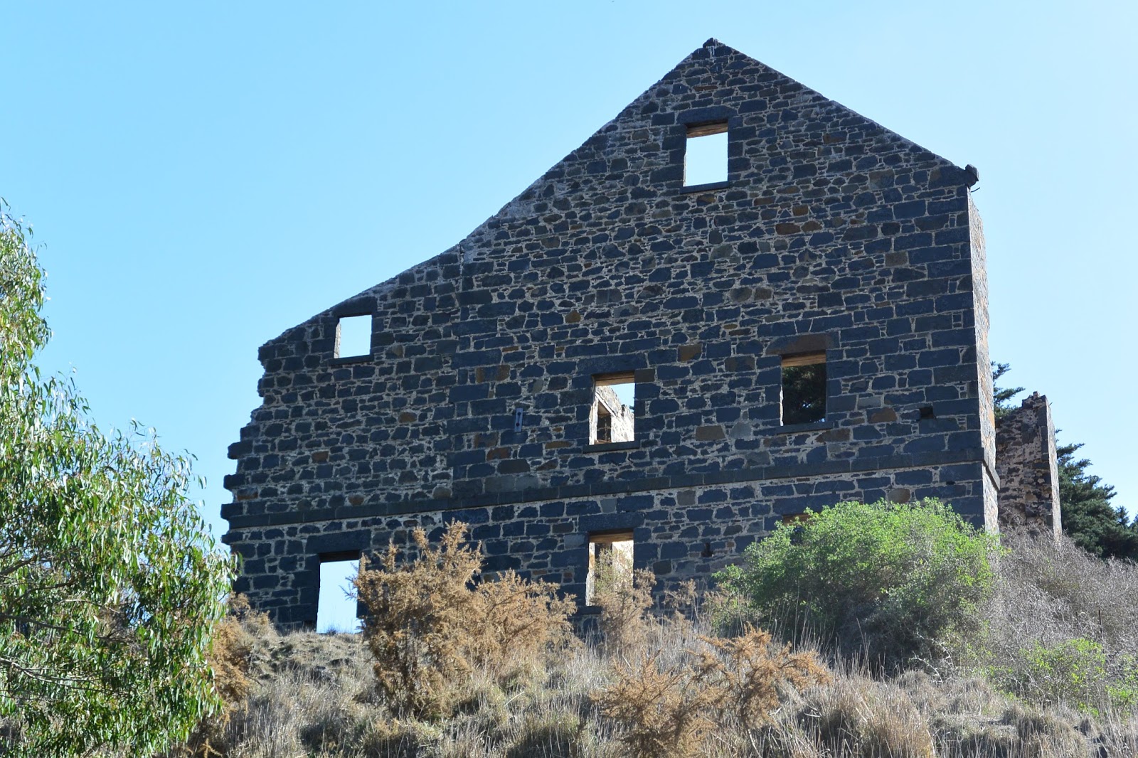
This led us to a relatively impenetrable section where we were required to drag up the bank and re-enter below down a steep-ish embankment through scrub. By that point however, we were in a wide pool situated immediately below the large building I'd remembered from my previous paddle. The building was of course - as discussed in my previous post - the old Carrah Flour Mill, built in the 1850s by Dr Robert Hope.
Looking across the river to the ruins of the Carrah Flour Mill
Carrah Mill from water level
From here, the river opened out into a wide, deep and easily paddled section for about 3.5km during which time it flowed north easterly down a long loop. There was little in the way of obstructions which made paddling simple.
Looking downstream below the mill
 At one extreme of the long loop was the confluence of the Barwon with Native Hut Creek, after which the river flowed around a sharp bend and back again to the south west.
The confluence of Native Hut Creek and the Barwon River, looking north
Below Native Hut Creek
Next it was back to another extended section of portage and rock-hopping between pools for around 1.5km before another navigable section of several hundred metres, then more portage, more paddling and so on for around 7.5km.
Some sections were easy
 Today, the land to either side is open grazing country, although current weather conditions and lack of rain means that the surrounding countryside is also very dry.
Grazing land, but not much feed to be found
More rocks...
...and more reeds...
Eventually, after around 16km of paddling and hundreds of metres of dragging over and around rocks, reeds and other obstructions and with the sun getting a little low for photography, we decided to call it quits at Murgheboluc and summon reinforcements to collect us. This was definitely a one way paddle!
Hubby taking his 'yak for a drag
It was also plan B. Our initial aim (which we knew was probably ambitious given the low water levels), was to push on all the way to the Pollocksford Bridge, however after six hours and what looked to be a significant amount of portage still ahead, we opted to stop at the access road which runs down to the river opposite the Murgheboluc recreation reserve.
A pretty pool before a large obstruction
By this stage, the river was quite overgrown and fortunately I'd thought to take a waypoint (GPS position) marking the location of the exit we needed. This was definitely a good idea as the bank at this point was relatively high meaning that the track was not visible from the riverbed.
Murgheboluc access track - like the sign at the road says "Please shut the gate"!
So all that remains now is to "paddle" a further 8km section of river from Murgheboluc to Pollocksford which promises to be similar to that immediately upriver. Hopefully this will happen sooner rather than later and more photos will be forthcoming in the near future. Whilst low water levels made hard work of this stretch of the river, it was still possible to get from start to finish, however it would certainly be quicker with higher river levels.

27 September, 2015

An Expedition

The weather yesterday was fine with only a light breeze, so I decided it was time to dust off the kayak and hit the water for the first time this season. My intended destination was a point a kilometre or so further upriver than where I normally paddle to as there were a couple of new geocaches which had popped up over the winter months which I wanted to go and find.
I knew I was going to have to get myself around/over a reasonably significant tree trunk to get there (which is why I usually stop where I do) and hoped I wasn't in for a swim. As usual, I headed up from Baum's Weir and passed a fisherman I have seen a number of times before. Being spring, the birds were out in force (I counted 32 different species throughout the course of my paddle) and lots of nesting was happening. I have no idea how, but I even managed to spot this Tawny Frogmouth sitting on a nest over the water about a kilometre upstream from Merrawarp Road.

A nesting Tawny Frogmouth
I made it to the obstruction  in question and despite reports it was possible to get past without exiting my craft, decided the easiest option was to drag over in knee-deep water. I manage that no problem and was off again to deal with a patch of Azolla which was almost impenetrable! I'm hoping by summer when it will no doubt take over huge tracts of the river downstream, that it won't be quite as lush as this patch or paddling will be almost impossible. By the time I made it through I was so busy picking bits of it out of my hair that I didn't think to take a photo.
From there, I had clear water for another kilometre or so, passing the usual array of partially-submerged trees and branches.
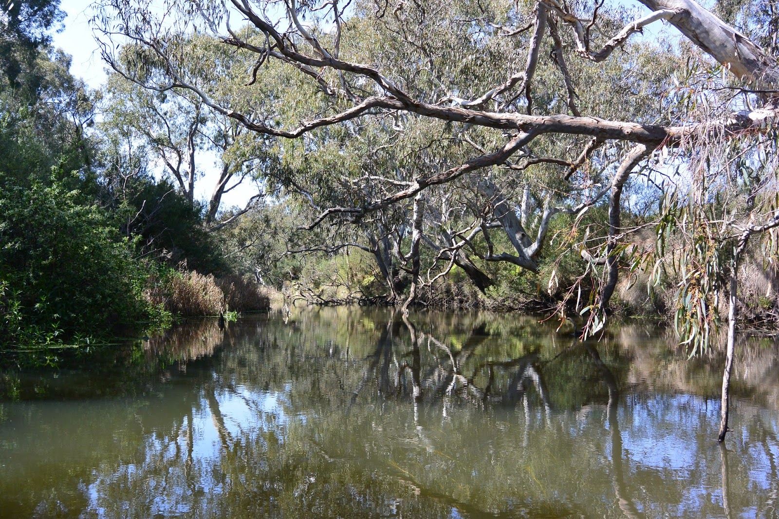
The Barwon above Merrawarp Road
Eventually, I hit some fairly fast-flowing water which I had to navigate round. The previous time I was on this part of the river I was heading downstream and the water level was lower so, possibly it wasn't moving so quickly. This also happened to be the point at which I needed to find the second "cache" so after a little "portage", I made it to my destination and located the prize.
The river above this point didn't look like it was going to be any easier and I still had more than 9km to paddle back to where I started, so I turned around and contemplated my next move. I decided I'd take the quick route out - ie through the small rapids - and managed to pull it off without a dunking, but that was more good luck than good planning. It didn't look like much, but I wasn't surprised that the speed and volume were enough to push me around whether I liked it or not.
Back in calmer waters, I headed back down to do battle with the Azolla once again. As with the section below this part, there are some very pretty spots along here and the birds continued to appear.
No rapids to contend with here!
When I spotted what I hoped was a Grey Goshawk, but turned out to be a brown instead, I decided it was time to stop for lunch. I spent the next half hour trying unsuccessfully to get a photo of the bird in question as it in turn tried to encourage me to leave by flying around and calling regularly.
In the end, I ran out of time and departed with only a few blurry snaps, but did get some reasonable shots of it nearby nest.
Brown Goshawk nest
From there it wasn't too far back to the Azolla patch and the tree, which I had to contend with once again, via some more of the usual scenery.

More water, more trees and more reflections
Strangely, when I did reach the fallen tree, I was surprised to find it had been sawn half through, at which point it had broken. It was a fresh cut (I could smell the sawdust) and I'm quite certain I would have noticed if this had been the case when I went upriver two hours earlier. There was no sign of whoever had done the cutting and I'm not sure what the purpose was as it still blocks the river. It did mean however, that I could (just) squeeze under and through some of the upper branches to get past which was good as I could no longer find the low point at which I had climbed over on my way up.
Slightly downstream near the second cache I needed to find, I also found the path I had taken on my way up (the same route I always follow) was now blocked by a small logjam which I am certain was not there when I passed earlier. Odd.
I carted around - noting footprints on the bank - grabbed the second cache and was on my way home, somewhat puzzled, but none-the-less pleased with the day's adventure.