27 September, 2015

An Expedition

The weather yesterday was fine with only a light breeze, so I decided it was time to dust off the kayak and hit the water for the first time this season. My intended destination was a point a kilometre or so further upriver than where I normally paddle to as there were a couple of new geocaches which had popped up over the winter months which I wanted to go and find.
I knew I was going to have to get myself around/over a reasonably significant tree trunk to get there (which is why I usually stop where I do) and hoped I wasn't in for a swim. As usual, I headed up from Baum's Weir and passed a fisherman I have seen a number of times before. Being spring, the birds were out in force (I counted 32 different species throughout the course of my paddle) and lots of nesting was happening. I have no idea how, but I even managed to spot this Tawny Frogmouth sitting on a nest over the water about a kilometre upstream from Merrawarp Road.

A nesting Tawny Frogmouth
I made it to the obstruction  in question and despite reports it was possible to get past without exiting my craft, decided the easiest option was to drag over in knee-deep water. I manage that no problem and was off again to deal with a patch of Azolla which was almost impenetrable! I'm hoping by summer when it will no doubt take over huge tracts of the river downstream, that it won't be quite as lush as this patch or paddling will be almost impossible. By the time I made it through I was so busy picking bits of it out of my hair that I didn't think to take a photo.
From there, I had clear water for another kilometre or so, passing the usual array of partially-submerged trees and branches.
The Barwon above Merrawarp Road
Eventually, I hit some fairly fast-flowing water which I had to navigate round. The previous time I was on this part of the river I was heading downstream and the water level was lower so, possibly it wasn't moving so quickly. This also happened to be the point at which I needed to find the second "cache" so after a little "portage", I made it to my destination and located the prize.
The river above this point didn't look like it was going to be any easier and I still had more than 9km to paddle back to where I started, so I turned around and contemplated my next move. I decided I'd take the quick route out - ie through the small rapids - and managed to pull it off without a dunking, but that was more good luck than good planning. It didn't look like much, but I wasn't surprised that the speed and volume were enough to push me around whether I liked it or not.
Back in calmer waters, I headed back down to do battle with the Azolla once again. As with the section below this part, there are some very pretty spots along here and the birds continued to appear.
No rapids to contend with here!
When I spotted what I hoped was a Grey Goshawk, but turned out to be a brown instead, I decided it was time to stop for lunch. I spent the next half hour trying unsuccessfully to get a photo of the bird in question as it in turn tried to encourage me to leave by flying around and calling regularly.
In the end, I ran out of time and departed with only a few blurry snaps, but did get some reasonable shots of it nearby nest.
Brown Goshawk nest
From there it wasn't too far back to the Azolla patch and the tree, which I had to contend with once again, via some more of the usual scenery.

More water, more trees and more reflections
Strangely, when I did reach the fallen tree, I was surprised to find it had been sawn half through, at which point it had broken. It was a fresh cut (I could smell the sawdust) and I'm quite certain I would have noticed if this had been the case when I went upriver two hours earlier. There was no sign of whoever had done the cutting and I'm not sure what the purpose was as it still blocks the river. It did mean however, that I could (just) squeeze under and through some of the upper branches to get past which was good as I could no longer find the low point at which I had climbed over on my way up.
Slightly downstream near the second cache I needed to find, I also found the path I had taken on my way up (the same route I always follow) was now blocked by a small logjam which I am certain was not there when I passed earlier. Odd.
I carted around - noting footprints on the bank - grabbed the second cache and was on my way home, somewhat puzzled, but none-the-less pleased with the day's adventure.

23 September, 2015

Branching out - silting up

On 1st July, 1851 two things occurred which changed the face of the Barwon catchment forever. On that date, Victoria was declared a separate colony from New South Wales and gold was discovered at Clunes on Creswick Creek, a tributary of the Lodden River. Five days later, James Esmond arrived in Geelong with samples of the gold found by himself and his two companions. Two days after that, the Geelong Advertiser published the news. By the end of the month, the Victorian gold rush had begun.
The first gold discovery in the Barwon catchment occurred only weeks after the initial discovery at Clunes on 8th August.
Information board near the site of Hiscock's first gold
discovery, situated roughly opposite the Buninyong Cemetery.
On that day, Thomas Hiscock - a blacksmith who had migrated from England ten years before - discovered gold in a gully which now bears his name, in the Buninyong Ranges west of the town.
Like the many creeks and gullies in the area, Hiscock's Gully ultimately drains into the Yarrowee/Leigh River and empties into the Barwon River at Inverleigh.

A memorial erected some distance to the east of the above
sign and which commemorates Hiscock's discovery
Ten days later, gold was also discovered at Poverty Point, Ballarat, on the banks of Canadian Creek only a few hundred metres from its confluence with the Yarrowee River. Within a matter of months around 20,000 hopeful prospectors had flocked to the region to work the easily accessible alluvial deposits.
Sign describing the first Ballarat gold discovery and
subsequent events
This initial rush was followed in subsequent years by the arrival of the big mining companies with the heavy equipment used to mine the deeper quartz reefs of the district. This saw excavation along the Leigh/Yarrowee, extend downstream past Garibaldi to the Leigh Grand Junction and beyond. 
The impact on the river and the creeks and gullies which flow into it was profound. The initial alluvial mining saw a significant reduction in the native vegetation as trees were cleared to make way for mining exploits or harvested for use in construction of the necessary infrastructure. Across the upper part of the catchment, the miners dug into the banks of the waterways, diverted water flows and turned over the soils of the creeks and river flats of the catchment. As they worked, large piles of discarded timber from felled trees washed downstream, causing logjams and impeding water flow. At the same time tonnes of rock and soil were displaced, leaving huge piles of tailings or mullock heaps littering the landscape.
Consequently, as early as the 1860s, the finer sediments from these deposits began to wash into the waterways and make their way into the Yarrowee River before working their way downstream towards the Barwon. On 29th October, 1869 a correspondent to the Geelong Advertiser wrote that:
For a number of years residents on and near the banks of the [Leigh River], and also those on that part of the Barwon below Inverleigh, have quietly looked upon their lands becoming impoverished by the settlement of silt upon them. The effect of the late flood, however, places the matter in a very serious light, and calls for immediate action. Beautiful flats of rich black soil have been converted into beds of clay, and that of the very worst description. Farms that a few years ago would have been suitable for the most exhaustive crops, are now rendered by the accumulation of sludge unfit for the production of grass....The bed of the river is rapidly filling up, consequently such floods must be more frequent and more disastrous.
By 1906 a Sludge Abatement Board had been established to monitor the water quality of rivers and was being called upon to address the complaints of the shires downstream on the Leigh which continued to bear the brunt of the problem. The sludge could be anywhere from about 45 - 180cm thick, with the largest deposits occurring on river bends. As the sediment flowed downstream and filled in pools and hollows, the rate of flow and the volume of the channel would also have decreased.
This image of the Yarrowee Dredging Co mine, 1889 (possibly the Yarrowee
Creek No 1 Gold Dredging Co) shows the degree of deforestation and erosion
caused by mining activity along the river. Image held by the
State Library of Victoria
In recent years, reports commissioned by the Corangamite Catchment Management Authority have confirmed what was evident 150 years ago. Modern understanding of the way vegetation affects hydrology, has also revealed the role deforestation must have played in increasing the quantity and rate at which runoff water entered the river. Today, the silts which were deposited after the beginning of the gold rush are referred to as Post Mining Alluvium and form the surface layer of soil in the area around Shelford and Inverleigh.
Meanwhile over on the Moorabool River, gold was also the order of the day, although the discovery and subsequent mining boom was a little later in coming. Gold was first discovered on the Durdidwarrah property of Augustus von Stieglitz in 1851, however the quantities were not considered workable. Some activity ensued in 1853 when Andrew Love and George Morton discovered alluvial gold on Sutherland's Creek, however, it was not until 1855 when William Hooley and Joseph Davis discovered a gold reef on Sutherland's Creek near Steiglitz that the rush really began.
From 1855 onwards, alluvial gold was extracted at various creeks and gullies along the Moorabool River including Sutherland's Creek, Dolly's Creek, Tea Tree Creek, Mt Doran, the Stony Rises (Elaine) and from the banks of the Moorabool itself at Morrison's however it was not until the 1860s that the large companies moved in and reef mining began in earnest.
The remaining brick footings of the United Albion Mine near Steiglitz
It seems however that the threat of a sludge deluge such as that seen on the Leigh, was not as much of an issue for the Moorabool River. Perhaps this is a reflection of the relatively greater proportion of reef mining in comparison to alluvial activity on the Moorabool.
It is interesting to note that a 2006 report commissioned for the Corangamite Catchment Management Authority showed that despite the greater water flow of the Barwon and the historic issues of increased sedimentation due to mining activities along the Leigh, it is the Moorabool which makes the greatest contribution to sediment deposited downstream at Lake Connewarre. There is no indication that this is related to earlier mining activities, instead it is postulated that the greater overall change in gradient along its length (by comparison with the Barwon and the Leigh) may account for the difference.

06 September, 2015

Branching out - Bowman's Bridge

During the course of my recent research into all things bridge-related, I came across a couple of bridges which, whilst no doubt important in their day, have now fallen into disuse, as have the sections of road on which they were built. Both are now private property, however I was lucky enough (along with local historian Marg Cooper and my mother) to gain access to one of the bridge sites to see what remained.
The site in question was Bowman's Bridge, a small, timber and masonry structure which crossed the steep-sided channel of Deep Creek - a tributary of the Leigh River at Bamganie. Deep Creek is a short creek, measuring about 6.5km in length which rises beside Bamganie Road, about 5km south of its intersection with the Meredith-Mt Mercer Road then follows a southerly course to its confluence with the Leigh River a few hundred metres upstream from where Woodbourne/Williamson's Creek also joins the Leigh.
View of Deep Creek a few hundred metres below the bridge
With permission gained prior to starting, a short wander across the fields brought us to the banks of the creek which, we agreed showed signs of significant water flow in the past, but at present, like many creeks in the area, contains only intermittent pools of water. We had been warned by the property owner, that there wasn't much of the bridge left to see and only knew roughly where to look, however we did know that the old road which ran to the bridge began at Bamganie Road beside the one time site of the Bamganie State School and traveled directly west, crossing Deep Creek but stopping short of the Leigh River.
Called Bowman's Road for several members of the Bowman family who had taken up land between Deep Creek and the Leigh River, it provided access for the family who came and went via the road, crossing Bowman's Bridge in the process and for their children who walked to school along the same path. After reaching the creek, we walked upstream only a short distance before we spied a large pile of rocks on the bank which clearly had not ended up there by chance.
The site of Bowman's Bridge
A little further investigation convinced us that we had found the relatively intact remains of the bridge's eastern abutment - a masonry structure formed from local uncut stones, cemented together and supported by a raised embankment.
The remains of the eastern abutment
The bank on the opposite side of the creek also showed signs of where the bridge had been. There was no trace of masonry, however we did find timbers with large bolts attached and it was clear that the bank - which was quite a bit higher on this side - had been carved away to make a cutting which brought the roadway on the western side, level with the bridge.
Burnt timbers with rusted bolts, originally part of the bridge
Whilst there is little remaining, it is possible to trace the history of the bridge through the newspapers of the day. The initial contract to build a small bridge on the site was awarded to W Watson in June, 1876 for a price of £11/15/-. Problems soon emerged however when it was brought to council's attention three years later that the western approach to the bridge was too steep and slippery for horses to keep their footing. By October, a cutting had been formed to ease the situation, however it was reported to council that the work of  Hugh McColl was not up to the required standard.
The cutting on the western approach to Bowman's Bridge
As was usual with timber bridges, over the following thirty years, Bowman's Bridge required ongoing maintenance. In 1903, J Elliott was awarded a contract for £2/19/6 to fix it and in 1908 it was suggested that timber from a disused bridge near the old post office could be used*. In October, 1913 the Meredith Shire engineer (CCP Wilson) declared that Bowman's Bridge was in such a poor state, it was almost beyond repair, but that good timber from recently-replaced Cooper's Bridge over the Moorabool River could be used to reconstruct it.
The repairs (if they eventuated), were only temporary and by early 1914, the shire was calling for tenders to replace the bridge. There seems to have been few takers for the job however, as tenders were set to be called once again in March, 1915. Finally, the following month, the council accepted the tender of William Smith to erect a timber bridge on Bowman's Road for £75. At this point, as with my previous posts, the trail goes cold, however I can only assume since the tender was accepted, that the bridge was rebuilt at this time, meaning the remains now visible date from that period.
The view looking east from the cutting
What I don't know is, regardless of whether the bridge was rebuilt or not, how long it stood for or when Bowman's Road was finally closed to the public.

*A post office first opened in Bamganie in 1877 amidst significant public demand, at (as far as I can tell), the original site of the primary school off Glentive Road which crosses Woodbourne Creek nearby. The timber may have come from a bridge at this crossing.

02 September, 2015

Branching out - The Garibaldi Bridge

My previous post illustrated the changes in materials used over the last century and beyond to patch and repair existing bridges in order to extend their useful lifespan. This has resulted in many bridges in the Barwon catchment region becoming hybrids, neither timber nor steel, concrete nor stone, but in many cases, a combination of different building materials.
Another great example of this type of evolving bridge, is the old bridge (now replaced by a modern concrete structure) across the Yarrowee/Leigh River on the Buninyong-Mt Mercer Road at Garibaldi. According to the media of the day, the foundation stone for the original bridge was laid in November, 1866 amidst much fanfare by the Buninyong Shire President Mr WH Bacchus. The region he declared, was in urgent need of a bridge as three people had lost their lives in recent years, attempting to ford the river during floods. The president was presented with an inscribed, silver trowel which he used to lay the stone along with a time capsule containing issues of several local newspapers and "a document in reference to the constitution of the shire, and the various coins of the realm". Once the president had declared the stone "well and truly laid", the company retired to the nearby Garibaldi Hotel where luncheon was laid on for 50 invited guests, with a keg of beer also provided for members of the local community. November, 2016 will mark the 150th anniversary of this event.
The old Garibaldi Bridge today
Less than a year later in April, 1867, under the name of the Durham Bridge, the new structure was officially opened. Disappointment was expressed at the event (which also included speeches, toasts and another luncheon) at the small number present to mark the occasion.
I can find no image of the bridge in its original (or any) form which shows its exact construction, but at the time of its opening, the bridge was described as measuring 100 ft in length and including three spans of 33 ft each, secured at each end by bluestone ashlar abutments and in the centre by two stone buttresses (pillars). The wooden deck was supported within each span by spandrels atop rows of 7 corbels resting on the stonework of each abutment or buttress and - it was proudly claimed - stood 6 ft clear of the highest recorded flood mark. The total cost of construction was £2,699.
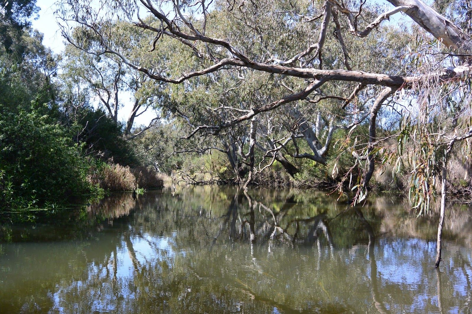
Looking upriver from the bridge, August, 2015
The first real test of the new structure came barely two years later in 1869 when the Yarrowee flooded, leaving large parts of Ballarat under water. It is a testament to the strength of stone bridges, that there is no further mention of the bridge throughout the remainder of the 19th century and this despite regular reports of substantial flooding over the years. In fact it seems that substantial maintenance was not required until December, 1914 when then shire engineer CCP Wilson reported that the bridge superstructure had been removed and the masonry prepared for replacement of the deck with a concrete structure. Interestingly, although they may not have foreseen the development of concrete in the construction of bridges, the original stonework was built in 1867 with a view to the future replacement of the timber structures with masonry.
These repairs it would seem stood for a further 19 years until December, 1933 when the Yarrowee/Leigh River experienced substantial flooding - the largest it was claimed in 50 years. Over the course of three days from 30th November to the 2nd December, catchments across the region were deluged, causing the bridge to collapse, washing away two of the three spans.
One abutment and parts of the deck of the Garibaldi Bridge washed away
during the 1933 floods. Image held by the Federation University Australia's
EJ Barker Library
Remains of the Garibaldi Bridge during the 1933 floods. Image held by the
Federation University Historical Collection
So great was the destruction across parts of the state that it was beyond the capacity of many municipalities to pay for the damage. This was certainly the case for Buninyong Shire which along with other shires sent a delegation to wait upon the minister to plead their case for funds. On this occasion, the government declined to offer flood relief for the affected shires. Buninyong looked at taking out a loan or applying for grants to cover their costs.
The Garibaldi Bridge, 2015 looking to the south east
Early estimates indicated that it would cost in the vicinity of £1,750 to repair the damage to the Garibaldi Bridge, however in March the following year, engineer Wilson stated that the job could be done for £1,000 - possibly less. The following month, approval was granted to purchase the necessary materials to complete the reconstruction.
It is perhaps this sequence of events and the need to economise which lead to the evolution of the bridge as we see it today. The deck appears to me to be narrower than the original structure of which, only one stone abutment, one buttress and the stone parapets remain. The other buttress and the southern abutment have been reconstructed in concrete as has the deck which is supported across two of its spans by concrete corbels. The span at the northern end of the bridge however, is not the same as the other two and seems to have been repaired in a different style and perhaps at a different time - although I can find no record of this.
The central and northern spans of the bridge, looking south west
The handrails which top the deck are typical of the water pipe and cyclone wire constructions used by CCP Wilson on other projects and the overall structure is not dissimilar to the Blue Bridge on the Yendon-Egerton Road, also repaired by Wilson. These repairs whilst perhaps looking a little unorthodox, have survived the test of time. The bridge carried traffic until as recently as 2007 when the annual report for the Golden Plains Shire for 2006/2007 indicated that a new bridge had been completed (slightly downstream) at a cost of $853,000.
The new Garibaldi Bridge
Today, the original bridge stands disused and largely unnoticed beside the new Garibaldi Bridge.