Showing posts with label Buninyong Shire. Show all posts

22 May, 2016

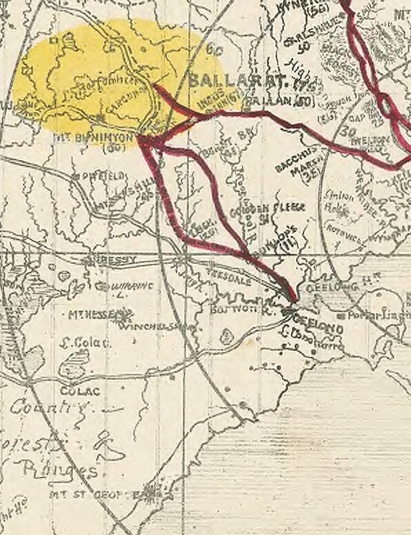
Mapping the Barwon Catchment

Before the arrival of John Batman and his party on the shores of Port Phillip Bay in 1835, the indigenous tribes of the Barwon catchment walked the land, following traditional "songlines" which had evolved over thousands of years. The songs and stories of the many tribes, described the land and the physical pathways they used to cross the countryside, enabling them to navigate long distances, passing safely through unfamiliar territory. I discussed songlines in my previous post.
Europeans on the other hand, saw the land very differently to the indigenous population and used very different navigation techniques. The Europeans too used maps, however they drew their maps on paper, measured distance, calculated elevations and aligned everything according to compass bearings. And they way they travelled was vastly different too. Whilst many still walked, others rode horses and drove bullock drays and it wasn't long before the paths of the songlines became the bullock tracks of the squatters. They in turn were followed by the surveyors with their chains and newfangled theodolites who marked out the roads of the selectors and villagers.
The settlers were also quick to start applying their own mapping techniques to their new surroundings. The squatter's runs were plotted out and the bullock tracks which linked them with the towns which began to pop up, were marked as vague wavy lines.
Section of Surveyor Alexander Skene's 1845 map of the Geelong District
showing early tracks and the names of squatters and early landholders
across the catchment. Original image held by the State Library of Victoria
The more the number of settlers increased however, and the more they extended the boundaries of their settled districts, the more maps were created. Not only did these maps indicate direction and location, but there were also administrative maps, electoral maps, geological maps, maps which indicated individual land ownership (an unfamiliar concept to the indigenous peoples), weather maps and many other types of maps besides. Soon the entire colony had been layered with maps and amongst the earliest of these maps were survey maps.
In order to better administer the vast areas of the new colony, the land was formally divided for the purpose of administering the sale and distribution of land. From the late 1840s until the 1890s, the government progressively undertook a comprehensive survey of the  Colony of Victoria, reclaiming the squatters' leaseholds and breaking up the thousands of acres into village allotments and farm-sized blocks. To aid administration, county boundaries were established and within each county the land was subdivided into civil parishes.
Portion of the Victorian Counties Atlas, 1874, showing those counties which fall
within the Barwon Catchment. Image taken from the State Library of Victoria
Initially, the county boundaries were by necessity ill-defined and changed according to need. The following description from the Geelong Advertiser 17th July, 1841, claiming to give the first official description of Grant County's limits, shows both how they changed over time and - like the Wathaurong whose lands it covered - how the new settlers also used the natural landscape to define boundaries.
The Coast Line from the mouth of the Werriby(sic), Port Phillip, round to a point bearing south of the sources of the Barwon [Barwon Heads]. An imaginary line from that point to the sources of the Barwon [the Otways]. the Barwon from its sources to its junction with the Native Hut Creek. The Native Hut Creek from that junction to the Buninyong and Melbourne road(sic). The line of that road to the Werriby, and The Werriby River to its mouth.
By 1871, the 37 Victorian counties as we know them today were in place. Counties and their accompanying civil parishes were - and still are - used entirely for real estate purposes, enabling the physical description of a piece of land.
Section of 1881 Victorian civil parishes map. Original image held by the
State Library of Victoria
With European settlement came the English system of government. Having been declared a separate colony from New South Wales on 1st July, 1851, Victoria needed to put a government in place, however it was not quite the system we have today. The original Victorian parliament was unicameral - having only one house. Called the Legislative Council, it was composed of 16 electoral districts from which 30 members were chosen. Ten were nominated by the Lieutenant-Governor and 20 were elected from the eligible voting population. To be eligible to vote a person had to be a male British citizen over the age of 21 who paid more than £10 per annum in rent or held the freehold for property valued at more than £100. Once again the colony was mapped and divided. This time for electoral purposes. The Wikipedia map below shows the original electoral districts and I have indicated the general area of the Barwon catchment within the black box.
Electoral districts of the original Victorian Legislative Council, 1851.
Original image from Wikipedia
Within a handful of years however, electoral boundaries were being shuffled and in 1856 a second or lower house - the Legislative Assembly - was introduced, resulting in the system we have today.
State electoral districts for both the upper and lower houses of the Victorian parliament have continued to change in response to the growing population. Today there are 88 electoral districts, each corresponding to a seat in the Legislative Assembly. These are combined into eight districts from which five Legislative Council members are elected, giving a total of 40 members in the upper house.
Current boundaries of the state electoral districts (lower house) which
cover the Barwon catchment. Original image from Wikipedia
In 1901, the cartographic landscape of the Barwon catchment changed once again with the advent of Federation. The Colony of Victoria became the State of Victoria and was divided for the purpose of voting into federal electoral divisions. These were (and still are) different to the electoral districts of the state government. The electorates of Corangamite, Ballarat and Corio are all, at least in part, within the catchment.
Federal seats within the Barwon catchment. Original image from Wikipedia
Of course, beneath the federal and state levels of government is local government. In the 19th century, local government stemmed from the need to raise funds for roads and infrastructure, consequently a series of "road districts" were gazetted across the colony. Within a few years, the road districts were transformed into shires which along with cities and boroughs today make up the various municipal districts of the local government system. Not surprisingly, as with state and federal electorates as well as county and parish boundaries, the banks of the creeks and rivers of the Barwon catchment often formed the boundaries of these early shires too. Also in keeping with other levels of government, the number of municipal districts has changed over the years. For instance, in 1915, the Shire of Meredith was amalgamated with that of Bannockburn.
Country Roads Board map, 1961 showing parish boundaries. Original image held by the
State Library of Victoria
In 1994, sweeping changes saw the amalgamation of many smaller shires and city councils in to a lesser number of much larger shires and cities. Where before the catchment contained perhaps as many as many as 15 shires and cities, after the amalgamations, this number fell to around six.
The outbreak of the Victorian gold rush in August, 1851 also saw a flurry of map making. Every digger wanted to know the best route to get to the diggings. As I have written before, there were claims, counter claims, insults and outright lies hurled back and forth between parties with vested interests in promoting their route to the diggings. Maps could not only be used to inform the general public (as below), but also to deceive as Geelong discovered when interests in Melbourne published a "false map".
The relevant section of a reasonably accurate "Digger's road guide to the gold mines of
Victoria and the country extending 210 miles around Melbourne", 1853. Image taken from
the National Library of Australia
 As well as the topography of the land and the roads and tracks which crossed it, the gold rush led to an intense interest in what lay under the surface of the soil. In 1852 Alfred Selwyn was appointed as Mineral Surveyor for the Geological Survey of Victoria and with one assistant and a tent-keeper, set about completing a comprehensive geological survey of the colony. Soil types were assessed, rock deposits dated and the potential presence of minerals noted. Over the years, the department expanded and exists today under the portfolio of the Department of Energy and Earth Resources in the Department of Economic Development, Jobs, Transport and Resources.
Adaption of the 1909 Geological Survey Map of Victoria. Image held by the
State Library of Victoria
Finally, another topic which has always been of particular interest to those living in the Barwon catchment. Rainfall. How much? How little? When? Where? Once again, the indigenous tribes had intimate knowledge of seasonal changes in climate and climate-dependent resources. The European settlers were equally as interested. They needed to know when to plant their crops and where to find water for their stock in different seasons.
Meteorological recording began in Melbourne as early as 1840 and regular, coordinated data collection began in 1854 with the establishment of the Victorian Meteorological Office. The first official report of rainfall data (I could locate) for Geelong appeared in the Victorian Government Gazette dated 21st August, 1857 for the April-June quarter of that year, although references were made elsewhere to earlier data.
Today, rainfall measurements are taken at various points across the Barwon catchment, including Weeaproinah in the Otways, near the headwaters of the Barwon River which has the highest average rainfall in the state. By contrast, the lowlands along the lower reaches of the Barwon, Leigh and Moorabool Rivers lie in the rain shadow cast by the Otway Ranges and receive a significantly lower annual rainfall.
Overview of long term rainfall averages for the Barwon catchment. Graph taken
from the Australian Bureau of Meteorology
Over the years since European settlement, many maps have been produced for many different reasons, dividing the catchment in a multitude of ways. Maps to direct. Maps to divide. Maps to quantify. Maps to persuade, even maps to deceive...

02 September, 2015

Branching out - The Garibaldi Bridge

My previous post illustrated the changes in materials used over the last century and beyond to patch and repair existing bridges in order to extend their useful lifespan. This has resulted in many bridges in the Barwon catchment region becoming hybrids, neither timber nor steel, concrete nor stone, but in many cases, a combination of different building materials.
Another great example of this type of evolving bridge, is the old bridge (now replaced by a modern concrete structure) across the Yarrowee/Leigh River on the Buninyong-Mt Mercer Road at Garibaldi. According to the media of the day, the foundation stone for the original bridge was laid in November, 1866 amidst much fanfare by the Buninyong Shire President Mr WH Bacchus. The region he declared, was in urgent need of a bridge as three people had lost their lives in recent years, attempting to ford the river during floods. The president was presented with an inscribed, silver trowel which he used to lay the stone along with a time capsule containing issues of several local newspapers and "a document in reference to the constitution of the shire, and the various coins of the realm". Once the president had declared the stone "well and truly laid", the company retired to the nearby Garibaldi Hotel where luncheon was laid on for 50 invited guests, with a keg of beer also provided for members of the local community. November, 2016 will mark the 150th anniversary of this event.
The old Garibaldi Bridge today
Less than a year later in April, 1867, under the name of the Durham Bridge, the new structure was officially opened. Disappointment was expressed at the event (which also included speeches, toasts and another luncheon) at the small number present to mark the occasion.
I can find no image of the bridge in its original (or any) form which shows its exact construction, but at the time of its opening, the bridge was described as measuring 100 ft in length and including three spans of 33 ft each, secured at each end by bluestone ashlar abutments and in the centre by two stone buttresses (pillars). The wooden deck was supported within each span by spandrels atop rows of 7 corbels resting on the stonework of each abutment or buttress and - it was proudly claimed - stood 6 ft clear of the highest recorded flood mark. The total cost of construction was £2,699.
Looking upriver from the bridge, August, 2015
The first real test of the new structure came barely two years later in 1869 when the Yarrowee flooded, leaving large parts of Ballarat under water. It is a testament to the strength of stone bridges, that there is no further mention of the bridge throughout the remainder of the 19th century and this despite regular reports of substantial flooding over the years. In fact it seems that substantial maintenance was not required until December, 1914 when then shire engineer CCP Wilson reported that the bridge superstructure had been removed and the masonry prepared for replacement of the deck with a concrete structure. Interestingly, although they may not have foreseen the development of concrete in the construction of bridges, the original stonework was built in 1867 with a view to the future replacement of the timber structures with masonry.
These repairs it would seem stood for a further 19 years until December, 1933 when the Yarrowee/Leigh River experienced substantial flooding - the largest it was claimed in 50 years. Over the course of three days from 30th November to the 2nd December, catchments across the region were deluged, causing the bridge to collapse, washing away two of the three spans.
One abutment and parts of the deck of the Garibaldi Bridge washed away
during the 1933 floods. Image held by the Federation University Australia's
EJ Barker Library
Remains of the Garibaldi Bridge during the 1933 floods. Image held by the
Federation University Historical Collection
So great was the destruction across parts of the state that it was beyond the capacity of many municipalities to pay for the damage. This was certainly the case for Buninyong Shire which along with other shires sent a delegation to wait upon the minister to plead their case for funds. On this occasion, the government declined to offer flood relief for the affected shires. Buninyong looked at taking out a loan or applying for grants to cover their costs.
The Garibaldi Bridge, 2015 looking to the south east
Early estimates indicated that it would cost in the vicinity of £1,750 to repair the damage to the Garibaldi Bridge, however in March the following year, engineer Wilson stated that the job could be done for £1,000 - possibly less. The following month, approval was granted to purchase the necessary materials to complete the reconstruction.
It is perhaps this sequence of events and the need to economise which lead to the evolution of the bridge as we see it today. The deck appears to me to be narrower than the original structure of which, only one stone abutment, one buttress and the stone parapets remain. The other buttress and the southern abutment have been reconstructed in concrete as has the deck which is supported across two of its spans by concrete corbels. The span at the northern end of the bridge however, is not the same as the other two and seems to have been repaired in a different style and perhaps at a different time - although I can find no record of this.
The central and northern spans of the bridge, looking south west
The handrails which top the deck are typical of the water pipe and cyclone wire constructions used by CCP Wilson on other projects and the overall structure is not dissimilar to the Blue Bridge on the Yendon-Egerton Road, also repaired by Wilson. These repairs whilst perhaps looking a little unorthodox, have survived the test of time. The bridge carried traffic until as recently as 2007 when the annual report for the Golden Plains Shire for 2006/2007 indicated that a new bridge had been completed (slightly downstream) at a cost of $853,000.
The new Garibaldi Bridge
Today, the original bridge stands disused and largely unnoticed beside the new Garibaldi Bridge.

20 August, 2015

...Like son

My previous post highlighted the achievements of Leigh Shire engineer, Charles Anthony Corbett Wilson, however he was not the only engineer in his large family. One of his younger sons - Frederick - was appointed Meredith Shire engineer in 1893, but it was his eldest son Charles Corbett Powell Wilson who arguably went on to have the biggest impact on the infrastructure of the district.
CCP Wilson, was born in Geelong around 1857 and learnt his trade working with his father. Between them, father and son were responsible for the design and construction of dozens of bridges, roads, public buildings and civic facilities across the Western Districts of Victoria in the 19th and early 20th centuries, many of them involving the Barwon River and its tributaries.
Charles Corbett Powell Wilson, shire engineer to Leigh,
Meredith and Buninyong Shires
By the time he arrived in the Barwon catchment region, CCP Wilson already had significant experience in civil engineering, having served as engineer to the Portland Shire from 1889 until 1908. Upon leaving Portland, Wilson was appointed as engineer to the Shires of Buninyong and Meredith and then, two years later upon the retirement of his father in 1910, he also took up the position of Leigh Shire engineer.
Whilst much of the work undertaken by Wilson involved the maintenance of existing roads and bridges, like his father, he too was responsible for the design of a significant number of bridges and other civil structures, a number of which are still standing to this day. Building on the pioneering work of his father, he was a huge supporter of the use of reinforced concrete as a cheap, durable and low-maintenance building product and there are several bridges still standing today as testament to the validity of his thinking.
One of his earliest and most significant projects was of course, the Leigh Grand Junction Bridge about which I have written in detail in previous posts and which dates to 1910. Located at the boundary of the three shires he served, it is a fitting testament to his many contributions.
Leigh Grand Junction Bridge, August, 2015
At about the same time, Wilson was also responsible for the design of at least two other bridges in the region which were substantially similar in design and appearance. The first was what is now known as Cooper's Bridge over the Moorabool River on the Meredith-Steiglitz Road. By July, 1911 the Meredith Shire Council was calling for quotes to rebuild the timber bridge which stood at that time. Wilson's bridge was the fourth to stand on the site. Whilst attending the official celebrations held after the opening of his new bridge in May, 1913 the engineer noted that there had been a bridge on the site for 35 years and that it was his father who had been responsible for building the initial structure, including the bluestone abutments upon which the new bridge stood. (This latter, despite a recommendation by Wilson that a new location for the bridge should be chosen to allow for a less torturous alignment, a point echoed by the Minister For Public Works in his speech at the opening event.)
Wilson then went on to note that 17 years earlier, his brother had drawn up plans to have the second bridge replaced with a steel structure, however this was deemed too expensive by council who decreed that a timber structure should be built instead - a decision which undoubtedly resulted in the construction of the bridge which still stands today.
Cooper's Bridge aka the Moorabool Bridge, August, 2015
The bridge designed by Wilson was built from steel-reinforced concrete, using the original bluestone abutments from the first bridge. It was supported between the abutments by two concrete piers which were 39 ft deep, 16 ft wide and 1 ft thick. The piers were reinforced with 1 inch mild steel (a strong, flexible steel often used for bridge construction) whilst the 9 in concrete beams they supported were reinforced with recycled steel cable from the Melbourne tramways - a measure of economy which Wilson also used to good effect on the Leigh Grand Junction Bridge. This structure was over-topped by a 6 in concrete deck. The guard rails were constructed from water pipe and panels of cyclone fencing.
Whilst the guard rails have today been replaced with modern edging, the rest of the structure appears to remain much as described in 1913. In total, the new bridge cost a grand sum of  £763, of which £68 was the cost involved in removing the previous structure. The original bridge had cost the shire £700.
Not too far away and also dating to a similar era is the bridge at Sharp's Crossing on the Moorabool River near Sheoaks. The first bridge on the site was built in 1882 after a successful campaign by locals  who complained that the existing ford (possibly pre-dating the 1870s) became impassable each time the river flooded. Once completed, it was noted that the new bridge was not of the highest quality, but would do the job - and this was true as far as it went. Like most wooden bridges however, it had an effective working life of around ten years before it required on-going repair, and council reports show that from 1893 onward, Sharp's Crossing required re-decking, repairing or the installation of new planks on an almost annual basis.
By 1904 it was reported that the centre bearers of the western span of the bridge were completely rotten and it was recommended that this part of the bridge be removed and replaced with an embankment. There is no suggestion that this plan was adopted and the repairs continued until the end of 1914 when construction finally began on a new concrete bridge, designed by CCP Wilson. The project was completed by February the following year, however with increasing wartime austerity, it was deemed that the money required for a grand opening would be better spent on other road works and so the bridge was opened quietly, without the pomp and ceremony which accompanied the opening of the Grand Junction and Moorabool bridges. It was remarked none-the-less, that the bridge was the most handsome, strong and best-looking bridge on river.
Sharp's Crossing Bridge over the Moorabool River, November, 2011 with the
trademark pipe and wire handrails of a CCP Wilson design, still intact
And so it continued year after year. The newspapers of the day - which dutifully reported all council proceedings - are filled with the reports and recommendations of Engineer Wilson. In addition to major projects, there were culverts, drains, small bridges, roads and an array of civic projects and the shire engineer was expected to design them, supervise construction and maintain them all.
He is indicated as having "erected a new concrete bridge over the Moorabool River below Egerton" early in 1914, however I suspect his contribution was to re-deck the existing Blue Bridge (now heritage listed) which was originally constructed in 1870 with a timber deck atop a bluestone pier and abutments. Wilson's changes typically introduced a concrete deck, reinforced and braced with steel rails.
Section of the Blue Bridge on the Yendon-Egerton Road
Some of the smaller projects undertaken by CCP Wilson included bridges across Lal Lal Creek, the Yarrowee River on Whitehorse Road at Buninyong and another small bridge near Clarendon, to name just a few. This latter bridge which still stands on Hopgoods Road was - as far as I can tell - built in mid-1914.
Small concrete bridge on Hopgood's Road, Clarendon
It is an interesting illustration of the techniques used by Wilson in his work with pre-stressed concrete. Today, part of the bridge corner post has fallen away, revealing the steel within the structure. The cable steel he sourced secondhand from the Melbourne tramways and the gravel for the concrete came from local deposits often on the Leigh river. Everything was constructed onsite.
Detail showing both cable steel and bars of mild steel used in the construction
Another surviving example of a bridge designed by Wilson and which is still in use today, is a somewhat larger bridge on the Scotchman's Lead Road south of Ballarat, known as Franklin's Bridge. Completed in early 1914, it is over 100 ft in length and 16 ft wide and at the time of its opening, the Ballarat Star newspaper proudly declared that it was the finest bridge in the shire. The deck is supported by two concrete piers between concrete abutments and in typical CCP Wilson style, in its original form included pipe and cyclone wire hand rails. Today these have been replaced by a more modern metal equivalent. The bridge was completed using "day labour" and cost around £800.
Franklin's Bridge on the Scotchman's Lead-Napoleon's Road
In addition to these road projects, Wilson also designed numerous other public facilities, some of which still stand today. He was for instance, responsible for the installation of concrete swings, fences and a significant concrete swimming pool along with other features, in the Buninyong Botanic Gardens. The pool is now empty but is still standing and has been converted into an attractive sunken garden which blends nicely with its surroundings.
Sunken gardens in the old concrete swimming pool at the Buninyong
Botanic Gardens
Inside the garden
A view of the gardens from above
Following World War 1 Wilson was particularly keen to support ex-servicemen and to commemorate their sacrifice. Buninyong's World War 1 memorial was his design as were the soldiers' memorial halls at Dereel and Shelford, built in 1920. He also designed an extension to the Buninyong town hall, dating to around the 1920s.
And so it continued with CCP Wilson serving as shire engineer of Meredith until the merger of that shire with neighbouring Bannockburn Shire in 1915, after which he continued to hold joint positions with Leigh and Buninyong until the time of his death on the 8th January, 1938 at the age of 80. Despite ill health for some time prior, he had continued to perform his role as engineer to both shires as well as holding the role of shire secretary to the Buninyong Shire from the mid 1920s.
Today, despite nearly 80 years having passed since the death of this revolutionary engineer, his legacy remains in the form of the many structures he designed all those decades ago which continue to stand - perhaps much longer than CCP himself could ever have imagined.

05 November, 2014

Branching out - a grand old bridge

The Leigh Grand Junction Bridge which today crosses the Leigh River east of Mount Mercer, is the second bridge to stand on this site. The 40 year history of the first bridge is described in my two previous posts here and here. The second bridge will be the focus of this post.
By 1908 it had become clear that the first bridge - built in 1873 - was in desperate need of replacement. In November that year, Buninyong Shire got the ball rolling when they approached the Leigh Shire to discuss the issue. The following month, the Leigh Shire engineer (presumably CAC Wilson) reported to council that the bridge was in bad repair and should be replaced by an iron girder bridge.
Over the next year and more, decisions were made, costs determined and most importantly, plans were drawn up. The end result however was not the iron girder structure recommended, but rather a revolutionary, steel-reinforced prestressed-concrete bridge. The technology was relatively new to Victoria as the first concrete bridge had been completed just over a decade earlier in 1899.

Charles Corbett Powell Wilson, civil engineer. Image held
by the State Library of Victoria
This revolutionary design was the brainchild of Charles Corbett Powell Wilson, shire engineer from 1908 for both Meredith and Buninyong, and then, from 1910 upon the retirement of his father CAC Wilson, for Leigh Shire also. CAC was a pioneer in the use of concrete to build bridges and no doubt passed this interest on to his eldest son.
 Between them, these two men were responsible for the design and construction of scores of bridges and a vast array of community facilities across the three shires. For over 90 years from 1864 to 1938 they served as engineers in one shire or another and amongst their contributions were a number of bridges which spanned the Barwon, Moorabool, and Leigh Rivers and their tributaries (post to follow). Few however, were as impressive as the Leigh Grand Junction Bridge.

Leigh Grand Junction Bridge looking downstream, photograph taken
by Colin O'Connor, Copyright Department of the Environment
By the time the bridge was completed in the first months of 1911, the total cost had been reckoned at £1,118 of which the government agreed to pay £150. The remainder of the cost was to be divided between the three shires, with Buninyong paying half and the other two shires one quarter each. As per my previous post, after significant debate, this was the eventual outcome.
As to the bridge itself, the end result was a concrete structure with a carrying capacity of 30 tons. Coming in at 165 feet in length, it was however only 8 feet wide - a single lane. Unusually for bridges in the area, it stood some 35 feet above the river below (or by today's measurements: about 50.3m long, marginally less than 2.5m wide and over 10.5m high). The significant elevation was a necessary requirement due to the Leigh River having quite a steep, narrow channel at this point.
Today, the Leigh Grand Junction Bridge is one of the oldest surviving examples of a true concrete-reinforced girder bridge in Australia and not surprisingly, is heritage listed.

Looking upstream from the picnic area
Structurally, the bridge has four spans, each 38 feet 6 inches in length, which are supported by three slender piers and at its northern end, by a bluestone abutment, with concrete serving at the southern end. The columns of these piers are reinforced with "mild" or low-carbon steel (suitable for many purposes, including bridge-building) and are further strengthened by interconnecting diaphragms (concrete panels) at two levels.
In a clever move of both economic efficiency and structural enhancement, the steel used to reinforce the four T-section, concrete girders which span the bridge was recycled cable from the Melbourne tramways. The girders are connected to the piers below by distinctive triangular fillets and the whole is topped by a concrete slab sealed with bitumen, flanked by metal guard rails.
Protection during times of flooding is provided by cut-waters - triangular projections on the upriver face of the outermost column of each pier, which reduce pressure on the bridge during times of high water flow.
Bridge detail. Click to enlarge
As a further measure of economy, the mortar used in the construction process was made onsite by local council workers using sand taken from the river, with outside contract labour used only to construct the temporary timberwork required during construction. In total, completion of the bridge took about four months.
Aesthetically, the Grand Junction Bridge was described by the media of the day as "light and graceful". It was noted that the site had been a popular picnic spot in previous years and it was felt that the new bridge would increase the natural beauty of the area - already known for its impressive rock formations and lush growth -  and would encourage picnickers to return once again.
Rock face and picnic area downstream of the bridge today
Of course, an event such as the building of a new bridge - especially one which was so crucial to movement between three shires - could not go unremarked. Naturally, there was an official opening. This took place on 6th May, 1911 in the presence of such dignitaries as the Mayor of Buninyong, the presidents of each of the three shires and a large contingent of locals, all of whom were in imminent danger of losing their hats  to the roaring gale which was, in the words of The Ballarat Star, "howling furiously about the high wall of rock, and stirring the sluggish waters below into unwonted activity".
So, under less than ideal conditions, the Acting Commissioner of Public Works declared the bridge open. A ribbon - placed with some difficulty by Mr Wilson - was then cut by Mrs Edgar, wife of the acting commissioner before the company enjoyed a luncheon served by the ladies. Naturally this was accompanied by the expected round of toasting and mutual back-slapping which seem to be traditional on such occasions.
Thereafter, with the exception of some discussion of the bridge with respect to the necessary adjustments to shire boundaries, the media appears to make no further mention of its existence. After the trials and tribulations over the 40 year lifespan of the previous bridge, this speaks volumes for the quality and the endurance of this revolutionary bridge which over 103 years later still survives as a tribute to the engineering skill and vision of CCP Wilson, shire engineer.

30 October, 2014

Branching out - pushing the boundaries

...and so the Leigh Grand Junction Bridge was built. It was a joint effort - as described in my previous post - by the shires of Leigh, Meredith and Buninyong, however as with all infrastructure, it required maintenance...and that was where things became a little tricky.
As I outlined, after contributing its allocated share to build the bridge, the Shire of Meredith declined to make any further contribution towards its upkeep - a state of affairs which continued until 1911 when the time came to replace the original bridge.
But on what basis did the shire argue that the responsibility was not theirs?
There were two arguments. The first relates to the vexed issue of shire boundaries and will be the primary focus of this post. According to the media of the day, the bridge was built a little north of the point at which the three shires met; Buninyong to the north and Leigh and Meredith Shires to the south, the latter two divided by the Leigh River.
Complications arose however, as the boundaries between the three shires moved over time. This was not an uncommon occurrence and the Victorian Government Gazette records regular boundary changes over the years - including some changes to the area in question.


The site of all the debate
But to go right back, it is perhaps most useful to establish some original boundaries, beginning with the Buninyong Road District (predecessor of Buninyong Shire) which was proclaimed in 1858. At that time it was noted in describing the extent of the new District that part of its southern boundary (which extended either side of the Leigh River for over 18 miles) included the northern boundary of the Mount Mercer Pre-emptive Right.
Later survey maps indicate that this part of the line became the eastern end of the Dereel-Mt Mercer Road. Further entries in the Victorian Government Gazette indicate that this remained the southern boundary of the Buninyong Shire until at least 1869. The line crosses the Leigh River about 700m south of the eventual site of the Grand Junction Bridge.
Next, the Meredith Road District was proclaimed in 1863. The description of its northern most extent on the Leigh River is somewhat unhelpfully indicated as the southern boundary of the Buninyong Road District. So far so good, however in November 1870, things got a little more complicated when it was recommended by the government that a part of Buninyong Shire be detached and instead added to the Meredith Road District.
Why? Well, one possible reason arises from confusion over rates. Land owners within a given shire or road district paid rates to that entity, however land allotments were originally surveyed and titles issued within civil parishes grouped into counties. Since shire boundaries did not necessarily follow parish borders, this meant that in some cases the property of a given land owner, whilst inside a single parish, could fall under the jurisdiction of two shires.
According to the Geelong Advertiser of 10th December, 1869 this was exactly the case for one particular landowner who had received rates notices for the full extent of his land holdings from both the Buninyong Shire and the Meredith Road District - and he wasn't happy! So the suggested boundary change may have been an attempt to resolve such issues.


Small weir below the Leigh Grand Junction Bridge
The section of land (relevant to this post) which was to be ceded to the Meredith Road District was described as extending from Williamson's Creek down to the "current boundary" which presumably was the southern border of Buninyong Shire as described above. This course of action was recommended by the government. I did not find official evidence of its having been enacted, however anecdotal evidence suggests it was.
For the purposes of the Grand Junction Bridge however, it meant that rather than lying entirely within the Shire of Buninyong, by the time the bridge was built, it was now partly within the Meredith Road District. Simple!
Well, no, not really because (as Meredith Shire would later claim), at the time of construction, some or all of the land gained in 1870 was returned to the Shire of Buninyong with the opening of the bridge in 1873. The reason for this was not mentioned as far as I can see and there seemed to be some doubt as to how much land it was. Regardless, by 1881 when the bridge was in need of repair, Meredith Shire claimed it was not liable for the cost as the bridge did not fall within its boundaries (and indeed claimed it never had). Notably at this time, Leigh Shire whose land never extended as far as the bridge at any stage, agreed to pay one quarter of the cost and felt that Meredith Shire should do likewise.
A vain hope. Meredith did not contribute. The wrangling may however have drawn the attention of the state government for in 1882 the two shires (Buninyong and Meredith) were told to sort out their boundaries. They were asked to come to an agreement on a common boundary which followed a survey line, thereby avoiding the original issue of allotments divided between shires. The problem by this time however, was that Buninyong were now opposed to "any severance of their shire" and would only agree to return the territory up to the original boundary. Forgive me if I'm wrong, but didn't that involve shire boundaries dividing allotments?

Survey map showing a section of Cargerie Parish and the most southerly
portion of the Buninyong Shire boundary as established in 1882.
Click to enlarge
Well, it would seem that in the end, Buninyong more than got their way. The new boundary heading east from the river was clearly defined as following the southern border of those allotments which had originally been divided between the two shires. So, from having had a foot in each camp, to belonging to the Meredith Road District these once divided allotments (and a number of properties to the north) now found themselves officially confirmed as part of Buninyong Shire.
Not surprisingly, when the bridge once again required repairs in 1890, Meredith Shire continued to maintain that it was not their responsibility, as the bridge was not within the shire. Likewise, Leigh Shire again argued that Meredith should bear part of the financial responsibility and were quick to express their disappointment at the minister's failure to arbitrate in the matter. None-the-less, Meredith made no contribution to the bridge's maintenance on this occasion or in 1902 when further works were carried out.
Finally, by 1908 the situation had reached crisis point. A new bridge was needed; the old one could no longer be repaired. Buninyong approached Leigh Shire citing a replacement cost of £800 for the new bridge.
Almost two years later by October, 1910 that estimate had risen to £1,000 and Buninyong was requesting that the Meredith Shire contribute one quarter of that cost. As usual, Meredith claimed that they were not responsible and added the rider that due to a fire in the shire hall in 1895 in which all their records were lost, they were unable to prove any liability in the matter.
This time however, representatives of the other shires were not so easily deterred and a "conference" - attended by representatives of all three shires - was held in order to settle the matter once and for all. As expected, the Meredith councillors cited the land handed back to Buninyong at the time the bridge was built and claimed that this exonerated them from any ongoing obligation regarding maintenance. They also pointed out the absence of records due to the fire, but insisted that "all they wanted was to see documentary evidence that Meredith Shire was a party to the agreement [to continue to maintain the bridge] before they took any steps in the matter".
Probably expecting this response, the councillors from the other two shires had turned to their own records from 1869 when plans for the bridge were originally outlined. The minutes from these proceedings some 40 years earlier clearly showed that the then Meredith Road District had undertaken to contribute to the ongoing maintenance of the bridge. Perhaps a little confusingly, they also indicated that the bridge had been built on the common boundary of the three shires (when in fact it would seem that it was built entirely on Buninyong land). Various councillors also claimed that the route of the road had been altered (perhaps to reflect some of the boundary changes), although no documentary evidence of the latter could be found.
Undaunted, the Meredith councillors argued that they had received no correspondence over the duration and that no approach had been made to them for maintenance costs.
On the contrary, claimed Councillor Eason for Buninyong, Meredith had been asked to contribute, but had declined to pay as they did not accept any liability in the matter. Eventually however, after all the arguments had been put forward, including the input of Councillor Vernon, the Leigh Shire President, who had been present forty years earlier at the initial negotiations,  the Meredith Shire representatives accepted their shire's responsibility and agreed to put the matter to council at their next meeting. 
Then (perhaps as a sweetener to ensure the deal to pay the £237/10/- was approved by council), councillor Eason for Buninyong made the following offer:
"owing to the friendly spirit which the Meredith Shire council had received the various delegates [at the conference], it would give him great pleasure to bring before his council the question of giving back to Meredith the land which was conceded to Buninyong 40 years ago".
And that finally, was almost that. After much discussion and despite dire warnings from some Meredith councillors that the east riding of the shire would secede to Corio Shire if forced to pay its portion of the £237/10/-, the council agreed at its meeting on 12th April, 1911 to pay up.
Mark up showing my interpretation of each boundary change. Click to Enlarge

All that remained was to build the bridge and once again establish shire boundaries. These were formally declared and described in the Victorian Government Gazette of 27th September, 1911. In brief, the southern-most section of Buninyong Shire's boundary approaching the Leigh River from the east would henceforth follow the line of the Elaine-Mt Mercer Road from its intersection with the Meredith-Mt Mercer Road up to the bridge whilst on the Leigh Shire side of the bridge, the boundary would continue to follow the road to the Mount Mercer intersection and beyond.
This latter stipulation as far as I can tell, also moved the boundary of the Leigh Shire to the north, ensuring for the first time that the bridge did indeed lie at the junction of all three shires, presumably scotching any further argument over responsibility. Today, the entire area lies firmly within the Golden Plains Shire, formed in 1994 from the amalgamation of the shires of Bannockburn, Leigh, Grenville and part of Buninyong Shire. The shire of Meredith had amalgamated with that of Bannockburn in 1915, only a few years after the new Leigh Grand Junction Bridge was opened.

Branching out - a bridge of contention

The Leigh Grand Junction Bridge which crosses the Leigh River at Mount Mercer comes with quite a bit of history attached. A little research has shown me that more than the single post I had initially intended will be required to untangle the threads of its past. This first post looks at the original bridge built on the site.
Note: I can find no photos of the original bridge so have settled for photos of the relevant shire halls in which decisions about its future were made.
By the late 1860s, there was mounting pressure from local farmers for the erection of a bridge across the Leigh River near Mt Mercer, to expedite the transport of goods and stock through the district. A petition submitted to the Leigh Shire Council in 1869 requested that the engineers of the Leigh, Buninyong and Meredith Shires look in to building a bridge at the point where the three shires met, the intention being that the cost of construction and on-going maintenance would be shared between them. Buninyong Shire were keen to proceed and, it is stated, initiated the project.
Original Buninyong Shire Offices 1837-1874, photograph held by the Victorian State Library
A simple enough arrangement, right? Perhaps.
Things started moving and in 1870, the Meredith Road District (which was not proclaimed a shire until 28th April, 1871) received correspondence from the Buninyong Shire asking that it contribute to the cost of building the bridge which was estimated at about £2,000. The bridge would be located "near" the boundary of the three shires but not at the exact point at which they met as this was deemed impractical. Instead, a site a few hundred metres to the north was selected, presumably placing the bridge entirely within the Shire of Buninyong.
By early 1871 however, progress stalled when the three shires decided that a timber bridge costing not more than £1,000 was all they could afford. Things hit a further stumbling block when Buninyong Shire elected to delay construction for a further six months for financial reasons.By 1872 however, construction was finally underway and the Victorian Government Gazette of 12th December, 1872 records that a payment of £533/6/- was made to Buninyong Shire for that purpose. The work seems to have progressed without further delay and the bridge was finally completed in 1873. In the end, the total cost of the project was in the order of £1,068 - about twice the amount contributed by the Victorian government. The additional cost was covered by the shires with Buninyong paying half and Meredith and Leigh a quarter each.
Only a few years later, disaster was narrowly averted when in January, 1875 bushfires threatened the new bridge which is said to have caught alight on several occasions, however it survived and that is where things stood - at least until 1881 when the bridge required repair. Recognising their responsibility under the original agreement, the Leigh Shire agreed to contribute one quarter of the cost of the £30 spent on repairs by Buninyong Shire and felt that Meredith Shire should do likewise. Upon receiving a request from Buninyong for a conference to discuss the issue, the Meredith Shire chose to take no action and as far as I can tell, did not make a financial contribution.
Meredith Shire Hall 1968, photo by John T. Colliins, held by the State Library of Victoria
It seems however that the measures were only temporary and by 1883 a Leigh Shire council meeting heard that the bridge was in such poor condition as to be almost impassable and was a danger to life. What measures were taken to solve the problem, I could not see. Things reached a head however in August 1889 when it was reported that the western approach had given way, taking part of the bridge with it. An engineering report reiterated an earlier recommendation that this section of roadway should be further dug out and a new section added to the existing bridge.
Once again engineers' reports were sought, along with financial assistance from the government. The cost of repairs was estimated at £568 of which the government initially offered to pay £100. This did not sit well with the shires of Leigh and Buninyong who felt that the government should pay one third of the cost, with each shire contributing the same. It was also demanded by the Leigh Shire that the liability of Meredith Shire to contribute should be tested. The sticking point according to Buninyong Shire was that Meredith had surrendered land to Buninyong at the original time of construction, and therefore Meredith Shire felt it was no longer responsible for the ongoing cost of the bridge. Approached on the issue, Meredith councilors indicated that the bridge was not within shire boundaries, never had been and was "now" even further away (more of which later). Leigh Shire - whose borders did not include the bridge either - wanted ministerial intervention to resolve the matter and were less than impressed when it was slow to arrive.
Leigh Shire Hall, taken March 2014
Eventually after several months' delay, it was decreed that the government would pay £200 on the proviso that Leigh and Buninyong each contributed £200 and sorted out their boundary differences (no mention of Meredith).
Plans for the repairs were drawn up by the Leigh Shire engineer - Charles Anthony Corbett Wilson and the work was overseen by Mr Hale, acting engineer for the Buninyong Shire. In June, 1890 Buninyong accepted a tender to repair the bridge and construct a bluestone abutment to stabilise the site. The eventual result was that the bridge was repaired using much of the original timber to cut costs, with a view to replacing it ad hoc down the track. At this time, it consisted of five spans (each 25 foot in length) with a masonry (presumably bluestone) abutment on the west side.
Whilst there does not seem to have been an official opening of the original bridge, there was - on the 17th September, 1890 - an official re-opening, attended by politicians, councilors and members of the public who were treated to a luncheon and speeches (with suitable toasts) before those present walked in procession across the bridge, sang "God Save the Queen" and "Auld Lang Syne" and the bridge was declared open.
And so things remained for a few more years. In 1898 however, the timbers in the bridge were yet again declared to be rotting and in 1902, the passage of a traction engine across the bridge, caused its southern end to drop by around 18 inches. A rubble wall was suggested by the Buninyong engineer to shore up the structure. The works were completed by September, 1902 with Leigh Shire again contributing financially. Further repairs were necessary when a bushfire damaged the timbers of the bridge in 1906.
Finally however, by 1908, it was clear to all concerned, that a new bridge was necessary.