Showing posts with label Narmbool. Show all posts

20 April, 2016

Making tracks: decisions! Decisions!

Over the past six months and 21 blog posts, I've followed in the tracks of the gold diggers making their way from Geelong to Ballarat, looking at how they travelled, where they travelled, who they might have met along the way and what conditions they faced. The aim was to decide which - if any - of the various tracks was the "main" route to the goldfields - a claim made of each of these tracks at one time or another.
Google Earth image showing the likely routes via Shelford (red),
the Geelong-Buninyong Track (green) and Steiglitz (blue)
Teesdale it is claimed at a local park lay on the "main gold route". The Eclipse Inn north of Steiglitz was situated on the "best line of road" to the goldfields, boasted a real estate agent in 1853. A report by the Victorian Heritage Database states that "later the Warrenheip Road to Ballarat became the main gold fields route from Geelong", whilst in 1943 a local resident of the town of Meredith recounted that "when gold was first discovered at nearby Buninyong, Ballarat, Steiglitz and Bendigo, most of the traffic to those places started from Geelong and came through Meredith by bullock teams along bush tracks."
Even Skene St in the Geelong suburb of Newtown was claimed as part of "the main route to the Ballarat goldfields" - presumably a reflection of the flow of traffic west towards Fyansford and across the Moorabool River to the Geelong-Buninyong Track near the future site of Gheringhap.
The one thing which does seem clear is that each claim had its own angle: the best road, the main route, the most traffic, a particular point in time. What is clear however, is that over the years, huge amounts of traffic flowed along all routes to the goldfields of Ballarat. But were all the routes equivalent?
Store drays camped on road to Ballarat, TS Gill, 1855, Image held by the
National Library of Australia
Well, the distance of each was not the same. The journey from Geelong to Ballarat via the Geelong-Buninyong Track and the Plank Rd was around 50 miles (80km). From Geelong via Steiglitz and Warrenheip to Ballarat was about 59 miles (95km) whilst the track via the Leigh Rd to Shelford and then to Buninyong and along the Plank Rd was also around 59 miles. If travelling via Magpie Gully instead of the Plank Rd, then an extra mile or more could be added to the journey.
A difference of 9 miles or 15km is not so much on modern roads with fast cars, but to a digger walking the distance, this could amount to almost half a day's extra walking. If however, a dray were to become mired in Scott's Swamp, not only hours, but days could be lost, not to mention the potential for broken wheels and axles, the loss of an expensive horse or bullock or even the significant physical exertion required to unload and reload an entire dray full of supplies in order to lighten the load and escape the bog. As a result, whilst the shortest route may appeal to those on foot, road conditions may have been more important than distance to those travelling by vehicle.
To complicate the issue further, there were any number of alternate routes and tracks connecting each of the three roads running north-south. From the Steiglitz road it was possible to cross the Moorabool River and reach the Geelong-Buninyong Track via the Melbourne-Buninyong Rd intersecting at Green Tent, Sharp's Crossing which intersected at the same point, the Steiglitz-Meredith Rd and at least one other unnamed crossing to name a few.
From the west, it was possible to cross the Leigh River at 'Narmbool' and possibly also at an informal crossing near Bamganie. Today, a number of small fords cross the Leigh on private property, presumably it was no different in the 1850s. In a time when a bad track or tricky creek-crossing saw travellers take to the bush, forging their own path, it is not surprising that informal tracks and crossings proliferated.
Google Earth image showing the interconnecting tracks between Geelong and Ballarat. Red
lines show tracks marked on survey maps, blue lines show approximate routes described, yellow
lines show likely connections along and between routes using modern roads, green lines
show estimated routes based on surveyor's field books. Early inns along the routes are also shown.
Click to enlarge
Another important factor was date. When the gold rush first broke out in August, 1851 everyone wanted to be at Hiscock's Gully. Two weeks later, after the discovery of Golden Point, they were also flooding to Ballarat along the Geelong to Buninyong Track. The surface alluvial deposits however, were quickly worked out and within a short time, deep lead mining became common. As the miners followed these leads, mining activities spread out across the Sebastopol Plateau following the course of an ancient river underlying the Leigh. It makes sense that anyone travelling to these mines during the 1860s would consider travelling via Shelford.
At Steiglitz, the discovery of quartz reefs in 1855,  drew traffic from Geelong and also from Ballarat, presumably making the route from Geelong to Ballarat via Steiglitz and Warrenheip more appealing at that time. This road also provided access to other nearby goldfields such as Mt Egerton, Dolly's Creek and Gordon to name a handful.
Despite all of this however, it is worth remembering that coaches - including Cobb & Co.'s famous Leviathan Coach capable of carrying 89 passengers - continued to run directly between Geelong and Ballarat along what soon became the Geelong-Buninyong Rd. After the discoveries at Steiglitz, extra services ran via Hope's Bridge over Sutherland's Creek to the town, however coaches from Steiglitz for Ballarat still travelled via Meredith, Buninyong and Magpie Gully, rather than the Eclipse Inn and Warrenheip. A comparison of distance shows the coach route to be only a mile or so shorter than travelling via Warrenheip. I cannot see any mention of a coach service via Mt Mercer throughout the gold rush period, however the Portland Bay service from Geelong did pass through Shelford, Cressy and Fiery Creek further to the west.
Cobb & Co.'s Leviathan Coach, c1862. Image held by the Victorian State Library
Regardless of which route the diggers chose, one thing was certain: at some point they would have to cross, walk alongside or take water from the the tributaries of the Barwon River. Whichever route they chose would require not just one, but numerous creek and river crossings. Whether at Batesford, Fyansford or east of Buninyong, the Moorabool River had to be crossed. Travelling via Shelford also meant crossing the Leigh/Yarrowee River at least twice, if not three times, not to mention the many creeks and gullies along the way. Below is a list of the main creeks along the three routes, grouped according to the river into which they flow.
In the early days before bridges were built, fording creeks and rivers was inevitable and bad weather could have a significant impact, not only on the road surface, but also on the ease with which a creek or river could be crossed - if it could be crossed at all. Newspaper reports of flooding often also came with reports of drownings, both of animals and humans as attempts were made to cross dangerously swollen creeks and rivers. Another reason for diggers to consider carefully which route to take.
There is one other factor which could also influence the decision and which could significantly alter the flow of traffic along a particular road: maps.
And some of those maps will be the topic of my next post.

18 March, 2016

Branching out: 'Narmbool'

Whilst writing my previous post, I came across quite a bit of information about the Narmbool Run; enough that it required a post of its own, so I am taking a slight detour on the track to the goldfields before heading east to Darriwill, Steiglitz, Darra and beyond.
Today, 'Narmbool' is a 2,000 hectare (4,942 acre) working property capable of running up to 12,000 head of sheep. It has been owned by Sovereign Hill since 2000 and in addition to its grazing interests, provides educational programs aimed at students in the middle years of their schooling as well as a range of facilities suitable for conferences, retreats and weddings. Of course this hasn't always been the case and sheep haven't always been the pastoral focus.
The rolling hills of 'Narmbool' with Mt Buninyong in the distance and
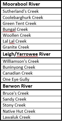
Williamson's Creek running through, October, 2015
For many thousands of years before European settlement, 'Narmbool' formed part of the lands belonging to the Wathaurong people. As I have mentioned in previous posts, many of the roads we drive today in large part follow the bullock tracks established by the European pioneers as they spread out across the countryside in search of grazing land. They in turn however, often followed the tracks of the Wathaurong people and Mary Akers in her book about 'Narmbool' "Hold fast the Heritage (2010), suggests that this may well have been the case for that part of the Geelong to Buninyong Track which passed through what became Narmbool Station.
That there were indigenous people living in the area is well documented and traces of their presence today can still be found by those who know what to look for. The name 'Narmbool' itself is believed to be a derivation of an indigenous word marmbula meaning "kidney fat".  The fat from around the kidney was important to indigenous tribes across the country who used it in their ritual practices. The fat was often taken from an enemy - alive or dead - or from the body of someone who had died an untimely death. It was then daubed on the body of the medicine man to strengthen his powers or placed on objects belonging to someone who was to be cursed.
Shaped edge on a piece of stone, still sharp enough to cut
Groove worn in a rock slab, presumably from repeated use
The cultural practices of the Wathaurong people of the 'Narmbool' region however, were severely disrupted by the arrival of European settlers in the late 1830s. The way the land was used was also changed forever when, in January, 1839 a young Glaswegian called Hugh Niven took up the lease on the 22,842 acres of land lying between Mt Mercer Cattle Station in the west and Borhoneyghurk in the east.
Niven ran both sheep and cattle on his property, but his main focus was the cattle and he was looking to increase both his herd and his land holdings. His plans were cut prematurely short however later that year when during a ride to Geelong on 21st September, he was thrown from his horse and kicked. He died two days later and was buried in Geelong's Eastern Cemetery. He was 34 years old.
Hugh Niven's grave at the Eastern Cemetery, Geelong. Hugh was the first
person to be buried there on 23rd September, 1839
Following Niven's death the lease for the still unnamed Portland Bay number 261 run, was taken up - along with the stock - in December, 1839 by a Melbourne solicitor whose name is still familiar to the area today - Charles Williamson. It was his name which was adopted for the creek which flows through 'Narmbool'. Like Niven, he concentrated on the breeding of cattle, holding the lease for the property until 1845 when it was taken up by brothers Thomas, William and Gideon Lang. It was the Langs it is thought who were responsible for giving the name of 'Narmbool' to the property during their short tenure of less than twelve months.
Over the next several years the licence for 'Narmbool' was held by Hector Simson and John Duerdin. They in turn transferred the lease to Henry Jackson Munday who took up the lease in May, 1849 and two years later in July, 1851 applied to take up 640 acres as his pre-emptive right, including his homestead, outbuildings and a dam. On this land in about 1850 he had constructed a two-roomed bluestone cottage. The Victorian Government Gazette of 25th August, 1854 records that at that time, Henry's Narmbool run was stocked with 20 horses, 150 cattle and 9,570 sheep, however by 16th February, 1855, these numbers had reduced to 10 horses, 100 cattle and 6000 sheep.
Sheep grazing in the distance at 'Narmbool', October, 2015
In September, 1852 he applied to purchase a second block of land within his run including an a washpool which he used for his sheep, however his request was denied, indicating instead that the area should be set aside as the site of a village. By that time, the gold rush was in full swing and there was great demand for accommodation, supplies and later, land and housing for the diggers who flocked to the goldfields.
That village would soon become the little settlement of Burnt Bridge, located near the site of the old log bridge constructed by Henry Anderson and William Cross Yuille as they journeyed to take up their runs on the other side of Mount Buninyong years before. First there was John Morrison's Burnt Bridge Inn, then a coffee tent, more hotels (one of which was a staging post for the Estafette Line of Coaches), a school, houses, and when the new road was surveyed, a toll house was also installed. By 1855 the government was calling for tenders to supply feed for police mounts which were also
stabled at Burnt Bridge.
By 1855 at 'Narmbool' however, Henry (whose brother William had died in January and was buried on the property) gave up the lease, married his brother's widow and moved back to Geelong. At this time the run passed back to a former leaseholder - John Duerdin - who also purchased the pre-emptive right.
Unlike Munday, Duerdin did not live at 'Narmbool', instead leasing it out. In this way, he held the lease until 1860 when it was transferred one last time to Samuel Wilson, younger brother of the Wilsons who had taken up the lease of the Woodbourne No. 2 Run not far away. In addition to his pastoral pursuits Samuel also trained as a lawyer and later, moved into state politics. Over the years he contributed greatly to the community, ultimately receiving a knighthood for his service to the Colony of Victoria.
Samuel Wilson, owner of 'Narmbool'. Photograph of an 1862
 painting. Image held by the State Library of Victoria
Wilson Hall at the University of Melbourne was named after him. The English perpendicular Gothic building was a centrepiece of the university and considered one of Melbourne's grandest buildings. It was built in 1882 at a cost of £40,000, following a £30,000 donation from the benefactor whose name it bore.The original building along with numerous paintings, ornate stained-glass windows and historical artifacts was destroyed by a fire caused by faulty electrical wiring on 25th January, 1952.
By this time, Wilson was long gone from 'Narmbool'. In 1863, He sold his pre-emptive right to David McNaught and John Boyd whilst continuing to maintain the lease on the remaining land. Finally, on 9th February, 1872, the lease was forfeited and the ownership of the property (now a freehold) passed to the partnership of David McNaught and John and Alexander Boyd. Having made their fortune as shopkeepers on the goldfields of Ballarat, McNaught and John Boyd ventured into property. This included 'Narmbool' which they ran successfully for many years, both at various times living on the property - or at neighbouring 'Cargerie'.
Wide open spaces, October, 2015
Over the period of their ownership however, laws enabling selection were passed and on 20th February, 1866 'Narmbool' was gazetted for selection. A number of portions of the original leasehold were taken up by selectors, several of whom worked for either Boyd or McNaught. By the time the property sold to members of the Austin family in 1884, only 18,000 acres of the original land remained. At the time the Austins took over, the homestead was a timber building. In 1889, extensive renovations were undertaken by Herbert Austin, although whether he completely demolished the original timber building  or merely added the large bluestone front an timber billiard room to one side, to the existing structure seems unclear.
A year prior, work on a second grand, brick home on the property had been completed and the land was then divided between the two Austin brothers. The snew house and the 7,500 acres which surrounded it, became 'Larundel', whilst the old homestead retained 10,500 acres of land.
In mid-1923 'Narmbool' passed out of Austin hands, purchased by William Phillips, however, like many of the large properties around the district, within months, about half the remaining land was acquired by the Closer Settlement Commission and divided into smaller lots for settlement by returning servicemen following the First World War. The endeavour was unsuccessful, with extensive land-clearing during the Austin era and over-farming by the settlers ultimately leading to a drop in productivity. By 1930, all of the acquired land had been returned to the Commission.
'Narmbool' 1972, image taken from the John T Collins Collection, State
Library of Victoria
Presumably as a consequence of this compulsory acquisition, by the end of 1923, the remaining 4,000 or so acres of the property had again been sold. This time, the purchaser was Alexander Sutherland, a land valuer with the government who had also advised on the carve up of 'Narmbool' by the Commission. Alec - as he was known - bred sheep and indulged his interest in horses. With difficulty, he nursed the property through the depression years of the 1930s, at one time even going shares in a speculative but ultimately unsuccessful mining venture on the property. During the 1920s, Alec also oversaw the establishment of a private game sanctuary at Narmbool. This government-sanctioned, private wetland retained its status until 1968 when the relevant legislation was changed. By that time, the property was in the hands of Alec's only son Ian who fought - to no avail - to have the sanctuary's status maintained.
Fortunately despite Ian's concerns, the native wildlife at 'Narmbool' was not adversely affected by the loss of sanctuary status. His tenure of the property lasted until 1980 when it was sold one final time to Robin and Andrew Ferry.
Upon their arrival, the Ferrys embarked upon an extensive program of replanting, regeneration and reclamation. Over the ensuing years, they installed a series of dams, fenced off the gullies and performed remedial works to tackle the significant erosion and salinity problems caused by the tree clearing and over farming of previous generations. In addition to this, they have been responsible for the planting of at least 40,000 trees across the property which not only contribute to halting erosion but have also provided habitat which has seen the wildlife at Narmbool flourish.
The next step in the Ferry's plans was a succession strategy. They were determined not only to leave 'Narmbool' in a better state than they acquired it, but also to preserve it for the community with a strong focus on education. To this end, after years of negotiations and planing, the property was was gifted to Sovereign Hill, to be used primarily to provide live-in 'environmental discovery programs' for middle school students whilst continuing the environmental initiatives put in place by the Ferrys.  In addition, changes were also made to provide a restaurant (The Garden Room) and function facilities, providing opportunities for interaction with the wider community.
Recreation settler's hut constructed onsite by Sovereign Hill for the education
program, October, 2015
Most recently, only days before Christmas on 19th December last year (2015) 'Narmbool' was dealt a devastating blow. A bushfire originating near Scotsburn, travelled south towards 'Narmbool', decimating the property and much of the surrounding land. The staff present on the day enacted their fire plan which meant that the  immediate homestead site, the lodge, the learning centre and some parts of the garden survived, however almost all of the pasture and fencing, as well as trees and some of the bush camp facilities used in the education programs were burnt in the fire. In addition, stock losses are believed to have numbered well over 1000, whilst parts of the garden were significantly damaged by the fire.
Burnt Bridge burns again: 29th December, 2015, roadside near the site of
Burnt Bridge following the Scotsburn fire
Roadside on the Midland Highway, looking south east towards Williamson's
Creek at the site of Burnt Bridge, following the Scotsburn fire,
29th December, 2015
In all, almost 4,700 hectares of land were burnt in the fire. The map below shows the extent of the Scotsburn fire as estimated by the "Incidents and Warnings" page of the Vic Emergency website, overlaid on Google Earth. Outlined in green is the current land area of 'Narmbool', with the red line indicating the extent of the original 22,842 acre Narmbool Run (my estimation from the 1848 surveyor's description) taken up by Hugh Niven in 1839.
Google Earth overlaid with the Vic Emergency website estimate of the Scotsburn
fire. The green line indicates the current extent of 'Narmbool'. The red line gives
the approximate boundaries of the original Narmbool Run
Finally, during a recent conversation I was informed that only 250 acres of 'Narmbool' land remained unaffected by the fire. It will be a long road back for this grand old property.


14 March, 2016

Making tracks: via Mt Mercer

I initially began researching the route travelled by the diggers who flocked to the goldfields of Buninyong, Ballarat and beyond after noticing that a number of towns located on the rivers, creeks and gullies of the Barwon catchment claimed to be on the "main gold route" or on the "best line of road" to the goldfields. But how could places as far apart as Teesdale on the Leigh Road and the Eclipse Hotel at Durdidwarrah and Morrisons, along with all the towns which sprang up along the Geelong to Buninyong Track, justify their claims?
It quickly became apparent that there were several different routes which hopeful prospectors could take to the diggings and each had its own claim to being "the main route from Geelong to Ballarat" (or Buninyong for the current purpose as all roads from Geelong passed through or near that town). The shortest route was certainly the bullock track which lead from Geelong to Buninyong. It was well established by the 1840s and had been used by the mail coaches to travel between Geelong and Buninyong since 1846. If volume of newspaper content is anything to go by, this was certainly the busiest route to the goldfields and the topic of my most recent posts.
Teesdale of course, is not on this route. It was however on the road taken by another of the earliest mail coaches in the district - the Portland Bay Mail Coach. The mail from Geelong (and from Melbourne via the steamer) was carried by coach through Leigh Road (Bannockburn), Teesdale, The Leigh (Shelford), Rokewood and onwards to join the Melbourne to Portland Bay mail at Fiery Creek (Streatham/Beaufort). An 1856 survey map of the Teesdale area describes this road as the "main road from Fiery Creek to Geelong via Batesford".
Shelford iron bridge under construction 1873-4. The timber pylons of the original
bridge are visible between those of the new bridge
Like the Geelong to Buninyong Track, the Portland Bay Road required travellers to undertake several river and creek crossings - the Moorabool River at Batesford, Bruce's Creek at Leigh Road and two crossings of the Leigh/Yarrowee River. The first of these was at The Leigh where, prior to 1850, the crossing was made via a ford. After this date, a wooden bridge was installed which served until 1873-4 when a wrought-iron box girder bridge was erected as per the design of Leigh Shire engineer C.A.C. Wilson.
After crossing the Leigh, those travelling to Buninyong needed to branch off the Portland Bay road and head north. First however, they could take a meal or stay overnight at the Settlers' Arms Inn, before following the track which lead to Mt Mercer and on to Buninyong. The inn was built in 1843 by Captain Francis Ormond who leased the surrounding land from George Russell of the Clyde Company, agreeing to improve the area and build the inn which soon prospered as a result of the passing trade.
Settler's Arms Inn built by Captain Francis Ormond in`1843. Situated near
the Shelford bridge across the Leigh River, the inn was a staging post on the
Portland Bay mail route. It was demolished in 1983 to allow construction
of the current road bridge. Image taken in 1975 is from the John T Collins
Collection, State Library of Victoria
Whilst none of the early maps such as those produced by surveyor AJ Skene (1845), Ham's map of the routes to the Mt Alexander & Ballarat diggings (1852) or Sands & Kenny's Map of Victoria (1859) show a road running from Shelford to Buninyong, the track did exist and it was used to access the goldfields. Survey maps as early as 1851, show the beginning of a road leading south from Buninyong "to The Leigh". It was not until 1857 however, that it was officially surveyed - at least in part - by government surveyor Maurice Weston and was indeed titled "part of Geelong and Ballarat Road from Shelford to Mt Mercer".
A dirt track leading into Shelford, taken during the late 19th century. Image held
by the State Library of Victoria
An important point of distinction however, which may also explain Teesdale's claim to be on the "main gold route" from Geelong to Ballarat, is a description which appears in the newspapers from the 1850s onwards, referring to the "main road from Geelong to Ballarat via Mt Mercer". It is probably telling that the description of this road always seemed to come with the qualifier "via Mt Mercer". I suspect this meant not that this was "the" main road, but rather that it was "a" main road and that it ran via Mt Mercer. In this era the phrase "government road" or "main government road" was often also used. It described official roads built and maintained by the government. From the 1860s, local road districts were established to levy rates and to maintain roads across the colony. The colonial government however, still retained responsibility for the most important roads, therefore a "main road" was any road which was paid for and maintained by the government rather than by the local road district or shire council. Having a road declared as a "main road" by the government could remove significant financial strain from a struggling rural shire.
Another consideration is the term "main gold route". Does this mean the route taken by the diggers to get to the goldfields or the route taken by the gold escorts bringing the gold back to Geelong? Newspaper reports show that the the contractors carrying gold to Geelong travelled via the Geelong to Buninyong Road. It was for this reason that a police paddock and associated buildings were established at Meredith in 1853 (and a little later also at Burnt Bridge), to provide a base for the police officers accompanying the gold; a staging post for changing horses.
This early photograph taken c1852-1854 shows the Ballarat gold escort. Image
held by the State Library of Victoria
Whilst it may have been shorter and there may have been more traffic on the Geelong to Buninyong Track, it was not without its problems. When the weather was bad, some sections of the road became a quagmire. Negotiating "Scott's Swamp" could prove an almost impossible prospect. The approach from Melbourne could also be a difficult journey; one traveller reported seeing hundreds of drays stranded in the mud during a single trip to the goldfields of Ballarat. It is probably no surprise then, that whilst researching a previous post, I found mention of the track from Shelford to Buninyong being used by travellers when the Geelong to Buninyong Track was impassable during bad weather.
It may have been longer, however travellers would go a significant distance out of their way to avoid bad roads, even taking to the bush when necessary.
It is also worth noting that the Geelong to Buninyong Road and the road via Mt Mercer did not exist in isolation from one another. They were connected by tracks (and later roads) which ran east-west between them. As I mentioned in an earlier post about the Green Tent, there was a track running from that place back to Shelford which was used by bullockies and those wanting to graze their stock, as well as the track which became the Meredith-Shelford Rd. If conditions were proving too difficult on one road, it was possible to veer off and head for the other.
And it is at this point that another local tale surfaces. Whilst on a visit to 'Narmbool' (the squatting property established in 1839 by Hugh Niven, now owned by Sovereign Hill), I was told that an old track leading down across Williamson's Creek was "used by the diggers during the gold rush". This would seem to be confirmed by a road marked on an 1892 geological survey map, running in a direct line between Horsehill Rd and Williamson's Creek along the fence line we were shown. After crossing the creek, survey maps of Clarendon Parish from 1915 show the road - presumably following the earlier track - continuing on to a fork. One branch ran north, following what today is a vague track which becomes Pryor's Rd, the other travelled only a short distance south west to Sand Rd. Both Sand and Pryor's Roads meet up again to the east of the mining town of Garibaldi before joining the Buninyong-Mt Mercer Rd. Thus the diggers could follow this road north to Buninyong or they could again join the Geelong to Buninyong Rd to the east of Scotsburn, or possibly further west, thus avoiding Scott's Swamp.
Local sources say that, a track used by diggers heading to the goldfields
(presumably from' the Geelong to Buninyong Rd) ran down the hill at the fence
line to cross Williamson's Creek at this point 
It is also worth remembering however that as the gold rush progressed, diggings spread out across the countryside. With the advent of large companies and deep lead mining towards the end of the 1850s, mines were established along the banks of the Yarrowee/Leigh River as far south as the Leigh Grand Junction Bridge and a little beyond. It makes sense therefore that by the time they were surveyed in 1857, that the Shelford-Mt Mercer Road and the subsequent Mt Mercer-Buninyong Rd would be the main access route for those heading from Geelong to the mining settlements along the river such as Garibaldi and Scotchman's Lead.
Looking at the survey maps available from the 1850s for the parish of Enfield, the old track by and large, followed the same course as the modern road, although where the modern road veers to the west to meet the road from Dereel, the old track stayed close to the river past Mt Mercer. Further north near Garibaldi, the track again followed a slightly different course, crossing the Yarrowee River about 700m north west of the present crossing which was not built until 1866. As I described in an earlier post, the river crossing at Garibaldi was dangerous, with three people said to have lost their lives during flooding prior to the erection of the bridge downstream.
Google Earth image showing: modern roads (yellow), Buninyong-Mt Mercer
Track (green), unused road on 'Narmbool' (blue), other pre-survey tracks (red).
Click to enlarge
Unfortunately the only 1850s survey map which I am currently able to access is that for Enfield Parish, so I am uncertain of the exact path of the original track to the north or south of this area. It does appear however, that the entry to Buninyong was intended to be via a more direct line one block to the east of the current alignment, which makes me wonder if perhaps Sandys Hill Rd (which intersects the road to The Leigh as marked on the survey map), may have been part of the original track from Mt Mercer.
It is also worth remembering that there may well have been other informal crossing points along the Leigh/Yarrowee which also gave access for those heading to the goldfields. I know of at least one bridge which no longer exists, but which was used by workers crossing to 'Golfhill'. Located at the end of Henderson's Rd, Bamganie, it was a timber swing bridge which existed into the 20th century, however I am unsure of its age. Similarly, there is a small bridge on Kelly's Rd, Grenville where the Leigh can be crossed, however the road itself does not appear on the earliest survey maps.
No doubt there were other crossing points and tracks along the way, all of which could have been used by those travelling to and from the goldfields to reach the road between Buninyong and Shelford.
If at any point I find more detail I will update this post accordingly.