Showing posts with label Capt Foster Fyans. Show all posts

12 September, 2016

Fyans' Ford

Today at Fyansford, the residential development which is Gen Fyansford seems to be racing along with new houses popping up everywhere. However, this section of the river flats overlooking the Moorabool River has not always been a residential area and on his Fyansford.com website John Flatt asks the question "is the Gen Fyansford Estate built on a quarry?" No, he decides and I agree. So, after finding some interesting snippets whilst researching my previous post about the Fair View Hotel which used to stand on the hill above, I thought I'd have a look at what uses the land which now comprises Gen Fyansford has been put to over the years.
Gen Fyansford map taken from GENFYANSFORD.COM.AU
The area in question is shown in the above diagram taken from the Gen Fyansford website and includes land both east and west of the Moorabool. I looked at the history of the quarry to the west of the river in a previous post, so will only deal with the land east of the river this time.
The earliest residents of the Fyansford region were of course the Wathaurong. At various times of the year, they used the rocky bed of the ana-branch between the Barwon and the Moorabool Rivers as an eel trap. The Wathaurong name for the area at the confluence of the two rivers was Bukar Bulac meaning "the place between two rivers" and as it was for the early European settlers, a shallow section of the Moorabool about one and a half kilometres upstream from its confluence with the Barwon was a natural crossing point.
The first European settler to take up residence along the banks of the Moorabool River at Fyansford was of course Captain Foster Fyans himself. But where exactly did he erect his hut? (Another question also asked by John.)
It is widely known that Fyans set sail for Port Phillip in September, 1837, taking with him, a dozen convicts and four staff with whom he established a camp at the spot which soon became known as Fyans' Ford. Pinpointing the exact location of that first settlement is a little more tricky, however there are a couple of sources at the Geelong Historical Record Centre which shed some light.
Captain Foster Fyans. Image held by the State Library
of Victoria
James Riley was a 17 year old English immigrant who travelled to Australia in search of land and opportunity. With letters of introduction to Captain Fyans, he made his way across the Werribee Plains to Fyansford where, for want of an inn, he was invited to stay with Fyans himself. An article written by Roy Holden and contained in his "Fyansford History Notes" (held by the Geelong Historical Records Centre), recounts a letter in which Riley recalls his stay with Fyans and describes the hut as well as its location:
"It is built of slabs well plastered, and the roof, instead of bark (like the Van Dieman's station), is grass covered outside with clay to prevent its blowing off or taking fire.
"Inside for a ceiling a large Union Jack was stretched from corner to corner - thus our own country's banner forming a shelter for our heads.
Fyans' Hobby
"There was a turning lathe in one corner, and small pictures of which there were many, hung around the room, the frames of which the old gentleman had amused himself in making, and which were really well done.
"There were spears, swords, armor and curiosities of all kinds exhibited on the walls. The hut is situated close to the River Moorabool, about one mile from its junction with the Barwon,.."
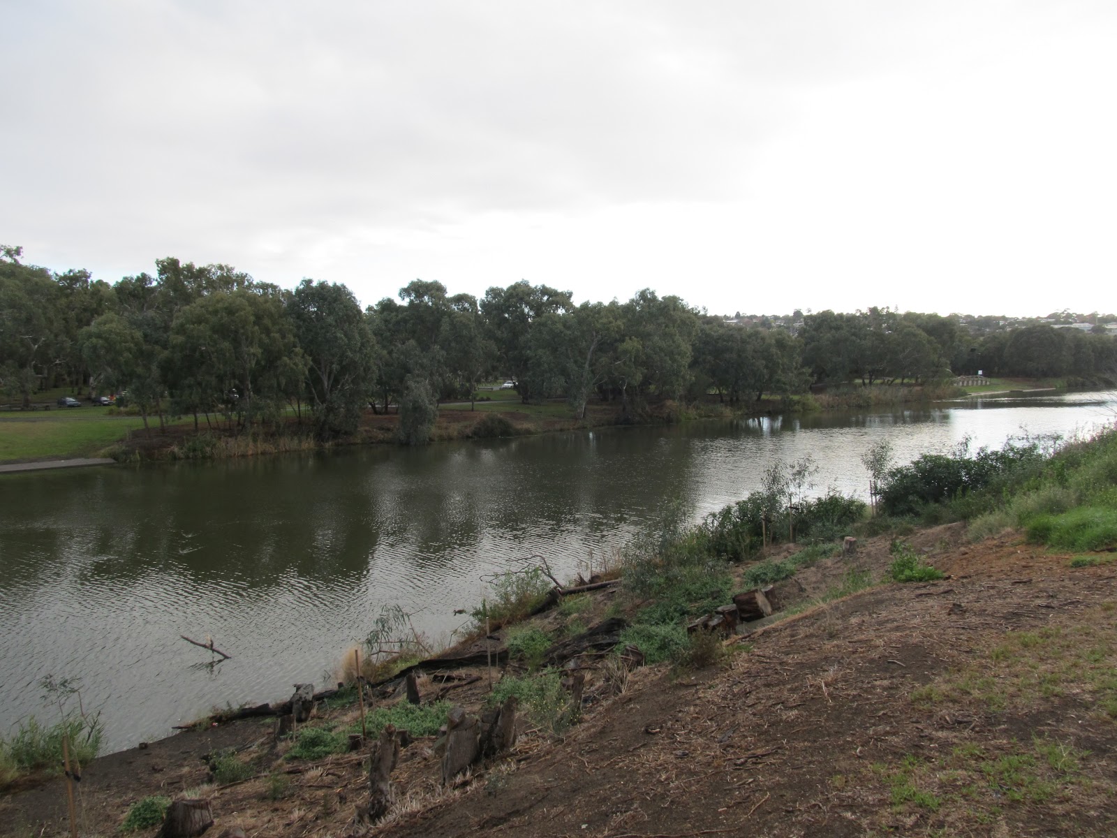
So, according to Riley, Fyans' hut was located on the Moorabool almost a mile from its confluence with the Barwon. At the beginning of the article, Holden indicates that the hut was on the east bank of the river, but oddly, states that it was a short distance downstream of the "current" bridge which is only three quarters of a mile from the confluence and yet, a grainy photograph from the same compilation of notes by Holden perhaps appears to indicate a site closer to the ford, as suggested by Riley.
Looking upstream from the Fyansford Monier bridge towards the ford and
possibly the site of Fyans' hut 
If Riley's estimate of the distance was the more accurate, then the hut would have been located close to the ford - the original crossing point at the time of Fyans' residence in the district - which would seem a logical location to position his hut and the tents of his men.
Fyans did not spend long at the site which would become the township which bears his name. Riley noted in his letter that once the "barracks" were built (presumably at Geelong), the camp would be disbanded. Whether this also included the removal of Fyan's hut or not, I do not know. On the 1st January, 1840 he was appointed Police Magistrate at Portland Bay, taking him away from the district at that time.
His tenure at Fyansford however was only the beginning. Within a few years, the site he had chosen to make his camp had become a thriving village.

03 October, 2015

Making tracks - the early days

It often seems that every time I talk to a local or read an information sign across the Barwon catchment, I see the phrase "such-and-such a town was on the route (from Geelong) to the goldfields" or "this-or-that road formed part of the old bullock track to the goldfields" or "the old maps show...". The problem as I see it, is that if each of the towns listed were on "the" track from Geelong to the goldfields of Buninyong and Ballarat, it would be a very long and erratic journey indeed!
As a result, I thought I would take a look at some resources from the early days of the gold rush and see what evidence I could find to support any of these claims. What route did they take? How did they travel? Which towns did they pass through? And importantly for this blog, what river crossings did they make?
 On one issue, there was broad agreement. Prior to the work of the government surveyors on mapping out the official roads of the new colony during the 1850s, most traffic used the informal bullock tracks, beaten through the bush by the squatters as they pushed the boundaries of settlement in the Port Phillip District. To a large extent, the geography of the surrounding districts determined the path these tracks would take. Rivers such as the Barwon, Leigh and Moorabool and their many tributaries formed barriers to travel, but at the same time provided much needed water for both stock and travellers. Not only did the early settlers make use of the Wathaurong's fords, but often, the routes they followed were paths which had been used by Aboriginal Australians, who it is also known, used the creeks and rivers of the region as paths and navigational aids.
Where a river or creek crossing was unavoidable, natural fords were used. In many cases, these were crossings which had been used by the Wathaurong people for thousands of years. Both Fyansford and Breakwater and I assume (but can't prove) Batesford are located at crossing points used by the indigenous population before European arrival. As traffic increased, these informal fords were lined with stone and packed earth, providing a more solid passage. The crossing at Fyansford was chosen as the site of a settlement by Captain Foster Fyans in 1837 when he arrived to take up the position of police magistrate for Geelong. He was quick to recognise the importance of the location which provided relatively easy access to the vast plains of the Western District.
An 1846 illustration of the ford at Fyansford, drawn by Charles Norton, image
held by the State Library of Victoria
During the late 1840s and 1850s, bridges were built at some of these key crossing points.
The first timber bridge at Fyansford was built in 1854, providing direct access via the Great Western Road (later known as the Lower Western Road) to the towns of Inverleigh, Cressy and beyond to Portland and the Western District.
Timber bridge at Fyansford, built 1854 (image c1866-1880), image held by the
State Library of Victoria
By contrast, there had been a bridge across the Moorabool River (on the Upper Western Road) at Batesford since at least 1846. As at Fyansford, this original structure was a timber construction which by 1847 was in very bad condition having been repeatedly patched in previous years (sic). After surviving the winter rains, the bridge gave way under the weight of a bullock dray at the end of August (damaging only the bridge itself). It was replaced the following year.
These early fords and bridges and the rough tracks between them, were first used by the squatters to bring their wool to market in Geelong. With their expanding enterprises came the need for better communication, so in 1844 the first mail coach ran from Portland to Melbourne via towns such as Hamilton, Dunkeld and Fiery Creek (the Streatham/Beaufort area) to Buninyong before continuing on to Ballan and Bacchus Marsh en route to Melbourne. It wasn't long however before a second route also became popular and by the end of 1846, a mail coach from Portland to Geelong was heading south from Fiery Creek, passing through Woady Yallock (Cressy) to The Leigh (Shelford) and then via Teesdale, Leigh Road (Bannockburn) and Batesford to Geelong. From here, the mail could also be sent by steamer to Melbourne. (NB: It was this mail coach which was held up at gunpoint by Owen Suffolk and Christie Farrell in May, 1851.)
These mail coaches were run by government contractors. To confuse the issue however, squatters unhappy with the available services on occasion established their own subscription-based services. This was the case when in September, 1846 a private mail route between Geelong and Buninyong was established. The alternative government route was to send the mail via Melbourne on the Portland route and later via The Leigh and presumably through Woady Yallock and Fiery Creek.
Image by S.T. Gill shows the Royal Mail service from Geelong arriving in
Ballarat, 1854. Image held by the State Library of Victoria
The first private coach made the run on 26th September, 1846. It was a weekly service which departed Geelong at around 3 or 4am and running via the Golden Fleece Inn on the Marrabool Creek, arriving in Buninyong before midday in time to connect with the Portland and other mail services. The return run was set to arrive in Geelong by Monday morning. Within a fortnight, government representatives had been sent to assess the route with a view to establishing a public mail service.
These then, were the main routes across the region, established by the squatters as they moved their stock, pushing the boundaries of the settled districts, looking for new pastures and more space. They were not formed roads as we understand them. In wet weather, they often became an impenetrable morass. So deep was the mud in places that carriages would become bogged above their axles whilst only double teams of oxen could drag drays through the mud, with any beast which fell, being dragged in its traces and often trampled or smothered in the process.
Although from the 1870s, this image from the State Library of Victoria shows
a coach ploughing through mud in bad weather 
One such section of the track near today's Scotsburn is described in Henry Mundy's account of his goldfield adventures (Henry Mundy: a young Australian pioneer, 1988 by Les Hughes). In 1847 the Geelong Advertiser and Squatters' Advocate described the road beyond the Batesford bridge "one of the great thoroughfares to the west" as being cut up below the level of the surrounding land with swathes of mud several feet deep in some places.
With an official government survey still some years away it was these rutted tracks - mud pits in winter, dust bowls in summer - which  the first of the gold diggers followed in the hopes of finding their fortune. The details I can find are sketchy and sometimes contradictory but over the next few posts, I will look at some of these routes and perhaps address some of the conflicting claims as to what was the "route to the goldfields".

17 May, 2013

"The best fertilizer is the gardener's shadow"

As is often the case in the course of researching a post for my blog, I sometimes come across a snippet of information which provides a clue as to what my next post might be. This was the case with the current topic.
As I scoured the contents of the 19th century newspapers on Trove, looking for details of River(s)dale and Captain Foster Fyans (hopefully more of which later...), I came across an article from The Argus of 8th December, 1866 which described some of the industry springing up along the banks of the Barwon at "Marnoch Vale" (aka Marnockvale) and downstream towards the township of Geelong.
Not surprisingly there were tanneries, flour mills, a woollen mill and even a ropeworks. The Riversdale Windmill was described as being to the left of the bridge leading to the Barrabools (Princes Bridge) with Captain Fyan's house to the right, but another thriving business was also listed which until now I hadn't seen mentioned - a Chinese market-garden.
A little searching around and I discovered that the Malay Immigration Society of Geelong were responsible for the arrival of a ship in 1848 carrying Chinese immigrant labourers to work for squatters in the district. Others arrived with the gold rush, before drifting into market-gardening when when it proved a more reliable source of income.
The Chinese were renowned as hard workers, establishing themselves on the outskirts of town and along the Barwon between Marnockvale and Breakwater. One garden was located below the Roadknight property on the river flats and in 1902 a snippet in The Argus mentions an assault on a Chinese man at a market garden in South Geelong. Much later, The Argus of 11th March, 1935 indicated that the home of a Chinese market-gardener at Breakwater was burnt to the ground as it was located outside the jurisdiction of the Geelong Fire Brigade.
Closer to town, one of the earliest market gardens was established on the river flats at Marnockvale between the West Melbourne Road (Marnock Road) and Rocky Point. The publication "The Earlier Days of Newtown and Chilwell" compiled by Charles S. Walker in 1958 describes some of the gardens in the area. The Chinese at Marnockvale would sell their vegetables either from their door or by pushing their wares in handcarts to the populated areas of Newtown and Chilwell and in town each Tuesday, Thursday and Saturday. The intervening days were spent cultivating, harvesting and preparing their vegetables for sale.
Handcart similar to those used by Chinese market-gardeners in 19th century
Geelong. Photo taken from the English-based Scale Model Horse Drawn
Vehicle Forum
The Argus of 8th December, 1866 describes the garden at Marnockvale thus:
The Chinese novelty...is chiefly remarkable for lack of beauty. Than its rickety make-shift surroundings, it would, perhaps, be difficult to find anything more distasteful to the eye or unattractive to the imagination; yet the Chinese garden is a feature in the district of much practical significance, and it stands as a reproach to the much-vaunted intelligence of the Anglo-Saxon, who, unable to detect a flaw in his own national character, can see only the beam in the eye of the children of Confucius.
Ah-Sam, who represents himself to be the head-man, has six acres under garden cultivation, for which he pays 14 a year. The land, formed of two slopes, north and sough, runs parallel with the river, and in the centre, on top of the rise, and at about fifty feet from the Barwon, there is a Californian pump, worked by three men by treddle motion. In a comparatively short time, sufficient water can be pumped up to flood the whole six acres; but, with an eye to economising labour in seasons when so much moisture is unnecessary, Ah Sam has constructed slabbed pits at every few yards along the various paths, and the water, as it flows from the shoot, passes along the different channels, and fills these pits before it can overflow the ground generally. At the present season all the ground is watered by hand - two stalwart Chinese filling large watering-pots at the pits, and with one in each hand sprinkling two vegetable beds simultaneously. All the young plants are mulched with long grass, and in some places a temporary paling roof is erected over the beds, to protect the more tender plants from the scorching rays of the sun during their early growth. "Next month," observed Ah Sam, "no rain; then (pointing to the river) give plenty water all over. Now plenty cabbage make no much money. Next two months make 14, 15 perhaps 20 a week." The ground appears to be manured chiefly with horse-dung. The land is anything but of good quality but the garden, which contains all kinds of kitchen vegetables, is beautifully kept, and the produce generally looks well. Besides Ah Sam, who appears to do the work of two men, and plies his feet vigorously at the pump, there are three Chinese labourers generally at work.
A second article from the Geelong Advertiser of the same year likewise describes the system of pits and channels used for watering and drainage, remarking in typically patronising fashion that "The affair is simple and efficacious; there is no pretence to engineering about the matter. No particular notice is taken of delicate gradients, and possibly no theory of gravitation ever disturbed the ideas of the projectors."
 As to the tools used by the Chinese in their work it was remarked that one  [man] was "...recreating with a sort of Armageddon-looking rake, with teeth of satanic length..."
A Chinese harrow (image from the Museum of the Riverina) which may have been similar to the tool described
The journalist also seems surprised by the Chinese knowledge of manuring to improve the soil and goes on to suggest that the European settlers would do well to follow their example stating that "It is not complementary to see Chinamen setting us an example, but as the example is a good one, it ought to be followed".
Then, in an almost prescient echo of modern concerns it points out that a thriving local market-gardening industry on the banks of the Barwon and Moorabool Rivers would reduce the reliance upon food grown in other areas of the colony.

Looking across the original Prince Albert Bridge towards West Melbourne
Road, c1860-1879. Scouring works are visible but not the market gardens
Such was the Anglo-centric view of Chinese industry in the early years of settlement at Geelong but whilst the temporary nature of their buildings may not have appealed to the European eye, there can be no doubting their perseverance. In October, 1867 a serious flood raised the Barwon to such an extent that much of the land from Geelong to Barwon Heads was said to be underwater.
Approximately the same view as the above photo as it appears today
The tanneries and wool scours at Breakwater suffered badly, with significant property damage and loss of stock, particularly to those on the south bank of the river. Captain Fyans was forced on to higher ground and an auctioneer living at the bottom of Yarra Street had to remove his family to safety by boat when his house was inundated. Ah Sam and his colleagues were not immune either, with the Gippsland Times of 3rd October stating that:
The Chinese gardeners at Marnock Vale had a very narrow escape of their lives, the water having risen 6ft in a very short time; as it was, they had to wade 200 yards with the water nearly up to their neck.
In his history of Newtown and Chilwell, Charles S. Walker indicates that there was a two-storey hut on the Marnockvale garden, intended to provide protection against high water levels, he states however, that it washed away the first time the river flooded - perhaps during the 1867 event described. The effect on the crops and loss of income must also have been significant.
In addition to the flood of 1867, high water levels were also recorded in 1870, 1893 and 1894 whilst one of the largest floods to hit the Barwon since European settlement was recorded in 1880. This is no doubt in addition to numerous minor flooding events which did not cause significant damage to buildings and infrastructure, but which would still have had a devastating effect on Ah Sam's vegetables.
Looking north west between Rock Point (right) and Marnock Road (left)
with the chimney of the Phoenix Wool Scour in the background
However, Ah Sam and his family were nothing if not resilient. Whilst there is a burial recorded at the Eastern Cemetery for the 14th March, 1903 (I am assuming this to be the same person), his garden lived on. In 1904 The Argus reported two local boys caught stealing peas were handed over to police after trying to escape by jumping into the river, then in 1930 Mr Ah Chee (presumably a relative), was fined for tampering with three water meters on his property.
Whilst there is nothing in the media to indicate exactly how long the garden remained at Marnockvale (or even if it was the only one), by the mid 1930s the number of Chinese-operated market-gardens began to decline significantly, so it is likely that Ah Sam's garden was also consigned to history.

20 October, 2012

Doing time

As I am currently unable to spend much time taking photos of the present-day Barwon, I thought I'd do a bit of historical research and see what I came up with. My starting point was the history of penal servitude in Geelong which dates back to the town's earliest days when convict labour under the guidance of Captain Foster Fyans built the first breakwater across the Barwon below the town. Naturally it was necessary to house Geelong's early felons and this was done in various police watch houses and at the South Geelong Gaol which was located on the south west corner of Yarra and Balliang Streets which at that time overlooked the Barwon which lay less than 500m away.
Building at the South Geelong Gaol taken 1904. Reproduction rights held
by the Victorian State Library
This early gaol is described as consisting of four slab huts, one of which was used as a watch house, one as a court house and the other two as police offices. The facility held up to 60 prisoners in appalling squalor. Newspapers of the day confirm that it was originally built as a watch house with £750 assigned for its construction in 1839, however a display at the "Old Geelong Gaol" indicates that the original huts were built in 1838 with the watch house deemed unsuitable and replaced by a more permanent structure between 1841 and 1842. The new building was constructed from freestone quarried, it is indicated, about 1.5 miles upstream on the Barwon. This is confirmed by a contemporary newspaper report which stated that the new watch house was the first structure to be built using stone from the quarry which I suspect may have been the one near the bottom of Pakington Street.
This upgraded facility according to the "Old Geelong Gaol" exhibit contained 6 solitary confinement cells, a keeper's room and "two balancing cells".
Reproduction of a photo at Geelong Gaol, showing part of the South Geelong Gaol
In June, 1850 it was recommended that further funds be allocated to allow another upgrade of the premises for use as a temporary gaol, pending the construction of a new building - the Geelong Gaol which opened in 1853 on the corner of Myer and Swanston Streets (which is the subject of a subsequent post: A model prison). A stone wall was eventually built to enclose the complex, although this it seems wasn't added until around 1851 perhaps as part of the upgrade recommended in 1850. Within the outer wall was also a kitchen and gaoler's room, located in the forecourt area along with a privy and night soil pit. The buildings stood until 1906 when they were demolished.

A current photo showing the south west corner of Yarra and Balliang
Streets from Yarra Street, looking south towards the Barwon
An account of the South Geelong Gaol published in 1899 in George E Boxall's book "History of the Australian Bushrangers" describes it thus:
The Geelong gaol, in fact, was little more than a lock-up, and it was only within the past two years that the gaol had been enclosed within a high wall. In 1850 it stood out on the hill, a short distance from the banks of the Barwon River, an ordinary-looking brick building, with the Governor's House and other offices grouped near it, and all opening out directly on the level flat which stretched from the top of the banks of the Barwon River to the hill on which the main portion of the town of Geelong was situated. On the top of this hill, the last building in that direction, in "old Geelong" as it was called, although it had only been founded about twelve years before was the court house, and there was no other building along Yarra Street, on the southern side of the hill and across the little flat (a distance altogether of about half-a-mile) until the gaol was reached.
This latter statement is clearly shown to be correct on John Taylor's map of Geelong, published by the Melbourne Surveyor's Office in 1855 which shows only vacant land on the west side of Yarra Street from Balliang to McKillop Street where the court house stood on what is now the site of the fire station.
Photograph of a sketch of the first Geelong courthouse with accompanying
stocks, 1842 © Deakin University 2009
The stocks which can be seen beside the building were, according to Boxall, removed in about 1854 when construction of a new courthouse began. They were the last remaining in Victoria at that time, those in Melbourne having been removed some time before. It should be noted that a copy of this illustration is labelled as the South Geelong Gaol in a display at the Old Geelong Gaol, however Deakin University who hold the image copyright seem clear on the topic.
It was from the South Geelong Gaol to this building that the infamous bushranger, Captain Melville was taken by dray to stand trial before Captain Foster Fyans on 3rd January, 1853.
But that's another story...

25 June, 2011

Grabbing a bite!


Works on the new Breakwater bridge
A pleasant - well relatively pleasant - winter's morning, so it was time for another ride around the river with a quick stop off to sniff out a geocache or two. We headed down to Breakwater intending to do the usual loop up to Fyansford and back only to discover that the path was closed for the day on the Belmont side to enable the installation of overhead spans for the new bridge. So, back we went and headed upstream via the other side of the river.
We'd had a coffee before departing, so didn't immediately feel the need for a stop, however by the time we reached Fyansford, my gloveless fingers were beginning to stiffen. With no great expectation,  I casually commented as we passed that we should stop for lunch at the Fyansford hotel.  I was taken at my word and we immediately re-routed across the common and headed for the pub and a coffee which was more for the benefit of my fingers than my caffeine levels!
In no real hurry, we also sampled a selection of bread and dips and contemplated the river and its environs. As we did so, we were drawn to consider the limited number of options along our route for refreshment. Of course, there are a significant number of opportunities for picnicking and barbecuing, but not so many options for those who either are not equipped or not wanting to self-cater.
In fact, the only venue which directly overlooks the river between Breakwater and Fyansford is the Barwon Edge Boathouse Restaurant. A licensed venue, it is located along the Newtown section of the river. This is a pleasant, modern restaurant with lots of glass to take in the river views and outside seating should the weather be suited. I can personally vouch for their coffee, cakes and several selections from the breakfast menu.
At a slight remove from the river and back towards town is the Boatshed Cafe, located within the surrounds of Mitre 10 who are currently in the process of removing themselves to the building next door. They provide coffee and cafe-style eating, but without the panoramic views of the Edge, they really don't have a "river" feel.
Towards Breakwater, there are no further options for refreshment,  unless of course the coffee van is at Landy Field providing much needed support for long-suffering, thermally-impaired parents and supporters of Geelong's brightest athletic talent.
Fyansford Hotel, built 1854
Nor is there an option along the opposite side of the river, returning back through town and beyond, until one reaches Fyansford, where at a slight remove from the banks of the river - actually the Moorabool River, a short distance above its confluence with the Barwon - we find the hotel as mentioned earlier. Today, the Fyansford offers a fairly sophisticated menu for both lunch and dinner, including the option to partake in the consumption of our national emblem, prepared in a variety of appetizing styles.
The building itself, if not the menu, has a significantly longer association with the river(s) than the other waterside eateries, but in typical 19th century fashion, also lacks river views from within. Not surprisingly, the history of the hotel parallels that of the township, making it one of the earliest watering holes in the district.
In the early days of expansion and settlement in the Western District, the naturally occurring ford at this site made it one of the most important points in the region, allowing traffic to access the ports in both Geelong and Melbourne. The influx of both money and population which accompanied the gold rush in the early 1850s and no doubt the rise of the wool trade following on from this era, made the little town of Fyansford a vital link in the movement of of both goods and people around the developing colony.
The first to recognize this importance was Captain Foster Fyans who established a police camp at the ford in 1837 and not surprisingly, the ford and the town which developed there came to bear his name. Nor was the town merely a way point on the journey to other places. In 1845 a flour mill was built on the banks of the Barwon, followed by a paper mill at Buckley Falls in 1876 (soon to be the topic of a separate blog post). Across the valley, overlooking the river junction, 1890 saw the opening of the cement works which operated until 2001. This soon made the little town a centre for the industry of the region and by 1854, the need was such that a timber bridge was erected downstream from the ford to provide easier access for heavy vehicles.
Three-span, Monier-reinforced concrete bridge over the
Moorabool River, built in 1900.
This bridge was in use until 1900 when a three-arch, concrete Monier-reinforced bridge (at that time, the largest in the world and designed by the engineer Sir John Monash and J.T.N. Anderson) was built nearby. This bridge in turn served until it was replaced in 1970 by a modern structure on the site of the original bridge.
At the same time that the increase in traffic required the building of the bridge, it became apparent that there was a need for a public house both for those passing through and for the local community.
As a result, in 1854 the publican C.B. Dawson called for tenders for the building of an hotel and by 1855, the new structure was erected only a stone's throw away from the site of the new bridge. The building which took shape and still stands today, is a two storey, brick structure which, I am informed, is a transitional Colonial Georgian style with "distinctive symmetrical fenestration and angled corner entrance" which was typical of many public houses built during this era.
On the whole, the building has not changed significantly across the years. The original roof cladding was replaced with corrugated iron, the corner entrance was also somewhat altered and the brickwork painted, but otherwise the facade of the building remains similar to its original form. Some additions were made at the back of the property in later years and the interior also had adjustments, but the Fyansford Pub would still be quite recognizable to the many generations of patrons who have passed through its doors over the course of more than a century and a half.
And so, with lunch complete and a few unwelcome clouds rolling in, we again headed for the bikes, and made our way back downstream.

26 March, 2011

Bell-Bird Balyang

Captain Foster Fyans
Fyans Park, Fyans Street, West Fyans Street, Little Fyans Street and of course Fyansford. The name is integral to Geelong and so in the town's earliest years, was the man himself - Captain Foster Fyans. So, who was he and what was his connection to the Barwon River?
The Australian Dictionary of Biography gives a more detailed and relatively flattering description of Fyans' life
http://adbonline.anu.edu.au/biogs/A010389b.htm for those who are interested, but in short, Captain Fyans was born in Dublin in 1790 to an Irish Protestant (the Church of Ireland) family. In 1811 he joined the army at Portsmouth, England and served in Cadiz and India before purchasing his captaincy in 1827. By 1833 he was serving at the Norfolk Island penal colony as captain of the guard. So successful was he, that he was transferred to Moreton Bay where he took on the role of commandant from 1835-1837. Here he gained a reputation for fairness, whilst at the same time maintaining respect and discipline amongst the convict population. However, some reports indicate a quick temper and his actions in putting down an attempted mutiny during his time on Norfolk Island were strict and certainly by today's standards - harsh. It was during this period that he acquired the sobriquet "Flogger Fyans".
Current Breakwater Bridge
In September 1837 when his regiment was ordered to return to India, Fyans sold his commission in the army and instead, sailed to the Port Phillip district where he was installed as the police magistrate at Geelong. Once here, he established a base on the Moorabool River at Fyansford and with a small group of officials including twelve convicts, set about establishing the township of Geelong.
One of his most important acts in ensuring the viability of the emerging settlement was to secure its water supply, which he did by directing the building of the breakwater across the Barwon River at what is now the suburb of Geelong which bears this name. After a meeting in Sydney with Governor Gipps at which the site for the new town was established, building began on the breakwater.
The site had been chosen by Fyans who was probably well aware that the indiginous people of the area used the place to cross the river, the water level being only about 18 inches deep and flowing over an outcropping of basalt. The project, which included two large rough stone walls with a clay filling in between, was completed by 1840.
The approximate site of Captain Foster Fyans' house
Bell-Bird Balyang
Its importance to Geelong at that time cannot be underestimated. Not only did the breakwater serve to maintain water levels near the newly established town, it also prevented the flow of brackish water back upstream from the tidal reaches of the river, thus ensuring clean drinking water. In addition, the breakwater provided an important crossing point for drays and stock travelling into Geelong from Colac and the more distant parts of the Western District. As discussed in an earlier blog, it also prevented noxious wastes from the rapidly developing scouring and tannery works from polluting the town's water supply. After a chequered history and a series of council battles over maintenance, Captain Fyans' breakwater was eventually replaced in the 1960s by the present bridge which will itself become obsolete in the near future when the Breakwater Road realignment project currently underway is completed and a new bridge, above flood levels is completed.
From 1840 onwards, Fyans' role changed to that of Commissioner of Crown Lands for the Portland Bay pastoral district and he took up grazing land in the region of Colac. This included substantial amounts of travel throughout the district.
Grave of Captain Foster Fyans at the Eastern Cemetery
In the course of his duties as magistrate and as commissioner, Fyans was required to arbitrate in disputes between the new settlers and the increasingly displaced indiginous community. In most, if not all cases, he found in favour of the settlers. Needless to say, indiginous accounts of the behaviour of whites towards blacks differ significantly and Fyans is not remembered as a friend to the indiginous population.
In 1843 he was married at Geelong and then in 1845 took up 145 acres of land with frontage to the Barwon River. He named the property Bell-Bird Balyang and on it, he built a stone residence which is believed to have stood close to what is now the Princes Bridge at Shannon Avenue in Newtown. A Sundial with a plaque now marks the approximate location of the Fyans' house.
For some time, Fyans also maintained a property on the north bank of the Barwon a little further downstream as it was announced in the Geelong Advertiser on 30th October, 1854 that he was selling his house and estate of Riversdale which was situated between the properties of JA Gregory (Barwon Banks) and William Roadknight (Barwon Crescent).
His wife Elizabeth lived only until 1858 and was survived by Foster, two daughters and a son. Foster himself remained in his home by the Barwon for the remainder of his life, dying at Bell-Bird Balyang in 1870. He was buried in the Eastern Cemetery with a number of family members and lies only a short distance from another notable Geelong citizen and the father of refrigeration - James Harrison.