26 July, 2012

Time for a tree change?

Trouble is afoot and controversy is brewing on the banks of the Barwon.
Over the last week or so, a furor has erupted over the by the Corangamite Catchment Management Authority (CCMA) to remove 15 elm and ash trees which line the river bank in Newtown near the bottom of West Fyans Street.
Elm/ash trees by the Barwon listed for removal
The removal, which constitutes part of a larger plan by the CCMA to improve the health of the Barwon River through Geelong, has been on the cards for some time and is planned for some time in August. The CCMA have already removed a number of trees along other sections of the river from Princes Bridge to Landy Field but as far as I could see none formed part of an avenue of trees and their removal seems to have gone unremarked in the local media at least.
As with any disagreement, there are arguments for and against both view points. Those who argue in favour of keeping the trees point to their aesthetic appeal, provision of recreational shade, historical association with the Geelong community and that their removal will leave a significant gap in the treescape for quite some time. They also indicate a lack of community consultation on the issue.
Leaflet produced by Save Barwon River Trees group
The other side of the debate argues that introduced species of trees contribute to the degradation of waterways, potentially causing riverbank erosion leading to loss of habitat for native fauna; an increase in the nutrient levels of the water contributing to more frequent blue green algae outbreaks; and are able to propagate further by the movement of seeds downriver. Conversely, replacement with native trees will eliminate these problems and provide additional habitat for native fauna. To that end, new native plantings have been installed - one gum tree for each of the elms which is to be removed.
Existing ash/elms with newly-planted eucalypts
I have not investigated the issue in any great detail, however I have yet to see any indication of exactly how much of a problem these particular trees are.
Following is a list of articles and webpages which I have located at this point:
  • Those who are against the proposed removal have set up a page on Facebook (where the debate appears to be raging) at the following address: Save Barwon River Trees
  • There is also a link to a petition calling for a halt to the proposed felling: Petition
  • This morning on the 26th July, the Geelong Advertiser ran the following article: City Hall goes into battle to save elms
  • The Geelong News of Wednesday, 25th July covered the issue on its front page, The Independent which arrived in my mailbox today, dated 27th July carries a small article on the topic on page 5 and I believe that the Geelong Times also printed an article on the 12th July.
  • The CCMA has the following article: Improving the health of the Barwon River
  • Whilst this report on management of the Barwon through Geelong by the CCMA may also be of interest: Barwon (through Geelong) Management Plan
Happier times: the trees in April, 2011
And on another note for those interested, I gather that the Save Barwon River Trees group will be holding rallies and community days on-site this week-end between 10am and 3pm.
Note: my subsequent post on the topic can be read here.

20 July, 2012

Chasing rainbows

For quite some time I have been on the hunt for a suitable rainbow shot to include in my annual Barwon River calendar which I hand around to the rellies at Christmas, and until recently, I had met with very little success.
Aside from the obviously ephemeral nature of rainbows, there just hadn't been that many around. However with the onset of a somewhat wetter winter than usual, the odd opportunity has arisen to get some rainbow photos.
Rainbow on the Barwon
My first chance came during the opening of the Troop Loop couple of weeks back. As we know, if Lee organises something there will be rain. So right on cue, Lee arrived and so did the rain, just as the formalities were winding up. And with it came a fairly substantial rainbow which arched its way towards the river.
According to my calculations, the pot of gold should be somewhere in the
middle of the river...
This gave the photographer from the Geelong Advertiser and myself (suffering a severe case of lens envy) an opportunity to snap a few scenic shots of river and rainbow, which was great - in theory.
Close up...
...and at a distance

The practise is somewhat more difficult. The main problem with rainbows is that they involve...well...rain and rain and cameras can be a pain as I quickly discovered. Not only does the rain make it difficult to get a clear, focused shot, but keeping it off the camera lens is also tricky. So, in between wipes and whilst trying not to get too comprehensively drowned, I took what I could.
This afternoon as I was out for a ride, I came across another rainbow, however as I rode in the rain, my camera was sitting comfortable and dry at home...I did make an attempt at some shots with the phone, however the results were less than impressive:
A pale imitation
And so the quest continues. With a little luck I will eventually find the right rainbow on a suitably picturesque part of the river...

12 July, 2012

An open and shut case

Last Wednesday I posted on the opening of the Troop Loop. New marker posts were installed, Lee Troop and a number of local junior runners turned out for the opening along with the expected array of councilors and dignitaries.
The start of the Troop Loop
And thus, a new running track was born.
By Saturday morning however, Geelong's newest running facility was - at least in part - closed.
The no-go zone
Why? Well, because 'they' (Parks Victoria I am guessing) are surfacing the unsealed section of track from a few hundred metres past the start point of the Troop Loop to the old Breakwater Bridge.
This measure is designed to improve the track through this section which is presently unsealed and prone to turn into a quagmire at the first sign of rain. And, with the weather we have had so far this winter, it is a valid concern.
I might also add that as a runner, I do find it easier to run on a sealed track (although I know some prefer a softer surface). What this will do I think, is change the atmosphere of this section of the track which at the moment I think feels somewhat less formal and in some parts is probably more picturesque than other sections.
Then: September, 2010
And now: Saturday, 7th July, 2012
Whether this is a good thing remains to be seen.
As at Saturday afternoon, the track had been graded in preparation for further works and signs were in place indicating that the track was closed - not that this seemed to be deterring many of the local contingent who continued to walk, run and ride as usual.
By Monday, work had begun at the Landy Field end, laying stones ready for the bitumen.
Surfacing works
And then on Tuesday, the rain began...and the work stopped....and there for the moment at least, it appears to have halted...
When work will recommence and how long it will take I don't know.

04 July, 2012

Loop de Troop

This story began yesterday when I headed down to the Barwon on the bikes with the kids. As we squelched our way through the mud towards Breakwater (more of that later), I noticed some new signage displaying numbers and proclaiming itself in large yellow letters to be the "Troop Loop". What the heck was the "Troop Loop"?
Newly installed signage at Breakwater
A couple of kilometres up the track we found our answer in the form of a couple of council workers in the process of installing the new posts. The Troop Loop they informed me was a "new" running/walking trail around the Barwon ...well, the posts are new, some of the surface will be new, but the route...well, we've all been running that for years. What is also new is the decision to acknowledge the achievements and contributions to the local running scene of Geelong's own Lee Troop.
Lee Troop opening the Troop Loop
The designated starting point is at the end of Swanston St next to Landy Field and there are two distances to choose from. The shorter, 6km loop takes the jogger down to the old Breakwater Bridge, around and back along the river to a turn around point at the McIntyre foot bridge before returning to the starting point. The longer, 10km loop extends to a return point at Princes Bridge before heading back to a point a few hundred metres past the starting point.
A quick Google of the topic found City Of Greater Geelong meeting minutes in which $7,500 were allocated for the installation of the signs, but nothing else. The workmen had informed me that there would be an official opening of the course the following day but there was no sign of it in the media.
A riverside interview
With that in mind I headed out before midday for a run which covered the same territory as the Troop Loop.
All the signs were now in place, a row of witches' hats prevented entry to the top end of the car park and a few of the usual crowd were out for their daily constitutional, but there was a distinct absence of dignitaries. This was still the case when I completed the loop and headed home.
Later in the afternoon I ducked down again to see if there was any sign of action and discovered some setting up happening. I asked the appropriate questions and was given a start time of 4pm. I returned at the appointed hour and was able to observe proceedings and ask a few questions.
Lee Troop unveiling the board at the beginning of the Troop Loop
I managed to discover that the currently very muddy but otherwise picturesque gravel section of track down to Breakwater will be sealed with bitumen within weeks. This should prove better for running, but will certainly change the character of this part of the trail. I also received confirmation that the grand dream of a track extending all the way to Barwon Heads was quote "not gunna happen". At that point I pushed my case for an extension of the existing track in the direction of Armstrong Creek but can't say I received an enthusiastic response. My pleas for improved signage and better connections between riding/running tracks received a somewhat placatory response that they were getting to it.
Ready! Set! Go! Runners from the Barwon Academy put Lee through his paces
Meanwhile, speeches were made, thanks given, photos snapped and tributes paid to the man of the moment who then unveiled an information board before taking a not so quick turn a short distance up the track with a selection of the local junior talent who were then treated to a Lyons Club sausage sizzle before heading to training to run it all off. The Advertiser were of course there to record the occasion with the article appearing in Thursday 5th, July's edition here.
The lead runners return as the cameraman from
the Advertiser is hard at work
At this point the rain began. It always does when Lee organises an event - or so he informed me back in 2009 when, along with several thousand others I completed the inaugural Run Geelong in pouring rain.
On this occasion I finished snapping my shots and retreated out of the elements.

03 July, 2012

Branching out - Big Storm on the New Gold Mountain

This week-end saw us spend the night in Ballarat - a place I have been to on and off my entire life. In keeping with the accepted stereotype, it was cold and wet which somewhat limited photographic opportunities.
Despite this, I did still manage to snap a few shots of the Yarrowee River as it runs through town on its way down to join the Barwon at Inverleigh (by which time it has become the Leigh). At this point, I know very little about the Yarrowee and what I've seen so far isn't impressive. This poor river as it runs through Ballarat is little more than an open drain.
Grant Street bridge over the bluestone-lined Yarrowee River
A quick history lesson courtesy of my other good friend Mr Wiki, informs me that the Yarrowee was prone to flooding, causing problems for the initial inhabitants of the township of Ballarat. This was remedied in 1877 when a dam was built out of town at Gong Gong near the river's headwaters which also supplied water for the town.
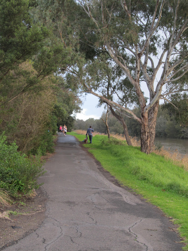
The Yarrowee River looking upstream from Grant Street towards town and
the confluence with Canadian Creek
During the gold rush era the river through Ballarat was used not only a supply of drinking water but also provided water for the mines as well as itself being mined for alluvial gold. Problems at this time with erosion and flooding saw much of the watercourse through town lined with bluestone. These stone-lined channels can still be seen across the city, not only along the Yarrowee but also along the several creeks which feed into the river as it passes through the suburbs.
The same view as above on a nicer day
During the early 20th century, the river became very polluted as industry grew and then in the 1960s, the river through the CBD was rerouted and completely sealed over so that it now runs through an underground channel along Grenville St before re-emerging downstream near Dana St.
View from Grant St looking down river
In more recent times there has been a push to improve river health, including the construction of wetlands which naturally filter the stormwater running into the river. This is not a new idea. The largest and best known wetland associated with the Yarrowee through Ballarat is of course Lake Wendouree which was constructed during the gold rush days from the area known as Yuille's Swamp after Archibald Buchanan Yuille, an early squatter who built his home on the edge of the swamp.
"Lake" Wendouree in May, 2007 during the drought with Mt Buninyong
in the distance
At this point it might also be of interest to provide definitions for a few names, most of which come from the local Wathaurong clan of Boro gundidj. The name Ballarat - originally Balla arat - is thought to have meant "resting place". Wendouree is a corruption of the Wathaurong word wendaaree meaning "go away". Legend has it that this was the response given by a local tribeswoman when asked by William Cross Yuille (brother of Archibald) what the name of the place was.
The origins of the name Yarrowee however are not so clear. It seems to be most commonly held that the name was given to the river by the Scottish settlers to the district who named it after Yarrow Water, a river in Scotland. However while we were in town we dropped in to the Gold Museum at Sovereign Hill. Here I found an alternative explanation. It was suggested that Yarrowee is in fact a Wathaurong word meaning "big storm".
Other names from the region reflect the influx of peoples of all nationalities to the goldfields. A tributary of the Yarrowee I mentioned earlier is Canadian Creek. Out of town and south west of Buninyong (a Wathaurong word meaning "man lying on his back with his knee raised" - yes, really!) is Scotchman's Lead.
One ethnic group who represented a quarter of those on the goldfields but who were intensely disliked by the other miners were the Chinese. Whilst their presence is not prominently reflected in today's place names, I do know that the Chinese referred to the Victorian gold diggings as "The New Gold Mountain" - the other being the diggings in California - and hence the title of this blog post.
As I said, no spectacular photography for this post, but hopefully I will soon rectify this with some photos of the more rural parts of the river.