Showing posts with label Ocean Grove. Show all posts

11 May, 2016

Mountain to Mouth 2016: 80km of extreme arts

My previous post on Geelong's Mountain to Mouth 2016 described our participation in the Gathering of the Elders ceremony at Big Rock in the You Yangs before a 30km walk to the Geelong Waterfront for the Gathering of the City ceremony. This post will look at the rest of the walk (50km) which took place the following day beginning at 6am Saturday morning, whilst the walking circles and installations we passed at stations along the way are shown here.
Under cover of darkness, "Canoe" prepares to depart the Waterfront
Carrying "Canoe" up Moorabool St with a one-man police escort
Unlike the previous event, the weather was clear and perfect for an early morning walk. We departed the Waterfront punctually, and made our way up Moorabool Street to the Barwon River and the sixth station - an interpretation of Eugene von Guerard's famous painting of the river and naturally of particular interest to me.
Centrepiece of the sixth walking circle
With the coffee van arriving late and a rapidly growing queue, I elected instead to walk the circle, snap some photos and depart slightly ahead of "Canoe". Somewhere during this 15 minute or so period, the sun came up and we walked the short distance along the river to Swanston St in daylight.
Following "Canoe" along the banks of the Barwon River
From there, it was onto the Bellarine Rail Trail for a long slog to Leopold and Station 7 at the top of the Leopold hill. As I have noted before, those of us who regularly use the trail are fortunate that steam trains did not like steep inclines.
On the trail
I was hoping I'd be in better shape than this truck by the time I finished!
Once at Christie's Rd, I finally got that coffee and a "Killer Python" (I needed those carbs for energy!). As I watched some of the walkers taping their blisters, I was very pleased I had taken the precaution of taping my feet before I started walking.
A bird in its nest - part of the Christie's Rd installation
Flag bearers ready to leave for Drysdale
And then we were off again. The section from Leopold to Drysdale was relatively short with some spectacular views along the way.
A mere 27km away from our starting point...yet we'd walked 50km...
In the distance I could hear the train ready to take a special service to our next stop at Swan Bay for those who preferred to give their feet a rest. Tempting! But I was walking the whole way!
Art and music; the centrepiece of the Drysdale walking circle
For the rest of us, it was back on the trail for the longest section of the whole walk - around 14km -between Drysdale Station and the Marine and Freshwater Discovery Centre at Queenscliff.
Not everyone was interested in an extreme arts walk...
...and these guys were sitting on the fence too..
Unfortunately for those of us not taking the train, it was also the hottest part of the day and probably the section with the least shade. The marshals on their bikes were keeping a close eye on those of us walking ahead until we finally made it to Queenscliff.
At this point the train was beginning to look like a good option!
The road ahead...
My feet were definitely beginning to feel it by now, but a quick rub and we were off to Point Lonsdale.
Basalt Banjo Ray walking circle at Queenscliff
 After the long, hot stretch to Queenscliff, the short walk around the foreshore to Point Lonsdale and the tenth station was relatively easy by comparison and I was provided with distraction in the form of a fellow pilgrim who was happy to chat as we walked.
A sand sculpture en route to Point Lonsdale
The Point Lonsdale Village station is unavoidably short on for space, so rather than a walking circle there was a sand sculpture to welcome us on the boardwalk and an installation which according to the description has "continual interaction of wind, sun, clouds and sea".
Sculpture to the left as "Canoe" and the flag bearers arrive at Point Lonsdale
At this point, "Canoe" and the walkers diverged slightly as we wove our way through the ti-tree and "Canoe" continued up the road, before we converged once again for the climb over the dunes to the beach.
The "path" ahead
Whilst the scenery on this section of the walk was spectacular and the soft sand under sore feet was initially somewhat of a relief, I knew from previous experience that this was not going to be easy. We had around 8km of sand to cross and an incoming tide to beat as well and sure enough it soon became a trudge, however eventually, I was greeted by the cheerful volunteers at station eleven: Ocean Grove.
Ocean Grove and the end of the sand at last!
After a short break as "Canoe" was delivered to the walking circle at a run by the Ocean Grove Harriers running group, we were off on the final 3km stretch to Barwon Heads. Just as dusk was falling, we tramped across the Barwon via the William Buckley Bridge and made our way around the final walking circle headed for the tent and that last stamp on the M to M passport which said for some of us, that was had completed the entire 80km.
"Canoe" arrives at Barwon Heads
All that remained then was to find a suitable vantage point and watch the final Gathering of the Elements ceremony played out on the the banks and the waters of the Barwon.
The ceremony begins
Actors and dancers took their places as shoals of "fish" with glowing eyes lit the sands and a lone boat paddled across the river. Uncle Bryon Powell, cloaked in traditional possum skin, handed over the water which had been carried from Big Rock and it was again returned to the ocean before "Canoe" once again took centre stage in a fiery finale which saw it set alight and left to drift on the waters of the Barwon towards the heads and the ocean beyond.
Fire on water
"Canoe", set adrift on the Barwon, floats out to sea


15 May, 2014

M~M 2014: the end is nigh

On Friday and Saturday the 9th and 10th of May, I participated in the 2014 Mountain to Mouth extreme arts walk from the You Yangs to Barwon Heads. Parts 1 and 2 of the journey are described here:
M~M 2014: the journey begins
M~M 2014: across The Bellarine
Having endured the rain and the blisters, enjoyed the sunshine, listened to the music, seen the displays and walked the first 10 circles, we were nearly at our journey's end. A mere 11.5km or thereabouts remained. Nothing really, considering the distance we had already travelled. Right? Well, except that 8 of those kilometres were across sand.
After a brief stop at Point Lonsdale, we formed up once again and trooped out in the direction of the Point Lonsdale Surf Lifesaving Club. After a short walk along the road behind the dunes, it was up and over for our assault on the beach.
The flag-bearers departing Point Lonsdale
Throughout the journey I had heard murmurings from the walkers about tide levels, concern that it would be too high to walk and mutterings from the organisers that those who fell behind would be bussed to the next station (something I was determined to avoid by this stage). Fortunately, everything went to plan, we stayed on schedule and hit the beach with enough sand to walk on albeit with a clearly rising tide.
Heading to Ocean Grove
By this time, an 8km slog over a semi-solid surface was challenging to say the least, but we soldiered on. The weather remained picture perfect as sunset began to approach but whilst some of the travellers may have struggled with the sand, one did not:

The canoe getting a lift
On a custom-designed trailer, the canoe made its way across the sand towed behind a surf rescue vehicle, with its bottles of water from the wells at Big Rock still safely intact. And then finally, we had reached Ocean Grove.
The flag-bearers passed through the circle and I was greeted by my family who had arrived in time to walk the final section with the group.
Centre piece of the Ocean Grove walking circle
 We also walked the circle and had our "passports" stamped to mark our presence, after which I glanced around only to discover that the flags and the canoe were nowhere to be seen!

The canoe passes through the walking circle
A quick scramble - it could hardly be called a jog at that stage - ensued before I once again had the canoe and flags firmly back in my sights. I hadn't walked 77km only to miss the big arrival!
The final approach across the William Buckley Bridge at Barwon Heads
The final stage was a short one over firm ground and with a definite air of elation we crossed the William Buckley Bridge at Barwon Heads to be greeted by around 1,000 spectators who had come to join the festivities and watch the closing ceremony which was tipped to be a belter!

Flag-bearers walk the final circle at Barwon Heads as darkness descends
So, with darkness now upon us, we also walked the final circle and then took up position for the grand finale.


07 September, 2013

All the rivers run...eventually....

My recent lack of posting is - at least in part - due to having spent some time travelling in Outback Queensland which has left me a little short of time for research and wandering up and down the banks of the Barwon.
The Barwon River and Barrabool Hills
My trip did however prove one thing to me: rivers can vary quite dramatically. Here in the south of the country (short of extreme drought conditions) we tend to think of a river as a continuously flowing body of water whose level varies with rainfall or as a result of human intervention such as dams and weirs.
The Barwon River below Pollocksford Road Bridge
 
In the interior of the country, this can be quite different. I knew this before I went travelling, however seeing it is still a little surprising. My first experience was from the lounge car of the Spirit of the Outback train on which we travelled over the course of 24 hours from Brisbane to Longreach, (If you can afford it, a sleeping car in first class is well worth the experience.)
The Brisbane River, James Cook Bridge from the CityCat
As the journey progressed, we watched the landscape change from the mangrove-lined banks of the Brisbane River through the CBD to the broad, tidal expanse of the Fitzroy River in Rockhampton.
With it, the climate also changed notably. We were definitely in the tropics as attested by the fields of sugar cane and pineapples which appeared as we neared Bundaberg.
The Burnett River, Bundaberg as seen from the Tilt Train
Further inland as we made the long run westward from Rockhampton, these crops were replaced first by fields of wheat and cotton and then by thousands of acres of dry grass, eucalypts and gidyea (pronounced "gidgee") scrub.
As we neared our destination the creeks and rivers we crossed took on rather a different complexion.
Surprisingly perhaps, the average annual rainfall for Geelong (527mm) is not so different to that of the town of Barcaldine (507mm). Whilst the Otway Ranges cast a significant rain shadow across an area from Geelong to Werribee, reducing the average rainfall of these areas, the upper reaches of the Barwon receive more than double this average rainfall. The other difference of course is in the distribution of rainfall across the year.

The Alice River, Queensland near Barcaldine
Whereas the upper Barwon receives the highest rainfall in September and the lower reaches in October and November, the northern parts of the country receive the most rain over the wet summer months, with Barcaldine receiving just 15mm on average in the month of August.
However, not all rivers in the Outback dry up completely. The Thomson River which flows through the town of Longreach, providing the town's water supply is one such. Rising as Torrens Creek outside Charters Towers, it becomes the Thomson River north of Muttaburra, flowing south and west through Longreach and several other towns, joined on its way by a number of creeks. Just north
of the town of Windorah is the confluence of the Thomson and Barcoo Rivers which then become Cooper Creek - the only place in the world where two rivers meet to form a creek which then "flows" into Lake Eyre.
The Thomson River, Longreach

Unlike  other rivers and creeks - including the Barwon - the Thomson River does not flow to the sea and Lake Eyre is dry except in times of high rainfall at which point the rivers and creeks burst their banks causing widespread flooding as there is nowhere for the water to run off in such a flat landscape. If the rainfall is high enough then some of the water which would otherwise evaporate, reaches Lake Eyre.

The Thomson River, Longreach on sunset
Between periods of flooding, many of the rivers and creeks form a series of isolated billabongs or chains of waterholes and it was these which provided water for stock in the early days of European settlement. During a period of severe drought in the 1880s however, test-drilling confirmed the presence of the vast subterranean water supply known as the Great Artesian Basin.

Naturally forming mud spring near Barcaldine
Bores were sunk across the countryside, providing water for stock, humans and crops alike.

Natural artesian pressure from a bore near Barcaldine

Artesian bore near Barcaldine
Today, the Artesian Basin is still the main source of water for the Outback, although many of the original bores have been capped to reduce wastage and improve water pressure.
For now however, it is back to the south and back to the Barwon where water flows down from the mountains and reaches the sea.
The mouth of the Barwon River from Ocean Grove


19 October, 2011

Another hidden gem

Today I rediscovered a lake which I had not visited for more than ten years; and in the bright sunshine of our first 30 degree day of the season, Blue Waters Lake in Ocean Grove did indeed sparkle like a jewel - a sapphire.
Blue Waters Lake, Ocean Grove
This very pretty little lake is another of the wetlands which drains ultimately into Barwon River. It has been substantially developed in recent decades, but was originally a natural lagoon. Like Balyang Sanctuary, Jerringot Wetlands and Gateway Sanctuary, it now filters stormwater, trapping harmful pollutants before they can end up in the larger river system. A City of Greater Geelong council report from 2003 acknowledges the vital importance of the lake in collecting and treating a significant proportion Ocean Grove's stormwater runoff and looks at ways to improve water quality. It also recognises the value the local community places on the lake as a recreational facility.
Hardhead Duck
Like the other wetlands along the river, Blue Waters is home to a sizable bird population. Today I noted at least a dozen species after only a cursory check, including quite a number of Hard Head Ducks. The only other place I have seen hard heads was a pair at Jerringot Wetlands a few months ago. Aside from a tendency to dive every time I attempted to take a photo, they were reasonably unconcerned by the presence of people.
Unlike the other wetland areas along the river, Blue Waters has a substantial number of non-native plantings, which whilst probably not helpful environmentally, make the lake significantly more attractive. These include quite a number of large willows at the water's edge which along with interspersed native plantings screen out many of the houses which border the lake.
Today's walk did not see us complete a lap of the lake, so I will return in the not too distant future to take a few more snaps and count a few more birds.

30 July, 2011

A bridge too far?

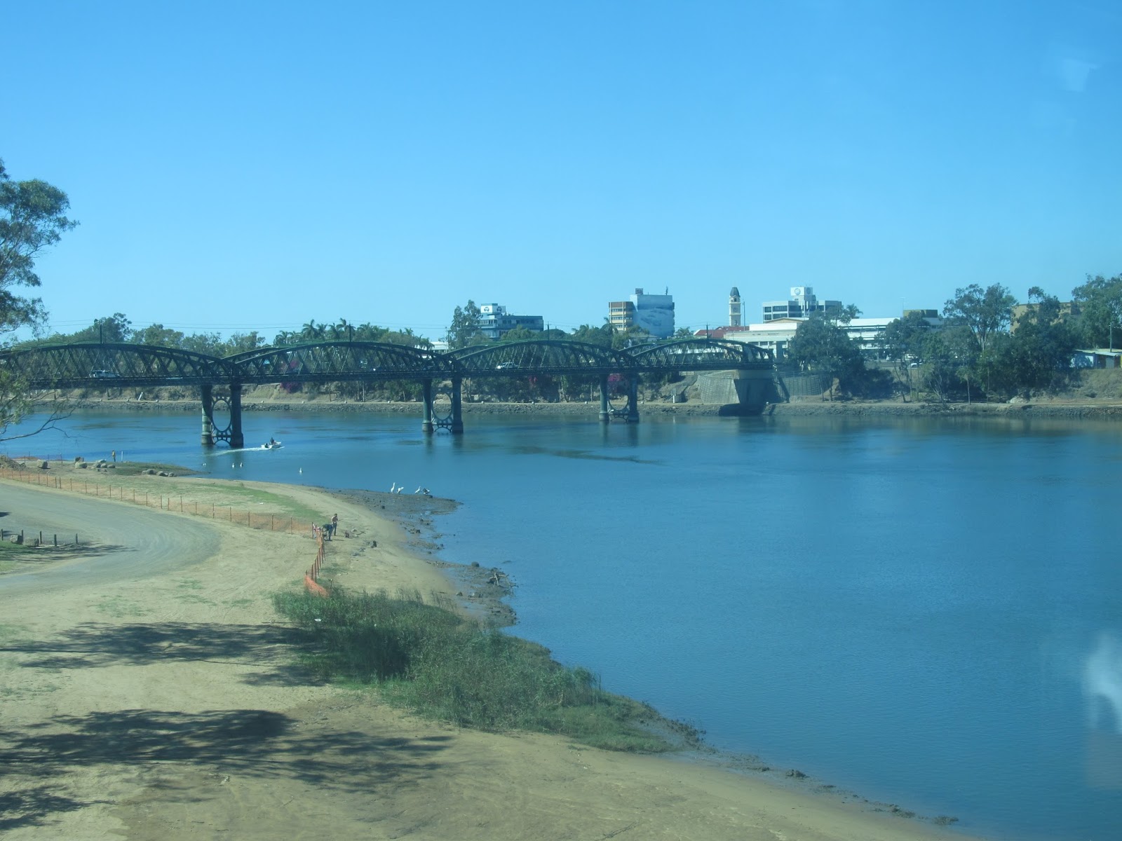
Naturally enough, bridges are important crossing points along any river and as I have discussed previously, the Barwon is no exception.
Once the Barwon River flows through Geelong however, there is no point of crossing until one reaches the river mouth at the towns of Barwon Heads and Ocean Grove - a distance by road of some 19-20km. In recent times, this distance was highlighted when the Barwon Heads Bridge was nominated as an available river crossing point for those in Geelong wanting to cross the river during the UCI World Cycling Championships which saw the closure of the Moorabool Street, Prince's and Queen's Park Bridges - a round trip approaching 40km just to get to the opposite side of town? Bearable for the space of a week, but not very practical on a regular basis.
Original Barwon Heads Bridge December 2009 during
reconstruction
How difficult must life have been then, for those living in Ocean Grove and Barwon Heads before the construction of the Barwon Heads Bridge?
Prior to its erection in 1927, a trip from Barwon Heads to Ocean Grove on the Bellarine Peninsula required either a boat or a round trip via Geelong on the road. In the early days a rowboat service was available and later, a motor launch. Today a trip between the two towns takes a few seconds in a car or a couple of minutes on foot. A quick swim across the river in good weather always seems like an inviting option too, however the accidental drowning of a swimmer who tried just that in 2008, showed fairly clearly that it is not a wise option. As the 26 year old swimmer attempted to cross from one bank to the other, he was caught in a strong incoming tide which created dangerous undercurrents and was unable to swim out. By the time he was rescued, he was unable to be resuscitated.
There is no question that the erection of the bridge made life safer and far more convenient for almost everyone (with one notable exception I will mention later). It can also be said however, that the bridge at Barwon Heads was a source of controversy even before its construction began.
Realising that crossing the river by boat was not adequate to the needs of growing traffic movement, various ideas were put forward to solve the problem. Whilst a bridge was the preferred option for most, it was also expensive so other, cheaper options were touted. These included a punt and in 1910 a pontoon ferry service was recommended, but was soon shelved for lack of support.
Whereas a pontoon ferry capable of carrying motor vehicles would have cost a total of about £600 in 1910, the bridge would have cost many thousands more. When a ferry was again suggested in 1925, the estimated cost had increased ten-fold. The idea was once again shelved, this time in favour of a bridge, as traffic flow - partly due to an increase in holiday makers from Melbourne - made the ferry untenable.
As a result, a call was put out for tenders, with the winning submission by Stan Patience of Gippsland to cost £10,400. The expense was to be divided between the Country Roads Board and the shires of South Barwon and Bellarine with public subscriptions providing the final £1,000. The bridge would be a timber truss structure, a little more than 300m in length.
The finished product was opened on Christmas Eve, 1927, but without the presence of construction boss Stan Patience who had died some months earlier in a workplace accident at Marshalltown Timber Yard.
Whilst most were happy to see the completion of the new bridge, for one group it spelt the end of their livelihood. Prior to 1927, Ocean Grove was home to a thriving fleet of couta boats which fished off the coast outside the heads. Unfortunately for the fleet, the erection of the bridge meant that they could no longer moor their vessels in the harbour upstream at Ocean Grove. This resulted in the fleet moving instead to new facilities below the bridge at Barwon Heads.
The bridge which still stands today, remains largely unchanged. In 1933, the timber surface was sealed with bitumen. Major repairs had to be carried out following the record flooding of 1952 then in 1961 the bridge was remodeled and in 1965 was widened, at which time the pedestrian walkway was moved to the upriver side of the bridge. Cantilever fishing platforms which were part of the original design were added back to the structure during renovations in 1998.
Newly completed road bridge at Barwon Heads
It was in this year that the ABC TV series Seachange first aired. Filmed in and around Barwon Heads, the bridge featured regularly in the show which ran until 2001. In an echo of real life, the bridge was often the focus of debate and controversy amongst the population. This was also true in real life and never more so than in 2006 when it was determined that the original bridge had reached the end of its lifespan and needed replacing.
Whilst everyone realised that something needed to be done, there was no agreement as to how the issue should be resolved. VicRoads determined upon replacing the original bridge with two new structures - a road bridge and a separate pedestrian bridge located downstream. This option was widely condemned by the local community, including such celebrity figures as cycling star Cadel Evans, forcing VicRoads to rethink their plans for a two-bridge solution.
Ultimately however, this protracted three year battle was unsuccessful and a contract was awarded to McConnell Dowell Pty Ltd in 2009 to build the two bridges. Construction began on the road bridge which replicated the style of the original and incorporated various timber components from the earlier bridge. The new bridge has 34 spans supported by 165 treated timber piles. Strength is provided by steel beams running through the structure which is over topped by a reinforced concrete deck. At 308m the new, two-laned bride is slightly longer than the original. The bridge was opened to traffic in November, 2010.
Almost completed pedestrian bridge downstream of the
reconstructed road bridge at Barwon Heads
The controversial pedestrian bridge which was constructed downstream of the road bridge opened to the public in April, 2011. At 4.5m wide, this bridge is half the width of the other and is made from 18m concrete spans, with single piers supporting each span. The piers are positioned to align with every third timber pier in the road bridge. The pedestrian bridge also incorporates fishing/viewing platforms along its length on the downstream side and a boardwalk at the Barwon Heads end with beach access, facilities for bike parking, seating and a drinking fountain which have been available to the public since June.
An official opening event is scheduled for later in the year, and true to form, there is already controversy over the naming of the bridge. A competition to choose a name has been announced with opponents claiming it should remain simply the Barwon Heads Bridge. In the past week, this issue has taken a new turn with some suggesting that following his stunning win in the Tour de France, the bridge be named after Barwon Heads resident Cadel Evans, however authorities have been quick to quash this idea and the issue if a name is yet to be resolved.