Showing posts with label Flood waters. Show all posts

23 November, 2013

Eaten away

Erosion is a problem common to many rivers and it comes in three main forms: bank erosion, gully erosion and hillslope erosion. Whilst the Barwon is subject to all three forms, studies have shown that by far the biggest impact comes from bank erosion.
Riverbank between Pollocksford and Merrawarp Roads
As the products of erosion enter the river system, they take one of two paths. The lighter matter remains suspended in the water and is carried downstream whilst the heavier material forms what is known as "bedload" which sinks to the streambed to be washed down more slowly. Whilst the suspended material may be deposited on flood plains, ultimately increasing soil fertility, it can cause a reduction in water quality as well as problems downstream, particularly in the shallow lake systems below Geelong.
Bedload can build up on the stream bed further upstream, restricting the flow of water and movement of fish and other river fauna as well as adversely impacting on their habitat.
Prior to European settlement, the river environment was believed to be relatively stable, however from 1836 onwards, clearing of native vegetation, the introduction of stock which impacted soil quality and bank stability and the exploding rabbit population burrowing into banks all added to a rapid increase in erosion along the Barwon. Other contributing factors included the draining of wetlands and marshes for farming purposes and the diversion of water from the Barwon and its tributaries.
The West Barwon Dam
Early efforts to control erosion included the planting of willow trees which it was believed would stabilise the banks. Unfortunately however, they - and any number of other exotic plant species - had the opposite effect, not only contributing to the erosion, but also impacting upon nutrient levels in the water and destroying the habitat of native animals. As their dense roots extend into the riverbank, burrowing animals such as platypus are unable to dig their burrows. As I have blogged previously, by 1949 willows were found to choke the stream, causing flooding, erosion and silting. Today, only a few willows remain here and there along the river.
Another introduced species which can impact riverbank stability is the introduced carp, which not only eats the plants necessary for the survival of native fish, but with its aggressive feeding habits can cause bank erosion. Various initiatives such as "Catch-a-Carp Day" and the draining and dredging of Reedy Lake where a tonne of carp was removed help to control levels of this pervasive pest. If caught while fishing, it is illegal to return carp to the river.
A carp grazing along the riverbank at Marshall
If not used with care, speed boats can also contribute to bank erosion. Speed limits are used to help minimise these effects.
In some cases, natural events also contributed to the problems. When a landslide blocked the channel of the East Barwon River in 1952 causing the creation of Lake Elizabeth, water flow was significantly impacted. The following year when the blockage was partly breached, soil and debris was washed downstream, covering lower-lying farmland. Major flooding in 1995 also caused significant erosion.

Aerial view of the 1995 floods looking south west from the Geelong Advertiser
By the 1940s, efforts were underway to control erosion (whether natural or manmade) and improve water flows and water quality by stabilising the banks and bed of the river. In the 1970s further measures were taken such as the installation of silt traps and revegetation. Following the 1995 floods, intensive measures were required to control and reverse the damage done by the increased water flow.
Today, ongoing measures to minimise erosion and improve water quality are in place and a multitude of Landcare groups across the region work in conjunction with the Corangamite Catchment Management Authority to rehabilitate the Barwon.
Bank and gully erosion can be reasonably effectively controlled in rural areas by restricting the access of stock to rivers, creeks and gullies and by revegetation along riverbanks and areas likely to suffer from erosion. Education of landholders and improved farming methods are also important.
Hillslope erosion is best controlled by encouraging good ground cover improved soil structure which can be aided by measures such as the retention of stubble from cereal crops and the use of raised-bed farming.
Sheep on the river between Pollocksford and Merrawarp Roads
I have noticed in recent times (hence the idea for this post), that bank-stabilisation works are currently being undertaken near Breakwater where rocks are being used to line sections of the bank. Upstream at Queen's Park, some removal of exotic suckering species of trees such as ash has occurred, however I don't know whether this is for stabilising purposes.
Bank stabilising near Barwon Valley Golf Course

17 May, 2013

"The best fertilizer is the gardener's shadow"

As is often the case in the course of researching a post for my blog, I sometimes come across a snippet of information which provides a clue as to what my next post might be. This was the case with the current topic.
As I scoured the contents of the 19th century newspapers on Trove, looking for details of River(s)dale and Captain Foster Fyans (hopefully more of which later...), I came across an article from The Argus of 8th December, 1866 which described some of the industry springing up along the banks of the Barwon at "Marnoch Vale" (aka Marnockvale) and downstream towards the township of Geelong.
Not surprisingly there were tanneries, flour mills, a woollen mill and even a ropeworks. The Riversdale Windmill was described as being to the left of the bridge leading to the Barrabools (Princes Bridge) with Captain Fyan's house to the right, but another thriving business was also listed which until now I hadn't seen mentioned - a Chinese market-garden.
A little searching around and I discovered that the Malay Immigration Society of Geelong were responsible for the arrival of a ship in 1848 carrying Chinese immigrant labourers to work for squatters in the district. Others arrived with the gold rush, before drifting into market-gardening when when it proved a more reliable source of income.
The Chinese were renowned as hard workers, establishing themselves on the outskirts of town and along the Barwon between Marnockvale and Breakwater. One garden was located below the Roadknight property on the river flats and in 1902 a snippet in The Argus mentions an assault on a Chinese man at a market garden in South Geelong. Much later, The Argus of 11th March, 1935 indicated that the home of a Chinese market-gardener at Breakwater was burnt to the ground as it was located outside the jurisdiction of the Geelong Fire Brigade.
Closer to town, one of the earliest market gardens was established on the river flats at Marnockvale between the West Melbourne Road (Marnock Road) and Rocky Point. The publication "The Earlier Days of Newtown and Chilwell" compiled by Charles S. Walker in 1958 describes some of the gardens in the area. The Chinese at Marnockvale would sell their vegetables either from their door or by pushing their wares in handcarts to the populated areas of Newtown and Chilwell and in town each Tuesday, Thursday and Saturday. The intervening days were spent cultivating, harvesting and preparing their vegetables for sale.
Handcart similar to those used by Chinese market-gardeners in 19th century
Geelong. Photo taken from the English-based Scale Model Horse Drawn
Vehicle Forum
The Argus of 8th December, 1866 describes the garden at Marnockvale thus:
The Chinese novelty...is chiefly remarkable for lack of beauty. Than its rickety make-shift surroundings, it would, perhaps, be difficult to find anything more distasteful to the eye or unattractive to the imagination; yet the Chinese garden is a feature in the district of much practical significance, and it stands as a reproach to the much-vaunted intelligence of the Anglo-Saxon, who, unable to detect a flaw in his own national character, can see only the beam in the eye of the children of Confucius.
Ah-Sam, who represents himself to be the head-man, has six acres under garden cultivation, for which he pays 14 a year. The land, formed of two slopes, north and sough, runs parallel with the river, and in the centre, on top of the rise, and at about fifty feet from the Barwon, there is a Californian pump, worked by three men by treddle motion. In a comparatively short time, sufficient water can be pumped up to flood the whole six acres; but, with an eye to economising labour in seasons when so much moisture is unnecessary, Ah Sam has constructed slabbed pits at every few yards along the various paths, and the water, as it flows from the shoot, passes along the different channels, and fills these pits before it can overflow the ground generally. At the present season all the ground is watered by hand - two stalwart Chinese filling large watering-pots at the pits, and with one in each hand sprinkling two vegetable beds simultaneously. All the young plants are mulched with long grass, and in some places a temporary paling roof is erected over the beds, to protect the more tender plants from the scorching rays of the sun during their early growth. "Next month," observed Ah Sam, "no rain; then (pointing to the river) give plenty water all over. Now plenty cabbage make no much money. Next two months make 14, 15 perhaps 20 a week." The ground appears to be manured chiefly with horse-dung. The land is anything but of good quality but the garden, which contains all kinds of kitchen vegetables, is beautifully kept, and the produce generally looks well. Besides Ah Sam, who appears to do the work of two men, and plies his feet vigorously at the pump, there are three Chinese labourers generally at work.
A second article from the Geelong Advertiser of the same year likewise describes the system of pits and channels used for watering and drainage, remarking in typically patronising fashion that "The affair is simple and efficacious; there is no pretence to engineering about the matter. No particular notice is taken of delicate gradients, and possibly no theory of gravitation ever disturbed the ideas of the projectors."
 As to the tools used by the Chinese in their work it was remarked that one  [man] was "...recreating with a sort of Armageddon-looking rake, with teeth of satanic length..."
A Chinese harrow (image from the Museum of the Riverina) which may have been similar to the tool described
The journalist also seems surprised by the Chinese knowledge of manuring to improve the soil and goes on to suggest that the European settlers would do well to follow their example stating that "It is not complementary to see Chinamen setting us an example, but as the example is a good one, it ought to be followed".
Then, in an almost prescient echo of modern concerns it points out that a thriving local market-gardening industry on the banks of the Barwon and Moorabool Rivers would reduce the reliance upon food grown in other areas of the colony.

Looking across the original Prince Albert Bridge towards West Melbourne
Road, c1860-1879. Scouring works are visible but not the market gardens
Such was the Anglo-centric view of Chinese industry in the early years of settlement at Geelong but whilst the temporary nature of their buildings may not have appealed to the European eye, there can be no doubting their perseverance. In October, 1867 a serious flood raised the Barwon to such an extent that much of the land from Geelong to Barwon Heads was said to be underwater.
Approximately the same view as the above photo as it appears today
The tanneries and wool scours at Breakwater suffered badly, with significant property damage and loss of stock, particularly to those on the south bank of the river. Captain Fyans was forced on to higher ground and an auctioneer living at the bottom of Yarra Street had to remove his family to safety by boat when his house was inundated. Ah Sam and his colleagues were not immune either, with the Gippsland Times of 3rd October stating that:
The Chinese gardeners at Marnock Vale had a very narrow escape of their lives, the water having risen 6ft in a very short time; as it was, they had to wade 200 yards with the water nearly up to their neck.
In his history of Newtown and Chilwell, Charles S. Walker indicates that there was a two-storey hut on the Marnockvale garden, intended to provide protection against high water levels, he states however, that it washed away the first time the river flooded - perhaps during the 1867 event described. The effect on the crops and loss of income must also have been significant.
In addition to the flood of 1867, high water levels were also recorded in 1870, 1893 and 1894 whilst one of the largest floods to hit the Barwon since European settlement was recorded in 1880. This is no doubt in addition to numerous minor flooding events which did not cause significant damage to buildings and infrastructure, but which would still have had a devastating effect on Ah Sam's vegetables.
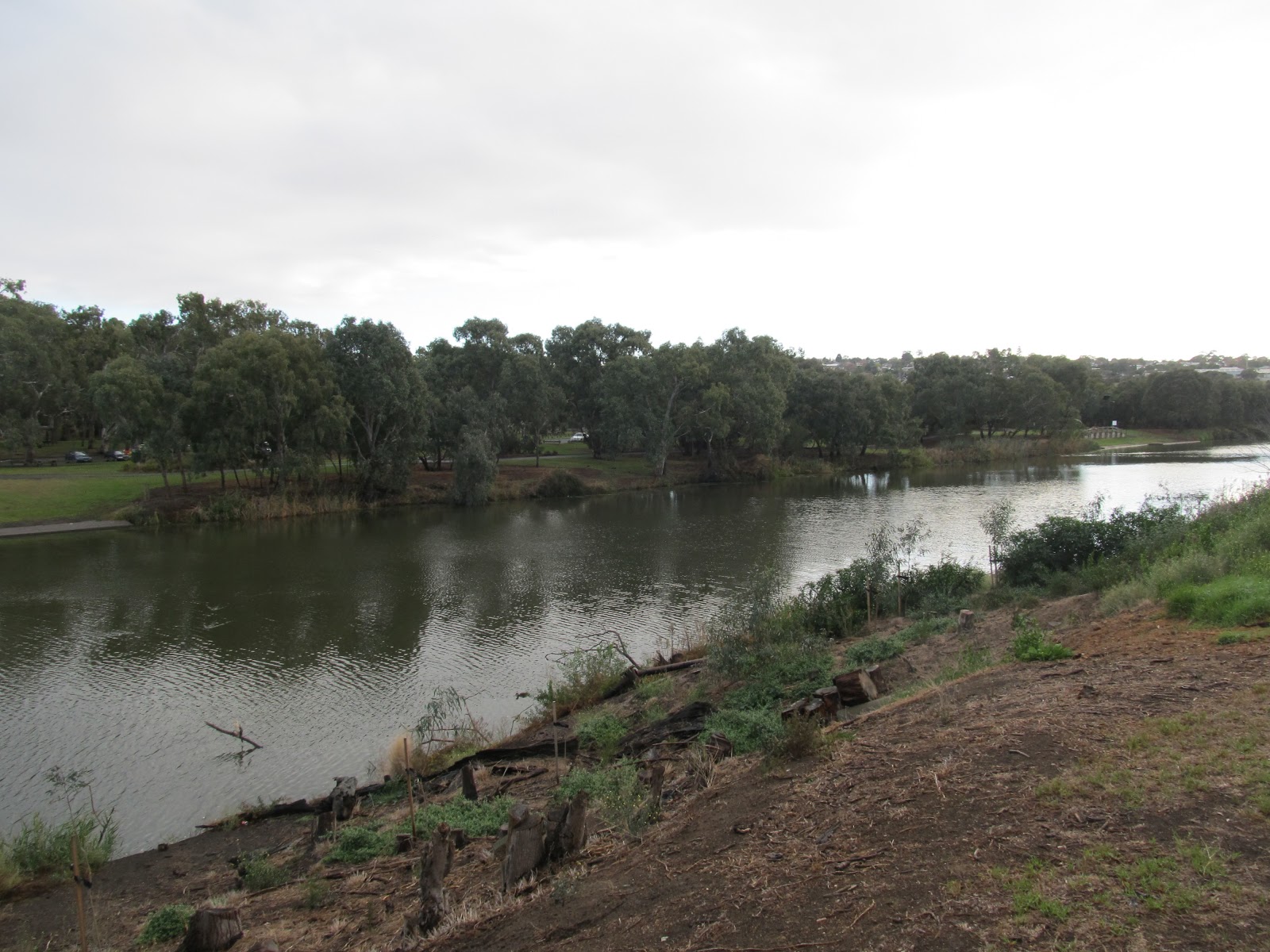
Looking north west between Rock Point (right) and Marnock Road (left)
with the chimney of the Phoenix Wool Scour in the background
However, Ah Sam and his family were nothing if not resilient. Whilst there is a burial recorded at the Eastern Cemetery for the 14th March, 1903 (I am assuming this to be the same person), his garden lived on. In 1904 The Argus reported two local boys caught stealing peas were handed over to police after trying to escape by jumping into the river, then in 1930 Mr Ah Chee (presumably a relative), was fined for tampering with three water meters on his property.
Whilst there is nothing in the media to indicate exactly how long the garden remained at Marnockvale (or even if it was the only one), by the mid 1930s the number of Chinese-operated market-gardens began to decline significantly, so it is likely that Ah Sam's garden was also consigned to history.

14 June, 2012

The Jewels of the Barwon

Tuesday morning this week was the coldest morning of the year so far. I can vouch for that as it was still barely above freezing by 9:30am when we hit the river for a morning ride. We very quickly found ourselves looking for the The Barwon Edge to grab a take away and warm frozen fingers.This objective having been achieved, we headed up towards Fyansford.
After last week's "non-flood" during which river levels through Geelong peaked at 2.42m (2.5m constitutes a minor flood), various sections of the track were still quite sticky with an inch or two of mud covering the whole path in places. Being the intrepid adventurers that we are, we ploughed on through, trying not to end up coated from head to foot in what only days ago was probably quality topsoil in some farmer's paddock.
The sealed bitumen track near Queen's Park
As we neared Fyansford and with the sun finally managing to peek out from behind some clearing clouds, our perseverance was rewarded by an interesting spectacle. The grass between us and the river looked to have a fine covering of snow or frost. The same was also the case a little further round on Fyansford Common where the low-lying areas were still filled with water, forming small lakes in the dips.
Fyansford Common
It was a cold morning and we were in a relatively deep part of the river valley, so frost was not unlikely, however closer inspection revealed not ice or snow, but rather dewdrops, millions of them  suspended in fine, intricate webs on the top of the grass.
An exploratory swipe or two  and both web and droplets vanished into nothingness. Intrigued, we snapped a few photos and agreed with an interested passerby that it did indeed look quite pretty. And such was the angle of the sun that at one point, the light refracting off the droplets created a rainbow which stretched out across the grass at ground level. (It occurred to me at this point that I have long wanted to take a photo of a rainbow along the banks of the river, but this was not quite what I'd had in mind.)
A rainbow in the grass
Somewhat limited for time, we concluded our examination and headed on our way. It was not until I got home and downloaded  my photos that I became more interested in the artistic possibilities of suspended dewdrops. And of course, as is nearly always the case, I didn't have exactly the photo I was looking for.
Dewdrops suspended
By now it was nearing 2pm and knowing that it was probably wishful thinking, I grabbed the camera, jumped in the car and headed back down to Fyansford in the hope that the fairytale landscape hadn't completely evaporated. Despite the sun, it was still a cool day and as luck would have it, the larger area of droplets on the common was still present, so I got snapping.
Hanging by a thread

A matrix of droplets
This time it wasn't long before I discovered the secret of these tiny suspended jewels of water and light. Spiders! Hundreds of tiny spiders were everywhere, spinning the webs on which the droplets had formed. Back and forth, stretching from one blade to the next, their webs criss-crossed the grass creating a continuous carpet on which the droplets had formed.
After a little Googling, I believe these guys are money spiders (also known as sheet weavers) which belong to the Linyphiidae family. Legend has it that if a money spider falls upon you it will bring you financial good luck (here's hoping!).
An artist at work
Upon closer examination, the spiders could be seen singly and in groups moving across the webs. I assumed initially that they weren't concerned by wet feet but now that I think about it, all of those hairy little legs didn't seem to be disturbing the tiny balls. In fact, in none of the photos I took can I be sure that any of the spiders are actually touching a dewdrop. Somehow they seem to be able to co-ordinate all eight legs in such a way that they always step between the drops.
Tiptoeing between the drops
The last thing I noticed was that above the array of webs and their suspended drops, the spiders were busy creating a new layer of webs, these ones had clearly been spun more recently as they were higher than the others and had no droplets attached. The spiders on these strands passed back and forth without any risk of an involuntary foot bath.
King of the mountain - a tiny figure atop the mound of drops
Of course, with any of the above photos - or those in any of my blog posts - clicking on the picture will enlarge it for a closer view.

06 June, 2012

What a difference a day makes

As of 4pm Wednesday the Barwon has not yet peaked in Geelong. The estimated time has now been pushed out to sometime tonight or early tomorrow but the water level is definitely rising. (Updated Thursday 7th June roughly as waterlevels peaked just below the minor flood level of 2.5m, see photo below.)
Old Breakwater Bridge, Tuesday 5th June, 2:45pm

Old Breakwater Bridge, Wednesday 6th June, 1:45pm
Old Breakwater Bridge 7th June, 11:50am at peak water level

The 2 top photos were taken about a day apart, the latter just as VicRoads was preparing to close the bridge to traffic.
VLine train crossing the flooded Barwon River
I also took the opportunity to take some photos which I doubt have been seen before as the new Breakwater Bridge endures its first flooding event.
Rail bridge and Old Breakwater Bridge in flood 6th June
as seen from the new bridge
At other points along the river through Geelong, things were also progressing as they usually do. Below is the view from Queen's Park this afternoon:
Queen's Park in flood from above
Elsewhere, the path opposite the rowing sheds was under water by this morning, the mill race at the paper mill was overflowing:
The paper mill at Buckley Falls
and a little upstream, the Bunyip Pool was well on the way to becoming a turbulent mass of water:
Water levels rising at the Bunyip Pool, 6th June, 2012
I also noticed that the resident bird life has been quick to take advantage of what I assume is an increase in available food sources as insects and perhaps even fish are driven from their normal homes.
One of a pair of pelicans catching breakfast in the shallows of the
flood waters this morning near the Moorabool Street Bridge

Mudlark with an insect driven out by the rising waters
As of Friday morning, water levels are receding. As predicted, the river peaked in Geelong around midday Thursday  at 2.42m just below the minor flood level (2.5m). Earlier predictions of about 2.8m were not realized.
Whilst this is by no means a record-breaking flood event, there are still some interesting statistics which have arisen from the recent weather. The Geelong Advertiser carried an article today which pointed out that the rain which fell between Sunday afternoon and Tuesday (about 61mm) was the largest in a 3 day period in June since 1952, which it will be remembered, was the year of Geelong's "great flood". The rainfall on Monday also approached the record for the single wettest June day on record which occurred on 1st June, 1939.
However, with no further significant rain forecast for the present, river height records of the past are safe for now.

16 January, 2011

Flood Sports

A week can make quite a difference when it comes to a river. Last week I ran a short distance upstream and back, nothing unusual in that or in the river and its surrounds. Between Monday and last Friday, the rain gauge in my backyard recorded 125mm of rain - and the result? By Saturday night the river level had risen to be at "moderate flood levels" through Geelong.
Barwon River in flood - Breakwater.

The Bureau informs me that the Barwon officially peaked at a height of 3.68 metres very early on Sunday morning and by the time I made it down to survey the extent of the damage it was already beginning to recede. Having said that, there was still plenty of water where it shouldn't have been. As always, the first point to go under was the Breakwater and Barrabool Road was of course closed. Whilst I didn't see the flood marker at this point, various citizens were wading up the middle of the road somewhat above waist height. Likewise, virtually every low-lying section of the track around the river was under water.
One of the first things of note when the Barwon floods is the number of locals who come out for a look - me included. Suddenly I am not the only person toting a camera and looking at the river. Virtually every access point has someone there taking in the action.
Baum's Weir.

And action there was. At both Buckley's Falls and Baum's Weir the volume of water and the speed at which it was flowing was clearly in evidence. Noise, foam, water and mud were the order of the day as I have found to be the case with previous flood events. Whilst the flow of water is spectacular, the mud which will coat everything once water levels subside, is not and may well keep me off some parts of the track for several days. On this occasion, there seems to be little in the way of damage to buildings. The rowing sheds are partially submerged as are a few other low-lying buildings, however as this is a semi-regular occurrence for these buildings, I imagine there is not too much damage that can be done. In this respect, Geelong is fairly well positioned with respect to enduring floods. There are few, if any, low-lying houses and it is only in the worst of floods that more than one bridge will be out of action. In fact, when the Breakwater Bridge redevelopment is complete in a year or two, even that problem will be solved. 
Barrabool Road.

This raises the point that floods in Geelong are generally more a source of entertainment or at worst an inconvenience than a source of death and destruction as has been the case in Brisbane. Everyone comes out for a look and compares water levels to either the 1995 flood or in the case of the over 60s, the 1952 flood. 
In addition to the sightseers, there are those who also come to play - no doubt against the advice of authorities. It occurs to me that in addition to the usual array of sporting activities which take place on and by the river, there is a category which only comes into its own during floods. Some are merely variations upon everyday activities - such as walking and riding along what is left of the track or wading along flooded roads. There also seems to be some sort of sense that dogs are immune to the dangers of swimming in flood waters. When we were surveying the scene at Fyansford mid-morning, there were no less than five dogs swimming on the Common. I was later given a very friendly greeting by a very soggy Labrador near the Moorabool Street Bridge.
I have it on good advice that an athletics meet of some description was held at Landy Field yesterday. This morning, there was one hardy soul doing sprints in the car park, but otherwise, the only activity was a pair of wood ducks having a paddle near the discus nets.
Landy Field.

Kayaking is also very much a "flood sport". During each flood event it is almost mandatory that the Geelong Advertiser posts a photo of a bloke in a kayak going over Buckley's Falls. This time things were a little different. There was no photo and the bloke got stuck in a tree minus his kayak - now that would be a photo worth seeing!
Other sporting activities are somewhat more inventive and my favourite for the day was a group of young guys in boardies with a 4WD ute, a rope and a skimboard (or similar). With several of their number watching on, the chosen one would place the board in the water, grab hold of the rope and then attempt to mount the board and skim in the shallows at the edge of the river while his mate towed him with the ute - something like a cross between water skiing and skateboarding. Not withstanding the mess they were making of the riverbank at this point, they were actually quite good at what they were doing. Again, I'm not sure the authorities would have been impressed.

The latest sporting craze.

Of course, for the four wheel driving enthusiast, there is also the option of finding the biggest puddle you can and seeing if you have the guts to drive through it. This may also provide photo fodder for the Advertiser if your vehicle gets stuck. Maybe this was what one driver had in mind when he attempted to cross what would otherwise be an expanse of grass near the Moorabool Street Bridge. Once the water level reached almost to the top of his tyres he clearly decided that he wasn't equipped for serious water crossings and reversed back to higher ground. I suspect I may have missed yet another photo-opportunity.