Showing posts with label Moorabool Valley. Show all posts

01 August, 2016

Fyansford's forgotten falls: a lost von Guerard

My previous three posts identified the locations along the Barwon River of several sketches made by 19th century landscape painter Eugene von Guerard during his visits to Geelong during the 1850s. Some were developed into oil paintings which became well-known works of art such as View of Geelong and Mr Lewin's Hut on the Barwon River. Others, such as his sketches of the Barrabool Hills appear to have remained just that - sketches. Whilst the locations of these and other illustrations depicting scenes on the Barwon at Buckley Falls were easy enough to identify, there was one sketch which had both George Hook and I scratching our heads.
The scene portrayed was a narrow waterfall beside an elevated road, upon which two loaded drays were travelling. The first clue as to the fall's location came from von Guerard's own notes which indicated that the scene was the "Moorabool Valley and new [road] to Ballarat near Fyansford. 14 March. Geelong." (My translator was unsure of the 5th word and from context the year was 1855.)
So, this spot was near Fyansford on the Moorabool River, not the Barwon.  But where? I had never seen such a fall along the lower reaches of the Moorabool. I was aware that a section of several kilometres along the river had been diverted during the 1980s to facilitate works at the Batesford Quarry. Could the waterfall have been in this section? Perhaps.  I had only ever seen the newer diversion, not the original watercourse.
von Guerard sketch of the Moorabool Valley
If this was the case then where was the"new road" which appeared in the sketch? Survey maps of the area mostly indicated that the only surveyed road between the Lower Leigh Rd (Hamilton Hwy) and the Leigh Rd (Midland Hwy) was today's Fyansford-Gheringhap Rd. The 1861 geological survey map marked some roads running to the river (which I doubt were ever made), but none of them crossed or ran alongside the river. Could the "road" have been a track on private land?  If so, why describe it as a new road? To me this implied a newly made public road. Furthermore, this land west of the Moorabool was considered grazing land. The geological survey was yet to be undertaken in 1855 when the sketch was made and the quarry was decades away. There were river crossings at Batesford and Fyansford but no mention of another between the two.
So, was there a road near the Moorabool at Fyansford which would have been considered new in 1855 when the sketch was made? Well, yes. There was. In 1854 the first bridge at Fyansford was built across the Moorabool River. It was erected several hundred metres downstream from the original ford and at the time of its construction, the road leading out of the valley on either side of the river was redirected to the new crossing point and upgraded - a new road near Fyansford. A road furthermore, which was heavily plied by diggers heading to the goldfields of Ballarat or the pastures of the Western District.
It was probably no co-incidence that it was this same section of road to the west of the river which immediately came to mind when I first saw the sketch. I envisaged von Guerard positioned with his back to the river and looking up to the road rising out of the valley to the west.
But where was the waterfall? Could the site have been a gully running into the river beside the road at this point, rather than a fall on the river itself? An initial visit to the cutting did not immediately reveal the likely site of a gully, but much has changed since 1855. Both the Monier Bridge (1900) and the current bridge (1970) were built on sites downstream of the original bridge. By the 1920s, the land to the south of the Hamilton Hwy was Nichterlein's bluestone quarry and the Lower Papermills Rd had been built in the 1870s, a narrow gully could easily have become the victim of 160 years of development.
Modern cutting on the Hamilton Hwy at Fyansford, June, 2016
And there things might have stayed except that on a subsequent visit to the site, I noticed an old section of road rising up the valley, roughly parallel and a short distance to the south of the present road. I soon decided that this was the route of the original section of road formed in 1854 when the first bridge was built. Finally perhaps, a remnant from von Guerard's day.
I then discovered that in 1854 this road passed by a dangerous drop which according to The Argus of 27th April, 1855 (a mere five weeks after von Guerard made his sketch) was the scene of an accident which saw a horse and dray, along with its driver, plunge down a "precipice some twenty feet deep" next to the "new road" which was "not fenced in on either side, and [was] very narrow".
So, I now knew that the road out of the Moorabool Valley at Fyansford had passed by a steep drop of about 20 feet (or 6 metres), however as indicated during my conversations with George Hook, the height of the falls as estimated from the sketch may have been closer to 8m - perhaps even 10m. All this however was academic if the falls themselves could not be found. Imagine my excitement then when, on a subsequent visit, about 100m up the old line of road I heard the sound of trickling water!
Upon investigating the source of the noise, I discovered a channel - no more than a drain today - which ran beside the highway for some distance before dropping a short distance to a rocky crevice through which water was flowing.
Rocky channel from above the crevice
At this point, the water flowed over a natural rock formation, however the height of the drop was nowhere near the expected 8-10m, instead it was closer to 4m and the water was falling not onto the ground, but into a drain which was located just inside the fence of Nichterlein's former quarry (now the Fyansford Waste Disposal and Recycling Centre). From what I could see, it consisted of natural rock walls enclosed by a bluestone wall several metres in width and height. The floor was concrete and the collected water escaped via a large underground pipe at the bottom of the wall.
Drain in a corner of the old quarry
From above, it was difficult to determine angles. I needed to be down below, looking up as von Guerard had been. Time to visit the tip!
To cut a long story short, I was - reluctantly - allowed access to look at the site from below with just enough time to snap a few photos and ask a couple of questions. No, the manager didn't know when the drain was built, but assumed it was done when the site was a quarry and when OH&S and environmental concerns were unheard of. The pipe leading from the drain ran underground to the front of the property where, as he later showed me, it emptied into a culvert which runs under Lower Papermills Rd and drains into the river.
The extent of the fall today, viewed from the top of the bluestone wall
So, had I found another "missing von Guerard"? Well on balance, probably. Comparing my photos of the site at the tip to the sketch, there were certainly similarities, however it was also clear that quarrying had removed the majority of the high ground to the left of the waterfall whilst the height of the drain significantly impaired the view of the falls from below. Nor was it possible for me to establish what the original ground level was. Perhaps before the installation of the drain, the fall had been much greater. In addition, there were several places where boxthorn and other weeds growing over the rock face obscured some of the natural features, making comparison harder.
von Guerard's sketch and a photo taken from inside the quarry for comparison
In general however, the lines were the same as those of the sketch. In the photo I took, the cutting is out of shot to the right of the picture but is still present at the site. I have searched for photos which might include the site in the hope of getting a better idea of the original ground level, but have so far been unsuccessful.

31 January, 2015

A ride to remember

This weekend sees thousands of cyclists once again take to the streets and roads around Geelong, this time in the inaugural Cadel Evans Great Ocean Road Race. The elite men's race will take place tomorrow (Sunday) around a course in part based on the route used during the 2010 UCI World Championships.
This morning however, it was the turn of the citizens when at 7am, almost 4,000 riders left the Geelong Waterfront on a community ride over a distance of either 65km or 111km. All riders head first to Barwon Heads, with the short course riders heading back to Geelong whilst those on the long course followed a similar route to be taken by the elite riders, heading next to Torquay and Bells Beach before returning via an inland route through Moriac to Geelong to take on the seriously nasty hill-climbs of Challambra Crescent, Melville Ave and "Cementies Hill" on the way back to the Waterfront.
Whilst I wasn't up early enough to watch the riders depart, I did come across the tail end of the bunch making their way across the Barwon at Queen's Park before heading up Melville Ave.
Riders in the Momentum Energy Community Ride crossing the Queen's Park Bridge
Some were making harder work of it than others this late in the ride, but spirits still seemed generally high.
Riders heading up "Joey's Hill" to Melville Ave

Meanwhile, things got a little more serious with the start of the elite women's race at 11:30am. I grabbed a spot on the Breakwater Bridge, settled in and waited for the fun to start - and it didn't take long. Within 10 minutes of the race start, I could see the media helicopters overhead and then the support vehicles and media bikes began appearing, accompanied by a sizeable squad of Geelong's finest flashing their reds and blues.
One of four media helicopters covering the race
In a matter of seconds, the peloton appeared around the corner...
The peloton sweeping around the corner over the bridge
...and then just as quickly, they were gone..
The rear of the peloton crossing the Breakwater Bridge
Meanwhile above the river, one of the local White-faced Herons was forced to share airspace with a much larger type of bird:
There were several birds in the sky today.
Then, while the peloton headed off to take in the sights of Barwon Heads and the Great Ocean Road, I headed for "Cementies" (Hyland Rd in Fyansford which runs up beside the cement works). I arrived (via bike) in time to take up pole position on the seat half way up. There were a couple of other amateur snappers already waiting a little further up the hill and as we waited...and waited...well past the expected time of arrival, several more of the locals wandered down for a look.

One of Cadel's boys sussing out the course
At one point, a couple of the men's teams headed past - no doubt checking out the route for tomorrow's race - then we were treated to the spectacle of local Geelong West legend Sebastian Flaccavento slogging his way up the hill on one of his tiny bikes. He had his seat up nice and high today as he does for long rides, so I can only assume that he was the last rider through in the earlier community ride (the long course...of course).

Sebastian making his way up "Cementies"
After Sebastian came and went, we continued to wait. By now I had become quite well-acquainted with the lady standing to my left who then introduced me to a friend who also arrived. And still we waited. I know that the riders had expressed concern about the high winds forecast leading up to the race and I suspect their concerns were justified.

Not long to wait now...
It was not until about 2:30pm that the lead rider appeared around the corner and headed up the final hill. This as it turned out, was South Australian rider Rachel Neylan from the Building Champions Squad who made her move up Melville Ave and managed to hold off Valentina Scandolara from Orica - AIS and Tessa Fabry from High5 Dream Team to take the win.
Orica - AIS rider Amanda Spratt climbing the hill
After the lead riders passed, we waited in vain for any sight of a peloton. It seems the hills had taken their toll and the group pictured below was the largest remaining.
The remains of the peloton heading up
The tight bunch which had crossed the Barwon at Breakwater, had been torn to shreds by the time the riders climbed the hill above the Moorabool and somehow I doubt they had time to appreciate the view!
Looking past the riders to the Ring Road and the Lewis Bandt Bridge over the
Moorabool River

21 May, 2014

Branching out - GOLD! GOLD! GOLD!

There's gold in them thar hills! Well, in the Moorabool Valley to be precise - at Morrison's and Steiglitz on land which originally formed part of the squatting runs of Moranghurk, Durdidwarrah and Borhoneyghurk.
Gold was first discovered in the area in small quantities in 1851 but was not considered workable. In 1853, the squatter Andrew Love and George Morton found alluvial gold which resulted in a small flurry of activity, but it was not until late 1855 when William Hooley and Joseph Davis discovered the first of several gold reefs at Steiglitz on the banks of Sutherland's Creek near the bottom of the main street that the rush really started.
Timber bridge over Sutherland's Creek, Steiglitz
The table below gives a timeline of the development of gold mining along the Moorabool and it's tributaries - most notably Sutherland's Creek, Tea Tree Creek (which runs into the west bank of the Moorabool West Branch between Elaine and Morrison's) and Dolly's Creek (which also joins the west branch of the Moorabool from the same direction but further to the north).
Date
Place
Type of mining
1851
Morrison’s Station
-
1851
Dolly’s Creek
-
1855
Hooley & Davis discover reef at Sutherland’s Creek, Stieglitz
Quartz
1855
Sutherland’s Creek
Alluvial
1855
Yankee Gully
Alluvial
Late 1850s
Morrison’s Diggings
Alluvial
1857
Dolly’s Creek
Alluvial
1857
Tea Tree Creek
Alluvial
1862
Stony Rises
Alluvial
1863
Stony Rises
Quartz
1890s
More gold at Stieglitz
Quartz

This first rush in the area at Steiglitz involved alluvial mining, however reefs - the richest in the country - were also discovered and through the 1860s and 1870s deep lead mining of quartz veins became the norm. It was one of the first areas in the country where reef mining took place and in the very early days, the lack of quartz crushing facilities posed a problem so it was suggested that quartz be carted off site either to Geelong or back to England for crushing! This situation was soon rectified in 1856 when the first public crushing plant opened in Steiglitz and by 1862, fifteen quartz batteries were operating there.
Remains of a mullock heap at Steiglitz
As they were discovered and worked, the reefs were given names to differentiate them. The best known was perhaps New Chum, but others included Gibraltar, Tam-O-Shanter, Ironbark, New Years, Cooper's, Dreadnought, Yankee Smith,  Hanover, Boxing, Mayday, Sailors, Victoria, Clifton, Portuguese, Commissioners, Scotchman's, Birmingham, New Lode, Satchwell's, Garlick's, Durham and Italian.
The long term nature of reef mining and the requirement for heavy equipment meant that the settlement at Steiglitz was more permanent than many goldfields and by the late 1850s the town boasted four churches, five schools, four hotels and a police magistrate to maintain good order.
By 1859 Steiglitz boasted two bridges "paved with gold", specks of which could be seen in the quartz tailings from the worked out Italian Reef which were used as road base.
As the mining operations at Steiglitz began to shift from alluvial to reef mining, smaller claims were amalgamated and larger companies moved in, meaning miners were paid a wage rather than working their own claim. Some older reefs were also reworked as cheaper, more efficient methods of quartz crushing became available. By 1862, forty leads were being worked and 15 quartz crushers were operating. The majority  however were still involved in alluvial mining up and down Sutherland's Creek.
Sutherland's Creek just west of Steiglitz township
This was also the year in which the Geelong-Ballarat railway line opened, providing reliable transport to the goldfields which was connected from the station at Meredith by coach.  By the 1870s, there was also a public library, racecourse and the new brick courthouse which was built in 1875.
The courthouse at Steiglitz
By 1879 however, as the gold supply began to dwindle, the number of miners fell to about 100. The last crushing plant had closed a couple of years prior. People moved on and the population likewise dwindled.
As I discussed in one of my previous Woodbourne Creek posts, the 1860s saw changes in the law which opened up land for selection and closer settlement by small farmers. In the case of the Steiglitz area, many of these selectors had first tried their hand at mining but instead turned to the land to support their families. It was this pressure which saw the land east of the Moorabool River which had been part of the Moranghurk Estate, carved up into smaller properties when the squatting licence for the run was revoked in 1870.
Then, in the early 1890s, new gold deposits were discovered at Steiglitz and the miners began to return once again. The population sprang up to 2,000, trades and services returned, clubs and societies flourished to entertain the population. The boom was back.

Steiglitz township during the gold rush
However it was relatively short-lived and as yields dropped in the late 1890s, the population once again began to decline. People moved away, taking their business - and in many cases even their houses - with them.
Mining licences continued to be issued in small numbers over the years until 1941 when the last mine closed. From this time, public buildings were moved away and services relocated to other towns. Those who remained, looked to other industries to earn a living.
In 1951, the centenary celebrations marking the discovery of gold in the district saw the erection of a commemorative cairn. The central stone at the bottom was taken from the home of William Sharpe and those to the right and left from the original von Stieglitz home. They are topped by pieces of quartz from the abandoned mines.
Commemorative cairn at Steiglitz

20 October, 2013

Branching out - from squatting to schooling

Today, Bell Post Hill is a suburb of Geelong and the home of Kardinia International College, a non-denominational private school which caters for students from Kindergarten to year 12, however things were once very different.
In March, 1836, it became the site of one of the very earliest squatting runs in the Port Phillip district when John Anthony Cowie and David Vere Stead moved into the district. The pair had arrived from Tasmania in November the previous year with John Batman's party of settlers. The only other settler in the district at that time was Dr Alexander Thomson who arrived some two months after Cowie and Stead and settled on the south bank of the Barwon at the future site of the suburb of Belmont, Geelong.
On 9th July, 1836 John von Steiglitz (recently married to Cowie's sister Emma) arrived at Point Henry with stock for the run which they continued to build on for the next few years. The land held by Stead, Cowie and Steiglitz as their grazing run extended from Bell Post Hill down to the Moorabool River near Batesford and north towards what is now Lara - known to the early settlers as Duck Ponds.
Looking across the Moorabool Valley towards the Batesford quarry from Bell
Post Hill over what would have been part of Cowie and Stead's holding running
down to the river
Popular legend has it that Bell Post Hill was named for a bell, erected on the high point of the hill (possibly an old ship's bell brought by Cowie and Stead) which was used to notify settlers of the arrival of ships approaching Point Henry and also of imminent attacks by hostile members of a no doubt displaced indigenous population.
The view towards Corio Bay today from Bell Post Hill
Cowie, Stead and the von Steiglitz brothers did not long remain in the district and by 1838 they had moved up the Moorabool River where they took up a number of runs which will be the subject of future posts.
Being close to the newly established town of Geelong, the original Bell Post Hill run was soon divided up for closer settlement - possibly a reason for the departure of Cowie & Co. By 1852 subdivision was occurring in the area of Cowies Creek and by the 1860s it boasted a population of about 500 people and two pubs. Land at Bell Post Hill on the Bates Ford Road was being auctioned in lots upwards of an acre by 1853.
During 1859-60, John Calvert Esq who then owned land at the top of the hill, had a grand house erected which he called "Morongo".
"Morongo" 1863, image held by the Victorian State Library
A roughly similar view today
In addition to this residence, Calvert had squatting interests in the Western District holding the Irrewarra and Watch Hill runs with Captain John Bell who was also his neighbour at Bell Post Hill, having built his own mansion - "Bell Park" - only a short distance from Calvert's residence some years earlier in 1853-1854. All that remains of "Bell Park" today is an extension to the house, added in 1860 which now serves as a chapel for the McKellar Centre owned by Barwon Health.
Bell Park 1863, home of Captain John Bell. "Morongo" can be seen at the top
of the hill in the background. Image held by the State Library of Victoria
"Morongo" however, still survives. Following the death of Calvert in 1869 the property was advertised for auction. In 1884 with Mr Everingham as its current occupant the property, including the house and 100 acres of land, was advertised for lease. It was again advertised for lease in 1895, this time with Mrs James Bell the occupant.
In 1921 Senator James Francis Guthrie purchased "Morongo". The senator was active in the wool trade in both Geelong and Melbourne and was largely responsible for establishing the Corriedale breed of sheep in Australia. Further biographical details for Senator Guthrie can be found in the Australian Dictionary of Biography.
After only five years in residence, Guthrie sold the property in October, 1926 to the Presbyterian Church. The church then established the Morongo Girls College which opened its doors in 1927. It is said that the old bell used by Cowie and Stead which had been discarded but later found and retrieved from the Moorabool River by a fisherman, became the school bell which was used for the next 26 years until it was stolen in 1953. An article appealing for information was published in the Argus.

"Morongo" homestead today
The school itself operated until 1994 when its doors closed for the final time. The following year, Mr Yoshimaro Katsumata, a Japanese businessman purchased the school which opened at the beginning of 1996 as Kardinia International College. Today the school boasts some 1,700 students across all year levels.
The "Morongo" homestead survives as one of the school buildings and one side of the driveway would appear to be lined with the trees planted during Calvert's time and which appear as saplings in the sketch of the homestead.
Trees lining the driveway leading to the homestead


26 November, 2011

The Cowies Creek Caper

Yesterday's bike ride took me along the Barwon as far as Fyansford (with a quick stop for coffee at Barwon Edge on the way past), but from there I decided to head off and investigate a riding/walking trail I'd been meaning to get to for some time - namely Cowies Creek. As usual, I unsuccessfully attempted to ride up the "Cementies" hill and so, having failed in that objective, I stopped at the seat halfway up to snap a few more photos of the soon-to-change Moorabool Valley below - but more of that in another post perhaps. From here, I headed off round the linear trail which is still looking slightly bare without its tracks that have all been taken away to improve the line on the Bellarine Railway.
Overlooking the Geelong Ring Road and the Moorabool Valley
Then, rather than continue on the trail as I did a couple of weeks ago, I cut down Church Street and onto the start of the Ring Road track. I stopped again to snap a couple more photos of the Moorabool Valley - there was even a handy sign informing me of the valley's name in case I wasn't already aware of it - before pushing on towards my eventual goal.
Cowies Creek, North Geelong: pretty but weed-choked
That goal was the lower end of Cowies Creek and the track which runs alongside it. I've ridden out to this point previously, but not along the creek until now. The path itself is relatively new and in good condition  up to Anakie Road and the creek itself in reasonably good shape through the section past the Corio Leisuretime Centre and beyond, however by Thompson Road, things are not so great. The creek becomes very weed-infested and the path is quite bumpy and not in great condition. Another negative is the several road-crossings required along the way, however these are unavoidable and taken with care shouldn't pose any real problem.
Weir Deppeler Park, North Geelong
Things improve again in the short section immediately before the Melbourne Road where the creek opens out into a lake which has the usual array of aquatic plants and bird life surrounded by parkland known as the Weir Deppeler Park. The path is in good condition and there are bridges crossing the lake. Unfortunately however, it is at this point which the track comes to an inauspicious halt. There is no obvious way of reaching the bay trails which extend around the Geelong Waterfront, nor is there a connection to the top of the McKean Linear Trail which itself comes to a grinding halt only 100m away at Douro Street.
This would seem to be the perfect opportunity for council to make some improvements to the local recreational facilities by connecting these existing pathways with dedicated walking/riding paths.  They should not of course let the small matter of a national highway and an interstate rail link interfere with this endeavour!
Up to this point, I had visions of winding my way through the aforementioned traffic obstacles and onto the path round to the Waterfront, so with this in mind, I headed up Edols Road, crossed the train line and started up Douro Street, but by now, I was stopping regularly to pump a leaky tyre and not quite sure which was the best way to proceed so when the start of the linear trail suddenly appeared before me, I decided to cut my losses and head back along the trail to Fyansford, then home along the river.
This I managed to accomplish with only a couple of stops to inflate my tyre and a lunch break when I reached the point below Fyansford where the Moorabool meets the Barwon. There is a conveniently positioned chair nearby and it is proving to be an interesting place for bird spotting. It was here that we discovered the kingfishers a couple of weeks ago and yesterday, I found only the second Great Cormorant that I have seen on the Barwon (the other was below Baum's Weir over a year ago).
Great Cormorant near Fyansford
So, having eaten lunch and chatted to a passing friend, I snapped the mandatory photos and headed for home.
I should mention at this point, that I had considered constructing a potted history of Cowies Creek and Mr James Cowie after whom the creek is named, however it is somewhat outside the scope of my blog and I soon discovered that a local amateur naturalist whose blog I follow had already done the job for me in a series of five posts from April and May this year. For those interested in learning more, the posts can be found on the Bushranger Blog. Just check the archive for the months in question to find the posts.

01 April, 2011

Riding the rails...

...well, the rail trails that is!
Whilst I run, walk and ride the sections of the river from Breakwater to Baum's Weir fairly regularly and have done for some years, I do occasionally venture further afield for a change of scenery. Of late, I have been riding more often and as a result of being able to cover more distance, have been looking for other tracks and trails to ride.
I have started by revisiting several of the tracks which I have run in the past: the Bellarine Rail Trail, the track to Waurn Ponds, the linear park running along the disused train line from the cement works to North Geelong, the Waterfront. All of these are - or have the scope to be - excellent community facilities for those wishing to run, walk or ride effectively from one side of Geelong to the other. 
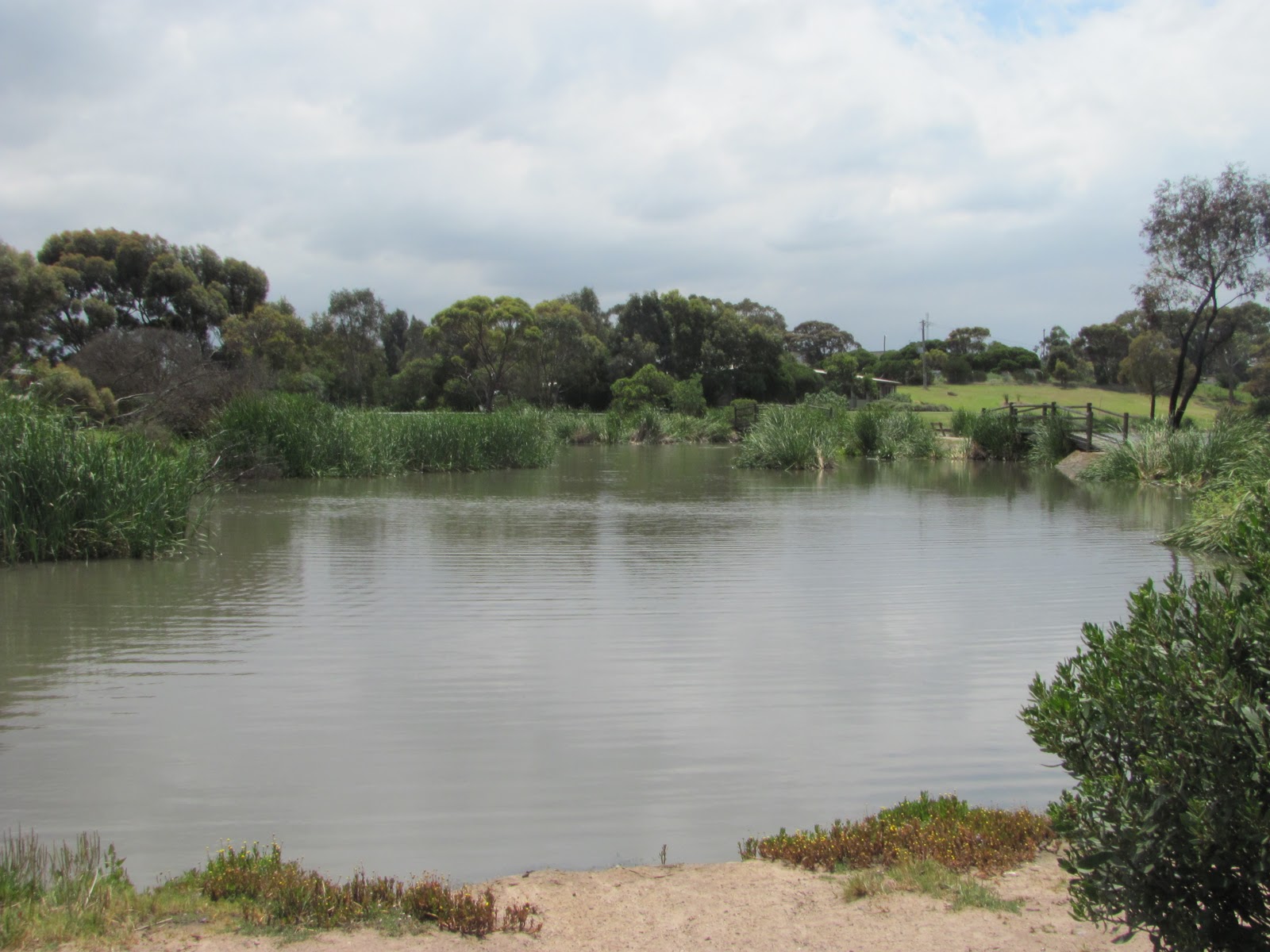
Looking at the cement works across the junction of
the Barwon and Moorabool Rivers at Fyansford
And they all have one important feature in common: at some point, they all link, or will eventually link to the Barwon River.
So, with this in mind, yesterday's excursion stemmed from a couple of runs I'd done in the past and a desire to prove that I could run up "Cementies Hill" (the hill which runs up from Fyansford past the now decommissioned Australian Portland Cement works).
My original run in January of 2010, took in the river up to Fyansford, the hill and part of the old railway line running between the cement works and the docks. This line has not been used since the closure of the cement works, but a walking/riding track now runs beside the line. Much of the infrastructure is still present including the rails and signage.
Originally opened in 1918, the line ran from the cement works to North Geelong where it connected with the Geelong-Ballarat line, servicing the cement works and also providing a public goods service. Incidentally, Australian Portland Cement also ran their own private 3'6" gauge railway from 1926 which serviced the quarries, carrying limestone up to the works. When the line closed in 1966 the one diesel and six steam engines were preserved in various museums. Today, five of the six steam engines are in the keeping of the Bellarine Railway and some are used to pull the tourist train which runs between Queenscliff and Drysdale (see my subsequent blog).
Railway sign, Herne Hill
But now, back to my ride! From the cement works, I headed up Church Street to connect with the Waterfront to take me around to Limeburner's Point before working my way back home via East Geelong. All up, about 20km. Not quite half marathon distance. As far as runs go, it is a somewhat scrappy, disjointed route with several road crossings which make it difficult to get a decent rhythm going. From a cycling perspective it is not too bad, providing either off-road trails or on-road bike lanes the majority of the way.
What would be ideal is a complete loop for walking, running and riding linking Fyansford with the Waterfront and on the other side of town, the river to the Waterfront. I know this is under consideration by the powers that be, however it has yet to be fully implemented.
In September 2010 when the World Championship Cycling was on its way to Geelong, there was a significant amount of action around the trails. Various parts of the river trail were resurfaced, new signage was put in place and the beginnings of a shared footpath/bike track was installed on Swanston Street between the river and Fyans Street. This was a great improvement. The problem however, was the way the remainder of the link to the Waterfront was to be achieved. A Copenhagen style bike lane with a cycling lane running between the footpath and parked cars was mooted and rejected. Local residents and businesses had concerns about changes to the availability of parking which is already at a premium in the area. This idea was shelved.
Over subsequent months, an on-road bike lane was marked out as far as Kilgour Street and the necessary changes made to the footpath structure. The paint rapidly faded and nothing else happened. In recent weeks however, the paint has been re-applied and and new markings now take the lanes as far as the McKillop Street intersection. Great! But what now?
Over the last few months I have made regular use of the bike lane to the river but on Tuesday as I was riding to the Waterfront felt somewhat vulnerable without my paint barrier. I can only hope that there is enough cash in the budget to take the road markings as far as the Waterfront in the not-too-distant future. But of course, funding may not be the only issue. As far as I am aware from the local media, a decision was still to be negotiated as to exactly what form the remainder of the trail would take.
Lewis Bandt Bridge across the Moorabool Valley on the
Geelong Ring Road
At the other end of my proposed loop, things may be looking a little brighter, partly because some of the required infrastructure is already in place. An off-road track runs up the hill to the cement works. It is in good condition and connects conveniently with the river trail at the bottom and with the linear park at the top - assuming you have the lung capacity to make it up the hill, or the nerve to make it down. It is quite steep. I have heard several tales from more than one generation of those occasions when making it to the bottom didn't quite go as planned. Having said that, there is seating at the halfway point for those who need it, and the view is panoramic, taking in the nearby quarry and parts of the Moorabool Valley, including the newly-built Lewis Bandt Bridge on the Geelong Ring Road which pays tribute to the Geelong inventor of that iconic Australian vehicle known as the "ute". The following link provides an interesting description of how the ute came into existence: http://www.fastlane.com.au/Features/First_ute.htm
After making it to the top by whatever means, the linear park begins just a short distance across McCurdy Road. This section of the old railway line extends to the Church Street intersection where a road crossing is required. Its name acknowledges the achievements of Barcelona Olympian walker and local girl Gabrielle Blythe. This, incidentally, is only a short step from the new track which was built alongside the Ring Road. I have yet to investigate this track but when I do, it will probably form part of a future blog.
For now, let's continue with the linear park. The entire path is bitumen-sealed and follows along beside the rails which are still present, however a recent article in the Geelong Times informs me that this is not to be the case for long as the sleepers and rails are to be removed within months. What then happens to the land does not seem to have been clearly decided.
Tom McKean Linear Park
We can only hope that the plan is to continue the already substantial planting and perhaps undertake an upgrade of the track which is suffering from root-damage in some places. In general, the path passes behind houses in the suburbs of Herne Hill and Hamlyn Heights and after reaching Church Street becomes the Tom McKean Linear Park (another Geelong notable citizen whom I believe was a teacher), passing across the Midland Highway and stopping at Thompson Road.
This crossing is the busiest of the three and would be well served if the nearby pedestrian crossing were to be moved to the same location as the path. By now, we are in North Geelong and the scenery is significantly less residential and proportionally more industrial. There is less in the way of tree plantings, but this could be rectified.
It also occurred to me that a lengthy concrete wall could provide an interesting opportunity for a sizeable mural presenting a topic or topics relevant to the area and to the park itself. Also present along the course of the track was the usual array of bird life found in the urban woodland areas of Geelong which could no doubt be encouraged by further native plantings.
Unfortunately at this point, the trail comes to an abrupt halt at Douro Street in North Geelong and it is here that things become complicated. As the crow flies, we are no more than one kilometre from Corio Bay or a little under two kilometers from the end of the bollard walk around the Waterfront at Rippleside Park. However, between Douro Street and the Waterfront is a significant obstacle in the shape of the Geelong to Melbourne railway line, the Princes Highway and some fairly heavy duty industry. How exactly a walking/cycling path would pass through such an area remains to be seen. The present on-road option is to use the bike lane on Church Street, however this is not exactly a scenic, low-traffic alternative.
I have read of various potential plans including developing the track which extends around the coastline to Limeburner's Bay and beyond to Lara. I'm not sure if any of these options approached the issue of a connection to the linear park, however such an option would be a tremendous boon to the community and to the tourist industry generally.
Corio Bay
In the case of my most recent ride, I turned around at Douro Street and headed back the way I had come, however, having reached Corio Bay by whatever means and wanting to continue the loop, the cyclist, jogger or pedestrian can follow the path which runs around Corio Bay, passing the CBD and a variety of cafes and restaurants suitable for a leisurely lunch or a coffee and taking in the renowned bollards along the way. At Eastern Beach you can stop for a swim at the beautifully preserved art deco bathing facility before following the trail around to the Eastern and Botanical Gardens or, to complete our loop, rejoining Swanston Street and heading back to the river.
In the shape of the Barwon and the Waterfront, Geelong has two recreational facilities of international standard. Connecting them via nature trails of benefit to both locals and tourists alike would be of inestimal value to our city.