26 April, 2011

A tale of two rivers

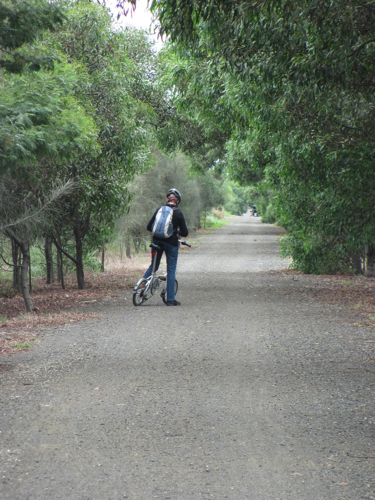
At the end of the previous post, we had stopped for a picnic lunch at the bridge across the west branch of the Barwon at Kaanglang Road outside of Forrest - a pretty spot with large trees rising all around.Next, we headed off, up a walking track which took us along the east side of the river towards the wall of the West Barwon Dam.
The terrain was relatively flat and the walk an easy one. The river at this point is still little more than a trickle, despite the presence of such a large reservoir so close by. This I discovered is the result of a controlled flow released from the dam by the relevant authority -  Barwon Water. What is not explained is how they decide exactly how much water is to be released from the dam at any given point in time and what impact that has on the river further downstream. For that matter, it would be interesting to know what type of river the Barwon would be if there were no dams, no weirs and no Breakwater to control the flows along its course. The Wautharong would have known.
Old apple tree run wild
The scenery along the track is a combination of towering gums to either side, a variety of non-native deciduous trees beginning to show the effects of autumn, clipped park lands and - somewhat incongruously - old apple trees which presumably are the remnants of another era. Regardless of their origins, the apples seem quite at home in their surrounds and are currently fruiting prolifically, cascades of fruit hanging from branches several metres high.
At one point, there appears to be a small weir which restricts the flow of the river and at another, so the visitor information at the dam informs me, is a pipe which feeds water from the West Barwon branch of the river across to the east branch. And so we continued, following the track, but - due to a noticeable lack of signage - not exactly sure where or how far we were going.
Despite this, we found ourselves after not too long at the foot of the dam wall and wondering how to ascend. Immediately in front of us was a wide spillway, obviously designed to carry overflow if the dam exceeds its capacity, however judging from the amount of graffiti to be found up its length, there has been no danger of an overflow in quite some time. To our right was a small foot bridge and a path which, we eventually discovered, would take us to the top of the wall. Another vestige of earlier times took the form of blackberry bushes growing to either side of the path, their fruit almost finished.
View of Munday Creek and West Barwon from the dam wall
The view from the top was, as you might expect, panoramic. The wall is located just below the junction of the west branch of the Barwon River and Munday Creek which flows into the Barwon from the East.
Walking across the top of the wall, we were able to see a short distance up each waterway, both of which appeared to be heavily wooded. It is pleasing to know that logging in the area has finally stopped, giving our most important waterway a chance of survival.
As is to be expected with such a large man made structure, tourist information concerning the history of the area and the dam itself was readily available. From the board I learnt that the dam was built in 1965 by the then Geelong Waterworks and Sewerage Trust (now Barwon Water) and now provides the majority of the water supply for the greater Geelong region.
Whilst boats are banned and swimming or wading is not allowed in the dam, fishing (with a license) is allowed from the bank. The dam is stocked with the expected supplies of eels, both brown and rainbow trout, redfin, and blackfish but other than at the dam wall, access can be difficult from the bank due to the steep approaches and thick tree cover.
Barwon East Branch
Perhaps more excitingly, the dam is also home to a small population of platypus, although I can not say we were lucky enough to spot one while we were there. After reading the boards and checking out the view, we headed back down, this time, taking the path down the opposite bank back to the car.
At this point, we still had a little time to spare, so we decided to head up a little higher and investigate the east branch of the Barwon.
What a difference a few mountains can make! The East Barwon I discover, is quite different from the West. Whereas the latter has been somewhat altered from its native state by exotic plantings, obvious signs of European influence and not to mention the dam, the east branch by contrast, is another world. It is cool, damp and has a distinct rain forest feel to it. Whilst the trunks of soaring gum trees rise above both rivers, along the banks of the east branch, the under plantings are much closer to the water and tree ferns are abundant. There are no clipped park lands, but rather a simple dirt track which winds its way beside the river, rising higher into the Otways as the track makes its way towards Lake Elizabeth.
Billabong beside Barwon East Branch
By the time we arrived at the bottom of the track, we were limited for time. So after another quick cuppa to sustain us, we headed upwards. At one point we came upon a pool - a billabong.
Really running short of time at this point, we continued up the trail, hoping to make it to the bottom Lake Elizabeth which we knew was somewhere up ahead.
Once again, we'd studied up on our tourist information and had been informed that Lake Elizabeth was formed on 17th June, 1952 when a landslide blocked the east branch of the river, forming a natural dam wall. The landslide was not discovered until a party was sent to investigate the sudden cessation of the river's flow. A little under two months after the landslide, the dam overflowed running down a natural channel. A year later in August 1953, the top 26 metres of the dam wall was washed away after particularly heavy rains, reducing the lake to approximately one fifth of its original volume, and changing the course of the river. The resulting watercourse was straighter than the original and lined with boulders and gravel along its length, carried down by the second landslip.
As we walked, the track continued to rise, steeply in places, until it was many metres above the height of the riverbed. Despite this, the gums growing at water level still towered above us. Eventually, with the light continuing to fail, an executive decision was made that we should walk until 5pm and if we had not reached the bottom of the lake by that time, then we would turn back.
Disappointingly, this did turn out to be the case. Whilst the walk was only a couple of kilometers, we were out of time. Lake Elizabeth and the promise of some fairly spectacular photographic opportunities would have to wait for another day. So we turned back and headed down to the car park, which somewhat surprisingly was busier than when we first arrived. Then, after a quick stop to use the visitor facilities, we were on our way home.

24 April, 2011

Onward and upwards

For some time I have intended to head to parts of the Barwon as yet unknown to me. Being school holidays and the weather reasonably fine, we decided to round up the kids and head upstream. Our first stop was morning tea at Winchelsea. We sat in the park overlooking the river, sipped our coffee and nibbled on biscuits and slices. The weather was cool but fine, well suited to snapping a few pictures.
Barwon River at Winchelsea
This wasn't my first visit to "Winch" and I'd taken quite a number of photos on my previous visit, so after a short walk along this part of the river towards the rail bridge, we decided to leave further investigation of both the town and this section of the river and head off. We dragged the kids off the play equipment, packed up the cups and headed for the car.Our next stop was the little township of Birregurra which has the good fortune to nestle on the banks of the Barwon. We parked near the nondescript bridge over the river and had a look around. We found ourselves in a wide, grassy area where the kids took the opportunity to have a run and in the distance we glimpsed what looked to be the sculpted lines of a golf course. Further investigation proved us correct, although, as with Winchelsea, further exploration of the township of Birregurra and its surrounds will have to wait.
The river itself was actually quite difficult to approach at this point as it is thickly lined on both banks with silver poplars. As is the case with these trees, they had no doubt been introduced at some point and then, as poplars are want to do, they'd taken hold, throwing up countless saplings along the banks, taking full advantage of a ready source of water. In the process, they had created a sizable thicket which made photography difficult and access all but impossible in most places.
Barwon River at Birregurra
Despite this, we did find a little track which allowed us to reach the water's edge where it appeared that a local angler had dropped in a line. Of the owner of the line, we saw no trace. Whilst the others crunched their way through the substantial drifts of leaves under the poplars, I made my way up to the bridge and attempted to snap a few photos looking both up and down river.I have to say however, that there wasn't much to see. Firstly, the bridge is located near a bend which precludes any significant view upriver, secondly it should also be said at this point that the Barwon as it flows through Birregurra is barely recognisable as the same sizable stream which flows through Geelong with enough depth and breadth for rowing, water-skiing, kayaking and a variety of other activities. I guess the weirs and the breakwaters either side of Geelong are doing their job. Here, the river is more like a small creek and were it not for the stranglehold of the poplars, it would probably be possible to jump from one bank to the other with a short run up. Certainly it would not be navigable by kayak - or other any other type of vessel for that matter.
And so we continued on our pilgrimage. From Birregurra we headed over the bridge and turned off on to the Forrest-Birregurra Road. Clearly were were approaching our objective. The only other town we passed along the way was the pertinently named Barwon Downs which is set in the rolling grasslands found at the foot of the Otways. As we travelled, we noticed that the mild season had allowed for a significant amount of back burning, resulting in regular plumes of smoke rising into the air from neighbouring farms.
Restored rail bridge on the "Birregurra-Forrest Tiger Rail
Trail" crossing the Barwon River
Although we couldn't always see it, we were in fact paralleling the course of the river and at one point, just outside Barwon Downs, we came upon another small, nondescript bridge crossing the river. At this point, whilst the riverbed was reasonably wide, it was choked with what was possibly Water Ribbon or Cumbungi and there was barely a trickle of water to be seen.More interestingly, the modern road bridge was flanked by what we discovered was a disused rail bridge. This quaint little red bridge, now restored, forms part of a much grander plan. As is almost de rigueur for disused lines these days, there are moves afoot to make use of the 30km or so of disused line as a riding/walking trail connecting Birregurra to Forrest. The following website indicates that about 5 or 6km of track has so far been laid between Forrest and Barwon Downs, with the rest to be developed along the course of the line to Birregurra.
http://www.railtrails.org.au/states/trails.php3?action=trail&trail=143
Naturally, having discovered a new (to me) trail, I had to investigate its history. This one - now known as the Tiger Birregurra-Forrest Rail Trail - was once used to transport timber from where it was cut in the surrounding bushland, processed in the sawmills at Forrest and then transported to Birregurra. In 1889 the line was opened as far as Deans Marsh and whilst originally surveyed as far as the township of Baramunga, financial limitations instead saw it terminate at what was to develop as the township of Forrest (which incidentally was named for a politician who fought to have the railway extended to that point). Extended to Forrest and opened in 1891, this branch line not only carried timber out of the region, but was also used to transport farming produce out and other needed supplies inwards. Tourists heading to Apollo Bay and Lorne also made use of the line.
Other towns serviced by the line included Pennyroyal, Yaugher and Gerangamete, however with the increasing use of road transport, the line closed in 1957 and was allowed to fall into disrepair. Today, all sidings have been removed and it is not always possible to see where the line once ran, however I gather that it is still possible to see some remains at certain points. The Birregurra Station still stands and is in use on the Melbourne-Warnambool line.
The West Barwon River at Forrest
Returning to our travels, it was only a short drive into the town of Forrest. Rather than stop here, we passed through, by now, following signs pointing us towards Lake Elizabeth and the West Barwon Dam.
Just a little out of town, we once again crossed the river and found ourselves in a picnic area by what had now become the west branch of the river. It was an appropriate point at which to stop for lunch, park the car and go for a wander. At this point, the river had widened a little and was not so overgrown. In some scrub near the opposite bank I came across a section of one of the many mountain bike trails which now form the basis of Forrest's tourist industry. At the edge of the track was a sign post informing me about the many miles of tramways which used to run in the area, all connecting to the rail terminus at Forrest, carrying in the logs, cut by the sawyers.
These days, there is no sign of the rail network which once served the area, however the effects of white settlement were none-the-less evident.
The Barwon River at Forrest
From our picnic table the view across the bridge and into the surrounding gum trees looked like nothing so much as a 19th century Hans Heysen painting, wanting only a drover herding cattle to wander down the unsealed road. However, turning barely 180 degrees and looking a little past the opposite bank of the river where non-indigenous plantings prevail, you would swear you had been transplanted to the England of a similar era.
Pretty as all this was, we had more exploring to do, so once again, we packed up the coffee cups, brushed off the crumbs and headed upriver - but that is a story for another day...

09 April, 2011

Jerringot

Jerringot Wild Life Reserve
For years I have driven past the Belmont Common, not really paying attention to the reedy, swampy land to either side. Yes, there were a few bird breeding boxes and I knew that it was low-lying and inclined to flood at the first sign of rain. Presumably it connected to the Barwon in some way or other - but how  and what was really in there?
I discovered the answer to these questions on a recent ride to Waurn Ponds - which incidentally is made somewhat complicated at present due to the road works which are being carried out for the Breakwater Road re-alignment and have resulted in the closure of the nearby bike tracks. Nonetheless, hidden in plain view I found the Jerringot Wildlife Reserve. Wedged between the Princes Highway and the Barwon Valley Public Golf Course, it provides a haven for waterbirds and other small animals. According to signage at various points around the reserve, the area is part of the Belmont Common Flood Plain. Water flows from the Belmont Escarpment above into the wetlands which originally consisted of Billabongs and Jerringot Creek which drains into nearby Waurn Ponds Creek. This in turn flows to the Barwon River.
I am also informed that there are up to 120 species of birds to be found within the reserve most of which I have so far - frustratingly - been unable to locate. Incidentally, this is almost double the number of species I have identified on other parts of the river to date. In typical fashion, I arrived in time to discover that the internationally protected Latham's Snipe - a wading bird which chooses to spend its summer vacations in Belmont - had most probably packed its bags and headed home to Japan about two weeks before I got there. Perhaps I will have more success with the Cattle Egret which is due to arrive any day now.
Black Swan at Jerringot
The Belmont Common was also significant to the local Wathaurong population who used the area as a meeting and camping place, taking advantage of the abundant local plants and wildlife to supplement their diet. Fish, shellfish, crustaceans, root vegetables, seeds, grains and a variety of land animals all formed part of the menu. The name Jerringot is a local Wathaurong word meaning "place of Billabongs". The Jerringot ecosystem is reliant upon regular cycles of drought and flooding to maintain the variety of animal species which live here including frogs, insects, birds and reptiles.
Clearly I have much to discover about this little pocket of the Barwon's ecosystem and will have to spend further time investigating in the near future.

08 April, 2011

"Ring! Ring!"

Riders along the Barwon
Ring Road that is! Today's escapade saw us take to the bikes again to investigate the relatively new track which runs alongside stage 1 of Geelong's Ring Road. Rather than take a shorter ride across town and fight with the traffic, we chose to take the scenic route and get our dose of the river along the way. I couldn't resist the urge to grab a "large, weak, skinny cap, please" from Barwon Edge on the way past and we sat at a conveniently located table a little further up the track to have morning tea, watching the usual array of cyclists, joggers, walkers and - a new one on me - a pair riding horses.
And so to Fyansford and the one hitch with this particular route - the cement works hill. Taking it somewhat slower than my last attempt and at a walk after losing my chain, we made it to the top then headed for the Gabrielle Blythe Linear Park for the ride around to Church Street.
This is not the most direct route to the Ring Road track, but it is more scenic than McCurdy Road which has the added disadvantage of no bike lane (although traffic is not heavy).
Lewis Bandt Bridge on the Geelong Ring Road from
the Ted Wilson Trail
As I have mentioned previously, I would also like to see the linear park provide an alternate route to busy Church Street by which to reach the waterfront.
Our detour turned out to be well worthwhile as we came across a group from the Bellarine Railway who were just starting the process of ripping up the rails as I had seen discussed in the papers only a week or so ago. We were informed that these rails would be re-laid in a section of the Bellarine line near Laker's Siding as they were longer than the existing rails and the resulting reduction in joins would mean a smoother ride for the trains.
Leaving the guys to their work, we headed to Church Street and then via the bike lane, the short distance to its western end. Had we chosen to ride in the other direction, we could have connected - as we did on our previous ride - with the trail around the bay, but this time, we were headed north.  
From the end of Church Street, it was a matter of metres to the beginning of the Ted Wilson Trail and a short stop to take in some sweeping views of the Moorabool Valley, the old quarry at Fyansford and the Barrabool Hills. 
Before we continue, it is pertinent to mention that Ted Wilson, after whom the trail is named, is a now-retired police officer from Geelong who was instrumental in establishing the Bikeplan program which was piloted in Geelong in the 1970s and 80s and in developing the Bike Ed program which is still taught in Victorian schools today. Ted was also responsible for the re-introduction of police bike patrols across the state in the 1990s. Now, where was I? 
View towards the Batesford Quarry
The Church Street end of the trail was perhaps the most picturesque section which otherwise spends much of its distance shielded from the traffic of the Ring Road behind the large, steel noise barriers. On the other side, the track opens on to suburban backyards and in some parts, on to neighbouring parkland. From the intersection of the Ring Road with the Midland Highway (aka Ballarat Road), there is a good view of the Batesford Quarry, a little further up the Moorabool River.
Along its length, the track is well made from concrete and makes for good riding with minimal road crossings over fairly even terrain up to Cowie's Creek. From there it heads downhill to - I am informed by the local media - Broderick Road in Corio, a total distance of 11.4km. However, we did not have time to go further on this occasion, so discovering the remainder of the trail will have to wait for another day.From this high point above the creek, the view extends north towards the You Yangs Regional Park and west across the northern suburbs of Geelong to the Shell oil refinery which, whilst rather industrial and mundane during daylight hours, becomes quite spectacular at night when it is ablaze with lights.
Looking south along the Ted Wilson Trail
Further contributing to the somewhat industrial feel is the looming presence of high-voltage power lines running above the track for some of the way. Clearly this is a new pathway which has had little time to develop. A concerted effort at tree-planting could go a long way to breaking up those somewhat bland sections which do not have a substantial view. Tree-cover would also provide a significant boon to the local bird-life and on a warm day such as today, would provide some welcome shade for those using the trail.
Another aspect which was brought to my attention was signage. The comments were made on another website bemoaning the lack thereof and in retrospect, yes, they have a point. By word of mouth I knew the trail started at the bottom of Church Street, but there was no sign at any point to inform me of this, nor, as was also pointed out, is there any sign at the major road-crossings (at least one of which required multiple sets of traffic lights to negotiate) which shows where or if the path continues on the opposite side of the road.
Despite these shortfalls, this is still an interesting and well-constructed trail and I am looking forward to investigating the remaining kilometres to Broderick Road at some point in the near future....

04 April, 2011

Up the creek

Waurn Ponds Creek near Cobbin Farm,
Grovedale
Another trail which links reasonably conveniently to the river track is the one which runs along the side of Waurn Ponds Creek which as I have mentioned, is a tributary of the Barwon River. The creek rises near Mount Moriac and winds its way towards Geelong, where it joins the Barwon a few hundred metres downstream of the Breakwater Bridge.
 The Waurn Ponds trail can generally be reached either via a track from the Breakwater Bridge to Barwon Heads Road or via a path across Belmont Common. The former route is currently out of action due to the Breakwater Bridge re-alignment project which will see the erection of a new bridge over the river. The latter is a more scenic option but at the moment requires a little on-road travel. It takes in the new criterium track, built last year when Geelong hosted the World Cycling Championships, so for those wishing to do so, it is possible to stop off for a few quick (or in my case, not so quick) laps on the way past.
Crossing the Princes Highway and following the trail around, leads to the Barwon Valley Public Golf Course. Down the driveway a short distance and off to the right is a continuation of the trail which leads around the outskirts of the Jerringot Wildlife Reserve, a section of remnant vegetation which lies between the golf course and the Barwon Heads Road. Part of the Barwon's natural environment and having significant flora and fauna as well as strong indigenous links, Jerringot really requires a blog post of its own.
Jerringot Wildlife Reserve
For now, back on the track. Under normal circumstances, it is possible to cross Breakwater Road and take the path which loops around either side of the South Barwon Reserve, providing another crossing at Barwon Heads Road, however the track around the reserve is not currently accessible from Breakwater Road, so some on-road travel is necessary.
There is also another option I would like to see become a reality in the not-too-distant future. I have mentioned previously that the track along the river does not extend beyond the breakwater, however I harbour hopes that with the new Armstrong Creek development getting underway, there might be plans to extend the track at least as far the aqueduct, linking the new suburb (perhaps via Horseshoe Bend Road) to the river trail and its park lands.
For those of us living at the other end, it would mean a variety of trails around the new suburb which could be accessed. An extended trail along the river would pass the Waurn Ponds Creek which runs beside the South Barwon Reserve. A short section of track could perhaps link the river trail to the existing path around the Reserve.
Cobbin Farm
Currently however and once across Barwon Heads Road, the trail follows the course of the creek behind local houses and from this point is sealed all the way to Waurn Ponds. The path is quite open with not as much in the way of re-vegetation. After crossing the Surf Coast Highway however, there is more of an open woodland feel with trees, shrubs and areas of grassland.
The trail continues past the historic Cobbin Farm, bending around with the course of the creek until it reaches Pioneer Road at which point it crosses the road and continues past the Waurn Ponds shopping centre, finally ending at the Princes Highway behind the homemaker centre. To this point in time I have not been past Pioneer Road.

03 April, 2011

Still on the rails...

Perhaps not surprisingly, disused railway lines provide excellent opportunities for councils and local communities to develop nature trails and linear parklands and as I discussed in my last post, this is the case in Geelong. Of course, the old line to the cement works is not the only linear park in the region and not even the first I discovered as a result of my perambulations.
Queenscliff Station
Nor is it alone in linking to the Barwon and the network of trails across Geelong.
A much more extensive and so far, better developed, linear park is the Bellarine Rail Trail which extends essentially from Swanston Street in South Geelong (which in turn links via the bike lane to the Barwon), all the way along the old Queenscliff line, through Drysdale to the little seaside town of Queenscliff.
The trail follows the route of the former South Geelong-Queenscliff railway line which was constructed in 1878/1879 primarily to service Fort Queenscliff. The new line enabled the movement of troops and supplies back and forth from Melbourne. The Fort was a key stronghold in the defence of the capital during times of war, being located at the narrow entry point into Port Phillip Bay.
Steam train at Queenscliff Station
At the same time, Queenscliff was - and from its establishment in 1852 - always has been a tourist destination and the railway line also serviced this industry as well as providing transport for the permanent population. Whilst it was never the busiest of lines, it was none-the-less and important link in Victoria's rail network, serving the Bellarine Peninsula through various changes in fortune until its final closure in 1976.
Almost immediately, the Geelong Steam Preservation Society stepped in and from 1979 ran the line from Queenscliff, initially to Laker's Siding and then to Drysdale as a tourist facility with their base of operations being Queenscliff. The service continues to run to the present day using steam and diesel locomotives to pull the heritage carriages between Queenscliff and Drysdale.
The Bellarine Rail Trail
near Leopold
It has been suggested that it might be possible to extend the rail service as far as Curlewis in the future, however that is a distant goal.
Interestingly, the railway has recently acquired three engines from the Puffing Billy museum. Two of these spent their working lives on the privately-run "Fyansford Cement Line" which carried limestone from the quarry below to the cement works above for storage or transport on the Fyansford branch line. Beside the Queenscliff line some distance outside of Drysdale, is a siding which stores rollingstock, including as it happens, a number of goods wagons also from the cement line.
Further information on the Bellarine Railway can be found at the following address: http://bellarinerailway.com.au/
Engine built by the Vulcan Iron Works
which worked at the Fyansford cement
works, now at the Bellarine Railway
Whilst the train runs only between Drysdale and Queenscliff, for those more interested in riding, running or walking, the good news is that the Bellarine Rail Trail - as mentioned - extends the entire distance from Geelong to Queenscliff through the surrounding countryside and the outskirts of Geelong.
At one time or another I have covered all of the trail either by bike or running. I have run the trail from Queenscliff to Drysdale on three occasions in various weather conditions - including this January through mud, rain and puddles. The terrain is undulating and scenic being both coastal and rural with the usual array of bird and plant life, complemented by sheep, cattle, horses and hay bales. On each occasion I have run to Drysdale then caught the train back to Queenscliff with various family members.
A year or so ago I also ran the remainder of the trail from Drysdale to South Geelong and then home on one occasion (also in the rain as I remember) and in recent weeks have cycled the trail from the Bellarine Highway to Drysdale and back.
The trail along most of its length is a loose gravel path, however there are sections through the outskirts of Geelong, Leopold, Drysdale and the approach to Queenscliff which are surfaced with bitumen. Up to Drysdale, the trail predominantly runs along the original line of the rails, however beyond Drysdale the path runs beside the railway line, crossing back and forth at various points.
Hereford cow outside Drysdale
Whilst as I mentioned, I have covered the entire distance at one time or another, I have yet to do it continuously either riding or - a goal I have long harboured - running. The distance from the Showgrounds in South Geelong to Queenscliff Station is around 34 kilometres, about 11 kilometres further than my longest run to this point, but one of these days...
Along all sections of the trail there are road crossings, however most are small, rural roads posing no real difficulty either riding or running. The two major road crossings I believe now have traffic lights. Despite this, a "training run" which was staged annually in about September running the whole distance of the trail has in recent years been changed to an out-and-back run between Queenscliff and Drysdale; the same distance as
the original run, but without the bragging rights of the former.
Details concerning the Bellarine Rail Trail and the Friends of the Bellarine Rail Trail group can be found at the following site: http://www.fbrt.com.au/fbrt/main/home.asp


01 April, 2011

Riding the rails...

...well, the rail trails that is!
Whilst I run, walk and ride the sections of the river from Breakwater to Baum's Weir fairly regularly and have done for some years, I do occasionally venture further afield for a change of scenery. Of late, I have been riding more often and as a result of being able to cover more distance, have been looking for other tracks and trails to ride.
I have started by revisiting several of the tracks which I have run in the past: the Bellarine Rail Trail, the track to Waurn Ponds, the linear park running along the disused train line from the cement works to North Geelong, the Waterfront. All of these are - or have the scope to be - excellent community facilities for those wishing to run, walk or ride effectively from one side of Geelong to the other. 
Looking at the cement works across the junction of
the Barwon and Moorabool Rivers at Fyansford
And they all have one important feature in common: at some point, they all link, or will eventually link to the Barwon River.
So, with this in mind, yesterday's excursion stemmed from a couple of runs I'd done in the past and a desire to prove that I could run up "Cementies Hill" (the hill which runs up from Fyansford past the now decommissioned Australian Portland Cement works).
My original run in January of 2010, took in the river up to Fyansford, the hill and part of the old railway line running between the cement works and the docks. This line has not been used since the closure of the cement works, but a walking/riding track now runs beside the line. Much of the infrastructure is still present including the rails and signage.
Originally opened in 1918, the line ran from the cement works to North Geelong where it connected with the Geelong-Ballarat line, servicing the cement works and also providing a public goods service. Incidentally, Australian Portland Cement also ran their own private 3'6" gauge railway from 1926 which serviced the quarries, carrying limestone up to the works. When the line closed in 1966 the one diesel and six steam engines were preserved in various museums. Today, five of the six steam engines are in the keeping of the Bellarine Railway and some are used to pull the tourist train which runs between Queenscliff and Drysdale (see my subsequent blog).
Railway sign, Herne Hill
But now, back to my ride! From the cement works, I headed up Church Street to connect with the Waterfront to take me around to Limeburner's Point before working my way back home via East Geelong. All up, about 20km. Not quite half marathon distance. As far as runs go, it is a somewhat scrappy, disjointed route with several road crossings which make it difficult to get a decent rhythm going. From a cycling perspective it is not too bad, providing either off-road trails or on-road bike lanes the majority of the way.
What would be ideal is a complete loop for walking, running and riding linking Fyansford with the Waterfront and on the other side of town, the river to the Waterfront. I know this is under consideration by the powers that be, however it has yet to be fully implemented.
In September 2010 when the World Championship Cycling was on its way to Geelong, there was a significant amount of action around the trails. Various parts of the river trail were resurfaced, new signage was put in place and the beginnings of a shared footpath/bike track was installed on Swanston Street between the river and Fyans Street. This was a great improvement. The problem however, was the way the remainder of the link to the Waterfront was to be achieved. A Copenhagen style bike lane with a cycling lane running between the footpath and parked cars was mooted and rejected. Local residents and businesses had concerns about changes to the availability of parking which is already at a premium in the area. This idea was shelved.
Over subsequent months, an on-road bike lane was marked out as far as Kilgour Street and the necessary changes made to the footpath structure. The paint rapidly faded and nothing else happened. In recent weeks however, the paint has been re-applied and and new markings now take the lanes as far as the McKillop Street intersection. Great! But what now?
Over the last few months I have made regular use of the bike lane to the river but on Tuesday as I was riding to the Waterfront felt somewhat vulnerable without my paint barrier. I can only hope that there is enough cash in the budget to take the road markings as far as the Waterfront in the not-too-distant future. But of course, funding may not be the only issue. As far as I am aware from the local media, a decision was still to be negotiated as to exactly what form the remainder of the trail would take.
Lewis Bandt Bridge across the Moorabool Valley on the
Geelong Ring Road
At the other end of my proposed loop, things may be looking a little brighter, partly because some of the required infrastructure is already in place. An off-road track runs up the hill to the cement works. It is in good condition and connects conveniently with the river trail at the bottom and with the linear park at the top - assuming you have the lung capacity to make it up the hill, or the nerve to make it down. It is quite steep. I have heard several tales from more than one generation of those occasions when making it to the bottom didn't quite go as planned. Having said that, there is seating at the halfway point for those who need it, and the view is panoramic, taking in the nearby quarry and parts of the Moorabool Valley, including the newly-built Lewis Bandt Bridge on the Geelong Ring Road which pays tribute to the Geelong inventor of that iconic Australian vehicle known as the "ute". The following link provides an interesting description of how the ute came into existence: http://www.fastlane.com.au/Features/First_ute.htm
After making it to the top by whatever means, the linear park begins just a short distance across McCurdy Road. This section of the old railway line extends to the Church Street intersection where a road crossing is required. Its name acknowledges the achievements of Barcelona Olympian walker and local girl Gabrielle Blythe. This, incidentally, is only a short step from the new track which was built alongside the Ring Road. I have yet to investigate this track but when I do, it will probably form part of a future blog.
For now, let's continue with the linear park. The entire path is bitumen-sealed and follows along beside the rails which are still present, however a recent article in the Geelong Times informs me that this is not to be the case for long as the sleepers and rails are to be removed within months. What then happens to the land does not seem to have been clearly decided.
Tom McKean Linear Park
We can only hope that the plan is to continue the already substantial planting and perhaps undertake an upgrade of the track which is suffering from root-damage in some places. In general, the path passes behind houses in the suburbs of Herne Hill and Hamlyn Heights and after reaching Church Street becomes the Tom McKean Linear Park (another Geelong notable citizen whom I believe was a teacher), passing across the Midland Highway and stopping at Thompson Road.
This crossing is the busiest of the three and would be well served if the nearby pedestrian crossing were to be moved to the same location as the path. By now, we are in North Geelong and the scenery is significantly less residential and proportionally more industrial. There is less in the way of tree plantings, but this could be rectified.
It also occurred to me that a lengthy concrete wall could provide an interesting opportunity for a sizeable mural presenting a topic or topics relevant to the area and to the park itself. Also present along the course of the track was the usual array of bird life found in the urban woodland areas of Geelong which could no doubt be encouraged by further native plantings.
Unfortunately at this point, the trail comes to an abrupt halt at Douro Street in North Geelong and it is here that things become complicated. As the crow flies, we are no more than one kilometre from Corio Bay or a little under two kilometers from the end of the bollard walk around the Waterfront at Rippleside Park. However, between Douro Street and the Waterfront is a significant obstacle in the shape of the Geelong to Melbourne railway line, the Princes Highway and some fairly heavy duty industry. How exactly a walking/cycling path would pass through such an area remains to be seen. The present on-road option is to use the bike lane on Church Street, however this is not exactly a scenic, low-traffic alternative.
I have read of various potential plans including developing the track which extends around the coastline to Limeburner's Bay and beyond to Lara. I'm not sure if any of these options approached the issue of a connection to the linear park, however such an option would be a tremendous boon to the community and to the tourist industry generally.
Corio Bay
In the case of my most recent ride, I turned around at Douro Street and headed back the way I had come, however, having reached Corio Bay by whatever means and wanting to continue the loop, the cyclist, jogger or pedestrian can follow the path which runs around Corio Bay, passing the CBD and a variety of cafes and restaurants suitable for a leisurely lunch or a coffee and taking in the renowned bollards along the way. At Eastern Beach you can stop for a swim at the beautifully preserved art deco bathing facility before following the trail around to the Eastern and Botanical Gardens or, to complete our loop, rejoining Swanston Street and heading back to the river.
In the shape of the Barwon and the Waterfront, Geelong has two recreational facilities of international standard. Connecting them via nature trails of benefit to both locals and tourists alike would be of inestimal value to our city.