Showing posts with label Geelong-Ballarat railway. Show all posts

01 November, 2016

The Clyde Hotel

My previous posts looked at the Railway Hotel at Bannockburn and the Separation Inn which stood on the road from Geelong to the Ballarat diggings during the gold rush. The picture would not be complete however, without also taking a look at the Clyde Hotel.
According to early survey maps from 1856 and 1865, the Clyde was located on the south east corner of what is today the Midland Hwy and Maude Rd leading to Russell's Bridge. Some more recent sources place the hotel diagonally opposite on the north west corner. As far as I can tell, this is incorrect.
The hotel of course derives its name from the Clyde Company, whose representatives - chiefly George Russell - were amongst earliest settlers on the Moorabool River.
George Russell, c1852. Image held by he State Library of Victoria
Initially the company leased vast amounts of land between the Moorabool and Leigh Rivers from the government and then from 1839 onward began purchasing sections of that land in the names of various shareholders. In 1853 (title deed dated 15th August, 1853, Victorian Government Gazette, 12th October, 1853), George Russell purchased section 15 B in the parish of Wabdallah. This 522 acre block was adjacent to a further three blocks (allotments A, B and C of section 16) which he had purchased the previous year and made a substantial addition to several thousand more acres in the Parish of Gherineghap, purchased mostly in the 1840s and including the site upon which the Separation Inn was built.
Russell's interest in these land purchases was to a large extent speculative. Within a year of having purchased section 15 B, Parish of Wabdallah he hired a surveyor - Matthew Biddle - who subdivided much of the land and laid out two "new townships", one in either parish. Each town was to be named after the parish in which it was situated and both were arranged as a series of one acre allotments along the Geelong-Ballarat Rd, with increasingly larger blocks stretching away to the banks of the Moorabool River.
The site of Wabdallah Township had been carved out of the southernmost portion of section 15 B and included the future site of the Clyde Hotel. As per my last post, late in 1853, George Williamson had taken on the license of the Separation Inn, a little over 3.5 miles closer to Geelong, however I suspect this was never intended to be a long term arrangement. A message from Williamson to George Russell, penned on 15th May, 1854 and reproduced in the Clyde Company Papers states the following:
I may mention that the House I was expecting from Germany, & which I spoke to you of, has now arrived and lies piled up on the Beach at Geelong. I should wish to see you about it, as you will recollect promising me a site for it; and if you will be good enough to let me know what day you are likely to be at home I shall make a point of meeting you.
[Endorsed by G.R.: 'G. Williamson, Separation Inn, May 15th/54….answd; no wethers at present; site can be bought by auction']
Clearly it had been Williamson's intention to build his own hotel for some time, although perhaps he had not envisaged having to purchase the land to do so, however, buy the land he did.
In a series of advertisements, the Geelong Advertiser and Intelligencer first promoted the sale of what it termed "that well-known lovely spot Russell's Rich Flat", noting that there would be no private sale before auction (25th March, 1854). This it seems however, was merely media hype as was the declaration by the same newspaper on 29th May, that some blocks had already been sold at the exorbitant price of £230 per acre.
An insert on the survey map produced by Surveyor Matthew Biddle c1854 for
George Russell (Clyde Company Papers), with the blocks purchased by
Williamson highlighted in yellow.
The rest of the allotments would definitely have to go to auction the following day it claimed, however the records of sale in the Clyde Company Papers show that only purchases at auction were made (no private sales) and the record shows that the largest single purchaser of town allotments at Wabdallah was George Williamson who paid £372 for his 11 allotments - a figure closer to £34 per acre! With his land now purchased, Williamson wasted no time in erecting his new hotel (although whether this was the pre-fabricated building referred to in his letter to Russell is not clear). By 7th November, 1854, the Geelong Advertiser and Intelligencer proudly announced the opening of Williamson's new premises with the following advertisement:
CLYDE HOTEL–CLYDE HOTEL–To Travellers on the Ballarat Road – GEORGE WILLIAMSON, late of the Separation Inn, begs to inform all persons visiting Ballarat, that he has opened that commodious and elegant Hotel, known as the Clyde Hotel. It is situate on the Government Road, at a more convenient distance from Geelong, being five miles from the old Separation Inn, and about half way between that place and the Muddy Water Holes.The long experience of Mr Williamson on this road, enables him to guarantee all the comforts of a first-class English Hotel. No expense has or will be spared in making the culinary department second to none in the colony. The proprietor flatters himself that one trial of the wines, spirits and other liquors will induce the traveller to remember the Clyde Hotel with satisfaction..The Stabling is large and commodious and being under the immediate superintendence of the proprietor will be found to combine perfect safety coupled with the most reasonable charges.

Once again however, it is necessary to untangle a little truth from advertising fiction. Whilst the Clyde Hotel was certainly more commodious than the Separation Inn, to say that it was 5 miles further up the road is somewhat of a stretch as my measurements put its distance closer to 3.5 miles beyond the Separation Inn and some 5 miles distant from the Muddy Water Holes (aka Lethbridge).
Despite the claims of "perfect safety", the Clyde was not immune to some of those problems which routinely plagued public houses - especially those houses frequented by travellers.
Barely a month after the above advertisement, it was reported that William Buckley, a passing traveller had arrived at the Clyde and, under the influence of alcohol had retired to bed after complaining of being ill. The following morning he was found dead. In September, 1855 a horse was advertised as stolen from the hotel, with a £2 reward offered for its return. So much for safety!
The Clyde also hosted its share of inquests. In April, 1858 John Stacy, a teamster left the Clyde perfectly sober - after only three small glasses of liquor - but was fatally injured after falling from his dray and being run over. His fellow teamster took him to the Clyde where he died the next morning (The Age, 10th April, 1858). In November, 1867 a similar incident occurred when Walter Bolger, who had stopped at the Clyde was run over by his dray which was loaded with flour from the nearby Clyde Mill.
Regardless of such unpleasant events, the Clyde Hotel does seem to have been considered the hotel of choice in the region for public events. On New Years Day, 1856, Williamson was responsible for hosting a race meeting, with a variety of events to suit most horses. Meetings in relation to the Wabdallah Farmers' Common were held at the hotel along with public rallies at which political candidates for the region put their case. On 27th June, 1857 according to the Ballarat Star, the hotel was even favoured with the presence of Sir Henry Barkly, Governor of the Colony of Victoria, who stayed two nights whilst on his way to and from a visit to the goldfields at Creswick.
By the beginning of 1858 however, Williamson had had enough and he put the Clyde on the market with the following extensive advertisement appearing in both the Ballarat Star and The Argus on 25th February:


There is no doubt that by comparison with the Separation Inn, the Clyde Hotel was a cut above. In addition to the high-profile patronage, it had taken less than four years for the Clyde to have cornered the coaching market if its bold claim can be believed. Certainly, the famous Cobb & Co. service changed its horses at the Clyde, although whether other carriers such as Estaffette, Criterion or the Washington Express (aka Little Go) did likewise is less clear.
Regardless of which line of coaches was chosen, travelling to the goldfields could be a risky prospect. Accidents were common and not even Cobb & Co. were immune. On 3rd March, 1858, The Argus reported on a coaching accident in which a Cobb & Co. coach leaving the Clyde Hotel, tipped down an awkward embankment after the horses were spooked by a bullock dray. A woman was injured, requiring treatment in Geelong and the driver hurt his wrist. The coach's arrival in Ballarat was delayed until 10pm.
Whilst the flow of traffic to the goldfields continued unabated throughout the 1850s, by the end of the decade, things were about to change. Perhaps it was the anticipated arrival of the Geelong-Ballarat Railway which encouraged George Williamson to put his property on the market. From 1862 onward, the line would pass less than 3/4 of a mile to the west of his hotel with a station built at Leigh Road the following year; a circumstance which would significantly affect the level of traffic on the road passing his hotel.
Bannockburn Station (originally the Leigh Road Station), built in 1863 after
the opening of Geelong-Ballarat Railway in April, 1862. Photo taken April,
2012 at the 150th anniversary celebrations of the line's opening
A quick sale however, was not forthcoming for Williamson and by March, 1859 a tenant - Benjamin Hall - was found to run the hotel. A mere two months later however, the Clyde was once again advertised for sale, this time for sale by private contract (Geelong Advertiser, 13th May, 1859). Eventually, a purchaser was found and by September, Williamson was holding a clearing sale.
Despite the change of proprietors, Hall remained as the publican for several more years before finally moving to Ballarat to run the Farmer's Hotel in September, 1862 (The Ballarat Star, 6th September, 1862). From this point, until April, 1864, I could find no mention of a licensee for the Clyde, however there were various references to James Thomas Bushell of the Clyde Hotel throughout 1863, before a publican's license was granted to Thomas Howe in April, 1864.
On 11th September, 1865 however a sale of all the goods, stock, furniture and livestock associated with the Clyde was announced in the Geelong Advertiser, the entire inventory itemised room by room, item by item. The reason given was the insolvency of James Bushell. (Who incidentally had made a number of land purchases in the parish the previous year.) Then, on 7th December 1865, Thomas Howe published his intention to transfer his publican's license for the hotel to John Henry Jones. From this, I am led to suspect that whilst I found no mention of the sale of the hotel itself, Bushell was the property owner and Howe his tenant. Consequently, when Bushell became insolvent, Howe had to go.
From 1865 onward, John Henry Jones - familiar to those who read my post about the Railway Hotel in Bannockburn - became the licensee and at some point, the owner of the Clyde. In December of the same year, he also purchased two blocks of land from the government. The blocks were allotments 5 and 7 of section D, Parish of Wabdallah. Both were situated on the Ballarat Rd with allotment 7 located on the south west corner of the Ballarat Rd-Clyde Rd intersection - the site said by some recent sources to be the location of the hotel. Could this land purchase by Jones be the reason for the apparent confusion as to the location of the hotel?

A section of an 1865 survey map of the Parish of Wabdallah, showing the
location of the Clyde Hotel and the blocks of land (not marked) purchased by
John Henry Jones. Image held by the State Library of Victoria

Over the next several years, Jones' name appeared in the newspapers in relation to the usual array of thefts, untimely deaths and community events hosted by Jones and his wife. I am led to suspect however, that Bushell may not actually have left the Clyde. On 23rd April, 1870 the Geelong Advertiser published a death notice, stating that James Bushel(sic) had died on 21st of the month of pleurisy at the Clyde Hotel. He was 37 years of age.
Another issue of note, concerns a legal wrangle between Jones and the Bannockburn Shire Council over the erection of a tollgate on the Geelong-Ballarat Rd in 1868. Whilst he appears to have had no issue with the erection of the gate, Jones took exception to a proposed fence which his lawyers claimed risked debarring him from parts of his property. His proposed solution was a gate, which he felt the council should pay for. The council for their part decided he should have his gate, but that they would not be paying for it, and that it seems was the end of the matter.
By 1871, as I described previously, Jones was in the process of renovating the Eureka Hotel at Bannockburn which he re-branded the Railway Hotel. After some issues sorting the transfer of licenses, he then became the licensee of the Railway Hotel. Whether he also retained a separate license for the Clyde I am unsure, however in June, 1871 the hotel was the venue for the meeting of the Moorabool Ploughing Match Committee. The following year at the April licensing meeting, a new license was issued for the Clyde. This time the licensee was Charlotte Upjohn - John's mother-in-law, the mother of his wife Emma.
Sketch of an 1875 ploughing match near Kyneton, similar to those held in
the Moorabool Valley and other locations across the district. Image held
by the State Library of Victoria
This arrangement lasted only a year or so and by May, 1873, the Clyde was advertised to let. I found no further mention of a license, however Jones was indicated as the landlord during 1874 when Emma and Charlotte were witnesses in court to a case of concealing the birth of a child. The case was dismissed based on medical evidence, but reading between the lines could perhaps have been a miscarriage or an abortion.
On a somewhat lighter note, in July, 1875, Jones and his wife hosted a sumptuous dinner for about 70 locals at the Clyde, following a staging of the Moorabool Ploughing Match. The repast, which by all accounts exceeded the excellence of previous years, was served in the "spacious dining-room", with guests treated to a meal of "viands, fowl, vegetables, and pastries". Many toasts were drunk, speeches made and the festivities concluded with a ball which saw the guests dancing until daybreak (Geelong Advertiser, 22nd July, 1875).
It is at this point however, that the trail goes cold. I found no further licenses for the Clyde nor mention of it trading beyond 1875. Whilst no longer in business, the building did remain standing and was occupied by the Jones family as a farmhouse. Disaster struck however some time before 9am on 19th July, 1883 when the timber hotel building caught fire. By the time it was discovered, the building was so well alight that no attempt could be made to save it and it was completely destroyed. Fortunately perhaps for the family, they were away at the time - Mrs Jones in Queenscliff and Henry and their son in Melbourne (Geelong Advertiser, 21st July, 1883).
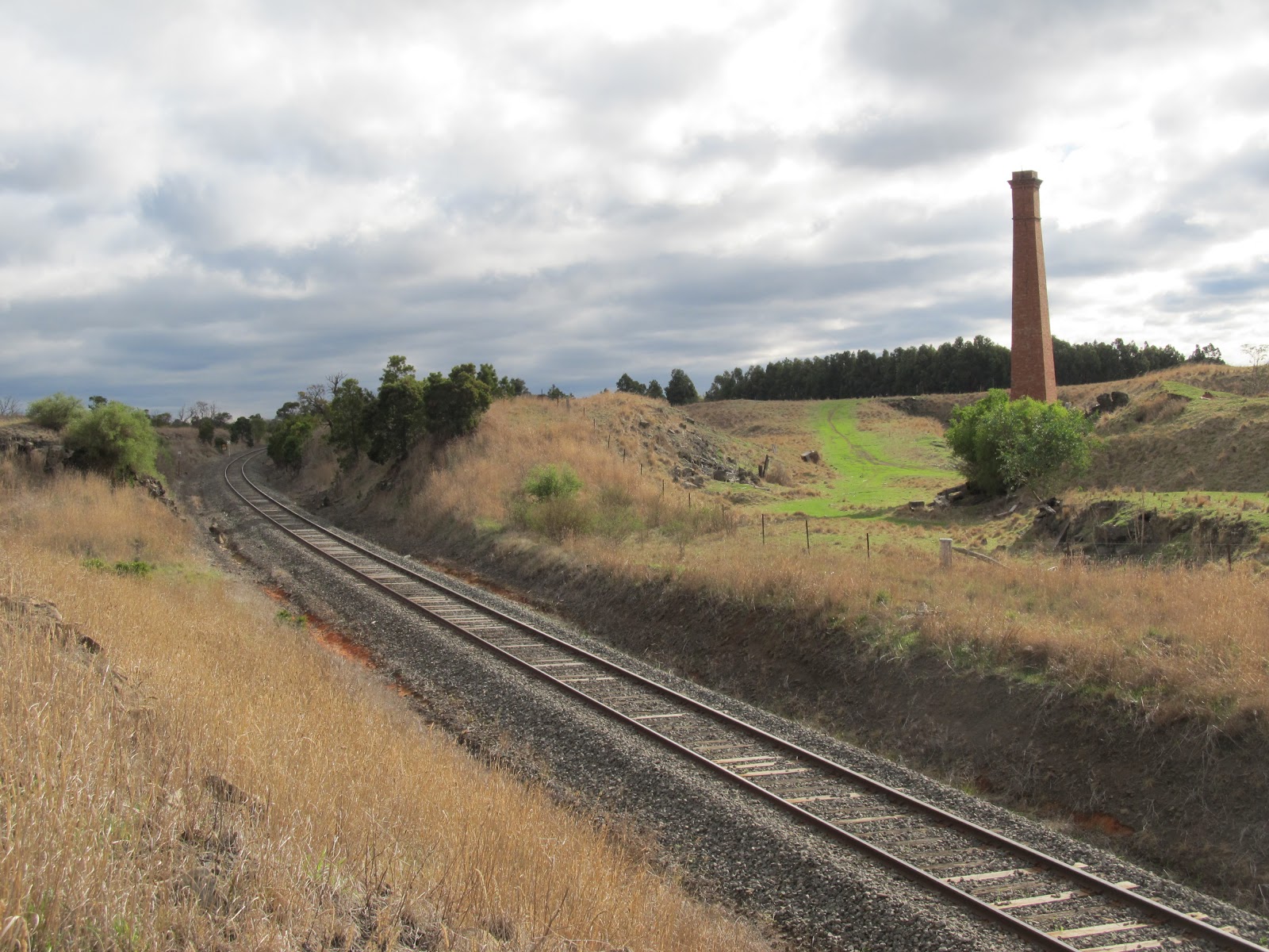
The site of the former Clyde Hotel, October, 2016
The building was insured and by early August, the claim had been settled, however this was the beginning of a difficult period for John Henry Jones. By 1885 he was insolvent and by the end of the year, his wife Emma had died. Consequently, as described in my post on the Railway Hotel (see link above), he was unable to obtain a license for that hotel.
Despite these trials, by April, 1887 he had been cleared of his insolvency and was again the licensee of the Railway Hotel. According to his will, at the time of his death on 11th May, 1891, John was a gentleman, living with his son Willie Herbert at Leigh Road. William Flahive - by then the proprietor of the Railway Hotel - had mortgaged the property to Jones who had little in the way of assets having sold most of his goods and chattels after selling the hotel. There was no mention of the land on which the Clyde had stood, from which I presume it had passed from Jones' ownership some time after his declared insolvency in 1885.
Today, the site is an empty field, overgrown with weeds and grass. There is no sign that one of the most popular hotels on the Geelong-Ballarat Rd was built there at the height of the gold rush. The township of Wabdallah, drawn up by surveyor Biddle never eventuated. Its proximity to Leigh Road (Bannockburn) and the arrival of the railway taking travellers off the road, coupled with the fact that the largest source of fresh water was the Moorabool River over a mile away, probably helped to seal its fate.
Google Earth image showing the site of the intended town of Wabdallah. Faint
lines still denote the boundaries of some of the surveyed blocks.
For the sake of clarity, it is worth mentioning that a second attempt was made to establish a township named Wabdallah. In 1863, only a year after the opening of the railway line, changes began to occur at Bannockburn. The original town had been gazetted and built on the west bank of Bruce's Creek, in the Parish of Murgheboluc. From 1862 the train line passed a little less than a mile to the east, across the creek - in the Parish of Wabdallah. Naturally, settlement began to drift towards the train line. New land adjoining the line and directly opposite the station was surveyed. The name given to this "new" township was Wabdallah. The original settlement on Bruce's Creek became known South Bannockburn. Today the blocks surveyed as Wabdallah form part of central Bannockburn, including the site of the Railway Hotel.  In 1872, more town blocks were surveyed on the opposite side of the line, close to the station at Leigh Road. There was no mention of Wabdallah, instead the township took on the name of the station around which it now clustered, a moniker which was used until the beginning of the 20th century when the town took on the name always used by the shire: Bannockburn.


12 December, 2015

Making tracks - the Mt Doran dilemma

With Watson's Hotel and the fledgling township of Meredith now behind them, the aspiring diggers of the gold rush era continued their journey up the "track". As I discovered whilst researching my previous post, this most likely took them out of town across Coolebarghurk Creek (at that time known as Marrabool Creek) and either towards Lal Lal on the old Lal Lal Road or along a route running roughly parallel to today's Midland Highway, at a distance a few hundred metres to the east.
At this point, things would seem to be a little hazy and in some places, downright contradictory, however as I alluded to previously, I may have found an explanation. In short, it all comes back to post offices and one or two old maps. Looking once again at Skene's 1845 map of Victoria, the track from Geelong to Buninyong appears to lead out of Meredith along the old Lal Lal Road as described by a local resident in 1943. From there, it was claimed, the track lead "through Mt Doran to Buninyong and Ballarat". Skene's map however, shows the road veering slightly away from the Lal Lal Road following a north westerly path instead; a path which passed directly through the site which became the township of Elaine.
From this point, the track continued its parallel path beside the Midland Highway, passing east of a little settlement known as Burnt Bridge. This route leaves the current Mount Doran some 5 or 6 km to the east and is seemingly at odds with the contention that the bullock track passed through Mount Doran - a route which would have added several kilometres to the diggers' journey at a time when there were no established towns between Watson's Hotel and Buninyong. Disappointingly I cannot locate the survey books for the upper part of the parish of Meredith and those of Borhoneyghurk Parish, meaning I cannot clarify the issue by continuing to plot the tracks I described in my last post.
Because there was little, if anything, in the way of settlement between Watson's and Buninyong I cannot locate a detailed description of the area at the time the gold rush broke out, but within a few years, signs of enterprise had begun to arise, perhaps giving some idea of the route followed by the diggers.
Google Earth screen shot overlaid with a section of surveyor A.J. Skene's 1845
map. The dotted line indicates the route as shown by Skene. The Midland Highway
is shown in yellow and the green lines indicate the approximate tracks plotted in 
my previous post. Click to enlarge
Recalling a journey taken in 1854, one correspondent to the Geelong Advertiser recounted some 50 years later, that sly grog-selling was rampant between Geelong and Burnt Bridge, with one of those illegal establishments lying between Meredith and the Stony Rises - the earlier name for Elaine. When surveyor Maurice Weston was taking his measurements for the land north of Meredith in 1857, he noted a "tent" on the east side of the present highway, slightly north of its intersection with Boundary Rd and around 600m west of the approximate line of the "Old Main Road". I don't know if  this tent was the same as that described in 1854, but such establishments came and went regularly and probably changed location equally rapidly. If the establishment at the Green Tent was anything to go by, they could also be located some distance from the road - perhaps due to their less-than-legal status.
Depiction of a coffee tent in 1852, by S.T. Gill, Image held by the
National Gallery of Australia
Regardless, this might suggest that the Stony Rises was a known location even in the early days of the gold rush. The first contemporary use of the name which I could find was an 1854 reference in the Geelong Advertiser and Intelligencer to the above sly grog tent, followed in 1855 by advertisements in relation to the construction of the new road to Ballarat. In 1857 there is reference in The Ballarat Star, to a murder inquest held at the Stony Rises Hotel. The hotel was also marked on an 1868 survey map which placed it west of the current highway, almost opposite the road to Morrison's. An article from The Ballarat Star of 6th August, 1889 gave the following description of the Stony Rises Inn at the time of its destruction by fire some decades later:
In the destruction of the Stony Rises hotel there has been wiped out of existence one of the land marks of the "fifties." In the golden days it was known as "Yankee Bill's," and the owner of the soubriquet dispensed food to man and beast in a tent. The late building was erected on the site of the canvas hotel, and passed successively into the hands of John Boler, Jarvis, and Grenfell, the last of whom held possession at the time of "holocaust."
Liquor licenses show that John Boler was the publican  by early 1857. With "Yankee Bill" in residence before this, it would seem that the hotel in some form at least was present before 1857. I notice that the 1868 survey map shows the boundary of the new line of road deviating slightly towards the site of the hotel, making me speculate as to whether the building was present before the new road, dating it to at least 1855 and presumably on the line of the old road.
I should also note that another description from January, 1853 does not mention the inn, but does make reference to a second coffee tent located about a mile before the next stopping point for the diggers - and possibly part of the key to the Mt Doran puzzle and the track to Buninyong - the little settlement of Burnt Bridge. The first reference to the settlement appears in several editions of the Geelong Advertiser and Intelligencer of 1852. An 1855 survey map shows the prospective township situated a few hundred metres south of the first crossing of Williamson's Creek (a tributary of the Leigh River) on the east side of the Midland Highway heading to Ballarat. Not only does it show the current road alignment as a section of plank road (a type of timber roadway generally built to provide a firm surface over swampy, low-lying ground), but it also indicates the line of the "old track of road from Ballarat to Geelong" which ran parallel but to the east of the new road. The construction of the plank road began in 1854 and it was presumably this impending realignment which caused resident John Morrison in 1853 to build a new hotel facing the new road, replacing his original establishment - described by a traveller in January 1853 as a "coffee tent" - which stood some hundred metres away on the old road.
A Google Earth screen shot overlaid with a section of the 1855 survey map of
Burnt Bridge. The current road (roughly aligned with the plank road) is shown
in yellow. The old track is shown in red. Click to expand
So, the above information would seem to confirm that after leaving Meredith the old track to Buninyong followed a course reasonably similar to today's Midland Highway, passing some 6km to the west of Mt Doran. I did however make a discovery which may explain the reference to Mt Doran. In 1859 with the gold rush in full swing, the new road open, the Geelong-Ballarat railway under construction only a few kilometres away and Morrison's "Railway Hotel" doing a solid trade, a post office was opened. It was given the name "Mt Doran".
Tenders for mail contracts at the time described the post office as "Mount Doran (Burnt Bridge)". Initially I suspected the post office may have been located at the Burnt Bridge settlement on the Geelong-Ballarat Road, however, tenders called the following year referred to the transport of mail from "the railway cutting (Mount Doran)".
I gather that this part of the line at the time of construction was known as the Burnt Bridge section and now believe that the post office was probably located in the temporary camp which sprang up to house the railway workers. Descriptions portray a series of timber cottages for management with the labourers housed in canvas tents. It was also remarked that some residents had built themselves little cottages and planted out small gardens in the bush surrounding the line.
The rail bridge on Blue Bridge Rd about 2.5km from Mt Doran and 3.5km from
Burnt Bridge on the Burnt Bridge section of the line

By the mid-1860s however, with construction on the line complete and the workmen gone, the tender notices for the mail run began to refer to "Mount Doran (Stony Rises)". My first thought was that perhaps "Mount Doran" may have referred to a much larger district than it does today and this may have been true as I also found an address stated as "Mount Doran, Clarendon", however there is another explanation which may account for the change.
Put simply, the "Mt Doran" post office, changed both names and locations over the years as the population fluctuated throughout the district. In about 1864 the post office was relocated from Mt Doran, to a site around a kilometre to the east of the developing township of Stony Rises. In 1872, reflecting the change in the name of the township, the post office was also renamed as Elaine.
 Just to confuse the issue however, Stony Rises/Elaine had been lobbying hard to have a railway platform erected in the township, near where the new line (which opened in 1862) crossed the surveyed road to Ballarat. It was finally granted in 1871 and then in 1875 after further lobbying by locals, the Post Master General opened a post office at the site. Perhaps somewhat confusingly, it was called the Elaine Railway Station Post Office. Elaine now had two post offices less than a mile apart.
Probably to avoid confusion, in October, 1877 the original Elaine Post Office to the east of town, reverted to its earlier name of Mt Doran. The post office at the railway platform was henceforth to be known as Elaine and was relocated to the primary school at around the same time. One disgruntled Mt Doran correspondent to the Ballarat Courier of 15th November was quick to point out the irony of this situation, stating:
It is passing strange that Mount Doran Post Office should not be at Mount Doran at all, but at Elaine, some four or five miles away. A few years ago that post office was really at the Mount: but the post-master and others, on the occasion of a [gold] rush to Elaine, eloped with our post office.
However, reading between the lines of the local newspapers, it may not have been long before the residents of Mt Doran got their wish as it seems that by the 1880s the post office had moved once again and was operating out of the Mt Doran State School.
Mt Doran State School, students and teachers in 1906.
Image held by Museum Victoria

So, it would seem that the Mt Doran Post Office probably began its life in 1859 at the site of the Burnt Bridge railway cutting at Mt Doran, before moving in about 1864 to a location east of Elaine township (but central to several mines active at that time) before finally coming to rest back in the township of Mt Doran not too long after its final name change in 1877, where it probably operated out of the state school. This much-travelled little post office closed its doors for the final time in 1930.
So finally, from what I have found, I doubt that the crowds heading to the gold fields of Buninyong and Ballarat in those earliest years did actually pass through or near Mt Doran. Instead, they most likely followed the old track via the Stony Rises and Burnt Bridge. I think that over the years the story has become blurred.
Whilst the mount itself no doubt existed well before the gold rush, Mt Doran as a town or locality seems to post-date those earliest years of the gold rush, appearing only in the newspapers from 1858. Quite some years later in 1866 there was a small "rush" to Mt Doran which no doubt resulted in diggers travelling directly to the district, but by then, the modern roads had been surveyed and the original diggers were long gone.
A partially covered mine entrance. Testament to the gold rush at Mt Doran
Then, over the years, as often happens in rural communities Mt Doran was sometimes described alongside other towns such as Clarendon, Burnt Bridge and Stony Rises, all of which lie on what I suspect was the most likely route of the old road from Geelong to Buninyong.  In combination with the re-location of the Mt Doran Post Office to Elaine for about 20 years during the 1860s and 1870s, it probably isn't surprising then, that those living in Meredith and surrounds might come to say that the route to the gold fields of Buninyong, Ballarat and beyond lay up the old Lal Lal Road to Mt Doran.


04 July, 2013

Branching out - Bruce's Creek

All rivers have tributaries and the Barwon is no exception. Bruce's Creek is a tributary of the Barwon which rises to the north west of the township of Lethbridge and "flows" across the basalt plain, through Lethbridge and then Bannockburn and empties into the Barwon a little to the east of Murgheboluc. (NB Whilst it does have areas which contain water, it does not have a continuous flow.)
This little creek like much of the district through which it runs has seen quite a bit of history. Prior to European settlement, the area through which Bruce's Creek runs formed part of the land belonging to the Wathaurong, who used the stream bed as pathway to guide them to the Barwon.

Bruce's Creek where it crosses the Hamilton Highway and "flows" west before
joining the Barwon River near Murgheboluc
With the arrival of European settlers, the surrounding land was opened up to grazing and then farming. The creek derives its name from the settler James Bruce who occupied land in the area from 1840 and claimed descent from the famous Robert The Bruce of Scotland who defeated the English in the Battle of Bannockburn. In a nod to the famous battle, this name was eventually given to the township which was established on the creek's banks.
Bruce was the second European to occupy the land, the first having been George Russell who held the land in the name of the Clyde company as part of his Golf Hill Station, but resided some distance away at Shelford (then known as Leigh) on the Leigh River.
Prior to the town's development the area was known either as Leigh Road (the name given to the railway station which opened there on the Geelong-Ballarat railway line in 1863) or simply as Bruce's Creek. In these earliest days, there was no bridge, just a collection of the readily-available basalt rocks piled across the creek to form a fording point. The ford still exists and is listed on the Victorian Heritage Database, but with little additional information, I am unsure if this was a public vehicle crossing point however, early maps do not seem to indicate that it was ever part of the route of the Lower Leigh Road of the 1850s between Bannockburn and the Leigh.
Historic crossing on Bruce's Creek near Bannockburn

Bruce's Creek ford

The ford and track leading over the hill towards Bannockburn
On the contrary, an 1855 surveyor's map of the "township and suburbs of Bannockburn" shows a bridge at the point where today's Pilloud's Bridge stands, located about 2km downstream from the ford. I am unsure of the age of the modern bridge, but it appears to be a newer structure supported by older bluestone piers.
Pilloud's Bridge across Bruce's Creek, Bannockburn
The other township to spring up on the banks of the creek was Lethbridge, originally known as Muddy Water Holes for a chain of ponds which ran along Bruce's Creek at that point. Gazetted in 1854, the town originally centred around the Ballarat Road (Midland Highway) and catered to the traffic passing to the newly discovered goldfields of Ballarat. From 1858 when the railway came, Lethbridge thrived as local bluestone was quarried to build the line, however as in Bannockburn, the centre of business eventually drifted away from the highway to the railway line with businesses either closing or relocating to survive. This left only the Lethbridge Primary School and the Catholic Church on the road to Ballarat, however in an ironic reversal, the school and church have now both closed, but a significant increase in housing has occurred along the highway.
As with much of the country, European settlement caused significant change to the immediate environment of Bruce's Creek. The area through which the creek runs is part of the Victorian volcanic plain region, categorised today as lying within the Leigh Landscape Zone. This particular area is flat and rocky and before European arrival, would have been a lightly-wooded, grassy plain. Since then, significant clearing of the ever-present rocks and trees to enable grazing and farming, has given much of the landscape surrounding the creek quite a barren look and in many places there are few or no trees along the creek at all.
The other significant factor influencing the appearance of the creek was the construction from 1858 of the Geelong-Ballarat railway line. In order to provide access for vehicles carrying bluestone from the quarry at Lethbridge to the railway works, a small bridge - also of bluestone - was built across Bruce's Creek on Russell Street in the township.
Bridge over Bruce's Creek, Russell St, Lethbridge
The Victorian Railways created a reservoir along the course of the creek some few hundred metres from the Lethbridge station along with a 90,000 litre tank and a pump which supplied water for the steam trains as they made the long uphill haul from Geelong to Ballarat.
In the 1970s when diesel had replaced steam, the council purchased the reservoir which was developed into a lake and picnic area and is now home to a variety of birdlife.
As mentioned in an earlier post - Walking the line - the railways built a second bridge across Bruce's Creek, between Lethbridge and Bannockburn, known to locals as the Lower Camp Bridge after the workers who camped at that point as they worked on the line.

The "Lower Camp Bridge"
Today, in addition to the bluestone bridges built by the railway, the ford at Bannockburn and no doubt a number of informal crossings on private property (I know of at least one) there are modern bridges at Bannockburn (Pilloud's Bridge) and the unnamed road bridge on the Hamilton Highway near Murgheboluc.
Looking to the future, the Golden Plains Shire and its landholders are acting to improve the health of this little waterway, preserving and enhancing remnant vegetation and developing plans for the future management and use of the creek and its surrounds.


13 June, 2013

Backing the Black Line

...and so...back to trains...
After the successful construction of both the Melbourne-Geelong and Geelong-Ballarat railway lines, the push was on for a line which would service the south west of the state and it was with this in mind that the line from Geelong to Winchelsea opened in 1876. In following years the line was extended as far as Port Fairy, although the section beyond Dennington is now closed and forms the newly-opened (May, 2012) Port Fairy-Warnambool Rail Trail.
First however, like the Ballarat line, a route had to be chosen. One rejected suggestion was to extend the line via an existing branch to the waterfront on to Limeburners Point, from there heading inland to cross the Barwon River at Breakwater. History shows that this option was not taken up, but in the 1850s, this was by no means certain. Letters to the local media pointed out the benefits of a rail link to Point Henry, enabling the unloading of cargo from vessels unable to cross the sandbar and enter Geelong's inner harbour, prior to the dredging of the Hopetoun Channel which was not completed until 1893.
Corio Bay from Western Beach, 1880 showing the Railway Pier (Cunningham
Pier)
This was considered a matter of some importance as both Geelong and Melbourne competed for incoming trade. Routing the line to the south west via Limeburners Point - with a train or tram connection to Point Henry - made economic sense. An extension to Queenscliff where cargo for Geelong could be unloaded directly rather than via Melbourne was also discussed. In 1867 a select committee recommended that a rail line to Colac follow "Corio Terrace" (presumably branching off the existing line to the Railway Pier) as far as "Sydney Place", turn to cross the Barwon at Breakwater and continue on to Germantown (Grovedale), passing 5 miles south of Winchelsea and through Birregurra before terminating on the southern shore of Lake Colac.
By 1873, engineers' reports were being tabled in the Victorian parliament, considering three different options: known as the black line, the red line or the green line. The green line which it seems was favoured by the Commissioner of Railways did not include Geelong at all, but saw a line branch off the existing Geelong-Ballarat line at Leigh Road (now Bannockburn). Requiring only 40 miles of track to be laid but resulting in a total route which was 5 miles longer than the black, it was considered cheaper to construct.
Bannockburn (Leigh Road) Station
From the reports of the day, it seems there was fierce lobbying from all quarters, with allegations of lies, distorted estimates and vested interests claimed all round, however the proponents of the black line won out in the end. This more direct route it was argued, would bring more benefit to more people, opening up vast new landholdings in the process - exactly the claim made by advocates of the green line. The third or red line, deviated somewhat to the north of the black line but does not seem to have been seriously considered by any party.
Having chosen the black line, the major stumbling block was how the new track should leave Geelong. The idea of a rail link to Point Henry seems to have disappeared from the agenda by this stage but a report in The Argus of 9th April, 1873 spells out the various options considered:
With regard to the question of the tunnel for getting out of Geelong the first estimate of its cost was £95,000, but recent surveys showed that a line could be adopted by Fenwick-street, whereby the cost of the tunnel might be reduced to £59,000. Two other lines had also been surveyed - one by the Botanical gardens, in which the tunnel would only cost £64,000, and another by Sydney-place, crossing near the hospital, in which a tunnel would cost £74,000.
Rail tunnel from Geelong Station to McKillop Street
Another point in favour of the black line was that a branch to Queenscliff would be a simple matter if the route through Geelong was chosen. Despite debate over the need for such a line at the time, the coming of the military to Queenscliff, saw the line built only a few years later, opening in 1879
 (see previous post). In addition, a short branch line to the old Geelong racecourse from Marshall opened in 1878 (see this previous post). This would not have been possible had the green line been chosen.
History of course shows which tunnel was eventually built. Then as now, the politicians making the decision were subject to the influence of lobbyists and money but had these forces been otherwise, the landscape of the Barwon  may be very different today.
The decisions made then determined the two points at which rail bridges still cross the Barwon today: Breakwater and Winchelsea, not, as the proponent of the "single great trunk line of railway for Victoria" would have had it (see this post)  at Melville's Quarry near what is today the west end of Noble Street, or at Buckley Falls.
One detail however is not so dissimilar to that suggested in his letter of 1857 where he indicated that the line should run "50 chains" (a little over a kilometre) due south from Geelong Station. The decision to choose the Fenwick Street option saw the line travel due south for exactly that distance, however rather than a sweeping curve to the west "between Newtown Hill and the Barwon" (presumably in the vicinity of West Fyans Street) as proposed, the line as we know headed south east before making a sweeping curve to cross the Barwon at Breakwater.

Vintage Rail steam engine R707 entering the tunnel May, 2013
When all the debate was done and dusted, the first sod on the new Geelong and Colac Railway line was turned by the Mayor of Geelong at a site near Johnstone Park on 24th October, 1874. A holiday was declared, military and civil displays were held for the populace - of whom 5,000-6,000 turned out to witness the event - flags and bunting flew from ships and buildings across town and three cheers were given for the "Black Line".
At a subsequent banquet held for the dignitaries, the expected speeches were made and toasts proposed. It was clearly stated that this was only the beginning and that extension of the line to Queenscliff and Camperdown should be urgently promoted. The mayor it was noted, apologised for the absence of "the members of the ministry and a number of other gentlemen." With the whole event having the distinct air of a victory party for the Black Line, one can't help but wonder whether some of those absent gentlemen were proponents of the green line.
The original timber rail bridge over the Barwon River at Breakwater, 1937,
reproduction rights held by the State Library of Victoria
From this point, building continued apace with the complex and expensive construction of the tunnel and bridge at Breakwater being a priority which took about 12 months to complete, thereby allowing the line itself (thus connected to the existing line) to be used for the transport of materials for further construction.
The original rail bridge over the Barwon at Breakwater was a timber construction some 186m in length and only a short distance further down the line a similar but smaller bridge spanned Waurn Ponds Creek. From this point onwards, the track works were considerably simpler, but no less controversial.
Current Breakwater rail bridge built in the 1960s to replace the original
The second rail bridge across the Barwon was built at Winchelsea, however the original route surveyed for the "Black Line" saw it pass some miles south of Winchelsea, instead favouring selectors on the edge of the Cape Otway forest in the vicinity of Deans Marsh. Once again, the lobbyists were out in force with one scathing critic of the  "Winchelsea Deviation" reported thus in The Argus of 26th January, 1876:
One gentleman wanted to know what Winchelsea had done

"That the claims of the forest should be sacrificed for its aggrandisement. As a township it claimed to be a centre of population, and the father of the shire. He regretted to say it was the centre of a vast area of arid plains, only fit for a few sheep-walks, and scarcely suitable for that; that the few farmers in the neighbourhood had deserted their holdings, and the land for miles around was held in the hands of two or three individuals; and that as a township it had fallen into decay, and only existed in the form of a couple of publichouses(sic), one or two stores, and a few shingle shanties."
In spite of such opinions and perhaps even despite the original route providing a greater boost to the economy, the Winchelsea Deviation was confirmed as the passage of choice. This second section of the track past Freshwater Creek included some 40 bridges and culverts, one being the second crossing of the Barwon at Winchelsea. Like the first at Breakwater, this bridge was a timber construction, but at only 146m in length, shorter than its downstream counterpart.
VLine train from Warnambool crossing the Barwon on the present-day
Winchelsea rail bridge. The first timber bridge was replaced at some point
 by this concrete and steel girder construction
 Finally, after all the debate, significant engineering hurdles and several years of hard work, on 24th November, 1876, the much awaited first stage of the Geelong and Colac Railway was opened to Winchelsea.
A train carrying dignitaries including the Commissioner of Railways who conducted the formalities was dispatched from Melbourne and further notables were collected in Geelong before proceeding to Winchelsea where the residents of the district greeted them with the expected pageantry, speeches and of course, a banquet. The worthies then took a turn around the town before piling back onto the train and heading for home, leaving the good residents of Winchelsea to hold a ball to further mark the occasion.
The following year, the section of track to Colac was completed and - as hoped from its inception - subsequent decades saw the extension of the line to Camperdown (1883), Terang (1887), Warnambool (1890) and Port Fairy (1890). In all, one would have to say, a resounding victory for the supporters of the Black Line.
And now, almost 137 years later as I write this post, I can hear the trains still travelling along the route envisioned by such illustrious names as Levien, Johnstone, Lang, Thomson, Armitage, Sladen, Austin and many more...

04 June, 2013

Walking the line

Following on from my previous post Anticipating the Octopus Act, I thought it might be interesting to look at the route finally chosen for the Geelong-Ballarat railway line and to use some of those photos I've been saving for just such a post. So here it is:
After the opening of the rail link between Melbourne and the growing township of Geelong (population 23,352) in 1857, tenders were taken and in 1858 construction began on the Geelong-Ballarat railway line. The chosen route branching off the Melbourne-Geelong line at North Geelong did not cross the Barwon River as at least one proponent had suggested, instead, it crossed the Moorabool River by means of the  the Moorabool Viaduct  located about 1.5km west of the Geelong-Ballan Road.

The Moorabool Viaduct 1863
The line was officially opened on 10th April, 1862, following the route we know today. It remained the only rail link from Melbourne to Ballarat until 1889 when a direct line between those two cities was opened.
The 86km of line from Geelong to Ballarat was built to the highest engineering standards of the day and in addition to the viaduct, included a number of bridges crossing roads and creeks.

Rail bridge near Moorabool station
Not surprisingly given that the line passes across one of the world's largest volcanic plains, the predominant building material was bluestone, examples of which can still be seen right along the line.

Double-arched bluestone bridge carrying the Geelong-Ballarat rail line across
Cowies Creek and Bluestone Bridge Road at Lovely Banks
Stone for the construction was quarried at Lethbridge, which township the line passed en route. During construction of the Lethbridge section of the line, workers lived in tents at two camps along the line. One was located a few hundred metres north of Lethbridge station. The other, about 3km south and a little east of Lethbridge, was situated on the banks of Bruce's Creek (a tributary of the Barwon River) just to the south of a bluestone rail bridge which crossed the creek on the property owned by my grandfather (Jack Stevenson) about a century later.

Lower Camp Bridge, outside Lethbridge
Today I took a walk up the line from Lethbridge Station and snapped some photos.
The bridge was known to locals as Lower Camp Bridge, presumably after the men who built it. Rivalry between the two camps was strong, both on the sporting field of a Sunday afternoon and in their bridge-building prowess. Attention to detail can be seen in the finish of the stonework on the bridges near Lethbridge. Perhaps I'm biased, but the detail of the Lower Camp Bridge does seem somewhat greater.

Road bridge on Quarry Road, Lethbridge


Remaining chimney at the quarry from which stone was cut for the
Geelong-Ballarat railway line (later Nash's Quarry)
Rail bridge over O'Connor Road, Lethbridge
By comparison, the bridge across Bruce's Creek on Russell Street in town is a much simpler construction. Whilst not part of the railway infrastructure, it was built by the railway to allow access to their works.
Bridge over Bruce's Creek on Russell Street, Lethbridge
Initial stations - also of bluestone - were erected along the line at Moorabool, Lethbridge, Meredith, Lal Lal and Yendon (Buninyong). Later stations were added to the line at Geringhap, Bannockburn, Elaine, Navigators and Warrenheip. The stations at Moorabool, Bannockburn, Lethbridge, Meredith and Lal Lal remain standing today:
Moorabool Station April, 2012
Bannockburn Station April, 2012

Lethbridge Station April, 2012


Meredith Station April, 2012
1The Geelong-Ballarat railway celebrated its 150th anniversary in April, 2012 with an open day and special vintage rail service. Freight traffic for Mildura continues to travel via the Geelong-Ballarat line however, passenger services were suspended in 1978. A recently concluded study looked into the feasibility of re-introducing a rail passenger service between Geelong and Ballarat, extending to Bendigo via Maryborough and Castlemaine. It was estimated that such a project would cost almost $1 billion to implement with ongoing running costs of $17 million per year and was unlikely to receive funding however, some within political circles are not quite willing to write the subject off just yet, pointing out that figures for the Geelong-Ballarat section of the line alone may be more economically viable...

Anticipating the Octopus Act

This blog post has been a while in the making - over 150 years in fact - and it begins at a time when decisions were made which created the city of Geelong and the landscape of the Barwon River as we know it today. But it could have been so much different.
On Sunday, I was alerted to the presence of a steam train in town when I heard its whistle at South Geelong Station and zipped off to snap a few pics. Over the years, I have collected snippets of information and photos of Geelong's rail heritage (some of which has already appeared on this blog), but in some cases wasn't sure of their relevance to the Barwon.
R707 City of Melbourne steam train Melbourne bound
Then, a few weeks back whilst researching a previous post, I came across a newspaper article from the Bendigo Advertiser of 1857 which gave me the excuse I needed.
This was a time when Victoria's railways were in their infancy.  By the end of the 19th century a network of train lines would sprawl across the state, their development supported by the government in the form of the so called "Octopus Act" of 1884 which legislated for the construction of 59 new railway lines. But in 1857 this was yet to come and debate raged over what form any future development should take.
The privately-funded Melbourne-Geelong railway line was about to open and there was increasing agitation from other regional centres - particularly Ballarat and the Goldfields - to have rail links of their own. But what routes would the new lines follow? After all, easy access to rail services could make or break the future of small rural towns which meant that there was some fierce lobbying before a final decision was made.
In particular, competition for trade and services between the growing urban centres of Melbourne and Geelong was strong as they vied to attract the riches flowing from the Goldfields of Ballarat and Bendigo and the wool of the Western District. Ultimately, strong influence by interested parties from Geelong, combined with a 20km shorter distance than that to Melbourne ensured that the government elected to run the line to Ballarat from Geelong. This section of track was completed in 1862 and is the subject of a subsequent post.
A photograph of an earlier depiction of the Geelong railway station by S.T. Gill
In 1857 however, this outcome was by no means assured and various different track alignments were under discussion. One of the hottest topics of the day was the idea of a single "great trunk line of railway for Victoria" which, starting in Melbourne, would then need to take in the towns of Geelong, Ballarat, Bendigo and Castlemaine - presumably with branch lines to service outlying areas.
One example of how a trunk line might run was published in the form of a letter to the editor of the Geelong Advertiser and reprinted in the Bendigo Advertiser on 11th April, 1857. The author of the letter felt that a trunk line could best be achieved in this way:
Starting point from the metropolis, Melbourne, and using the Geelong and Melbourne line from Melbourne to Geelong, which we may say is already constructed and ready for continuation. 
Starting point from Geelong, due south, 50 chains from the present station, then taking a sweep to the westward along the flat land between New Town Hill and the Barwon to the point known as Melville's quarry, crossing there, thence proceeding along the point at the foot of the Barrabool Hills, crossing the Barwon at Buckley's Falls, thus arriving on the flat plain land in the short distance of about three miles and a-half; then taking a straight direction west by north to Meredith; from Meredith west by south, half west to the course of the river Yarro Wee, better known by the name of the Leigh, crossing the same at the junction of Williamson's Creek, travelling along the level land by the side of the Creek, south of Buninyong, Green Hills, and Hard Hills, rising on the table land in the immediate neighbourhood of Winter's, going along the level land, through Sebastopol and White Horse, to a grand western station situated on the level land between the township of Ballaarat and the swamp, thus crossing the dividing ranges without any difficulty of any importance, the highest point yet attained being the station of Ballaarat; preventing extra rising to the extent of 200 feet, which is the fall from the saddle of Warrenheip to the township of Ballaarat...
The proposed site of a rail bridge across the Barwon below Queen's Park
He went on to detail the route to Castlemaine and Bendigo also suggesting locations for stations along the route as follows: a station at the second  crossing of the Barwon (Buckley Falls) would service farmers in the Barrabool Hills and Murgheboluc, a second at Lethbridge would be closest to Steiglitz and farm land along the Moorabool with a third at Meredith and a fourth on the Leigh River to the south of Buninyong to allow access to the goldfields. Subsequent stations along the line would be located at Ballarat, Coghill's Creek, Deep Creek, Lodden, Harcourt and Sandhurst. This route he claimed, would be the flattest and the cheapest, requiring less infrastructure than other proposed routes.

Looking downstream towards the site of a second rail bridge proposed for
the Barwon River in 1857. The paper mill was built at about this point in 1875
The final paragraph of the letter then addresses the previously unstated issue of competition between Geelong and Melbourne, declaring:
It cannot be anything but a want of knowledge of the country, or jealousy of the metropolis of the infant town of Geelong...[which would cause the rail route to be aligned other than as stated in his letter].
In the event, the authorities of the day did not agree entirely with this vision for the future of Victorian rail and so the line to Ballarat branched off the Melbourne-Geelong line at North Geelong, crossing the Moorabool River instead of the Barwon. Stations were located at Lethbridge and Meredith, however, rather than extend the track beyond Ballarat, a separate line was built from Melbourne to Castlemaine and Bendigo. Completed by 1862, perhaps it ensured that this trade at least passed through the port of Melbourne.
As for the Barwon, it would remain without a rail bridge for several more years.