28 December, 2013

From yarns to yeast

Geelong's wool trade of the 19th and 20th centuries was intimately connected to the Barwon River with first tanneries and wool scours and then woollen mills popping up from Breakwater to Newtown from the 1840s onwards. A late-comer to the scene was the Valley Worsted mill which opened in 1925 to capitalise on Geelong's role at the centre of Australia's wool trade.
In March, 2012, I posted about the future of the mill which, after 50 years in operation, ceased production in the 1970s. In 2011, the entire mill complex was sold to the Little Creatures Brewery - a Fremantle-based company - who developed the site as an east coast base for their brewing operations. For months we have seen the comings and goings as the works have taken place. On some occasions we even watched as picket lines blocked the front gates.

Little Creatures Brewery, cnr Fyans and Swanston Sts, South Geelong 
But finally, on 10th December, 2013 the doors were opened and Little Creatures' was ready to serve the people of Geelong. In addition to their brewing operations, the new brewery houses a large canteen on the premises which serves their own beers and ciders in addition to a selection of locally-produced wines and a light menu for those wishing to have a bite to eat with their beverage of choice.
Strolling from the gateway through the old mill complex

Please queue through the shipping container to the right...
And the local citizens it seems, were very keen to be served - myself included. At the invitation of friends, I headed down for a look and a beer just before Christmas. Within an hour of our arriving, the place was full to overflowing and there was a queue waiting for admission, all controlled by a clearly visible security detail.

More like a street party than your average canteen
My observations at this point only extend to the public area, however I believe tours of the site are held daily. My first impression upon arriving at the "canteen" was of a busy street market, with people milling everywhere, tables, seats and umbrellas interspersed with fruit trees in large planter boxes and a bustling waiting staff taking orders back and forth.
On this occasion we sat outside facing a herb-oriented wall garden as the waiters came and went, chasing the brightly-coloured, sparkly hats which are used to identify order numbers.
The vertical garden with recycled planters
The weather on this occasion was perfect for sitting outdoors, however, had this not been the case, the indoor seating surrounding the bar is almost cavernous in its extent. Just inside the door as you enter is a table inviting you to sample the brewing process by smelling the dried hops and tasting the malted barley.
Hops, malt and water
Kids (or little creatures as they call them) are catered for with a kids' menu and two large sandpits, one inside and one out.

The view indoors
Another cute decorative touch is a substantial amount of yarn-bombing which appears on poles and posts both inside and out. Orders are made at the bar and food delivered to your table. At this stage I can personally recommend the prawn tortillas and the lamb spareribs, however I will definitely be back to sample some more.
So now those who are out there enjoying the surrounds of the Barwon, can break their ride, run, walk with a 300m detour up Swanston Street for a refreshing ale and a bite to eat.


26 November, 2013

Branching out - music at Meredith

In 1991, a couple of mates got together and decided to throw a party following end of year exams at university. They wanted music, a stage and a venue which was out of town with plenty of space so that people would be encouraged to camp out onsite and not have the hassle of driving home after a big night.
Greg "Peelie" Peele had the idea and as it happened, Chris Nolan had the venue - his parents' farm outside Meredith, overlooking the Leigh River which has been in the family since the 1860s. Together with Marcus Downie, they were the founding members of the now hugely successful Meredith Music Festival.
The valley of the Leigh River below the festival site
The first event saw six bands play to a turn out of 250 people - mostly friends and friends of friends. In those first years, the stage on which the bands performed was the back of a truck. It was pretty much BYO everything and the locals put on a BBQ. The following year there was an audience of 500 and 17 bands and the organisers were joined by Matt High.
By 1995 the event had grown large enough that for the first time, numbers had to be capped. They sold out two weeks before kick off and have continued to sell out since. Throughout the first 10 years of the festival's existence emerging bands such as Spiderbait, The Whitlams, Rebecca's Empire, Something For Kate, Jebediah, The Mavis's, Tex Perkins along with The Cruel Sea and many more besides appeared on the bill.
Dramatic rock formation on the Leigh below the festival site
1993 saw the running of the inaugural "Meredith Gift". With one of the acts running late, it was decided to hold a footrace to stall for time. The prize would be increased if participants were nude or ran in their undies. The event has become annual feature and today competitors vie for the co veted "golden jocks" prize - Google it if you are brave enough! By now, it was beginning to look as if the festival might turn a quid.
But then in 1996, the festival was dealt an almost fatal blow when co-organiser Chris Nolan suffered a mystery illness resulting in multi-organ failure, permanent disability and the need for 24 hour care, however the festival survived and indeed thrived. Today it remains an independently funded, non-commercial concern, committed to maintaining its easy-going philosophy of BYO, musical variety and a strict "no dickheads" policy. The locals still provide much of the food and part of the proceeds from each event go towards Chris' on-going care and to support a number of Meredith community groups.
The festival site November, 2013
Over the years the Festival has faced a number of other challenges. In 2001, organisation for the following year was thrown into a spin when it was declared that the original event site could no-longer be used. Fortunately the Nolans came to the rescue again with a second venue - now known as the Supernatural Amphitheatre (aka the "Sup") which has grown to include an impressive array of permanent and semi-permanent infrastructure used by musicians, staff and audience alike during the festival.
The stage as seen from the back of the "Supernatural Amphitheatre"
In 2004 an electrical storm which came within a whisker of forcing an abandonment. In 2006, the venue was swathed in smoke from nearby bushfires whilst in 2008 rain was again an issue - in the middle of a drought.
But through it all, the artists kept coming, those who returned time and again and a new generation including interstate acts, local acts who were forging a name and those who hoped to do so. Amongst the line up from 2000 onwards were: Regurgitator, John Butler Trio, Jet, Xavier Rudd, Wolfmother, TISM, The Presets, Gotye, Sarah Blasko, The Hoodoo Gurus, Rose Tattoo, Tame Impala, Paul Kelly, Neil Finn and a solo Kram from Spiderbait.
This metal flamingo which lights up the night sky marks the
entrance to the only licenced venue on the site - the Pink
Flamingo Bar
In addition to the many acts, an array of sideshow attractions such as The Meredith Eye and the Ecoplex Cinema have sprung up along with a number of quirky totems and mascots such as this blue cow which hangs from a tree during the festival.
Add caption
So popular has the Meredith Music Festival become, that in 2007 a second, spin off event known as the Golden Plains Festival was born. The long weekend in March, 2014 will be the 8th time this event has been held and it has grown to become a huge success in its own right.
Between them, the two events now bring folk from all over to listen to music in the country on a scale never imagined by the organisers in those early years.

23 November, 2013

Eaten away

Erosion is a problem common to many rivers and it comes in three main forms: bank erosion, gully erosion and hillslope erosion. Whilst the Barwon is subject to all three forms, studies have shown that by far the biggest impact comes from bank erosion.
Riverbank between Pollocksford and Merrawarp Roads
As the products of erosion enter the river system, they take one of two paths. The lighter matter remains suspended in the water and is carried downstream whilst the heavier material forms what is known as "bedload" which sinks to the streambed to be washed down more slowly. Whilst the suspended material may be deposited on flood plains, ultimately increasing soil fertility, it can cause a reduction in water quality as well as problems downstream, particularly in the shallow lake systems below Geelong.
Bedload can build up on the stream bed further upstream, restricting the flow of water and movement of fish and other river fauna as well as adversely impacting on their habitat.
Prior to European settlement, the river environment was believed to be relatively stable, however from 1836 onwards, clearing of native vegetation, the introduction of stock which impacted soil quality and bank stability and the exploding rabbit population burrowing into banks all added to a rapid increase in erosion along the Barwon. Other contributing factors included the draining of wetlands and marshes for farming purposes and the diversion of water from the Barwon and its tributaries.
The West Barwon Dam
Early efforts to control erosion included the planting of willow trees which it was believed would stabilise the banks. Unfortunately however, they - and any number of other exotic plant species - had the opposite effect, not only contributing to the erosion, but also impacting upon nutrient levels in the water and destroying the habitat of native animals. As their dense roots extend into the riverbank, burrowing animals such as platypus are unable to dig their burrows. As I have blogged previously, by 1949 willows were found to choke the stream, causing flooding, erosion and silting. Today, only a few willows remain here and there along the river.
Another introduced species which can impact riverbank stability is the introduced carp, which not only eats the plants necessary for the survival of native fish, but with its aggressive feeding habits can cause bank erosion. Various initiatives such as "Catch-a-Carp Day" and the draining and dredging of Reedy Lake where a tonne of carp was removed help to control levels of this pervasive pest. If caught while fishing, it is illegal to return carp to the river.
A carp grazing along the riverbank at Marshall
If not used with care, speed boats can also contribute to bank erosion. Speed limits are used to help minimise these effects.
In some cases, natural events also contributed to the problems. When a landslide blocked the channel of the East Barwon River in 1952 causing the creation of Lake Elizabeth, water flow was significantly impacted. The following year when the blockage was partly breached, soil and debris was washed downstream, covering lower-lying farmland. Major flooding in 1995 also caused significant erosion.

Aerial view of the 1995 floods looking south west from the Geelong Advertiser
By the 1940s, efforts were underway to control erosion (whether natural or manmade) and improve water flows and water quality by stabilising the banks and bed of the river. In the 1970s further measures were taken such as the installation of silt traps and revegetation. Following the 1995 floods, intensive measures were required to control and reverse the damage done by the increased water flow.
Today, ongoing measures to minimise erosion and improve water quality are in place and a multitude of Landcare groups across the region work in conjunction with the Corangamite Catchment Management Authority to rehabilitate the Barwon.
Bank and gully erosion can be reasonably effectively controlled in rural areas by restricting the access of stock to rivers, creeks and gullies and by revegetation along riverbanks and areas likely to suffer from erosion. Education of landholders and improved farming methods are also important.
Hillslope erosion is best controlled by encouraging good ground cover improved soil structure which can be aided by measures such as the retention of stubble from cereal crops and the use of raised-bed farming.
Sheep on the river between Pollocksford and Merrawarp Roads
I have noticed in recent times (hence the idea for this post), that bank-stabilisation works are currently being undertaken near Breakwater where rocks are being used to line sections of the bank. Upstream at Queen's Park, some removal of exotic suckering species of trees such as ash has occurred, however I don't know whether this is for stabilising purposes.
Bank stabilising near Barwon Valley Golf Course

16 November, 2013

Branching out - a Bavarian invasion


The von Stieglitz family of Tasmania and Victoria were descended from Christian Ludwig von Stieglitz who was created Baron of the Holy Roman Empire in 1765. The second baron - Heinrich Ludwig - son of Christian emigrated from Bavaria to Ireland with his family around the turn of the 18th century. However, following the death of the second baron in 1824, his wife, six sons and three daughters found themselves in straitened circumstances, consequently each of the six grandsons at one time or another sought their fortune in Australia. Biographical details for each can be found in the Australian Dictionary of Biography.
Of particular relevance to the Moorabool Valley are the three brothers - Robert William, John Lewis and the youngest - Charles Augustus. Robert along with his brothers Frederick and Francis arrived in Tasmania in 1829, with the others following in subsequent years. Unlike their brothers, John and Robert did not receive land grants in Tasmania but instead crossed Bass Strait with the earliest squatters to take up land in the Port Phillip district.
On 9th November, 1835, John von Stieglitz along with John Anthony Cowie and David Vere Stead were amongst the first settlers lead by John Batman to land stock at Port Phillip. They arrived from Tasmania on the ship Norval, landing at Gellibrand's Point (Williamstown).
von Stieglitz, Cowie and Stead were quick to head west in search of pasturage for their stock. In March, 1836, Cowie and Stead - I assume with the von Stieglitz's - took up a run at what is now the suburb of Bell Post Hill in Geelong, holding the land which ran down to the Moorabool River (see Branching out - from squatting to schooling).
About two months later on 3rd May, John von Stieglitz married John Cowie's sister Emma at her brother Robert's home in Tasmania. Soon after on the 9th July, he arrived at Point Henry with more stock for their run.
By 1838 - already finding the rapid increase in population occurring with the settlement of the town of Geelong too restrictive - the brothers, along with Cowie and Stead moved their stock on to greener pastures further up the Moorabool River. Robert settled his sheep on 4,836 acres which he called Ballan (named for a town in Ireland) near the head of the eastern branch of the Moorabool River.
Ballan House, drawn by Emma von Stieglitz (nee Cowie). Image held by the
State Library of Victoria
Brother John and his wife Emma established themselves on 16,000 acres which they called Ballanee (aka Ballenee) nearby on the Werribee River. In 1842, ties between the von Stieglitz and Cowie families were further strengthened when John Cowie married the von Stieglitz brothers' youngest sister Charlotte Christina at Ballanee.
Ballanee, drawn by Emma von Stieglitz, Image held by the State Library of Tasmania
 Four years before his marriage, Cowie along with David Stead had taken up a third run, south of Ballan on the banks of the East Moorabool River. They called their property Bungeeltap - also the subject of an earlier post.
The third of the von Stieglitz brothers to take up a run on the Moorabool was the youngest son, Charles Augustus. He arrived in Victoria in 1839, having stayed behind in Ireland to complete his schooling. Prior to his arrival, and the same year in which they were establishing the original Bell Post Hill run near Geelong, Cowie and Stead also  took up a lease of 8,000 acres further up the Moorabool on its eastern bank. This land lay between what would become the Moranghurk run of William Taylor and Dugald McPherson to the south and John Norman McLeod's Borhoneyghurk to the north. They called the run Durdidwarrah a Wathaurong word which I have seen described as meaning either "shelter of bark" or "dead water".
In 1842, Durdidwarrah - now extending to 24,000 acres - was passed to  Charles von Stieglitz who established himself there, extending the run to eventually include 74,000 acres. During the 1840s, a simple residence was erected on the property followed in 1849 by a larger brick house with Georgian and Edwardian features. Both still stand today, the former as an outbuilding and the latter with alterations and additions made over the years.

Original building at Darra, 1962. Image from the J.T. Collins Collection, La Trobe
Picture Collection, State Library of Victoria
Like his brothers, Charles did not remain in Victoria, but in 1853 returned to Ireland a wealthy man. In October that year the property was advertised for sale including "The Eclipse Hotel"  and again the following year including "...the Steiglitz Estate in lots to various purchasers...". By 1858, the homestead was still in operation as the Eclipse Hotel, however mention does not appear in the contemporary media after that date.
In 1863 Durdidwarrah was purchased by William Thomas Napier Champ, the first premier of Tasmania, who changed the name of the property to Darra. Champ had also served as the Commandant of Port Arthur and arrived in Victoria in 1857 to take up the role of Inspector-General of Penal Establishments. Throughout his career in the justice system he was seen as a fair and humane figure. He retired from his public role in 1868 to Darra where he spent the remainder of his life developing the property, pursuing pastoral pursuits and playing a role in the local community. In addition to the 200 acre pre-emptive right purchased by Charles von Stieglitz in 1853, Champ added a further 1075 acres, most of it purchased in 1867 and then another 300+ acres in 1884. He died in East Melbourne in 1892.

Darra homestead, 1962. Image from the J.T. Collins Collection,
La Trobe Picture Collection, State Library of Victoria.
The property remained in family hands into the 20th century. In February, 1900 The Argus reported that there was a devastating bushfire which tore through the district, burning houses and stripping grazing land. Whilst the Darra homestead remained standing, all fences and grassland were lost - for the second time, it claimed, within only a few years.
Such setbacks notwithstanding, Darra remained in family hands until January, 1922 when, due to advancing age, Mr JW Champ sold the property, consisting of around 2,000 acres with all stock and plant.
By the 1930s Darra was in the hands of the prominent Austin family, many of whom owned properties in the region.
Whilst the Durdidwarrah/Darra Estate saw the usual pattern of squatting and grazing, followed by selection and closer settlement, geological circumstance meant that the development of a part of this run was unlike any other in the region. It has been said that whilst he was digging a well, Charles von Stieglitz discovered a rich gold reef. He immediately had the well filled in and nothing further was mentioned. However, in 1855 everything changed...

07 November, 2013

Branching out - settling in

From what I have seen of the earliest days of settlement along the three rivers, there were two types of squatters who came to settle "Australia Felix". All were graziers, bringing with them the stock they hoped would thrive in the new land. All were adventurers, often embarking on extended treks into territory unknown to Europeans in search of grazing land but not all came to stay.
There were those like Cowie, Stead, the von Steiglitz brothers and the Learmouths who came, established their runs over the course of the 1840s and then returned to the United Kingdom. Then there were those like Russell, Thomson, the Austins and many more who came, built permanent houses on their runs and often took on prominent roles in the communities which grew up around them.
So for this post, rather than focus on a single part of a river or a single property, I thought this time I would look at a particular person who was amongst the second group: Dugald McPherson.
Dugald McPherson. Image held by Museum Victoria
Dugald was a Scotsman, born at Ashens, Argyllshire on 9th September, 1820. In 1840, he and his brother Peter arrived in Victoria and that same year, along with William Taylor - another Scottish immigrant -  Dugald took up the squatting licence for the property 
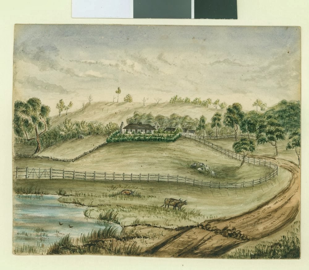
Moranghurk on the Moorabool River, about 42km from its confluence with the Barwon at Fyansford. There they ran their stock and built a small timber cottage.
They remained at Moranghurk until 1846 when, together, they made the move to the Wimmera district where they took up land. In 1848 the run was divided between the two. McPherson named his 53,000 acre run Ashens for his hometown in Scotland, whilst Taylor's run was known as Longerenong.
On the 1st June, 1852 at Melbourne, McPherson married Mary (May) O'Cock, the daughter of a St Kilda solicitor. With his new wife, Dugald returned to the Wimmera where May became the first white woman in the district, where she was considered quite a curiosity by the local indigenous population.
Only two years later however, McPherson was once again on the Moorabool River when 1854 he purchased the leasehold of John Cowie's Bungeeltap West run, presumably along with the pre-emptive right to 640 acres of land along the river which Cowie had purchased that same year.
Looking northwest across the Moorabool East Branch to Bungeeltap land
from the driveway of Emly Park
Here too the McPhersons are believed to have interacted with the local clan of the Wathaurong tribe, with Mrs McPherson reported to have witnessed a corroboree at the township on "Ballan Flat". The name Bungeeltap of course is derived from a local Wathaurong word, however I have seen two quite different meanings for the name. The first claims the meaning as "spirit water" the second, "eagle's nest". I do not know which is correct, but Bunjil (aka Bungal) was the name given to the eagle believed by the Wathaurong to be the creator spirit and who dwelt nearby at Lal Lal Falls.
Whilst not the first Europeans to settle the Bungeeltap West land, the McPhersons were the first family to call it home. In about 1863 they built a two-storey stone house in the gothic revival style, overlooking the east branch of the Moorabool River. It was at Bungeeltap homestead that their eight sons and five daughters were born. Two of the children who died in early childhood - Norman aged 3 (died 1861) and Cluny aged 4 (died in 1871) - are buried on the property. A shepherd named Tim who died from a snakebite during John Cowie's tenure in 1840 is also buried on Bungeeltap land, beside the river.
Looking north west across Bungeeltap land from the Egerton-Bungeeltap Rd
As with most of the large squatting runs, when the land acts of the 1860s were enacted, Bungeeltap West was thrown open for selection. In addition to the land held as part of his pre-emptive right, McPherson also purchased a further 293 acres directly to the north along the river. Another 274 acres were also purchased in the name of his father-in-law, Richard O'Cock, giving a total of around 1,200 acres in family hands before the squatting licence for the property was finally relinquished in 1880.
Then in November, 1875, a notice appeared in The Argus stating that estate agents had "...closed the sale of Emly Park Estate containing 6,700 acres...to Dugald Macpherson(sic)..." thus it seems that for a while at least, Bungeeltap East and Bungeeltap West were again held by a common owner. I cannot be sure how long Emly Park remained in McPherson's hands, however I was able to discover that in 1900, Vincent Valentine Mogg of nearby Yallock Vale purchased the property which he owned until his death in 1843.
As well as a grazier, McPherson was an innovator and was keen to improve his property and his flocks and herds. He was the first in Victoria to use an "earth scoop" also known as a "leveller" - a horse-drawn machine, guided by hand which was used to level ground for irrigation. He had his machine made at a local foundry from a drawing he had seen in a book.
Over the years, the property became known for its fine merino wool and beef cattle. Horses and horse breeding were also of interest to Dugald who it is reported, would drive a carriage and four-in-hand when visiting either Ballarat or Melbourne. At Ballarat's first national agricultural show in 1868, his horses, cattle and ewes all appeared in the prize lists and his name regularly appeared in the stock pages of the newspapers throughout the 1870s, 80s and 90s.
Bungeeltap stables. Image taken 1965 by John T Collins. Image held by
The State Library of Victoria
The McPhersons were also particularly active in the growing community at Ballan. Dugald was a councillor on the Ballan Council from 1864-1873, served as chief of the Highland Society of Ballarat and along with others was a founding member of the Australia Club in Melbourne. He was a devout Presbyterian and was the driving force and principal benefactor behind the establishment of St Paul's Presbyterian Church, Ballan which held its first service on 22nd June, 1866. The building still stands today as the Ballan Uniting Church.
Ballan Uniting Church
Dugald's wife "presented" the central stained glass window which adorns the northern end of the church and also laid the foundation stone. Her efforts to start a Sunday school at their Bungeeltap homestead, resulted in the opening of Bungeeltap State School No. 1155 in 1875.
Northern end of Ballan Uniting Church showing the window
presented by May McPherson
Interestingly, despite their Scottish ancestry and involvement with the Presbyterian Church, at least one of Dugald and May's sons attended Geelong Church of England Grammar School and is listed amongst the old boys in a 1915 issue of the school magazine The Corian.
In addition to their support for the church, the McPhersons appear to have taken an active role in the sporting life of the district. On 26th January, 1889 the younger members of the family were host to a cricket team made up of Ballan residents who travelled to Bungeeltap by coach to compete against a side composed of seven of the McPhersons and a few of their friends. The match was preceded by a luncheon, following which, hostilities commenced on "the well grassed flat on the banks of the Moorabool, between the Emly Park home station and Bungeeltap house" - I imagine on the Bungeeltap side. Whilst, the ladies of Bungeeltap were said to have been avid spectators at the game, Dugald does not appear to have been a participant in the match which was won comfortably by the Ballan men.
In addition to his pastoral interests at Bungeeltap, McPherson also held licences for Nhill Station in Northern Victoria and Paddington Station at Cobar in New South Wales, whilst his father-in-law Richard also moved to live near the family at Ballan. This house - known as Westcott - also passed to the McPhersons upon O'Cock's death in 1883, with one source indicating that the family used it as their town house. Between 1914 and 1930, the house was used as a private hospital and the fourth McPherson daughter died "at her residence, Westcott, Ballan" on 4th May, 1924.
The remaining portion of Westcott, Ballan
Dugald died at Bungeeltap on 20th October, 1901, but the family remained at Bungeeltap for the next 15 years until May also died there on 14th August, 1916. She was buried in the Ballan New Cemetery with Dugald in the family grave.
McDugald family grave, Ballan New Cemetery
Following her death, a clearing sale was held on the property, selling off the farm equipment and the property was leased out, however, the property did not remain long in family hands and by 1922, the property had been sold to William Rhodes who then undertook substantial renovation of the homestead and retained ownership of the property until his death in 1931 after which the estate passed to his widow and two children.

26 October, 2013

Branching out - Bungeeltap

In my previous post I mentioned two of the earliest squatters to settle near Geelong, overlooking the Moorabool River at Bell Post Hill - John Anthony Cowie and David Vere Stead. David Stead, born in 1797, was a Quaker from Falmouth in England. Cowie, also from England was born on 13th April, 1806. He was the youngest son of George Cowie, a bookseller from Hackney, London and Rachel Buxton. Cowie arrived in Tasmania in 1828 in a good financial position and took up land near Avoca. Soon he was expanding his holdings.

John Anthony Cowie, image on display at Osbourne House,
North Geelong
No doubt having heard of the potential wealth of "Australia Felix" as the unclaimed land across Bass Strait was known, both Cowie and Stead travelled to the Port Phillip district in November, 1835 from Tasmania with John Batman's party of settlers on the ship Norval, bringing stock for Dr Alexander Thomson. By March, 1836 the pair had taken up a run at Bell Post Hill overlooking Corio Bay and began to ship over their own stock.
According to the 1836 census of the Port Phillip district, Stead arrived there in February, 1836 which I am guessing may indicate that he returned to Tasmania after his initial landing to gather stock for the run he and Stead intended to select. In July, their colleague John von Steiglitz landed stock at Point Henry, presumably also for the Bell Post Hill run.
Their stay in the Geelong region however, was relatively brief. By 1838 Cowie, Stead and two of the von Steiglitz brothers were on the move again, taking their stock with them in search of greener pastures. These they found above the confluence of east and west branches of the Moorabool River. According to one story, after drawing straws it was decided that Stead should take up land on the east bank of the East Moorabool River, presumably leaving the west bank for Cowie. The von Steiglitz brothers moved on a little further still. Their properties will be the subject of a future post.
Together, the land held by Cowie and Stead covered some 30,000 acres. In 1850 the original run was officially divided. Stead's run to the east of the Moorabool East Branch was known as Bungeeltap East whilst Cowie's run was Bungeeltap West.

Looking towards Bungeeltap East from west of the river
Cowie settled into his new run by cementing family ties when on 14th September, 1842 he married Charlotte Christine von Steiglitz, the youngest daughter of the von Steiglitz family, sister to John, Robert and Charles von Steiglitz. The marriage took place at Ballanee, the squatting run of John von Steiglitz, located on the Werribee River.
Some years later, on 25th April, 1848 David Stead married Mary Jane Belcher, the daughter of Joseph William Belcher and Elizabeth Austin. The marriage took place on the run at Bungeeltap. The year following their marriage or soon thereafter, the Steads built a comfortable house known as Emly Park - no doubt named for his home in Falmouth, England on the eastern section of the run, overlooking the river. The original house still stands (with additions) today on the Egerton-Bungeeltap Road near the corner of the Ballan-Meredith Road. It is described as a colonial style house constructed from local sandstone and is open to the public as a guesthouse.
The front gates to Emly Park
David and his wife Mary Jane remained in Victoria for some years (although possibly not on the property), then, somewhere between 1858 and 1861, like many of the other Victorian pioneers, they returned to the United Kingdom. Their second son - named for his father - was born at Studley, Rostrevor, Ireland in 1861. Stead may none-the-less have maintained his licence at Bungeeltap for some time as he is listed as holding the property as late as 1861. This despite Thomas Montague Hammond described as being "of Emly Park" as early as 1854. David and Mary returned to Melbourne on at least one occasion from the UK, their names appearing in the shipping records in 1868.
Their fourth daughter Lillian Brooke Vere Stead (born 1863), further strengthened ties between the Stead, Cowie and von Steiglitz families, when she married John Charles von Steiglitz on 22nd September, 1886 at Bayswater, London. John was the nephew of John Cowie's wife Charlotte Christine von Steiglitz. The couple returned to Australia where they settled in Tasmania.
Sadly, less than two weeks after his daughter's wedding, Stead died in London on 5th October, 1886.
David Vere Stead, image held by the State Library of Victoria
The Cowies chose not to remain at Bungeeltap for quite so many years and in 1854 Cowie's portion of the run was taken over by another familiar name - Dugald McPherson - who with William Taylor held the original lease for Moranghurk from 1840 to 1846. McPherson (born c1820) was a Scottish immigrant who arrived in 1840 and built up large land holdings across Victoria, New South Wales and Queensland.
During his tenure at Bungeeltap West, McPherson built a two storey, gothic style house which has been dated to about 1862. Over the years the house underwent significant renovation. In 1922, the top storey was removed and the house almost entirely rebuilt. It sits on the west bank of the river, less than a kilometre as the crow flies from Emly Park.

Bungeeltap homestead in the 1960s. Image:  J.T. Collins collection,
La Trobe Picture Collection, State Library of Victoria
After giving up the Bungeeltap lease, Cowie meanwhile left Australia for the United Kingdom where he lived at  Rostrevor, County Down, Ireland. He died there on 7th January, 1875. His wife Charlotte survived her husband by four years, she died on 3rd April, 1879 at "The Willows" Rostrevor, Ireland. There were no children born to the marriage.
The squatting licence for Bungeeltap West, still held by Dugald McPherson was listed in the Victorian Government Gazette as up for renewal in April, 1880 however, I believe the lease was cancelled in 1880.
Moorabool East Branch, Egerton-Bungeeltap Road, boundary of Bungeeltap
East and West runs looking toward Bungeeltap West.

Both the Bungeeltap and Emly Park homesteads have changed hands numerous times over the ensuing century and a half and the squatters are long gone, however both houses remain as tangible links to Victoria's colonial past.

20 October, 2013

Branching out - from squatting to schooling

Today, Bell Post Hill is a suburb of Geelong and the home of Kardinia International College, a non-denominational private school which caters for students from Kindergarten to year 12, however things were once very different.
In March, 1836, it became the site of one of the very earliest squatting runs in the Port Phillip district when John Anthony Cowie and David Vere Stead moved into the district. The pair had arrived from Tasmania in November the previous year with John Batman's party of settlers. The only other settler in the district at that time was Dr Alexander Thomson who arrived some two months after Cowie and Stead and settled on the south bank of the Barwon at the future site of the suburb of Belmont, Geelong.
On 9th July, 1836 John von Steiglitz (recently married to Cowie's sister Emma) arrived at Point Henry with stock for the run which they continued to build on for the next few years. The land held by Stead, Cowie and Steiglitz as their grazing run extended from Bell Post Hill down to the Moorabool River near Batesford and north towards what is now Lara - known to the early settlers as Duck Ponds.
Looking across the Moorabool Valley towards the Batesford quarry from Bell
Post Hill over what would have been part of Cowie and Stead's holding running
down to the river
Popular legend has it that Bell Post Hill was named for a bell, erected on the high point of the hill (possibly an old ship's bell brought by Cowie and Stead) which was used to notify settlers of the arrival of ships approaching Point Henry and also of imminent attacks by hostile members of a no doubt displaced indigenous population.
The view towards Corio Bay today from Bell Post Hill
Cowie, Stead and the von Steiglitz brothers did not long remain in the district and by 1838 they had moved up the Moorabool River where they took up a number of runs which will be the subject of future posts.
Being close to the newly established town of Geelong, the original Bell Post Hill run was soon divided up for closer settlement - possibly a reason for the departure of Cowie & Co. By 1852 subdivision was occurring in the area of Cowies Creek and by the 1860s it boasted a population of about 500 people and two pubs. Land at Bell Post Hill on the Bates Ford Road was being auctioned in lots upwards of an acre by 1853.
During 1859-60, John Calvert Esq who then owned land at the top of the hill, had a grand house erected which he called "Morongo".
"Morongo" 1863, image held by the Victorian State Library
A roughly similar view today
In addition to this residence, Calvert had squatting interests in the Western District holding the Irrewarra and Watch Hill runs with Captain John Bell who was also his neighbour at Bell Post Hill, having built his own mansion - "Bell Park" - only a short distance from Calvert's residence some years earlier in 1853-1854. All that remains of "Bell Park" today is an extension to the house, added in 1860 which now serves as a chapel for the McKellar Centre owned by Barwon Health.
Bell Park 1863, home of Captain John Bell. "Morongo" can be seen at the top
of the hill in the background. Image held by the State Library of Victoria
"Morongo" however, still survives. Following the death of Calvert in 1869 the property was advertised for auction. In 1884 with Mr Everingham as its current occupant the property, including the house and 100 acres of land, was advertised for lease. It was again advertised for lease in 1895, this time with Mrs James Bell the occupant.
In 1921 Senator James Francis Guthrie purchased "Morongo". The senator was active in the wool trade in both Geelong and Melbourne and was largely responsible for establishing the Corriedale breed of sheep in Australia. Further biographical details for Senator Guthrie can be found in the Australian Dictionary of Biography.
After only five years in residence, Guthrie sold the property in October, 1926 to the Presbyterian Church. The church then established the Morongo Girls College which opened its doors in 1927. It is said that the old bell used by Cowie and Stead which had been discarded but later found and retrieved from the Moorabool River by a fisherman, became the school bell which was used for the next 26 years until it was stolen in 1953. An article appealing for information was published in the Argus.

"Morongo" homestead today
The school itself operated until 1994 when its doors closed for the final time. The following year, Mr Yoshimaro Katsumata, a Japanese businessman purchased the school which opened at the beginning of 1996 as Kardinia International College. Today the school boasts some 1,700 students across all year levels.
The "Morongo" homestead survives as one of the school buildings and one side of the driveway would appear to be lined with the trees planted during Calvert's time and which appear as saplings in the sketch of the homestead.
Trees lining the driveway leading to the homestead


13 October, 2013

To the break and back and a broken back!

After a series of recent posts which have required a significant amount of research I thought I'd throw in something a little lighter so yesterday, with the sun out and in need of some practise for a forthcoming event, I dusted off the kayak for the first paddle of the season.
As the Masters Games are currently in town and doing their bit on the river, I figured it might be a little busy on that section so I hit the river below the breakwater and headed down to the lower break. This is one of my favourite sections for paddling as the scenery is predominantly rural and the river remains relatively wide with no serious obstructions - although perhaps it might be best avoided if the water ski club are holding an event as things can get a little busy at the end of Wilson's Road.
"Greenbanks" at Marshall
Not surprisingly, the water level was higher than I'd been used to over summer and with the wind blowing about 15knots from behind it was a relatively easy ride downstream however, it soon occurred to me that it was going to be hard work on the way back - I wasn't disappointed.

Mudlark chicks in a nest overhanging the river at Marshall
Well, spring has certainly sprung. Birds were everywhere - I counted twenty-nine different species and everyone it seems is breeding. In addition to the family of four Grey Butcherbird chicks I found hopping around in the branches near Highton a couple of days ago, I found these little guys sitting around on a rather exposed branch overhanging the river whilst one parent or other shouted instructions from the safety of a nearby tree - after which they all quite literally pulled their heads in and were not to be seen above the nest.
Meanwhile, on the bank, this little parade made its way under the nearest fence to what it considered a safe distance.
Australian Wood Duck family at Marshall
Despite the wind, the weather was quite warm and the skies were blue. Unfortunately for the smaller creatures around, Brown Falcons and Marsh Harriers were also circling overhead. At one point a pair of rather unimpressed falcons were being told in no uncertain terms where to go by a magpie.

The view from the lower breakwater
Well I reached the halfway mark fairly comfortably and without too many blisters. The water level here was quite definitely higher than during summer when the metal side of the breakwater made it necessary to disembark and cart the vessel round via land in order to continue downstream. This time by contrast, I was at imminent risk of going over the edge and heading for Lake Connewarre whether I liked it or not!
The lower breakwater
In retrospect, this would actually have been the easier option, although I would still have opted for portage, as rapids - even man-made ones - really aren't my thing whilst carrying a camera and phone. I did consider rearranging my pick up for Tait's Point instead of Breakwater which would have suited my back and the palms of my hands much better, however I also figured that the slog back upstream would do me good.
So I snapped a few shots and turned around. Almost immediately I was hit by a wall of wind and had to plough my way through the chop on the surface of the river to the next quiet patch before repeating the process at regular intervals the entire 8km back to Breakwater.

A deceptively peaceful Barwon River at Breakwater
As I rounded the bend and headed up The Long Reach I was reminded exactly why it got its name. Of course, "Cuthy's" boys from the Grammar had the advantage of at least three of their schoolmates pulling with them and the possibility of a stop for refreshments at The Willows. A bit of teenage enthusiasm would have been handy yesterday!
However, I managed it eventually with only a few blisters and without actually being blown back downstream at any point. My arms and back certainly got that workout I was looking for. Now I just hope the effects wear off before next weekend's paddle...