Showing posts with label Mt Brandon Peninsula. Show all posts

22 September, 2012

A mill story!

Okay, enough of running for the moment! Time to get back to some local history with "a mill story" which for the record I am informed, is an old phrase referring to a piece of dubious gossip.
A couple of weeks back, I was involved in a very informative and extended exchange concerning flour mills in and around Fyansford and of course, the Barwon and Moorabool Rivers. For anyone interested, read this post and the comments attached thereto.
After quite a bit of scrounging through on-line sources, discussion and a little deduction my co-theorist and I reached some conclusions about flour milling in Fyansford in the mid-19th century.
The first problem we came up against in trying to sort out who owned what, when and where was the following statement which appears repeatedly on many sites, including some which should be relatively authoritative:
"In 1845 the first flour mill was erected by William Henry Collins on the banks of the Barwon."
Now, this statement is not as it turns out in and of itself incorrect. Collins did in fact open a flour mill on the Barwon in that year. The Union Steam Flour Mill. However, rather than being at Fyansford as is implied on various websites, this mill was located in Geelong next to where the Albion Woollen Mill was built, close to what is today, the James Harrison Bridge. This early flour mill eventually became the Union Woollen Mill which I have mentioned in a previous post. For the record, Collins also went on to establish the Collins Bros. Woollen Mill in the same area some years later.
Looking south towards the site of the Fyansford Steam Flour Mill,
September, 2012
All this however, is a separate issue to the Fyansford Steam Flour Mill which was built in the town of Fyansford.
This building was a 3 storey bluestone structure overlooking the banks of the Moorabool River. On 26th July, 1855, The Argus newspaper in describing Fyansford referred to "a very complete flour-mill". Records will show that the land on which the mill was built and the nearby Flour Mill House which still stands, were purchased by GJ Barthold at Fyansford's first land sales in 1854. Barthold and a business associate by the name of T Lowe appear to have run the mill until 1861 at which point they were declared insolvent and the mill sold. Exactly when this mill was built is not clear, but presumably it was not until the much later date of 1854 (not 1845) when Barthold bought the land.
To complicate things somewhat, by 1873 William Henry Collins to whom the building of the mill is wrongly attributed, was indeed the owner. In the Portland Guardian and Normanby General Advertiser of 25th July, 1873 refers to "his [Collins'] mill at Fyansford". Whether he purchased it in 1861 when Barthold and Lowe went bust I cannot determine.
According to the Victorian Heritage Database (which is one of those responsible for perpetuating the myth that Collins built the mill), following on from Collins' tenure, the mill passed through various hands, serving at one point as a dance hall before being demolished in 1930. The associated Mill House (pictured below) has however survived to the present day.
Flour Mill House, Atkins St, Fyansford September, 2012

All this is of course, not to be confused with the 5 storey bluestone Barrabool Flour Mill which was built in about 1851 (perhaps as early as 1849 if some sources are to be believed) by John Highett. This water-powered mill was situated on Mount Brandon Peninsula overlooking the Barwon River about 1.5km upstream of the confluence of the Barwon and Moorabool Rivers. It is about 1km from Fyansford as the crow flies  and on the opposite side of the Barwon.

The Barrabool Flour Mill, held by the State Library of Victoria
And for the sake of completeness, the Barwon Paper Mill and its associated water race both of which still stand today on the Barwon, were built quite some years later in 1875 and are located a few hundred metres downstream from Highett's flour mill and on the opposite bank.

24 August, 2012

Read All About It!

And indeed we can! The Mt Brandon - Draft Landscape Plan is now available for viewing either in person at the City of Greater Geelong (CoGG) customer service centres or can be downloaded as a series of pdf files via the CoGG website by following the "Have Your Say" link and choosing the link to the Mt Brandon report. It will be open for public comment until 24th September, 2012.
As a reminder, the area in question is a significant strip of land extending from the current Buckley Falls Park, along the south bank of the Barwon as far as the Geelong Ring Road. At the present time it looks something like this...
...although perhaps with slightly less water. Looking south across the base of
Mt Brandon Peninsula towards Rivergum Dve, during flooding on 16th January, 2011
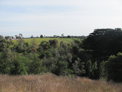
From the top of Mt Brandon Peninsula looking towards the Ring Road in the
distance. The land to the left will include part of the new parkland development
Looking at Mt Brandon Peninsula across "gully 1" (see council plans).
Development on Rivergum Dve can be seen to the left

And the view south from the base of Mt Brandon Peninsula
So...in brief, the plan is...to provide public recreation facilities, open spaces, both formal and informal walking tracks, habitat regeneration and - perhaps most excitingly for me - a pedestrian bridge near the Ring Road bridge which would provide a loop connection to the trail on the opposite bank which will also receive some needed attention.
The Ring Road (Geoff Thom) Bridge from the north bank and the site of
a future path and pedestrian bridge
The option of adding a few extra kms to my runs/rides/walks is an enticing prospect, however the downside of all this - especially for those who are as impatient as I am - is that the plan is to be implemented in six stages and is, at least in part, dependent on State Government funding. In addition, with the latter stages not due to be implemented until such time as urban growth extends to the area near the Ring Road, I may be more interested in wheel chair access than running tracks by the time it is complete! Nor did I see anything which even hinted at a potential time line for all these works.
In the short term and assuming the plan is implemented, the initial stages appear to involve revegetation in addition to that which is already being undertaken by the Friends of Buckley Falls group, ongoing weed control and the construction of some walking tracks at the Bunyip Pool end of the precinct.
As for the rest, I guess we'll just have to wait and see, but the prospect of this extension to the river trail, combined with the plans for nearby Batesford South and the Moorabool are an exciting prospect for the future of the Barwon River Parklands project, especially when combined with the prospect of trail extensions beyond Breakwater and the upgrade of park facilities further downriver at sites such as Tait's Point, Ash Road in Leopold and other works in Barwon Heads. More details on the Barwon River Parklands project is available on the Parks Victoria website.

19 August, 2012

Grand designs

It is easy enough to look at the history of the Barwon - particularly since European arrival - or to observe what is happening at the present time, but what of the future? Are there plans in place which will determine what will happen to the river, its resources and its surrounding environment?
Well yes, and as far as the section of the river through Geelong is concerned quite a bit of information is available on-line and through the media. Most obvious perhaps is the Barwon (through Geelong) Management plan which has been much cited of late in relation to those controversial ash and elm trees along the river at Fyans Park, as does the  Barwon & Moorabool River Reserves Masterplan & Management Plan.

The Barwon near Queen's Park
Something which attracted my attention several weeks back was an advertisement/article in the paper which lead me to a website I can no longer locate. It seemed however, to be largely based around details which can be found in the G21 Regional Growth Plan. Whilst the time frame under consideration is in the order of 20 years, the document provides a tantalising glimpse of what might be possible once the Batesford Quarry is decommissioned and the area transformed into a mixed residential and employment zone capable of housing up to 30,000 residents. The area I believe is designated as Batesford South and includes the Moorabool River between Batesford and Fyansford as well as the Barwon out as far as Friend In Hand Road.
View across the Moorabool Valley including the Ring Road and part of the
area proposed for development
Of specific relevance to this blog are the plans which would see the Moorabool through this area become a parkland within a 200m green zone including the ultimate conversion of the quarry itself into a large lake.
View of the Batesford Quarry across the Midland Highway near Ring Road
Also included in the larger scheme of things is the currently stalled Fyansford Green project which is on hold pending a buyer after a part of the Moltoni Group who owned the land met with financial difficulties.
The view from "Cementies" hill looking out over the Fyansford Green site
An extension of this project would also see a clean up and rehabilitation of the now disused CSR Quarry on the west bank of the river. I have no idea how current it is, but I did find a link to the following diagram which shows the layout of what the future quarry development would look like.
On the other edge of this proposed development is of course, the Barwon. I have mentioned in previous posts that there have been proposals to extend the river trail further up and downstream. I was under the impression that the track past Baum's Weir would be extended up to the Ring Road, however I have so far seen no sign of this.
Informal track beside the Barwon below Mt Brandon Peninsula
On the opposite side of the river however, at Mt Brandon Peninsula, it seems that things may be afoot. This week, a media release reported that a draft proposal by the City of Greater Geelong (CoGG) for the Mount Brandon Landscape Plan is being put out for public comment. On the agenda are a raft of changes including the usual infrastructure of paths, picnic facilities, public toilets, carparking and so on. What it doesn't mention is the time frame involved or an expected start date...or who exactly is providing the cash.
Remains of the the water race which fed the Barrabool
Four Mill on Mount Brandon Peninsula, dating to the 1850s
As I write this blog, the CoGG Community Update for August, 2012 has just landed in my mailbox and lo and behold, the entire front page and several subsequent pages have been given over to promoting what's new along the Barwon through Geelong and much of it can also be found on the CoGG website following the "Leisure" then "Paths, trails and tracks" links. Another useful document under the "Projects, plans and studies" links is the "Greater Geelong Cycle Strategy" which incorporates information about the cycle trails around the river and ideas for future development. The main drawback here however, is that the document was produced in 2008 and some of the plans do not reflect the current situation.
Ovoid sewer aqueduct at Breakwater
At the Breakwater end of the river for instance, I have seen tantalising glimpses of what might be. At various times there has been talk of paths extending along the riverbank (on one side or the other) as far as the aqueduct and beyond. The cycle strategy document mentioned above shows a "proposed" trail all the way along the river to Barwon Heads, however we know from a recent comment sent my way by a Parks Victoria representative that it "ain't gunna happen". What would be really useful is an up to date, straightforward outline of what "is gunna happen" or perhaps even what "might happen" given funding issues and environmental concerns along the lower reaches of the river.


28 April, 2012

The shepherd's companion

In the latter part of 2011 I made a few forays up the Barwon to the somewhat grandiosely named Mt. Brandon Peninsula. The results of my travels appeared in some of my previous blog posts. In particular, I spent some time photographing a nest belonging to a pair of Willie Wagtails.
Willie Wagtail and its nest, November, 2011
Yesterday, I headed back to Baum's Weir and the peninsula to see what was new. Everything was much as it had been before with the exception of a few dropped branches and a couple of non-native trees which were well into the swing of autumn. I did see several European Goldfinches past Baum's Weir and up on top of the peninsula as well as a flock of Flame Robins. This was the first time I'd seen either on the river.
I also went back to investigate the nest belonging to the Willie Wagtails. What a difference a few months can make. When I last visited the nest in November, the Willie Wagtail breeding season was well under way. It generally lasts from August to February and can involve the rearing of several broods of chicks.
Willie Wagtail in its nest, November, 2011
At that time, the female was always in the nest when I arrived and as I mentioned previously, she and her mate were typically aggressive in defending their territory both against myself and on one occasion, against an unfortunate Crested Shrike-tit which happened to venture onto their branch. I have also seen a Willie Wagtail take on a kingfisher and I believe they are quite happy to argue the point with even larger birds, including kookaburras and Wedge-tailed Eagles.
Perhaps because of their gregarious behaviour and chattering calls, the folklore of indigenous cultures across Australia tends to describe Willie Wagtails as the bearers of bad news. They are recognised as intelligent but are thought to tell-tales and steal the secrets of humans, according to some tribes, informing the recently departed if their living relatives speak ill of them. I have not been able to discover whether the local Wathaurong tribes have cultural links to the Willie Wagtail, however they cannot have been unaware of these vociferous little creatures in their landscape. They may even have raided their nests for eggs as they are often located well within human reach.
As is clear from the above photos, the nest is a cup shape composed of grass, bark and other fibrous bits and pieces, all bound together with cobwebs. The inside of the nest is lined with hair, fur and soft grasses. No-one seems keen to tell me what the spiders think of having their webs commandeered by the Willie Wagtails, but then, it is also quite possible that the spiders themselves have become dinner and are in no position to complain.
This time when I arrived, there was no sign of the birds and the nest was clearly in a state of disuse, except - somewhat ironically perhaps - by a spider or two who seemed to be taking their revenge.
Willie Wagtail nest April, 2012
Looking at the nest in November and now, it seems there were some additions made prior to the departure of the birds and the arrival of the spiders. The large twig still with seed pods attached is a more recent addition, as is what appears to be a piece of fishing line. Hair is also evident. It would be interesting to know where the birds sourced their building materials as there are not a lot of houses and their domestic animals in the immediate vicinity nor are there herd animals to provide these fibres.
It is from their habit of closely shadowing sheep and cattle or even riding on their backs - presumably to catch the insects they stir up in their wake - that Willie Wagtails are known as the Shepherd's Companion. Presumably they also take the opportunity to pinch a hair or two at the same time.
 I also noticed another interesting detail during yesterday's walk.  In November, I saw a Brush Cuckoo in the same tree as the nest and also saw Fan-tailed Cuckoos nearby. Now that the Willie Wagtails are no longer breeding, I neither saw nor heard any sign of cuckoos.
Brush Cuckoo in the vicinity of the Willie Wagtail's nest November, 2011
This is probably no coincidence as I discover that various species of cuckoo, including these two, will attempt to place their eggs in the Willie Wagtail's nest. The wagtails however, often recognise the impostor and remove it from the nest.
When summer and the nesting season end, the cuckoos - presumably realising the gig is up - depart for more northerly climes. The Willie Wagtails by contrast, hang around until it is time to start the whole process again.
As Willie Wagtails generally pair for life and are known to reuse nests, or to recycle old materials in building a new one, I will be keeping an eye out to see which - if either - happens with this nest and the birds who built it.


18 November, 2011

Birds of a feather...

At the present point in time, I have so far managed to observe and photograph ninety-nine different species of birds along the length of the Barwon River. Today, being without a car for part of the day, I decided to take an extended walk from the James Harrison Bridge in town, upriver to Buckley Falls and around Mt Brandon Peninsula past Baum's Weir and back.
The weather was quite hot and windy with a storm brewing, so I was almost convinced that most of the bird population would have taken to their nests or disappeared to whatever place it is that birds seem to go when it's windy. That didn't appear to be the case today however, as the feathered population which lives along the banks of the Barwon was out in force allowing me to spot fifty of those ninety-nine species.
I didn't add to my tally of new bird discoveries during the course of the day, but I did snap quite a few shots so I thought I would use this post as an excuse to upload a few of the better ones.
Willie Wagtail nesting near Baum's Weir
The Willie Wagtail shot is one I've been taking versions of for a few days now that I know where the nest is. When I arrive, the bird usually leaves the nest to tell me in no uncertain terms to keep my distance. It then watches me for a couple of minutes before hopping onto the branch and back into the nest.
Sulphur-crested Cockatoo
This little guy near Queen's Park was helping himself (and yes, based on eye-colour I think it is a he) to seeds from the grass at the side of the track. He was not even vaguely concerned by my presence or that of the cyclist who passed just after I took this shot.
Male Hardhead Duck aka White-eyed Duck
This rather intense-looking male Hardhead Duck was paddling around in the midst of a bunch of
Pacific Black Ducks at Balyang Sanctuary and trying unsuccessfully to look like one of the gang.
Little Black Cormorant

Great Egret
The fishermen of the bird world seemed mostly to have exchanged the lower weir at Buckley Falls for Baum's Weir today, as the above egret and cormorant were accompanied by a Nankeen Night Heron who was also fishing off the edge of the weir. It would appear that no-one has seen fit to inform the "night" herons on the Barwon that they are supposed to feed at night as I have regularly seen them on the hunt during daylight hours of late.

01 July, 2011

Grist to the mill...

Buckley Falls is probably one of the more interesting stretches of the Barwon as it runs through Geelong. As mentioned in an earlier posting, it is named for the escaped convict William Buckley who escaped from a fledgeling penal colony established near what is now Sorrento. At some point he came upon members of the local Wathaurong tribe who mistook him for the ghost of the warrior Murrangurk. Buckley lived with the tribe for thirty years before re-joining white society.
The history of the river at this point is also a combination of ancient Wathaurong and more modern European settlement. To the Wathaurong, the nearby Bunyip pool was a source of food. Yarrum Mordong is the Wathaurong name for this part of the river. Yarrum means rapids or a waterfall. Mordong means eel.
To the newly arrived Europeans of the 19th century, this part of the river was a source of power which could be harnessed for industry and not surprisingly one of the earliest recorded was flour-milling. The history of flour-milling at Fyansford seems to me to be somewhat unclear. It is widely reported that Henry William Collins opened a flour mill on the banks of the Barwon in 1845. Whether this is the same establishment as the Barrabool flour Mill which started operation in 1849 on a projection of land upstream of Buckley Falls, known as Mt Brandon Peninsula, I cannot determine, however a source stating that the latter was built in 1849 suggests that they were separate establishments.
Barrabool Flour Mill, built 1849
Records indicate that the Barrabool Flour Mill was a five-storey, bluestone structure whose 90cm thick walls were constructed from locally quarried stone - perhaps from one of the three quarries on the opposite bank of the river. It was powered by an "undershot" wheel and water was drawn from a channel which ran along the south bank of the river. Nowadays, there is no sign of the mill or an associated onsite cottage and no-one seems quite sure where the mill was located. A comparison of the two photos to the left however, is interesting.
It is also interesting to note the extent to which the banks on both sides of the river have been revegetated over the intervening decades as well as the presence of the lower weir (not built until 1927) in the lower picture.
The only traces of the mill and its surrounds now visible are a few non-native trees (possibly the cyprus growing on the high ground of the peninsula) and the remains of the outer race wall which can still be seen as I discovered for myself yesterday on another expedition to see a part of the river which, for some unknown reason, had to this point escaped me.
 Yesterday's saunter took me down to the south bank of the river opposite the car park at Baum's Weir and along an informal track, back towards Buckley Falls. Here, to my delight, I discovered the remains of the old bluestone race. Originally about 244m in length, it ran from a weir upstream down to the mill. Whilst not explicitly stated, I believe that the weir was in fact Baum’s Weir which is said to date from the 1840s, although no-one seems to know when or by whom it was built.
Remains of outer wall of the channel on the south bank of
the Barwon below Brandon Peninsula
Regardless of when exactly the mill was built, it would seem that by 1854 at the latest and probably earlier, an Englishman named John Highett was the owner. He may also have had to rebuild the mill subsequent to substantial flooding in 1852. I haven’t been able to turn up anything which indicates how long Highett ran the mill, however some time after his death in 1867 and with the opening of the Barwon Paper Mill on the opposite bank of the river in 1876 (more of which later), business appears to have dropped off. After standing idle for some years, the mill reopened. Confusingly once again, one source states that in 1887/1888 it reopened as the Fyansford Starch Factory, milling rice instead of wheat. This is supported by a contemporary photo showing the mill and labelled accordingly. It states that the mill buildings had almost completely disappeared by 1938. However, another reference published by the City of Greater Geelong, indicates that the mill was sold in 1888 and subsequently operated as a jam factory on a limited scale. This reference claims the building was gone by 1908.
A couple of possible explanations for these differences spring to mind, such as the possibility that the two businesses used the buildings jointly or perhaps the tenure of the starch factory was very short-lived. The difference in dates given for the disbanding of the mill buildings seems a likely transcription error.
So, who was the mill's owner John Highett and what was his association with the Barwon River? Highett (1810-1867) was an Englishman who migrated first to Van Diemen's Land with his brother William (a noted politician) before arriving in the Port Phillip district in 1837. He took up farming land overlooking the Barwon on the south side of the river and built a substantial house at the top of the hill overlooking much of the region in what is now Montpellier Park. The house later became the Montpellier Hotel, Picnic Ground and Pleasure Gardens and was run by Edwin Hooper. The surrounding land was also used for the cultivation of grapes, with vineyards extending down to the river, into the nearby Barrabool Hills and as far as Pollocksford. The Montpellier name derives from a town in Southern France known for its wine growing.
The house no longer stands, however the footings can still be seen in the park's grounds. The other, perhaps more permanent reminder of Highett's contribution to the development of the area in the early days of European settlement is the suburb of Highton, which was originally given the name Highett's Town. Of course, Highett Road which connects with Buckley Falls Road below the Bunyip pool is a further reflection the area's association with John Highett and his family.