My recent lack of posting is - at least in part - due to having spent some time travelling in Outback Queensland which has left me a little short of time for research and wandering up and down the banks of the Barwon.
 |
| The Barwon River and Barrabool Hills |
My trip did however prove one thing to me: rivers can vary quite dramatically. Here in the south of the country (short of extreme drought conditions) we tend to think of a river as a continuously flowing body of water whose level varies with rainfall or as a result of human intervention such as dams and weirs.
 |
| The Barwon River below Pollocksford Road Bridge |
In the interior of the country, this can be quite different. I knew this before I went travelling, however seeing it is still a little surprising. My first experience was from the lounge car of the Spirit of the Outback train on which we travelled over the course of 24 hours from Brisbane to Longreach, (If you can afford it, a sleeping car in first class is well worth the experience.)
 |
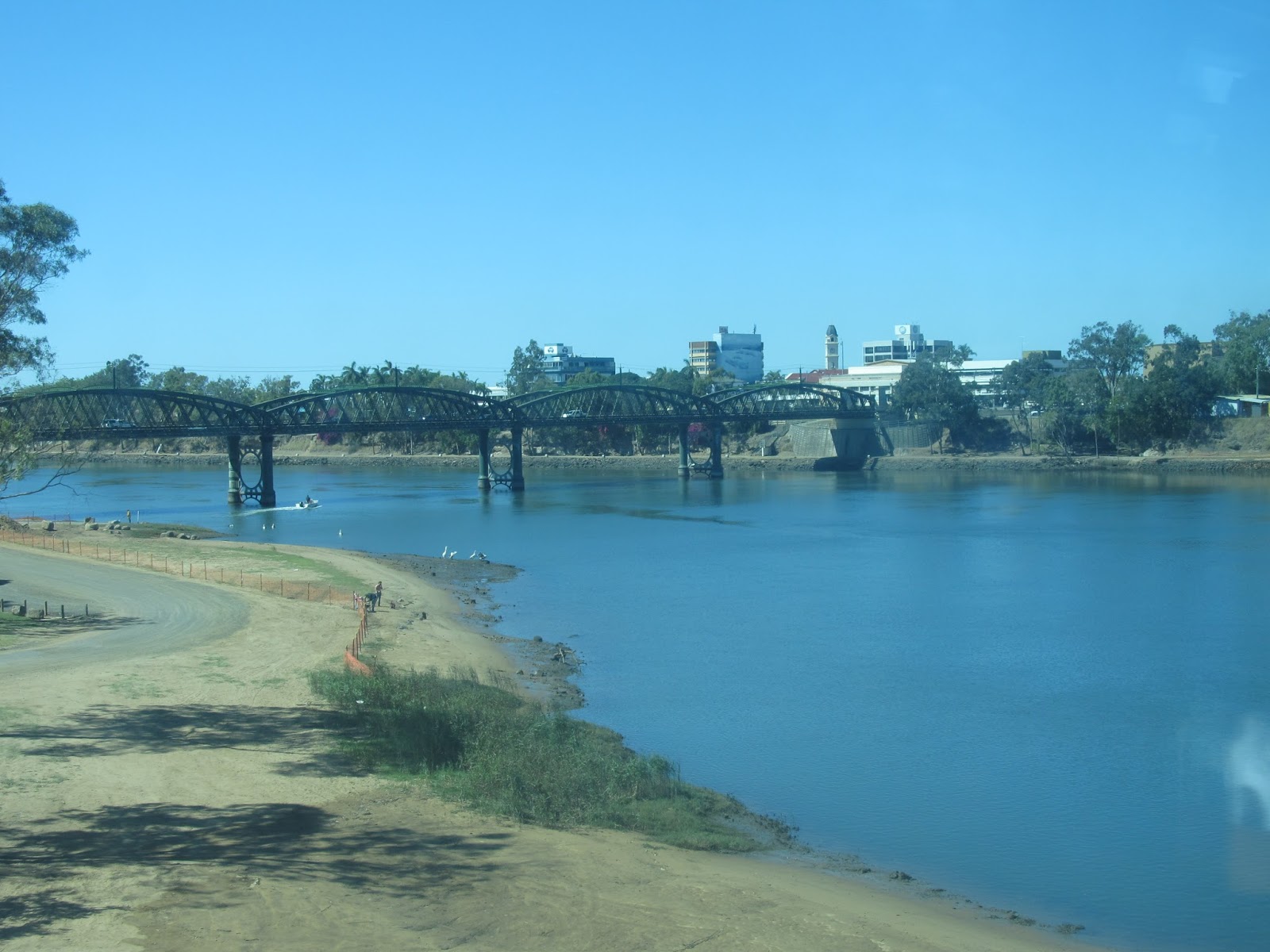
| The Brisbane River, James Cook Bridge from the CityCat |
As the journey progressed, we watched the landscape change from the mangrove-lined banks of the Brisbane River through the CBD to the broad, tidal expanse of the Fitzroy River in Rockhampton.
With it, the climate also changed notably. We were definitely in the tropics as attested by the fields of sugar cane and pineapples which appeared as we neared Bundaberg.
 |
| The Burnett River, Bundaberg as seen from the Tilt Train |
Further inland as we made the long run westward from Rockhampton, these crops were replaced first by fields of wheat and cotton and then by thousands of acres of dry grass, eucalypts and gidyea (pronounced "gidgee") scrub.
As we neared our destination the creeks and rivers we crossed took on rather a different complexion.
Surprisingly perhaps, the average annual rainfall for Geelong (527mm) is not so different to that of the town of Barcaldine (507mm). Whilst the Otway Ranges cast a significant rain shadow across an area from Geelong to Werribee, reducing the average rainfall of these areas, the upper reaches of the Barwon receive more than double this average rainfall. The other difference of course is in the distribution of rainfall across the year.
 |
| The Alice River, Queensland near Barcaldine |
Whereas the upper Barwon receives the highest rainfall in September and the lower reaches in October and November, the northern parts of the country receive the most rain over the wet summer months, with Barcaldine receiving just 15mm on average in the month of August.
However, not all rivers in the Outback dry up completely. The Thomson River which flows through the town of Longreach, providing the town's water supply is one such. Rising as Torrens Creek outside Charters Towers, it becomes the Thomson River north of Muttaburra, flowing south and west through Longreach and several other towns, joined on its way by a number of creeks. Just north
of the town of Windorah is the confluence of the Thomson and Barcoo Rivers which then become Cooper Creek - the only place in the world where two rivers meet to form a creek which then "flows" into Lake Eyre.
 |
| The Thomson River, Longreach |
Unlike other rivers and creeks - including the Barwon - the Thomson River does not flow to the sea and Lake Eyre is dry except in times of high rainfall at which point the rivers and creeks burst their banks causing widespread flooding as there is nowhere for the water to run off in such a flat landscape. If the rainfall is high enough then some of the water which would otherwise evaporate, reaches Lake Eyre.
 |
| The Thomson River, Longreach on sunset |
Between periods of flooding, many of the rivers and creeks form a series of isolated billabongs or chains of waterholes and it was these which provided water for stock in the early days of European settlement. During a period of severe drought in the 1880s however, test-drilling confirmed the presence of the vast subterranean water supply known as the Great Artesian Basin.
 |
| Naturally forming mud spring near Barcaldine |
Bores were sunk across the countryside, providing water for stock, humans and crops alike.
 |
| Natural artesian pressure from a bore near Barcaldine |
 |
| Artesian bore near Barcaldine |
Today, the Artesian Basin is still the main source of water for the Outback, although many of the original bores have been capped to reduce wastage and improve water pressure.
For now however, it is back to the south and back to the Barwon where water flows down from the mountains and reaches the sea.
 |
| The mouth of the Barwon River from Ocean Grove |


No comments:
Post a Comment