This causes me to wonder why then, the path is not extended either up or down river, if not both. Some time ago, I looked into the likelihood of this ever occurring and discovered that there have certainly been discussions along these lines, but frustratingly, not much seems to be happening.
The first information I found was on the Parks Victoria website http://www.parkweb.vic.gov.au/3barwon.cfm
 |
| Map of Barwon River from Geelong Ring Road to Barwon Heads taken from the Parks Victoria website |
Further investigation of the above website reveals that studies have indeed been done into the feasibility of a continuous trail and where it should go. This is by no means a simple or cheap undertaking. Financially such a trail would require a significant fiscal outlay. Environmentally, it is something approaching a mine field. Down stream from Geelong there is of course the environmentally sensitive wetland which includes Reedy Lake, Hospital Swamp and Lake Connewarre. This area is listed under the Ramsar Convention as a wetland of international significance and as such makes the choice of route for a trail tricky to say the least. The area includes important breeding grounds for various species of wildlife and is home to several endangered species of birds including the orange bellied parrot, which I have not yet managed to spot.
A download from the above web page will show that there have been four different trails proposed; each with its own problems. Two travel on the eastern side of the river at various distances from the river itself, a third follows the opposite bank and a fourth dispenses with sides and instead is on the river itself. Straight off, this latter option seems to be somewhat at odds with the stated aim of a continuous route along which to travel by bike or foot - but perhaps I'm missing something here...
Each of the options runs in part through privately-owned property which would require the good graces of the land owners, each in some fashion needs to address the environmental concerns of the region and each involves some varying degree of cost. Continued reading also informs me of a variety of significant safety concerns for the four routes. The considered options variously pass through flood plains, game reserves and remote regions subject to fire danger. They may also involve sharing roads with vehicles or include road-crossings.
So, as I see it, depending on which option is chosen and upon the season, I may be either shot, drowned, hit by a motor vehicle or burned alive. That is of course assuming, I'm not bitten by one of the no doubt environmentally protected reptiles and don't become irretrievably lost on the more remote areas of the chosen trail.
So much for the down-river section! What about upstream of Fyansford? Well, some little consideration has been given to this too, however it appears that is as far as things go and whilst I believe Parks Victoria intends to extend the existing unpaved trail from Baum's Weir up the short section to the Ring Road, there is a greater plan in action. This so-called "Barwon and Moorabool River Reserves Master Plan and Management Plan" was published in 2006 and deals with the future development of the section of river from Queen's Park up to the "proposed Western Bypass".
http://www.geelongcity.vic.gov.au/common/Public/Documents/8cbc858a1ee0a10-Barwon&MooraboolRiverReservesMasterplan&ManagementPlan.pdf
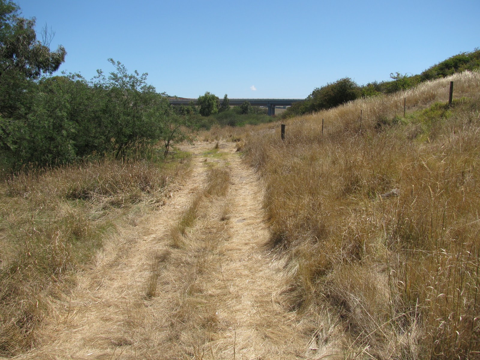 |
| Barwon River looking upriver towards the Geelong Ring Road. |
So, plans have been proposed, ideas put forward - but what has actually been done at either end of this part of the river? Well in terms of a usable trail, not much. Admittedly, there have been significant upgrades to the facilities at both Tait's Point and the viewing area at the end of Ash Road in Leopold throughout 2010, but disappointingly, I still need to drive to see them. As far as I can tell, there has been no action at all at the Wandana Heights end and at various points along the existing trail, damage caused by the flooding in January has yet to be fixed.
In the meantime, I continue to pound the same 18.5kms hoping for a change of scenery...
No comments:
Post a Comment