Showing posts with label Cowies Creek. Show all posts

10 May, 2016

Mountain to Mouth 2016: walk this land

This Friday 6th and Saturday 7th May, as I did just on two years ago, I took part in the Mountain to Mouth Extreme Arts Walk - M~M for short. For those who don't know, M~M is a multi-award winning, biennial community event which takes place across two days and 80km from the You Yangs to Barwon Heads.
Participants could choose to walk part or all of the 80km, accompanying "Canoe" the ephemeral centrepiece in which water from "Big Rock" in the You Yangs was carried to Barwon Heads where it was returned to the ocean; fresh water returning to the sea. To quote the event website:
The route is punctuated with edgy artworks commissioned for M~M, bringing people together through shared experiences of extreme arts that celebrate our land. In the tradition of Wadawurrung, M~M creates a contemporary songline across the Geelong and Queenscliffe regions.
"Canoe" and the walkers were accompanied on their journey by flags representing each of the City of Greater Geelong council wards and the Borough of Queenscliffe. The flags were carried by invited volunteers who have contributed to the local community. Likewise, "Canoe" was carried by those who contribute to the community in many ways - the CFA, Ford, Deakin University, The Celtic Festival, Crossing Supervisors, Surf Lifesavers to name a few.
At each of 12 stations along the route, walkers and the community were able to experience a different art installation, each of which was based around a walking circle created by a local artist or group of artists to reflect the local community and environment.
The show was kicked off by the first of three ceremonies, integral to the whole experience. The ceremonies were each designed to "celebrate the land, the heritage and the people of the Geelong region."
"Gathering of the Elders" ceremony, Big Rock
The first, was the "Gathering of the Elders" at Big Rock, a predominantly indigenous ceremony highlighting the ancient history of the region and culminating in the collection of water from the equally ancient rock well at the site, to be carried by "Canoe" to the ocean.
Wathaurong rock well, Big Rock
The ceremony concluded with the unveiling of the artwork "Canoe"
"Canoe" carried to the ceremony by the creating artists Leonard Tebegetu and
Mahony Maia Keily  and representatives from Parks Victoria
and an indigenous smoking ceremony before walkers, flag bearers and those carrying "Canoe" departed on the first leg of the journey.
Uncle Bryon Powell performing the smoking ceremony at Big Rock
 As was the case in 2014, our journey began by walking out of the You Yangs Regional Park, along Flinder's Ave to Serendip Sanctuary before entering Lara and arriving at the second station on the route. Under clear skies, this was a long stretch on a surprisingly warm autumn day.
Leaving the You Yangs behind
From Lara, our route took us along Cowies Creek - named of course for one of the region's earliest European settlers John Anthony Cowie who initially squatted at Bell Post Hill.
Cowies Creek, Lara
Our next stop was on the shores of Limeburners' Lagoon near Geelong Grammar where staff and students joined the walkers at the third station.
The shores of Limeburners' Lagoon nearing sunset
 After another all-too-brief stop, we were walking again, this time around the shoreline to Geelong's industrial heartland as the sun disappeared from view.
The shores of Corio Bay
The lights of Viva (previously Shell)
At Moorpanyal Park, still in the industrial precinct, we stopped at the fourth station as Ford employees handed the job of carrying "Canoe" over to representatives of Deakin University.
Past meets present. Ford employees carry "Canoe" to Moorpanyal park...
where Deakin's academics take up the responsibility 
From Moorpanyal Park, we began our final leg for the evening, walking around the shoreline of Western Beach to the fifth station at the Waterfront where the Mountain to Mouth collided with Geelong After Dark in a spectacular display involving sound, light, colour and dance in the form of the second ceremony "Gathering of the City: Geelong Connected Communities"
"Jellyfish" at the Gathering of the City Ceremony
Dancers performing during the Gathering of the City Ceremony
And there we left it for the night. I have deliberately not included photos of the individual walking circles and installations in this post. Instead, I have added a separate post showing each of the walking circles along the path we took: Mountain to Mouth 2016: walking circles

And the rest of the journey follows here: Mountain to Mouth 2016: walk this land


26 November, 2011

The Cowies Creek Caper

Yesterday's bike ride took me along the Barwon as far as Fyansford (with a quick stop for coffee at Barwon Edge on the way past), but from there I decided to head off and investigate a riding/walking trail I'd been meaning to get to for some time - namely Cowies Creek. As usual, I unsuccessfully attempted to ride up the "Cementies" hill and so, having failed in that objective, I stopped at the seat halfway up to snap a few more photos of the soon-to-change Moorabool Valley below - but more of that in another post perhaps. From here, I headed off round the linear trail which is still looking slightly bare without its tracks that have all been taken away to improve the line on the Bellarine Railway.
Overlooking the Geelong Ring Road and the Moorabool Valley
Then, rather than continue on the trail as I did a couple of weeks ago, I cut down Church Street and onto the start of the Ring Road track. I stopped again to snap a couple more photos of the Moorabool Valley - there was even a handy sign informing me of the valley's name in case I wasn't already aware of it - before pushing on towards my eventual goal.
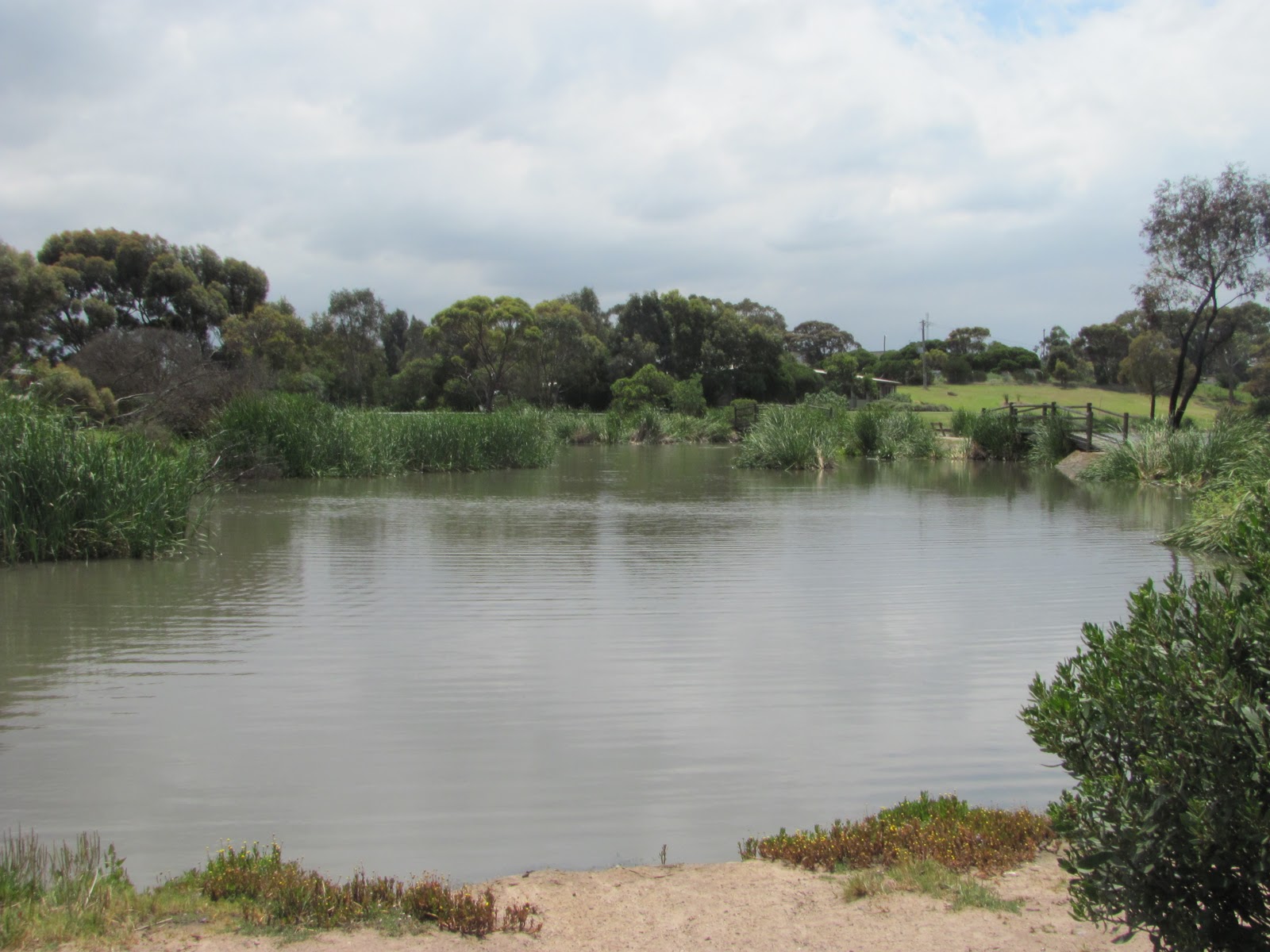
Cowies Creek, North Geelong: pretty but weed-choked
That goal was the lower end of Cowies Creek and the track which runs alongside it. I've ridden out to this point previously, but not along the creek until now. The path itself is relatively new and in good condition  up to Anakie Road and the creek itself in reasonably good shape through the section past the Corio Leisuretime Centre and beyond, however by Thompson Road, things are not so great. The creek becomes very weed-infested and the path is quite bumpy and not in great condition. Another negative is the several road-crossings required along the way, however these are unavoidable and taken with care shouldn't pose any real problem.
Weir Deppeler Park, North Geelong
Things improve again in the short section immediately before the Melbourne Road where the creek opens out into a lake which has the usual array of aquatic plants and bird life surrounded by parkland known as the Weir Deppeler Park. The path is in good condition and there are bridges crossing the lake. Unfortunately however, it is at this point which the track comes to an inauspicious halt. There is no obvious way of reaching the bay trails which extend around the Geelong Waterfront, nor is there a connection to the top of the McKean Linear Trail which itself comes to a grinding halt only 100m away at Douro Street.
This would seem to be the perfect opportunity for council to make some improvements to the local recreational facilities by connecting these existing pathways with dedicated walking/riding paths.  They should not of course let the small matter of a national highway and an interstate rail link interfere with this endeavour!
Up to this point, I had visions of winding my way through the aforementioned traffic obstacles and onto the path round to the Waterfront, so with this in mind, I headed up Edols Road, crossed the train line and started up Douro Street, but by now, I was stopping regularly to pump a leaky tyre and not quite sure which was the best way to proceed so when the start of the linear trail suddenly appeared before me, I decided to cut my losses and head back along the trail to Fyansford, then home along the river.
This I managed to accomplish with only a couple of stops to inflate my tyre and a lunch break when I reached the point below Fyansford where the Moorabool meets the Barwon. There is a conveniently positioned chair nearby and it is proving to be an interesting place for bird spotting. It was here that we discovered the kingfishers a couple of weeks ago and yesterday, I found only the second Great Cormorant that I have seen on the Barwon (the other was below Baum's Weir over a year ago).
Great Cormorant near Fyansford
So, having eaten lunch and chatted to a passing friend, I snapped the mandatory photos and headed for home.
I should mention at this point, that I had considered constructing a potted history of Cowies Creek and Mr James Cowie after whom the creek is named, however it is somewhat outside the scope of my blog and I soon discovered that a local amateur naturalist whose blog I follow had already done the job for me in a series of five posts from April and May this year. For those interested in learning more, the posts can be found on the Bushranger Blog. Just check the archive for the months in question to find the posts.

10 November, 2011

Branching out - the viaduct

The Moorabool Viaduct
Due to the apparent success of my two previous blog posts, I thought I would continue with my Moorabool theme for a while longer yet. Apart from providing some fresh material for  my posts, the water from the Moorabool does after all, end up in the Barwon.
Yesterday, in addition to my wander along the river, I visited a location where I couldn't actually see the Moorabool. I could however, see the tree-lined course it followed and I could most certainly see the impressive historical structure which carries rolling stock across the river.
This of course is the Moorabool Viaduct - a ten span, bluestone and steel structure built as part of the Geelong to Ballarat train line which opened in April, 1862. Designed by the civil engineer George Christian Darbyshire, it measures 442 metres in length and spans the Moorabool Valley near the small township of Moorabool. The line - also designed by Darbyshire - was originally opened to provide transport for both freight and passengers to and from the goldfields of Ballarat and was also the only rail route between Melbourne and Ballarat until a direct line was opened in 1889.
Bluestone Bridge Road, Lovely Banks
In 1918, the viaduct underwent substantial strengthening works, being rebuilt with steel under the supervision of civil engineer Frederick Esling and I believe has recently undergone further minor strengthening works to allow for the re-laying of a second - standard gauge - line running initially as far as Moorabool Station, with the intention of extending to Geringhap.
In addition to the viaduct, there are some ten smaller bluestone bridges which span various roads and watercourses along the line, including the double-arched bridge over the unsurprisingly named Bluestone Bridge Road and Cowies Creek, in Lovely Banks. Like these bridges which utilised locally quarried stone, the original station buildings which line the route are also constructed from bluestone. However, with no passenger trains using the route they are now in private ownership.