Showing posts with label Bellarine Rail Trail. Show all posts

11 May, 2016

Mountain to Mouth 2016: 80km of extreme arts

My previous post on Geelong's Mountain to Mouth 2016 described our participation in the Gathering of the Elders ceremony at Big Rock in the You Yangs before a 30km walk to the Geelong Waterfront for the Gathering of the City ceremony. This post will look at the rest of the walk (50km) which took place the following day beginning at 6am Saturday morning, whilst the walking circles and installations we passed at stations along the way are shown here.
Under cover of darkness, "Canoe" prepares to depart the Waterfront
Carrying "Canoe" up Moorabool St with a one-man police escort
Unlike the previous event, the weather was clear and perfect for an early morning walk. We departed the Waterfront punctually, and made our way up Moorabool Street to the Barwon River and the sixth station - an interpretation of Eugene von Guerard's famous painting of the river and naturally of particular interest to me.
Centrepiece of the sixth walking circle
With the coffee van arriving late and a rapidly growing queue, I elected instead to walk the circle, snap some photos and depart slightly ahead of "Canoe". Somewhere during this 15 minute or so period, the sun came up and we walked the short distance along the river to Swanston St in daylight.
Following "Canoe" along the banks of the Barwon River
From there, it was onto the Bellarine Rail Trail for a long slog to Leopold and Station 7 at the top of the Leopold hill. As I have noted before, those of us who regularly use the trail are fortunate that steam trains did not like steep inclines.
On the trail
I was hoping I'd be in better shape than this truck by the time I finished!
Once at Christie's Rd, I finally got that coffee and a "Killer Python" (I needed those carbs for energy!). As I watched some of the walkers taping their blisters, I was very pleased I had taken the precaution of taping my feet before I started walking.
A bird in its nest - part of the Christie's Rd installation
Flag bearers ready to leave for Drysdale
And then we were off again. The section from Leopold to Drysdale was relatively short with some spectacular views along the way.
A mere 27km away from our starting point...yet we'd walked 50km...
In the distance I could hear the train ready to take a special service to our next stop at Swan Bay for those who preferred to give their feet a rest. Tempting! But I was walking the whole way!
Art and music; the centrepiece of the Drysdale walking circle
For the rest of us, it was back on the trail for the longest section of the whole walk - around 14km -between Drysdale Station and the Marine and Freshwater Discovery Centre at Queenscliff.
Not everyone was interested in an extreme arts walk...
...and these guys were sitting on the fence too..
Unfortunately for those of us not taking the train, it was also the hottest part of the day and probably the section with the least shade. The marshals on their bikes were keeping a close eye on those of us walking ahead until we finally made it to Queenscliff.
At this point the train was beginning to look like a good option!
The road ahead...
My feet were definitely beginning to feel it by now, but a quick rub and we were off to Point Lonsdale.
Basalt Banjo Ray walking circle at Queenscliff
 After the long, hot stretch to Queenscliff, the short walk around the foreshore to Point Lonsdale and the tenth station was relatively easy by comparison and I was provided with distraction in the form of a fellow pilgrim who was happy to chat as we walked.
A sand sculpture en route to Point Lonsdale
The Point Lonsdale Village station is unavoidably short on for space, so rather than a walking circle there was a sand sculpture to welcome us on the boardwalk and an installation which according to the description has "continual interaction of wind, sun, clouds and sea".
Sculpture to the left as "Canoe" and the flag bearers arrive at Point Lonsdale
At this point, "Canoe" and the walkers diverged slightly as we wove our way through the ti-tree and "Canoe" continued up the road, before we converged once again for the climb over the dunes to the beach.
The "path" ahead
Whilst the scenery on this section of the walk was spectacular and the soft sand under sore feet was initially somewhat of a relief, I knew from previous experience that this was not going to be easy. We had around 8km of sand to cross and an incoming tide to beat as well and sure enough it soon became a trudge, however eventually, I was greeted by the cheerful volunteers at station eleven: Ocean Grove.
Ocean Grove and the end of the sand at last!
After a short break as "Canoe" was delivered to the walking circle at a run by the Ocean Grove Harriers running group, we were off on the final 3km stretch to Barwon Heads. Just as dusk was falling, we tramped across the Barwon via the William Buckley Bridge and made our way around the final walking circle headed for the tent and that last stamp on the M to M passport which said for some of us, that was had completed the entire 80km.
"Canoe" arrives at Barwon Heads
All that remained then was to find a suitable vantage point and watch the final Gathering of the Elements ceremony played out on the the banks and the waters of the Barwon.
The ceremony begins
Actors and dancers took their places as shoals of "fish" with glowing eyes lit the sands and a lone boat paddled across the river. Uncle Bryon Powell, cloaked in traditional possum skin, handed over the water which had been carried from Big Rock and it was again returned to the ocean before "Canoe" once again took centre stage in a fiery finale which saw it set alight and left to drift on the waters of the Barwon towards the heads and the ocean beyond.
Fire on water
"Canoe", set adrift on the Barwon, floats out to sea


13 May, 2014

M~M 2014: across The Bellarine

Part 1 of the adventure: M~M 2014: the journey begins
On Friday evening we had arrived at our overnight destination in mild, clear conditions. Not so the following morning when the walkers reconvened to begin the final day of our adventure - a 50km walk through Geelong, down the Bellarine Rail Trail and along the beach to Barwon Heads.
In the pre-dawn darkness and with rain falling steadily, we gathered at the Waterfront before setting off at 6am on the shortest leg of our journey; a 2.7km trek up Moorabool Street to the banks of the Barwon where breakfast was available for those who needed it.

Walking circle at the Barwon River, Geelong
As we formed up again and headed out along the river, dawn was just beginning to sneak in. The rain continued to fall and coats and pack covers were a must.

The Barwon a dawn
This was one of the longest stages of the walk, covering over 10km up the hill from Geelong to Christies Road in Leopold along the Bellarine Rail Trail. By the time we arrived, the weather had finally cleared and the Leopold Football Club had the snags on the barbie so I had a sausage in bread and sat down to attend to the crop of blisters I was already cultivating on my feet.
The living walking circle at Leopold
The next step was to make my way through the walking circle - which I did at each of the twelve stations on the journey. The circle at Leopold is a permanent one, built in to the garden which can be walked at any time. The canoe arrived a little after I did and was handed over to a group of scouts who were to carry it to the next station.
Scouts who carried the canoe from Leopold to Drysdale
From Leopold, we covered the 7 or so kilometres to Drysdale where another walking circle awaited us in the form of an amazing display of local produce.
Drysdale walking circle

Centre piece of the Drysdale walking circle
 This was a brief stop and we were soon on our way to Queenscliff - the longest stage of our journey. Whilst the rail trail is a great path to follow and I have run and ridden this section on many occasions and love its views and scenery, as a walker, I found it dragged. My blisters were gaining some serious momentum and we just seemed to take forever to get to the ninth station at the Marine Discovery Centre in Queenscliff.
Walking circle at the Marine Discovery Centre, Queenscliff

Once there however, there was time to dress my blisters once again - a process which it seemed was of interest to at least two photographers!
And then we were off again. This time the canoe was being carried by a group of crossing supervisors - the only group I am aware of who came with a name.

Lollipop Lollipop carrying the canoe to Point Lonsdale
This section from Queenscliff to Point Lonsdale I have to say, was a treat. Possibly my favourite part of the whole walk. Maybe that was because it was short, or because the weather by this stage was sparkling and the views are expansive.
The mayor of the Borough of Queenscliffe and flag-bearers heading to Point Lonsdale
However, it seemed like no time before we were at Point Lonsdale where the crossing supervisors handed over to lifesavers and we stopped to regroup and I was able to see perhaps the most unique of all the walking circles.

Surf lifesavers prepare to escort the canoe to Ocean Grove
This one was on a different scale altogether and with around 11km to go, it was just what I needed - a circle which you walked with your finger!
Point Lonsdale walking circle
This miniature walking circle we were informed, was carved from limestone quarried at Fyansford and a close examination would reveal fossils still embedded in the stone. But once again, having stamped our "passport" to prove we had been there and done that, it was off to Ocean Grove...


03 April, 2011

Still on the rails...

Perhaps not surprisingly, disused railway lines provide excellent opportunities for councils and local communities to develop nature trails and linear parklands and as I discussed in my last post, this is the case in Geelong. Of course, the old line to the cement works is not the only linear park in the region and not even the first I discovered as a result of my perambulations.
Queenscliff Station
Nor is it alone in linking to the Barwon and the network of trails across Geelong.
A much more extensive and so far, better developed, linear park is the Bellarine Rail Trail which extends essentially from Swanston Street in South Geelong (which in turn links via the bike lane to the Barwon), all the way along the old Queenscliff line, through Drysdale to the little seaside town of Queenscliff.
The trail follows the route of the former South Geelong-Queenscliff railway line which was constructed in 1878/1879 primarily to service Fort Queenscliff. The new line enabled the movement of troops and supplies back and forth from Melbourne. The Fort was a key stronghold in the defence of the capital during times of war, being located at the narrow entry point into Port Phillip Bay.
Steam train at Queenscliff Station
At the same time, Queenscliff was - and from its establishment in 1852 - always has been a tourist destination and the railway line also serviced this industry as well as providing transport for the permanent population. Whilst it was never the busiest of lines, it was none-the-less and important link in Victoria's rail network, serving the Bellarine Peninsula through various changes in fortune until its final closure in 1976.
Almost immediately, the Geelong Steam Preservation Society stepped in and from 1979 ran the line from Queenscliff, initially to Laker's Siding and then to Drysdale as a tourist facility with their base of operations being Queenscliff. The service continues to run to the present day using steam and diesel locomotives to pull the heritage carriages between Queenscliff and Drysdale.
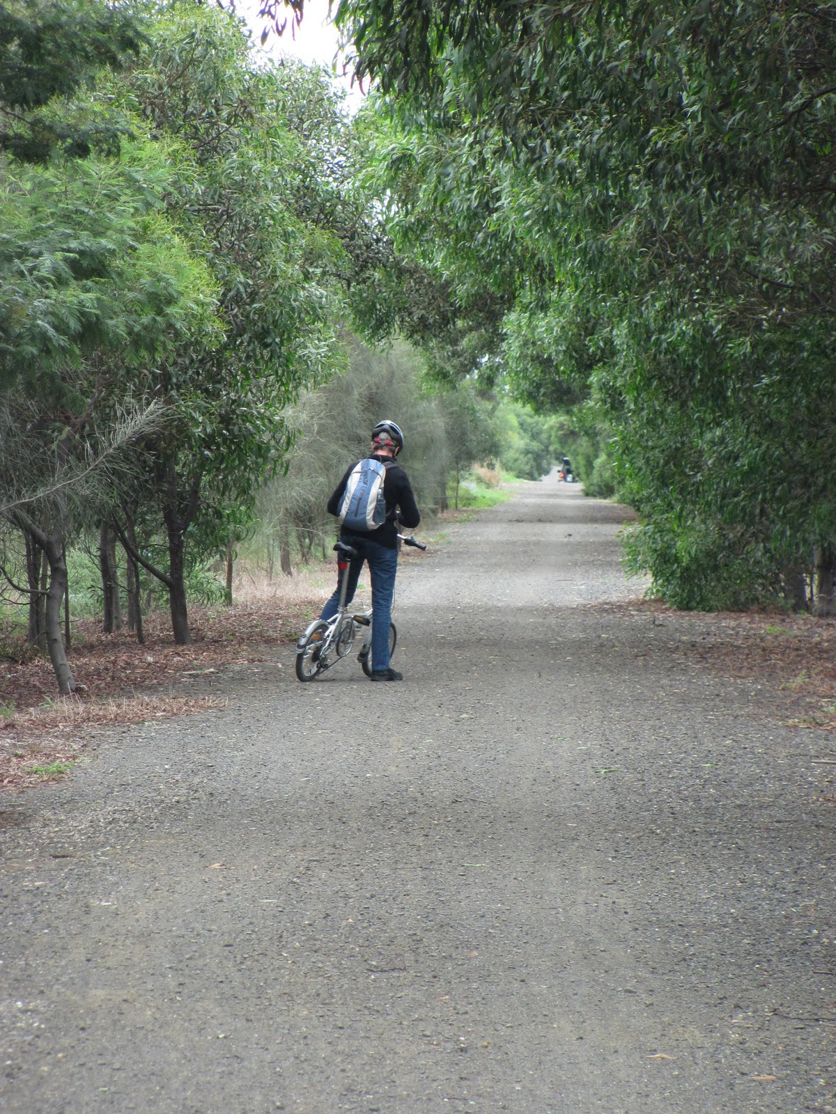
The Bellarine Rail Trail
near Leopold
It has been suggested that it might be possible to extend the rail service as far as Curlewis in the future, however that is a distant goal.
Interestingly, the railway has recently acquired three engines from the Puffing Billy museum. Two of these spent their working lives on the privately-run "Fyansford Cement Line" which carried limestone from the quarry below to the cement works above for storage or transport on the Fyansford branch line. Beside the Queenscliff line some distance outside of Drysdale, is a siding which stores rollingstock, including as it happens, a number of goods wagons also from the cement line.
Further information on the Bellarine Railway can be found at the following address: http://bellarinerailway.com.au/
Engine built by the Vulcan Iron Works
which worked at the Fyansford cement
works, now at the Bellarine Railway
Whilst the train runs only between Drysdale and Queenscliff, for those more interested in riding, running or walking, the good news is that the Bellarine Rail Trail - as mentioned - extends the entire distance from Geelong to Queenscliff through the surrounding countryside and the outskirts of Geelong.
At one time or another I have covered all of the trail either by bike or running. I have run the trail from Queenscliff to Drysdale on three occasions in various weather conditions - including this January through mud, rain and puddles. The terrain is undulating and scenic being both coastal and rural with the usual array of bird and plant life, complemented by sheep, cattle, horses and hay bales. On each occasion I have run to Drysdale then caught the train back to Queenscliff with various family members.
A year or so ago I also ran the remainder of the trail from Drysdale to South Geelong and then home on one occasion (also in the rain as I remember) and in recent weeks have cycled the trail from the Bellarine Highway to Drysdale and back.
The trail along most of its length is a loose gravel path, however there are sections through the outskirts of Geelong, Leopold, Drysdale and the approach to Queenscliff which are surfaced with bitumen. Up to Drysdale, the trail predominantly runs along the original line of the rails, however beyond Drysdale the path runs beside the railway line, crossing back and forth at various points.
Hereford cow outside Drysdale
Whilst as I mentioned, I have covered the entire distance at one time or another, I have yet to do it continuously either riding or - a goal I have long harboured - running. The distance from the Showgrounds in South Geelong to Queenscliff Station is around 34 kilometres, about 11 kilometres further than my longest run to this point, but one of these days...
Along all sections of the trail there are road crossings, however most are small, rural roads posing no real difficulty either riding or running. The two major road crossings I believe now have traffic lights. Despite this, a "training run" which was staged annually in about September running the whole distance of the trail has in recent years been changed to an out-and-back run between Queenscliff and Drysdale; the same distance as
the original run, but without the bragging rights of the former.
Details concerning the Bellarine Rail Trail and the Friends of the Bellarine Rail Trail group can be found at the following site: http://www.fbrt.com.au/fbrt/main/home.asp