Showing posts with label Barrabool Hills. Show all posts

28 August, 2017

Seidel's Farm

Last year, I looked at a number of the works of the 19th century landscape artist Eugene von Guerard who sketched and painted a number of locations along the Barwon River. With assistance, I was able to identify the locations from which von Guerard produced a number of his pieces. In addition to those drawings we studied, von Guerard also sketched another scene overlooking the Barwon, this time upstream from Geelong not too far from Ceres.
The scene which caught his eye on the 18th March, 1854 was a vineyard in the Barrabool Hills, owned by German immigrants Alwin and Bernard Seidel, vignerons who arrived in the district on a wave of Swiss chain migration which saw members of extended families settle on the fertile banks of the creeks and rivers around Geelong. The Swiss vine-growers were encouraged to come to Australia by Lieutenant-Governor Charles La Trobe whose wife Sophie de Montmollin was Swiss. La Trobe had spent time in Switzerland prior to their 1835 marriage and subsequent arrival in New South Wales in 1839 and would have been well-acquainted with Swiss wine production.
The Seidels it seems, were also acquainted with von Guerard as he mentions in the diary he kept of his time on the gold fields that he was travelling with "Seidel" - possibly one of the brothers. Clearly, he spent time visiting with them at the farm after his return from his gold-seeking adventures.
The Seidel's vineyard, was established in about 1849 (Geelong Advertiser, 2nd February, 1861) around a kilometre east of Ceres on Barrabool Road. Facing north east, it was situated high above the Barwon, looking out across both the Moorabool and Barwon Valleys. Today, the site lies just to the west of the Ceres/Highton exit from the Geelong Ring Road and whilst much has changed, the view is still commanding.
Looking towards the You Yangs from a position a little to the
east of Seidel's Vineyard
Initially known as the Ceres Nursery (later the Ceres Vineyard), the Seidels grew fruit trees - plums, apples, apricots and peaches are all mentioned - as well as grapes. A report in the Geelong Advertiser of 2nd February, 1861 indicates that the brothers may have farmed side by side rather than together. It states that "the Ceres Vineyard and nursery [is] the property of Alwin and Bernard Seidel, of which the former brother cultivates seven acres of vines and six of orchard and the latter six acres of either."
That they were there at all however is a testament to their determination. Ten years earlier, their fledgling nursery was completely destroyed when on 6th February, 1851 the Black Thursday bushfires struck the district. The family were lucky to escape with their lives but - undeterred - rebuilt their home and replanted their orchard and vineyard. After the outbreak of the Victorian gold rush in August, 1851, much of their fruit was taken to Ballarat for sale.
1854 Sketch of "Seidel's farm" by Eugene von Guerard. Click to enlarge
The Seidels retained ownership of the vineyard until 1863 when Alwin was declared insolvent and the property sold to Mr Louis Kitz for £1,356 (Geelong Advertiser, 5th March, 1863). Despite this setback, Alwin remained on the property as manager for some years.
In what is perhaps a testament to the vineyard's success - or perhaps just its proximity to Geelong - the vineyard was visited by the Governor of Victoria Sir Charles Darling, on his first tour of the district following his appointment. The governor spent over an hour on the property whilst Louis Kitz showed him sights and elaborated on the finer points of wine-making before inviting him to sample the produce (Geelong Advertiser, 9th December, 1863).
 By 1870 however, Kitz in turn had moved on and the property was sold to another pioneering vigneron - Alexander Belperroud, originally the owner of the Berramonga Vineyard located further upstream near today's Merrawarp Road. Belperroud renamed the property Sebastopol and began getting things in shape. The Geelong Advertiser of 7th June, 1871 reported that:
Mr Alexander Belperroud from seven acres has made 25 hhds, as against 4 hhds last year, when his vineyard was in a neglected condition he having only just taken possession.
His tenure however was also short-lived. Barely more than a month after the above article was penned, Belperroud's wife Mary died and by 1874 with his own health beginning to fail, he sold the vineyard and retired to a cottage at nearby Ceres where he died in July the following year.
Alwin Seidel died on 13th September, 1910 at the age of 88 and was buried with his wife Augusta (died 1895), in the Old Methodist section of Geelong's Eastern Cemetery the following day. His burial details record his name as Gustuv Alwin Seidel.
I am uncertain what became of Bernard, however an elderly man of that name died after he was involved in an accident with a police officer on a bike in Melbourne in 1903.
Today, little remains of the original farm buildings which are privately owned. The Victorian Heritage Database describes the remnant structures thus:
Intact cellar. There are also a concrete lined dam/water storage pond, a brick-lined cistern and an area of ruins. The cellar is rectangular, measuring approx 9.5 x 5m. It is entered through a standing sandstone porch, through double timber doors, of which one side remains in situ. Ten steps lead down into the cellar, which is of sandstone construction, with a barrel vaulted roof. There are two roof windows opening to the north. A further two windows in the south side of the vault are blocked but may once have been open. They are now covered on the outside by a stone pavement. There is a shallow niche in the west wall and what may have been another roof window, or a vent, above this. This window/vent is also blocked. A very old ivy bush is growing on the north corner of the porch. There may also have been a structure above the cellar but, if so, it has been removed. There is an area of stone pavement and a concrete slab to the south of the cellar. To the north are the cistern and an area of scattered building stone, bricks and concrete. The dam is located to the south, between the cellar and the road.

One final point of interest is to note that almost a year to the day after the date on von Guerard's sketch of Seidel's farm, he made another two drawings. Like the earlier sketch, these works took in the Barrabool Hills and were the subject of one of my earlier posts. The photo below was taken from a similar position to that from which von Guerard sketched the view looking south along the Barwon. The site of Seidel's farm - which cannot be seen for the intervening hills -  lies over the hill a mile south of the power line seen to the right of the photo.
The view close to the location on the Barwon from which von Guerard
sketched the southerly aspect of the hills.
When compared to the above sketch of Seidel's farm, the central hill in the above photograph is most likely the north face of the dark shaded hilltop to the left of the farmhouse.

27 July, 2016

Two von Guerards for the price of one!

Whilst it was easy enough to find the locations from which 19th century landscape painter Eugene von Guerard made his two famous Geelong paintings - View of Geelong and Mr Lewin's hut on the Barwon River, finding the location of some of the informal sketches he also made during his time in the region was a little trickier.
Whilst von Guerard spent many hours sketching the river from several vantage points along the Barwon Valley through what would become the suburbs of Highton and Newtown, he also took his sketchbooks to some more out-of -the-way locations. Places that I've seen too.
Most recently, I paddled up the river from Baum's Weir to the bridge at Merrawarp Rd - a section of the river I've paddled many times before. My main aim on this occasion was to take some photos of a couple of locations I was fairly sure von Guerard had visited a little over 160 years before me. Surprisingly for a July afternoon, we headed out in short sleeves on a sunny, windless afternoon, but with the river flowing somewhat higher than the usual summer levels, paddling upstream required a little more effort than normal.
Our first stop, was not far from the Geelong Ring Road where - as you head upstream - the river sweeps around three right-angled bends in succession, to form a large "U" shape beneath the Barrabool Hills. It is here that we think von Guerard's made two of his sketches. Neither, as far as I'm aware, was ever developed into a painting, however even in sketch form, they give a good impression of the height and dramatic appearance of the Barrabool Hills at this point.
Whilst I was certainly not the first person to take in this particular view, neither for that matter was von Guerard. In 1848, the landscape painter, squatter and later civil servant Charles Norton painted a very similar view to that of von Guerard's sketch. The watercolour, titled View from front door "Carlsbadt" on the Barwon, was one of a number of watercolours and sketches of the area completed by Norton between 1847 and 1849. For this short space of time, he occupied a squatting run on the Barwon which he named 'Carlsbadt' after the town in Germany in which his father was born. I can find no mention of 'Carlsbadt' on the maps or in newspapers from the era, but from context assume it must have been situated on the north bank of the Barwon, immediately to the west of the Fyansford township reserve, on land originally held by the Mercers on behalf of the Port Phillip Association.
View from front door "Carlsbadt" on the Barwon, 1848 by Charles Norton
Similar view to the above sketch, July, 2016, but taken from midstream
Soon after his arrival in the district, Norton married Susan Meade - governess to the children of then Superintendent La Trobe. In 1849, during their time at 'Carlsbadt', a daughter - Joanna Kate - was born to the couple. Her birth was registered at nearby Fyansford. This same year however, with the run proving unprofitable, (as as was the case with an earlier property held by Norton in the vicinity of Clunes) Norton advertised his stock (sheep) for sale as he intended leaving the district. By 1850 he and his family had moved to Melbourne where a further two sons were born. A longer biography of his career can be found at Design and Art Australia Online.
'Carldsbadt' near Geelong, sketched by Charles Norton, 1848. Image taken from
the State Library of Victoria
Some five or six years after Norton's departure from 'Carlsbadt', on the 13th March, 1855 von Guerard, with sketchbook in hand, took in the same view.  His vantage point however was not the same as Norton's from his front door, or mine from midstream. Instead,  he chose to perch on the steep slopes above the east bank of the river to make his sketch of the view before him. To find that spot, I needed to do the same. After two visits and some precarious climbing I felt I had come as close to von Guerard's vantage point as was possible.
Eugene von Guerard sketch looking south to the Barrabool Hills near
Fyansford, 13th March, 1855
A similar view to von Guerard's sketch as it appears today. 25th July, 2016,
possibly somewhat altered by the building of the Geelong Ring Road in 2009
The peaks were all there, the fence still followed the same line over 160 years later.  The only things which didn't quite match were the proportions of the double peak at the centre of the sketch; that and the presence of the Geelong Ring Road where von Guerard sketched two men on horseback, no doubt following a long gone track (although not one which shows on any map I've found). The profile at this point appears to have been eroded away somewhat, but as far as I can tell by comparing historical images on Google Earth, this was not the result of excavations for the Ring Road, so any erosion must be from an earlier date.
Next, as I traversed this section of the bank, I noticed that I could see not one, but two von Guerard "sketches". The second sketch (actually made earlier the same day), took in the hills a little further downstream from those shown above. Upon first seeing it, I had quickly recognised the location of this sketch, but had assumed it was made from a point near to the closest bend in the river to the hills. Looking across the Barwon from this more easterly perspective however, I realised that what I had thought was another hill, was actually the tip of the promontory around which the river flows and that this sketch must have been made from a very similar view point to the other with the two drawings effectively being a continuation of the one scene.
A second von Guerard sketch of the Barrabool Hills and Barwon River from a
similar perspective
A similar view to that sketched by von Guerard, 26th July, 2016
The angle and elevation of the above comparison photo is slightly different to that of the sketch as any lower perspective today is obscured by trees, however it was clearly from this part of the river that von Guerard made both his sketches. The relationship of the two drawings can be seen in the panoramic shot below.
The Barrabool Hills, 25th July, 2016. Click to enlarge
Finally, whilst there are several other sketches drawn by von Guerard on his various visits to Geelong, in my next (and probably final) post on these sketches I will look at an elusive little waterfall on the Moorabool River.

07 September, 2013

All the rivers run...eventually....

My recent lack of posting is - at least in part - due to having spent some time travelling in Outback Queensland which has left me a little short of time for research and wandering up and down the banks of the Barwon.
The Barwon River and Barrabool Hills
My trip did however prove one thing to me: rivers can vary quite dramatically. Here in the south of the country (short of extreme drought conditions) we tend to think of a river as a continuously flowing body of water whose level varies with rainfall or as a result of human intervention such as dams and weirs.
The Barwon River below Pollocksford Road Bridge
 
In the interior of the country, this can be quite different. I knew this before I went travelling, however seeing it is still a little surprising. My first experience was from the lounge car of the Spirit of the Outback train on which we travelled over the course of 24 hours from Brisbane to Longreach, (If you can afford it, a sleeping car in first class is well worth the experience.)
The Brisbane River, James Cook Bridge from the CityCat
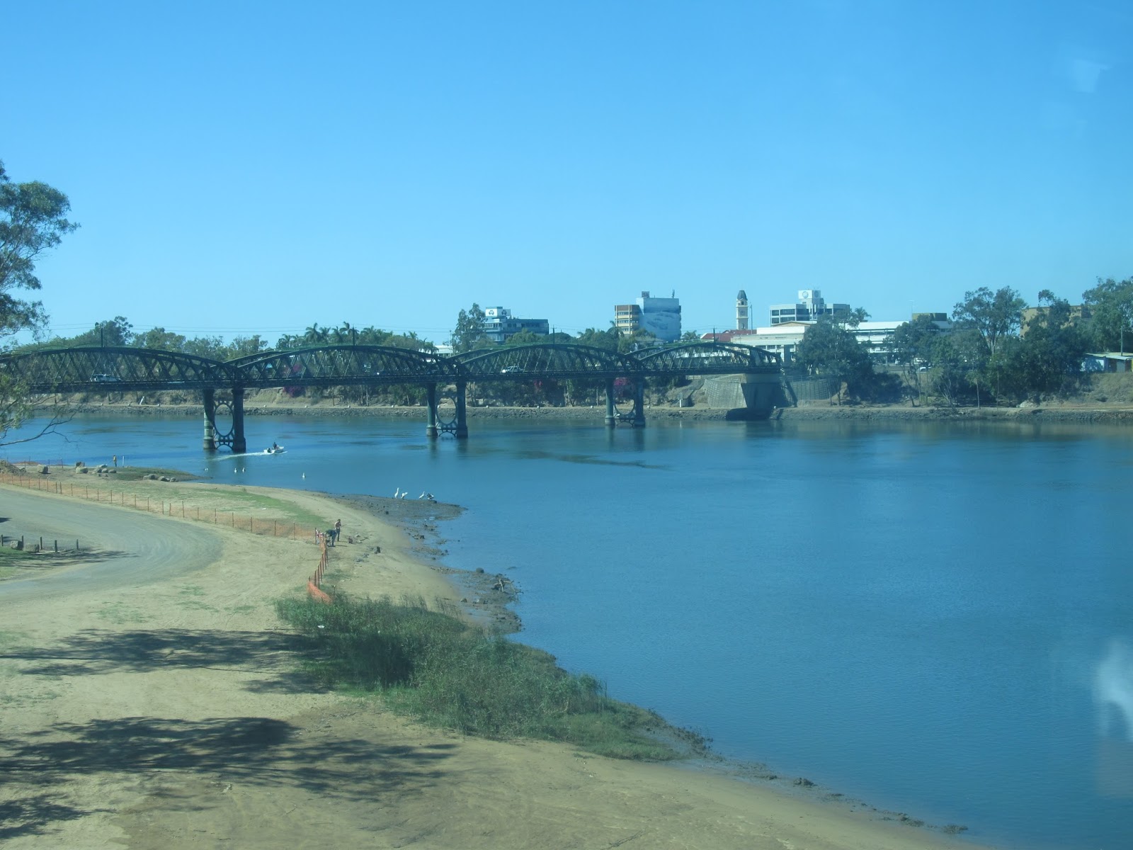
As the journey progressed, we watched the landscape change from the mangrove-lined banks of the Brisbane River through the CBD to the broad, tidal expanse of the Fitzroy River in Rockhampton.
With it, the climate also changed notably. We were definitely in the tropics as attested by the fields of sugar cane and pineapples which appeared as we neared Bundaberg.
The Burnett River, Bundaberg as seen from the Tilt Train
Further inland as we made the long run westward from Rockhampton, these crops were replaced first by fields of wheat and cotton and then by thousands of acres of dry grass, eucalypts and gidyea (pronounced "gidgee") scrub.
As we neared our destination the creeks and rivers we crossed took on rather a different complexion.
Surprisingly perhaps, the average annual rainfall for Geelong (527mm) is not so different to that of the town of Barcaldine (507mm). Whilst the Otway Ranges cast a significant rain shadow across an area from Geelong to Werribee, reducing the average rainfall of these areas, the upper reaches of the Barwon receive more than double this average rainfall. The other difference of course is in the distribution of rainfall across the year.

The Alice River, Queensland near Barcaldine
Whereas the upper Barwon receives the highest rainfall in September and the lower reaches in October and November, the northern parts of the country receive the most rain over the wet summer months, with Barcaldine receiving just 15mm on average in the month of August.
However, not all rivers in the Outback dry up completely. The Thomson River which flows through the town of Longreach, providing the town's water supply is one such. Rising as Torrens Creek outside Charters Towers, it becomes the Thomson River north of Muttaburra, flowing south and west through Longreach and several other towns, joined on its way by a number of creeks. Just north
of the town of Windorah is the confluence of the Thomson and Barcoo Rivers which then become Cooper Creek - the only place in the world where two rivers meet to form a creek which then "flows" into Lake Eyre.
The Thomson River, Longreach

Unlike  other rivers and creeks - including the Barwon - the Thomson River does not flow to the sea and Lake Eyre is dry except in times of high rainfall at which point the rivers and creeks burst their banks causing widespread flooding as there is nowhere for the water to run off in such a flat landscape. If the rainfall is high enough then some of the water which would otherwise evaporate, reaches Lake Eyre.

The Thomson River, Longreach on sunset
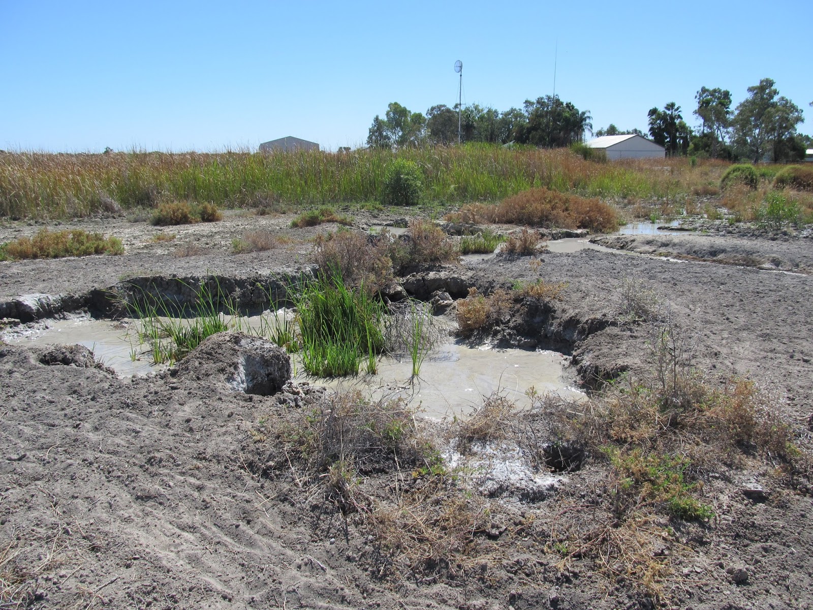
Between periods of flooding, many of the rivers and creeks form a series of isolated billabongs or chains of waterholes and it was these which provided water for stock in the early days of European settlement. During a period of severe drought in the 1880s however, test-drilling confirmed the presence of the vast subterranean water supply known as the Great Artesian Basin.

Naturally forming mud spring near Barcaldine
Bores were sunk across the countryside, providing water for stock, humans and crops alike.

Natural artesian pressure from a bore near Barcaldine

Artesian bore near Barcaldine
Today, the Artesian Basin is still the main source of water for the Outback, although many of the original bores have been capped to reduce wastage and improve water pressure.
For now however, it is back to the south and back to the Barwon where water flows down from the mountains and reaches the sea.
The mouth of the Barwon River from Ocean Grove


20 January, 2013

Beneath the Barrabool Hills

Saturday afternoon we took off for a second paddling expedition up (and down) the Barwon. This time I had the chauffeur paddling with me so an out and back trip was necessary. I decided we would head upriver from Baum's Weir, aiming for the Merrawarp Road Bridge and see how far we got.
At Baum's Weir
This section of the river travels through farmland and the Barrabool hills. The outcropping of sandstone from which it is formed is quite visibly different in its geology to the basalt which lines the river at Buckley Falls and gives a very different look to the landscape. The local Wathuarong clan of the same name lived in the area and gave the hills their name. At least three meanings have been suggested: oyster, a rounded mountain or a slope down to water. Given the nature of the landscape either of the latter two seem a likely possibility although "oyster" seems the better known.
Looking upstream to the Barrabool Hills
The cliff faces which rise up from the river appear to be inhabited by Welcome Swallows in their hundreds and they dart and dive above the river much like the Fairy Martins down in Reedy Lake. However, somewhat at odds with the rural landscape is the continuous traffic noise from the nearby Ring Road.
Looking downstream
The river channel past the Barrabool Hills is somewhat deeper than other sections of the river which I have seen and reminded me a little of the steeper banks of the Leigh and Moorabool Rivers.
As a consequence, it was difficult to see much of the surrounding countryside whilst on the river and the steep banks made it tricky to jump out and have a look.
High banks limit the view of the surrounding countryside
However, this is a very pretty part of the river with gum trees hanging out from the banks, over the water whilst in several places the river was so cluttered with logs, fallen branches and even whole trees that navigation became a little tricky. None-the-less on each occasion we managed to find our way through.
Dead tree  in the Barwon
We made it comfortably to Merrawarp Bridge - I can find no meaning for this name, indigenous or otherwise - in under two hours and decided we would push on and see how far we got. In the end it was probably an extra kilometer or two past the bridge through more dead trees, past a few fishermen (one in a kayak who proudly exhibited a sizable red-fin he'd caught), several pumps, the odd sheep or cow having a drink at the river and a couple of guys in a tinny, also off for a spot of fishing.
The bird life from what I saw was similar to other parts of the river, with the exception of a pair of Wedge-tailed Eagles circling overhead as we reached the upper limit of our trip - the first I've seen. Further downstream I came across a Nankeen (any-time-of-the-day-or)-Night-heron. For predominantly nocturnal birds, the local variety don't seem at all adverse to staying up late in the hope of making a catch. I spotted one during our circumnavigation of the lower breakwater on Thursday evening and often see them during daylight hours around Buckley Falls. This specimen however, was perched in a tree well above the river where it wasn't catching anything.
Nankeen Night-heron
Our return journey was reasonably uneventful, although we did stop off at one point to log a geocache which was only accessible by an on-river approach. This was our only landfall and the only opportunity to have a look at the surrounding countryside which was looking quite dry.
By the time we made it back to the starting point the earlier cloud-cover had cleared and I was able to take a few good shots with the sun behind.
The Geoff Thom Bridge on the Ring Road from the west
For the purposes of photography, paddling upstream would be best done in the morning...perhaps I'd better get a little more organised!

29 August, 2011

Bricks and Mortar

Trying to connect the topic of this post to the Barwon River is drawing a rather long bow, however I though it interesting enough to include anyway. So here goes:
A recent geocache hunt took me to Limeburners' Point where the remains of five lime kilns can still be seen so of course I snapped a few photos and did some research.
Remains of lime burning kiln at Limeburners' Point, East
Geelong
One of the earliest and most important industries to develop in the Geelong region was the production of lime which was in high demand by the building trade where it was used in the production of mortar, cement, plaster and stucco amongst other things. Lime production on the site is believed to date back to 1838 and the earliest days of European settlement in the region when limestone was quarried nearby and burnt in kilns on the western side of the point. Seashells were also collected and used in production. This site was no doubt chosen for the availability of limestone which was found in the cliffs, in the limestone gravel of the beach and in the shells which collected there. 
The limestone in the cliff face which is believed to be between 65 and 3 million years old was covered by a layer of clay, deposited in a later period. Other limestone deposits in the region are believed to have formed around 20 - 35 million years ago during the Oligocene-Miocene periods, when changing sea levels lead deposits of shells to form along shorelines which no longer exist. I wasn't able to discover how the deposit at Limeburners' Point relates geologically to these other deposits at places like Waurn Ponds, Fyansford and Batesford.
During the peak of operations at Limeburners' Point, the kilns operated day and night, burning timber which was hauled in on drays. Alternating layers of timber and limestone were fed into a funnel-like chimney at the top of the kilns which were stone and brick structures built into the cliff face. The contents were burnt, then the lime rendered by this process was collected from the chamber at the bottom of the chimney, bagged and carted away.
Remains of a bluestone quarry on the Barwon River
Initially owned by Messrs Taylor and Bourchier, the kilns were purchased in 1852 by George Cakebread from Caleb Joshua Jenner. Sources appear to differ on when the surviving kilns were built, however it would seem that these kilns date only to the 1860s or 70s. There are also the remains of a powder magazine at the site which dates back to 1854.
So important to the early building industry of the region was Cakebread's lime (the only other source of lime at that time was Point Nepean Peninsula) that it was shipped all over the Western District. I would imagine therefore that many of the significant homesteads of the region were built from rock quarried from basalt deposits along the Barwon and held together with mortar made using lime from the shores of Corio Bay.
One such example is Sladen House, Newtown which was built in 1849 with basalt taken from Melville's Quarry on the river at the bottom end of Noble Street. The first to do so.
Sladen House
Quite a number of quarries operated in this area: on West Fyans Street either side of Shannon Avenue, at Windmill Reserve overlooking Queen's Park and also near the end of Camden Road. All tapped into the deposits of basalt along the Barwon Valley, providing stone for local churches such as the Wesleyan Church in Noble Street, houses and even the Geelong-Queenscliff railway line.
Another example perhaps is the privately owned Barwon Bank in Riversdale Road, Newtown which was constructed between 1853 and 1856 from - I assume local - basalt, trimmed with freestone from the Barrabool Hills. Likewise, Barwon Park Mansion at Winchelsea is also built from basalt.
In addition to these buildings, Barwon Grange, Kardinia House and St. Albans Homestead along the banks of the Barwon are all brick, or stone and brick, structures built between 1850 and 1875 which presumably used Cakebread's lime.
Despite this overwhelming need for lime, pressure from tourist interests at nearby Eastern Beach soon saw the lime burning process forced to move to the eastern side of Limeburners' Point where these remaining kilns are situated. Production was not affected by the move and reached a peak in the 1870s, however nothing lasts forever and by 1875, another lime-burning operation located on the opposite side of Corio Bay at Duckponds (near Lara) was producing a superior quality lime. By the 1880s only one of the kilns at Limeburners' Point remained in operation and profits had dropped ten-fold.
Barwon Bank
The new producers had set up their kilns on the shores of the small lagoon into which Hovell's Creek empties. Somewhat confusingly, this is now known as Limeburners' Bay. At that time however, the entrance to the lagoon was known as  Limeburners' Point, with the site which is known by that name today, instead called Galena Point.
It is also worth mentioning that Duckponds and Limeburner's Point weren't the only source of Limestone in the region. The deposit near Waurn Ponds - an extension of which reaches to the Barwon where it forms the Belmont Escarpment - is still being quarried to make cement by Blue Circle Southern Cement Ltd. The stone is also used for monument-making purposes by various stonemasons in the region.
Historically, it seems that quarrying took place at Waurn Ponds as early as the 1840s, however it was probably only used for building purposes at this time. It was not until the 1880s when production at Limeburner's Point was in decline that kilns were built at Waurn Ponds and lime production began.
A little later, in 1890, the cement works at Fyansford commenced operation. The lime to supply these works was quarried about 5.6km away at Batesford from the Miocene era deposit which was found there in 1888. The rock was crushed on site and then transferred to the works at Fyansford first by a ropeworks and then by rail. With the opening of a new quarry in 1931, stone was loaded straight onto trucks and then taken to the works by rail for crushing. This open cut quarry is still in use today, despite the closure of the cement works.
Further research has just shown me that there was almost a very direct link between lime production in Geelong and the Barwon River. In the early 20th century the Fyansford Cement Works needed to get their product to the rail lines which would take it to Melbourne. Before the route from North Geelong to Herne Hill was eventually chosen, two other options were put forward. One was a railway line running from South Geelong through Newtown and Chilwell and then along what would become Deviation Road, whilst the other involved a siding running from South Geelong Station to the Barwon River and a wharf at Yarra Street. A second wharf upstream at Fyansford would be serviced by an aerial ropeway from the cement works. This plan however was overlooked in favour of the branch line from North Geelong.

06 July, 2011

Horses for courses

On a recent search to uncover one of those pesky little geocaches (located as it happened somewhere in the vicinity of a horse trough), it occurred to me that since Europeans arrived, the Barwon River has had a continuous association with horses.
Rider beside the Barwon in Newtown
Today, horse-riding along or over the Barwon is generally a leisure activity, whether riding along the banks or going for a beach-front ride at the river mouth in Barwon Heads.
In the early days of settlement however, when horses were the only real mode of transport, and bridges were scarce, crossing the river could be a difficult and expensive process. Private individuals operated punts which crossed the river at a number of points, charging a shilling for a man and horse to cross whilst for a horse and dray or cart, the charge was as much as 1 shilling and sixpence. A horse and pair cost an extra shilling.
Central to entertainment in any 19th century Australian town was horse racing and of course, Geelong was no exception. In the earliest days, race meetings were held at various places. The first was at Corio and another very early meet in 1843 was held at the Fyansford Inn (aka The Swan Inn) on the high ground above Fyansford, overlooking the Moorabool and Barwon Rivers.
From this time on, races were held in a variety of places right across the region including a 727 acre site on the Barwon at Marshall Town. Not surprisingly however, this course was subject to flooding and as a result winter events were regularly cancelled. In 1907, the current course in Breakwater became the permanent home for the Geelong Racing Club.
In addition to the race course, there have been and are currently a number of horse studs and training facilities located along the banks of the river. One such is Rosemont Stud at Ceres outside Geelong. Currently owned by media identity Anthony Mithen, Rosemont extends for 2.5km along the banks of the Barwon and runs back up into the Barrabool Hills behind, providing excellent facilities for breeding and training thoroughbreds.
Over the years, Rosemont was also home to the Barwon Valley Pony Club whose tenancy lasted from the early 1960s until 1989 when they moved to Moriac. Throughout this period, the pony club also had associations with another historic property located on the banks of the Barwon - Frogmore at Fyansford.
More renowned for its famous 19th century nursery than its equestrian connections, Frogmore has in recent years, been host not only to pony club competitions but also to polo contests which continue to the present day.
Of course, another renowned stud located on the banks of the Barwon was St. Albans. As I mentioned in an earlier post, it was located in the Geelong suburb which now bears its name and in its day played host to many Melbourne Cup runners including briefly, the legendary PharLap.
St Albans homestead was built in 1873 for the trainer and breeder James Wilson whose horses also had success in the VRC Oaks and Victoria Derby. The area whilst now a suburban development, traces of the stud still remain, including the homestead itself and traces of the race track and trees which were grown as a wind break on the property.
Water trough donated by Annis and George Bills
Naturally, with so many horses, it was necessary to keep them watered and fed. One couple who were particularly concerned for the well being of horses and other animals, were George and Annis Bills who were responsible for many bequests and philanthropic acts during the course of their lives which benefited both man and beast. Both born in England, they met and married in Brisbane in the 1880s then spent time in Echuca and Sydney before retiring to Hawthorn in Melbourne. Annis died in 1910 whilst on a trip to England and then upon the death of George in 1927 a trust fund was set up whose purpose was to:
"..construct and erect and pay for horse troughs wherever they may be of the opinion that such horse troughs are desirable for the relief of horses and other dumb animals either in Australasia, in the British Islands or in any other part of the world subject to the consent of the proper authorities being obtained."
Under this scheme, some 700 odd troughs were installed around the country during the 1930s and up to 50 in other countries. Amazingly enough, quite a number of these lovely old troughs have survived and are still in their original locations. The trough I was hunting today, sits on Fitzroy Street, Geelong in the short section between Sydney Parade and Ryrie Street. It is one of two in Geelong, the other being located at the Geelong Showground in Breakwater.
Each trough was supplied with a backing plate which carried the inscription "Donated by Annis and George Bills Australia". Unfortunately the trough in Fitzroy Street is currently missing its backing plate and does not appear to be in great condition as the concrete is beginning to show signs of erosion.
To continue the connection between horses, the Bills and the Barwon, two other towns located on the river are fortunate enough to have Bills Troughs. One is at Birregurra, in Beal Street. The other is in Winchelsea, located - appropriately enough - outside the Barwon Hotel. With any luck I will remember to snap a photo or two next time I'm passing through.

05 June, 2011

Women of Substance

Boronggoop? Sounds rather like the name of a frog - or perhaps an Aboriginal term? Well, the latter as it happens is true. The name Boronggoop comes from the Aboriginal name "Porrong Goop" meaning "Place of Quails". So, what and where is (or was) it? Boronggoop was a 10,000 acre  squatting run on the Barwon River, located in the vicinity of what is now the Geelong suburb of St.Albans Park.
In 1840, two pioneering women by the name of Anne Drysdale and Caroline Newcomb (anything sounding familiar about those names?) took up the lease for the run from the government and built  a four-bedroom cottage on the property where they lived and worked the lease as a sheep run.
Boronggoop extended from the Barwon in a north easterly direction across to Point Henry on Corio Bay.
Anne and Caroline were extrodinary women for their generation. Anne was a Scottish gentlewoman who, having farmed in her home country, moved to the Port Phillip District for her health in 1837, with the intention of farming in the region. Soon after arriving, she went to stay at Kardinia House (see previous blog) with Dr. Alexander Thompson. Here she met his young English governess Caroline Newcomb who had been with him since 1837 and the two formed a very close friendship which was to last the rest of Anne's life.
Caroline, herself a woman of pioneering spirit, but less financial means than Anne had arrived in the colony in 1836 as governess to John Batman - the founder of Melbourne - having migrated to Tasmania some three years earlier.
With Thompson's help, the two acquired the lease of Boronggoop, built a cottage and took up residence on the property. Their home was described in flattering terms by the Presbyterian minister John Dunmore Lang, himself responsible for the immigration of many of Australia's earliest settlers, who found "a rare domestic character". The grounds had gravelled paths and a well established garden which Anne populated with flora transplanted from the surrounding bushland. Their first home - long since gone - was situated between the banks of the Barwon and the site of St. Albans Stud, to which estate some of the Boronggoop land eventually passed. As their venture prospered, a sheepwash was set up in the river and some of the marshy land adjoining the banks of the river was ploughed to plant potatoes.
Lang was also no doubt impressed with the women's piety. Anne was a member of the Presbyterian Church whilst Caroline followed the Wesleyan faith and was active in the establishment of the Women's Benevolent Association of Geelong after Anne's death. This was no doubt an appropriate endeavour for a woman who achieved so much as a woman in 19th century society.
The shore of Reedy Lake at Coppards Road - probably
part of Boronggoop Station
The pair's endeavours met with enough success that they were able to extend their property to "Leep Leep" (also an Aboriginal term meaning "Place of the Water Bird" - specifically Lewin's Rail) on the shores of Reedy Lake, but their main aim was own their own land. This was achieved when they acquired the leasehold for Coriyule Station near the present town of Drysdale on the Bellarine Peninsula in 1843. In 1847 their dream was realised when they purchased the freehold for the land and by 1849 they had built a homestead overlooking Port Phillip Bay. The mansion was made from locally quarried basalt for the foundations, limestone, quartzite and ironstone for the walls and Barrabool Hills sandstone for the chimneys. They lived here, running the properties until Anne's death in 1853. Such was Anne's admiration for her partner and friend that she remarked in a diary entry that "Miss Newcombe who is my partner, I hope, for life is the best & most clever person I have ever met with. There seems to be magic in her touch, everything she does is done so well & so quickly."
After Anne's death, Caroline continued to run the Coriyule property, often stating in her later years "Tell me what a man can do that I cannot!" Despite her fiery temper and this fierce statement of independence, in 1861 she married the local Wesleyan minister - Rev. James Davey Dodgson. The remainder of her life until her death in the Melbourne suburb of Brunswick in 1874, was spent following her husband around his circuit, ministering to the faithful.
Tellingly perhaps, Caroline was buried not with her husband (who lived until 1892) or in church surrounds, but with her partner Anne, on the station at Coriyule. In later years, their remains were removed to the Eastern Cemetery in Geelong.
The Coriyule Mansion still stands today and is held in private hands. It has been suggested that the ghost of Anne Drysdale can sometimes be heard playing the piano in the house.
The original Boronggoop run on the Barwon, held by the pair when they first formed their partnership was reclaimed by the government in 1852 and subdivided.
A meat processing works was set up on part of the Boronggoop land which by the 1860s was owned by John Lowe, MLC. Lowe died in 1867 and passed the land to his son Edwin who set about building a boiling down works on the site.
The Barwon River at Wilson's Road, once part of Boronggoop
Station and later part of St. Albans Stud
In 1871, a further subdivision occured when 200 acres of Lowe's land were purchased for the purpose of establishing a meat preserving company. It was joined by a bone mill in 1872 which operated until 1877 when it was offered for sale. The preserving company had been put on the market the previous year. The eventual purchaser of this 200 acres, as mentioned in a previous post, was the noted horse trainer James Wilson who cleared the land and added it to his St. Albans Stud where he trained many of the finest horses to run in this country.
Included in the buildings to be cleared was the original cottage built by Anne and Caroline when they lived at Boronggoop. Wilson replaced their modest home with a substantial brick villa which still stands today.
Also present as a reminder of the contribution made to the colony by these two pioneering women are the town of Drysdale, near their property of Coriyule and the Geelong suburb of Newcomb.