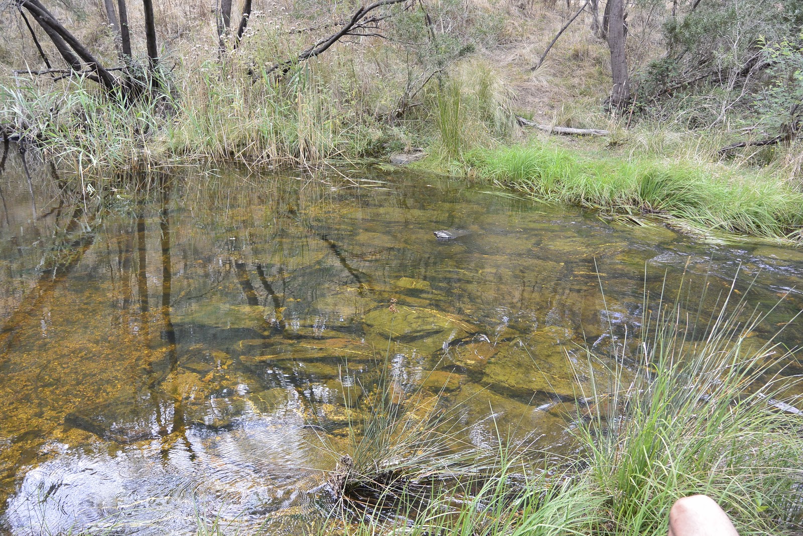
Showing posts with label Moorabool River. Show all posts

31 March, 2018

Moreep

The subject of my previous post was a short walk with a small group of interested individuals along the Moorabool River downstream of the Slate Quarry Road Bridge a short distance to the north east of Meredith. Following European settlement, this section of the Moorabool formed part of the boundary between the squatting runs of Durdidwarrah - established by Robert von Stieglitz - and Borhoneyghurk - first claimed by John Norman McLeod. As I have already written about each of these properties, I thought I would have a look a little further upriver at a third run, much smaller in size than the other two and sharing boundaries with both: 'Moreep'.
The earliest mention of 'Moreep' in the newspapers of the Port Phillip District as the area was then known, is in an 1848 listing of applications for squatting leases (Geelong Advertiser, 29th April, 1848). The applicant was J N McLeod. This was John Norman McLeod, leaseholder of 'Borhoneyghurk'. According to Victorian Squatters (Spreadborough & Hough, 1983) however, McLeod originally took up the 'Moreep' lease in October, 1837 which was about the same time at which he took up the Borhoneyghurk lease.
At an estimated 4,300 acres (Melbourne Daily News, 13th February, 1849) 'Moreep' was less than a quarter of the size of the 24,700 acre Borhoneyghurk run It was estimated that the land was capable of grazing 2,000 sheep. By January, 1850, McLeod had transferred the licences for both the Borhoneyghurk and Moreep runs to Messrs Ball and Sinclair (The Argus, 22nd January, 1850) who continued to occupy the Moreep run - populated with 4,000 sheep - until 1853 (Victorian Government Gazette No 8, 16 February 1853, 205--page 220). By February, 1854 however, the lease had passed to the Rev. Thomas Nattle Grigg (Victorian Government Gazette No 13, 14 February 1854, 327 - page 418)  who had also taken up the lease for the larger portion of 'Borhoneyghurk' which had by that time been subdivided.
Grigg's tenure however appears to have been fleeting with Hugh Morrison installed as licensee by 4th April the same year (Portland Guardian & Normanby General Advertiser, 7th May, 1854). Whilst Morrison also occupied the run for a relatively brief time, he remained in the district throughout his life. Survey maps for the Parish of Ballark show that on 7th June, 1856 he was the first to purchase the pre-emptive selection for the Moreep run - a 640 acre block a little to the east of the Moorabool River and somewhat west of the Meredith-Ballan Rd. Today, most of that block is planted with pine trees but the nearby settlement of Morrisons is a reminder of his tenure.
During the time of Morrison's occupancy, the gold rush was in full swing and an extension of what was called the Morrison's Lead, ran through 'Moreep'. Speaking in retrospect, Mr DM Morrison, son of Hugh, recalled the following (Geelong Advertiser, 4th May, 1907):
The northern extension of the lead through Moreep on the north side of the Moorabool gave a party of 20 for about 20 years a dividend of about £25 per man per week. Mr. Silas Hoyle, one of this party is still to the fore, enjoying the good things of this life upon his farm at Morrisons. 
Before the close of 1856 however, Morrison had also sold up, moving to the neighbouring Borhoneyghurk run which he occupied for the remainder of his life. Morrison died at his Geelong residence in Pevensey Crescent in 1871 and was buried with other family members at the Eastern Cemetery (Geelong Advertiser, 4th September, 1871).
The Morrison family grave in the Old Presbyterian Section, Grave 77 at the
 Eastern Cemetery, March 2018
'Moreep' meanwhile, passed to Thomas and Joseph Bray in partnership with James Wood. Between them, they were running 10 horses, 40 cattle and 500 sheep on their property and parish survey maps show that on 24th June, 1856 they expanded the extent of their holdings with the purchase of a 518 acre block of land which connected their original block `to the Moorabool River as well as two smaller blocks to the east of about 142 acres, which provided frontage to the Meredith-Ballan Rd.
Wood did not remain long in the partnership, leaving the Bray brothers to run the property alone which they did until 1861 when they were forced to declare their insolvency (Victorian Government Gazette No 177, 3 December 1861, 2325--page 2352). Originally, the pair were drapers who had been resident in Geelong since the 1840s (Geelong Advertiser, 25th June, 1849), where they ran their business in the Market Square. Like many at the time it would seem they decided to try their hand as pastoralists, apparently with disastrous financial results.
Following their failed venture at 'Moreep', the pair moved back to Geelong where Joseph returned to the trade he knew best, operating a drapery store (Geelong Advertiser, 22nd December, 1869), a business he successfully pursued for many years.
An image of Moorabool St, Geelong 1852 looking south west. "Bray's Drapery
Warehouse" is the light coloured building left of centre. Image held by the
State Library of Victoria. Click to enlarge
By 1872, his brother Thomas had moved to Sebastopol near Ballarat where he entered into community life, serving as a Justice of the Peace. In 1871 he was elected mayor of the Borough of Sebastopol and held the position until 1873. By the 1880s however, Thomas had moved to Corowa in New South Wales where he owned a grocery and drapery store (Weekly Times, 29th June, 1929) and also a vineyard - Mossgiel - where he lived until his death in 1907 (Melbourne Leader, 2nd July, 1898).
Joseph died at his Laurel Bank Parade home in Geelong at the age of 93 in 1919 (Geelong Advertiser, 11th January, 1919) and was buried at the Eastern Cemetery.
During their tenure at 'Moreep', it is clear that Thomas resided on the property with his wife and children as family notices show that two of his children died on the property in 1860 - one a stillborn baby (Geelong Advertiser, 30th January, 1860), followed later that year by his five year old son Thomas Charles who contracted diphtheria (Geelong Advertiser, 24th November, 1860). The child's body was returned to Geelong for burial at the Eastern Cemetery.
With the departure of the Brays, the next tenant to occupy 'Moreep' was Charles Samuel Morrow who by that time was also the licensee at nearby 'Bungal' and like others his tenure at 'Moreep' was short-lived.  By 1863, he was selling up and in May that year it was reported  that Morrow had sold the property for the sum of £10,000 to George Bassnett and John Bennett Evans, stationers from Ballarat turned graziers (Hamilton Spectator and Grange District Advertiser, 8th May 1863). The brothers however had seriously overcapitalised and were declared insolvent by 1864, having paid only £2,500 of the purchase price (The Argus, 14th April, 1864).
The Evans Brothers' substantial printers and stationers store in Lydiard St
Ballarat, 1861. Image held by the State Library of Victoria
And so, by early 1864 'Moreep' was on the market once again (Ballarat Star, 17th February, 1864). It was advertised as consisting of 2,030 acres of freehold land and a further 3,000 acres of land leased from the Crown. A house consisting of six rooms plus various outbuildings stood in in a ten acre garden which was planted with fruit trees and vines. Facilities for stock, including a wool shed and draughting yards for both sheep and cattle had been constructed and the titled land was fenced.
The next owner of 'Moreep' was a Scotsman by the name of Donald McKinnon from the Isle of Skye who had moved from South Australia with his daughters and wife Elizabeth. However, his tenure was also brief as he died at the property later that same year. Despite this, his family remained at 'Moreep' for many years until 3rd March, 1898 when disaster struck. At around 4am Elizabeth who was living there with one of her daughters awoke to find their home (by now an eight-roomed timber structure) on fire. With no water to hand and no help nearby, the house burnt to the ground. It was suspected that a spark from the kitchen started the blaze (Geelong Advertiser, 5th March, 1898). After this time, Elizabeth leased the property out and moved to St Kilda where she died at her home some five years later on the 26th September, 1903 (The Argus, 28th September, 1903). She was buried with her husband Donald at the Meredith Cemetery.
The next chapter for 'Moreep' saw the property purchased from the McKinnon daughters in 1911 by Mr William Rhodes. The sale included a homestead which presumably had been rebuilt after the fire (Hamilton Spectator, 9th March, 1911). Whilst Rhodes and his family retained ownership of the station for many years, they chose to base themselves at 'Bungeeltap' which they purchased in 1922, instead installing a manager - Rodolph Paulden - at 'Moreep'. The Paulden family were still in residence on the property at the time of Rodolph's death in 1952 (The Argus, 11th December, 1952).
After this time, I can find little information about the property but do know that by October, 1970 it was on the market once again (The Age, 24th October, 1970). More recently, according to the Australian Government Business Register, the Parsons Moreep Pastoral Trust held an Australian Business Number (ABN) which was cancelled in 2016, however it seems that much, if not all, of the property is in the hands of a Colac-based company by the name of Australian Kiln Dried Softwoods (AKD Softwoods) who from the mid 2000s began planting the property out with pine trees to supply their various timber products.
'Moreep' as seen on Google Earth today. The map shows the approximate extent
of the original squatting lease (red) as well as the 640 acres of the pre-emptive
right (green) and the current holding (yellow)
Today, 'Moreep' is covered almost entirely by pine trees (see above) which continue to mature. The venture however is not without its risks as the company newsletter Splinter illustrated when its February/March edition for 2014 described the loss of 3.2 hectares of trees during a fire started by lightning strike in hot summer conditions.

24 February, 2018

Branching out: a walk along the Moorabool

Recently I had the opportunity to view a section of the Moorabool River which I had not seen before. At the invitation of Cameron Steele - co-ordinator of the community group People for a Living Moorabool or PALM as they are known - I accompanied a small group of interested walkers along a short section (a little over 3km) of the river heading downstream from Slate Quarry Road where it crosses the Moorabool to the north east of Meredith. The bridge of the same name which crosses the river at this point dates, I believe to 1922, and may be the topic of a future post.
Slate Quarry Bridge, February, 2018
Over the course of several hours we made our way along the riverbank, sometimes walking easily, sometimes rock-hopping and scrambling, sometimes climbing up the occasional steep incline.
A small gravel island mid-stream

The geology of the river through this section varies significantly. In some places, sections of the slate for which the nearby bridge and quarry were named can be seen whilst in others, aeons old granite is visible. The relatively newer basalt which flowed from nearby volcanoes active within the last few million years, now covers sections of the older landscape and in places, these relatively recent lava flows have even changed the course of the river, filling the original river valley and forcing the river to find a new course through the rocks.

Somehow, the eucalypts manage to gain a toehold in the rocky soil

In a number of places, large rocky outcrops such as this dramatic example
tower over the river below
In places along the length of the river, refuge pools - some of them measured at over 8m deep - provide protection for aquatic life during periods of low river flow and in drought conditions. At the time of our walk, water levels were falling after the release of an environmental flow or "summer fresh" designed to mimic the variable seasonal water flow of the river prior to European settlement.


An elevated view of a natural "beach" formed along the riverbank
With the combined knowledge of the group we were able to observe a variety of native plant species such as cherry ballart - a native species of sandalwood - banksia and of course a multitude of eucalypts. Unfortunately, in addition to the native species, we also observed a number of invasive weeds in the form of willows, thistles, gorse bushes and some sizeable stands of blackberry.


A small stand of silver banksia finding purchase up the bank
Finally, we completed our walk by removing our footwear and wading across a shallow, rock-lined section of the river; a pleasantly cool experience on a warm summer's day. From there, it was a short walk up an access track to where Cameron's trusty Land Rover was waiting to return us to our starting point.
River crossing at the end of our walk
Whilst access to large sections of the river are at present limited, PALM are currently consulting with various agencies - including local landowners and the Corangamite Catchment Management Authority (CCMA) to investigate ways in which interested members of the public can access and interact with the river at various places with a view to increasing public involvement and support for what has been described as Victoria's most stressed river system.
More details on the Moorabool, its flora and fauna, cultural significance, maintenance and recreational opportunities can be found on the CCMA's  Living Moorabool Project pages.

19 October, 2017

'Lawrence Park'

The Learmonth family of squatting fame first arrived in Australia in the 1830s when Thomas Learmonth Senior established himself as a merchant in Hobart Town. In April, 1837 his sons Thomas and Somerville were amongst the first squatters to take up land in the newly-established Port Phillip District of New South Wales. As members of the Port Phillip Association (later the Derwent Company), they occupied land along the Barwon River up to its confluence with the Leigh River, beating out their competition in the form of the Clyde Company under the management of George Russell.
With their preferred land on the Barwon unavailable, the Clyde Company instead set up operations along the Moorabool River, north from Fyansford and west across to the Leigh River at Shelford. However, the Port Phillip Association once again got the jump on the Clyde Company when the first land sales were held for the parish of Gherineghap in February, 1839.
The Association disregarded the gentleman's agreement which prevented squatters from purchasing the land on which other land holders were squatting. Outbidding their rivals at the Sydney auction, they snapped up much of the land from Fyansford to the future site of Gheringhap along the Moorabool where George Russell was squatting and along the Barwon as far as Bruce's Creek.  Their success however, came at a cost. Philip Russell (half brother of George and shareholder in the Clyde Company) was able to force the sale price up to 28 shillings per acre. The Russells meanwhile, quickly stripped the land of the improvements they had made - huts, stockyards, tents, even a wool shed - and retreated to what had until then been their outpost on the Leigh River.
Google Earth map showing the boundaries of the 1839 land purchases of the
Port Phillip Association and the Learmonths as shown on the Gherineghap
Parish Survey Maps
Amongst the members of the Port Phillip Association was Thomas Learmonth Sr who is widely reported to have taken up the land after purchase before passing it to his youngest son Dr John Learmonth. In addition, the parish survey map shows that 611 acres west of Batesford was also purchased in John's own name. Meanwhile, his brothers Thomas and Somerville had headed north early in 1838, establishing first the Boninyong Estate, then the property known as Ercildoune.
In 1845 John began building a homestead on the property to replace an earlier building which according to the book The Stepping Stone: A History of the Shire of Bannockburn, Derek Beaurepaire (1995) had accidentally burnt down during an attempt to smoke out a swarm of bees.
By 1846 along with his wife - Alicia Macwhirter - John was living at the property which he called 'Laurence Park' (later 'Lawrence Park') after his father Thomas Learmonth's estate at Falkirk, Scotland. It was here that three of their ten children were born. In January that year, Alicia gave birth to a daughter who died two days later (Geelong Advertiser & Squatters' Advocate, 10th January, 1846). A second daughter followed in 1849 and a son in 1852.
In January 1854 however, John, his wife and their children (eight at that time) boarded the ship Kangaroo and headed back to Britain. 'Lawrence Park' was advertised to let as house and garden (Geelong Advertiser & Intelligencer, 7th March, 1854). It would seem perhaps that the lease was not taken up as the Australian Dictionary of Biography entry for the Learmonths indicates that after John's departure, his brother Andrew managed the property on his behalf from 1854-1855. By 1856 the property was once again up for lease, this time advertised "to be let for five years, with possession on the 1st April, the House, Garden, and Vineyard at Lawrence Park, Bates Ford, the property of Dr. Learmonth, together with about 200 Acres of fenced land" (The Argus, 30th January, 1856). John Learmonth and his family did not return.
'Lawrence Park' 19th September, 1971. Image from the J.T. Collins
Collection, La Trobe Picture Collection, State Library of Victoria
Like John, all of the Learmonth brothers were essentially speculators who eventually returned to their native Scotland. By 1867, 'Lawrence Park' which had been tenanted for some time was in the hands of neighbouring land owner George Hope of 'Darriwill' who soon on-sold the property to settler George Hill who for a time had been a tenant of the Hope family (The Leader, 23rd February, 1867).
The Hills were Scottish immigrants who had arrived in Australia in April, 1853 as assisted immigrants aboard the ship Confiance. With George on the voyage was his wife Sarah, and their young children James, Philip and George Jr. In the following years to 1870 a further seven children were born to the couple.
At the time of the Hills' arrival, the house was described by the Melbourne Leader on 23rd February, 1867 as:
possess[ing] historical interest, on account of its comparative antiquity; the walls are as massive as those of many a castle; the stone, probably, was found hard to work, but whatever the reason, the building has a rough and rather primitive appearance, although roomy, extensive and lofty.
After purchasing the property however, the Hills undertook extensions, adding a south wing during the 1860s and today, the Victorian Heritage Database gives the following description:
an h-shaped colonial vernacular building with gabled roofs. The earliest part is brick, that is, the north wing and middle section of the H. The south wing constructed in the 1860s is of random rubble. There are verandahs on the north and east sides. The house has been altered over the years and little remains internally of the original features. The only section in original condition is the upper level of the stone wing. A steep, narrow timber stair leads up to it. The overall condition of the building could be described as good, although the soft early bricks are deteriorating at floor level.
George ran the farm until his retirement in 1889 when he held a clearing sale and let the property to tenants (Geelong Advertiser, 4th April, 1889), retaining ownership until his death in 1909 at which time it was purchased at auction by his son Phillip. George and Sarah (died 1901) are buried in the Church of England section of Geelong's Western Cemetery in adjacent plots.
Grave of George and Sarah Hill, Western General Cemetery, Church of England
Section, Row 1, Graves 1249 and 1250
Philip in turn ran the property with his own family before retiring to Geelong in his later years. Philip died in 1931 and was buried next to his wife Mary Jane, not far from his parents. Newspaper notices suggest that his son George continued to,manage the property after his father's death until 1933 when the property was auctioned by the estate trustees (Geelong Advertiser, 14th October, 1933).  In August the following year, a clearing sale was held on the property (The Argus, 11th August, 1834) however presumably a sale was not negotiated as the lease of 'Lawrence Park', Gheringhap was listed in The Age, 18th April, 1934 and by 1940 Garry George Hill, son of Albert Alexander - Philip's younger brother - was running the property. Along with his wife Ella, Garry made a number of appearances in The Weekly Times during the 1940s and 1950s, promoting the benefits of the district and showcasing the prosperity of 'Lawrence Park'.
Photograph of members of the Hill family at the Geelong Sheepdog Trials,
Geelong Advertiser, 31st August, 1949, captioned " Mr. J. Pettitt (right),
Chairman of the Sheep Dog Trials committee, with Mr. and Mrs. G. G.
Hill, Mr. M. Hill and Miss D. Hill from Batesford"

 The couple had four children but it was their younger son Ian James Hill who was noted as still being in residence in 1995 (The Stepping Stone: A History of the Shire of Bannockburn, Derek Beaurepaire (1995). Ian had married Sheila Pilkington in 1953 in Melbourne but I imagine that it was on the property at Batesford that the family made their home.
Today, the property remains in the Hill family, with the current addressee listed as G M Hill and the house built by John Learmonth in 1845, then extended by the Hill family still stands as a reminder of the earliest days of European settlement in the Port Phillip District.

30 July, 2017

Fred Kruger

From the earliest days of European settlement, artists recorded the environment in which they found themselves and often their sketches, paintings and later photographs included the creeks and river systems of the regions they visited or in which they lived. This was also true of the Barwon River catchment. In the earliest days of settlement, artists such as George Alexander Gilbert, Samuel Thomas Gill, Charles Norton, Louis Buvelot, Eugene von Guerard and a host of others, recorded their surroundings and in the process created some of the region's best known artworks.
By 1879, a noted landscape photographer by the name of Fred Kruger had established himself in Skene St, Newtown and was rapidly becoming known about Geelong. In November he was invited to photograph the opening of the new Corio Bay Rowing Club boat shed, located near the Yarra Street Pier (Geelong Advertiser, 29th November, 1879). The following month, he was commissioned to photograph both the exhibits and the building when the newly-erected Geelong Exhibition Building hosted an Industrial and Juvenile Exhibition, boasting some 30,000 exhibits.
Geelong Exhibition Building, Fred Kruger (1882), Image held by the
State Library of Victoria
Over the course of the next eight years, Kruger contributed greatly to the photographic record not only of Geelong, but the entire region, including the Barwon, Leigh and Moorabool Rivers. So who was Fred Kruger?
 Johan Friedrich Carl Kruger was born in Berlin, Germany on 18th April, 1831 to a working-class family and as a young man, went into business as an upholsterer. By April, 1863 when his wife Auguste Wilhelmine Elisabeth Bauman and their three year old son Hans arrived in Victoria on the ship Macassar, Kruger had already settled in Rutherglen where he was a partner in his brother's furniture business which had operated since 1854. Soon after their arrival, a daughter was born to the couple and Kruger became the sole owner of the business which he sold before moving to Taradale where he established himself as a cabinet maker.
The births of two sons were registered at Taradale in 1866 and 1867 but the family did not remain long in the area, instead moving to Melbourne where Fred established a photography business in Carlton, later moving to Prahran then Preston. He soon developed a reputation as a landscape photographer, winning awards both internationally and in Australia as well as receiving acclaim for his photos of indigenous Australians.
Auguste and Fred went on to have a further six children, all born in Melbourne however at least five of their nine Australian-born children died as infants in their first year of life. Then, some time during the late 1870s or early 1880s Kruger and his remaining family moved to Geelong where they lived in Skene St, Newtown.
During his time in Geelong he took numerous photos of local scenes, travelling also to surrounding towns including Queenscliff, Point Lonsdale, Ballarat, Werribee, Winchelsea, the Otways and many places in between.
The Leigh River, near Inverleigh, Fred Kruger, 1882. Image held by the State
Library of Victoria
In order to make a living, Kruger accepted commissioned work both from the government and local landowners who wanted a visual record of their estate. He is also known to have taken photos of the Barwon in flood as well as shipwrecks off the coast at Point Lonsdale, as images of such events were popular with the buying public.
Kruger's 1881 Photograph of the paper mill at Fyansford. Image held by the
National Gallery of Victoria
I suspect, but do not know, that Kruger's photo of the paper mill may have been taken not long after extensive flooding hit the region. Kruger's photo above shows the ana-branch which connects the Barwon (left) to the Moorabool (right) a short distance above the confluence of the two rivers. Between the river and below the ana-branch is the almost completely denuded Redgum Island. In my image below, the course of the now tree-lined ana-branch runs through the middle of the shot with the lines of the rivers just visible to either side as an indentation in the trees.
A similar view of the paper mill taken May, 2016. At the time, I had no idea
I was standing so close to the spot where Kruger stood some 135 years
ago to take his photograph
In addition to a number of photographs taken near Batesford and the now non-existent town of Viaduct on the lower reaches of the Moorabool, Kruger also visited both Lal Lal Falls and the nearby Moorabool Falls in 1882, perhaps on his way to Ballarat.
The Moorabool Falls on the Moorabool River near Lal Lal, as seen by Kruger
in 1882. Image held by the State Library of Victoria
Moorabool Falls, April, 2012
On the 15th February, 1888, after contracting peritonitis, Fred died at the home of his son in the Melbourne suburb of Surrey Hills. His wife Auguste lived a further 25 years, dying at Preston in 1913. Over the years, his photographs have remained popular and as recently as 2012, the National Gallery of Victoria who hold a large number of his photographs, hosted the "Fred Kruger: intimate landscapes" exhibition. An earlier exhibition was held in 1983. Many of his works can also be found in digital format across the Internet.


30 November, 2016

Still standing

By the late 1850s, Batesford was a thriving township boasting a blacksmith's forge, bakery, post office, two shoemakers, four hotels, a museum and free library built by Henry Aaron Smith, two schools, three churches and a boarding house. On the outskirts of town was a pound and downstream from the town, the Hope family had erected their flour mill on the west bank of the Moorabool. A police barracks also stood west of the river, north of the road to Ballarat to service the gold escorts, whilst surrounding farmland had become popular with the many vignerons and orchardists - predominantly from Switzerland - who chose the fertile Moorabool Valley to plant their fruit.
By 1861 the population had grown to 254 people (Ian Wynd, So Fine a Country: a history of the Shire of Corio, 1986) and what began as a rough ford was now the main river crossing on the road to the goldfields and the Western District. As late as 1858 however, travellers on this busy road still relied on a timber bridge to cross the river.
An early view of Batesford looking north-west c1866-1880 by John Norton.
Image held by the State Library of Victoria
 Surprisingly perhaps, the decision to construct a more permanent bluestone bridge at the crossing in 1859 occurred with very little fuss at all by comparison with the complaints and criticisms which accompanied the reconstruction of the previous bridge in 1853. Prior to construction, there were no complaints about the condition of the timber in the old bridge, nor were there reports of flood-damage and the rebuilt timber bridge was little more than five years old when in 1858 tenders were called for the construction of a new stone bridge. Whilst I have found no official explanation for the decision to build the bluestone bridge at this time, I suspect that the construction of the Geelong-Ballarat railway line about a mile to the north of Batesford may well have been the deciding factor. According to Bettina M Blackall (On the other Side of the 'Ford: A Heritage Trail, Geelong Historical Records Centre) the bridge was designed by the Victorian Government Board of Land and Works who were also responsible for designing the Moorabool Viaduct which still carries the lien over the Moorabool River today.
A distant view of the Moorabool Viaduct, November, 2015
Commenting on the construction of the railway on 5th January, 1859 the Geelong Advertiser noted that:
...it is a mistake to suppose that railways supersede ordinary roads and bridges ; on the contrary, the more the railways are extended, the more will common roads be required. There will be less continuous traffic on the highways, but their ramifications must be extended and the tracks kept in good order.

It would seem then, that the Government was well aware of the need for additional infrastructure to support its huge investment in the new railway line and Batesford in this instance, was the beneficiary.
Prior to the bridge works getting underway however, £3,200 was also allocated "to complete the construction of the Ballarat road between Geelong and Batesford" (Ballarat Star, 16th December, 1858). Next the Victorian Government Gazette published a notice on 31st December, 1858 declaring that they had accepted a tender "For erecting a bridge over the River Moorabool, at Batesford".
The successful contractor with a tender of £ 3885, 19s, 6d was Mr David Barry who held several other contracts in the district. His bid had been selected ahead of five other tenders and the Government was no doubt pleased with its choice as construction seems to have progressed smoothly and with little disruption.
Building a stone bridge however, took time. Construction got under way in February, 1859 and on 5th April the Geelong Advertiser declared that it would be a further five months before construction was complete and gave the following assessment of the progress thus far:
The bridge will have five arches and here, as at the Viaduct, piles must be driven before the foundation can be laid, as no bottom can be got more solid than mud, without digging to an unreasonable depth. Piles have already been driven for three of the piers and the stonework has been carried above the winter level of the river. The rains, therefore, will not interfere with the further progress of the work. The appearance of the river at present would not justify to the eye of a stranger, the large dimensions and solid make of the bridge in course of construction. The water lies here and there in pools in the bed of the river, and where it crosses the direct line of the road it is dry. The raised approaches to the new bridge on either side of the river are in course of completion. There are said to be forty men employed on the work.
The solid design of the Batesford Bridge was similar to that of the bridge at Richmond, Tasmania in that none of its five arches included a keystone. The basalt used in its construction was quarried locally from the same source used to supply the material for the nearby Moorabool Viaduct.
Once construction was underway, it was elected to use rubble masonry rather than the more expensive ashlar masonry, meaning in the case of the Batesford Bridge, that the bluestone blocks were not cut to a regular width, but instead used whatever lengths were available. This being said, coursed rubble was used, meaning that although the lengths varied, the stones were still laid in regular, horizontal courses of even height.
In mid-June, further details of construction emerged:
The abutment piles had been driven to a depth of 26 feet, whilst those for the central piers were 28 feet deep. With 70 men now on site, the abutment on the western bank was almost complete with that on the east bank requiring a further two week's work. The piers had been built to a height of 10 feet above the summer water level and were 8 feet thick at the base, narrowing to 4 feet 6 inches.
Construction of the arches - each to measure 30 feet across - was just beginning, starting with that closest to the west bank. To assist in this process, a mobile crane erected on a scaffold was used to lift the arch stones into place. The underside of each arch would stand 19 feet above the summer river height and around two feet higher than the flood of 1852 - the largest recorded since European settlement. The width of the bridge was 20 feet with stone parapets rising on either side, thus preventing the kind of accidents which seemed to occur with alarming regularity on the previous timber constructions (The Argus, 14th June, 1859).
By 7th October The Argus further claimed, things were progressing so well, that the stonemasons and a number of the other men employed in the building process voted to hold a public dinner in honour of the contractor Mr Barry.
By this time the bridge must have been all but complete and if not already, then very nearly open to traffic. It was not until 2nd January however, after some small alterations to the original cost estimate, that responsibilty for the bridge passed from the contractor to the Government. Once again The Argus (13th January, 1860) was at pains to point out the good working relationship between Mr Barry, his men and the district engineer.
Batesford Bridge, Moorabool River painted by prominent Australian artist
Walter Herbert Withers, some time after his arrival in Australia on
New Year's Day 1883
One one point however, there was significant discord: the approaches to the bridge were as steep and dangerous as ever. Whilst a significant sum had been voted towards the completion of the road between Geelong and Batesford at the end of 1858, this did not it seems, include safety measures on the riverbanks at each end of the bridge or changes to the alignment of the road descending into the Moorabool Valley.
On 14th June, 1859 whilst the bridge was still under construction, The Argus pointed out that mishaps on the descent to the river had cost four lives and caused the deaths of numerous horses and bullocks and a significant loss of property. The correspondent further claimed that:
Representations have in vain been made to the Government, the Road Board, and the District Engineer. The disgraceful state of the hill remains unaltered, and most likely will do so until a coach-load of passengers, containing some man of importance, shall be precipitated into the chasm that is ever yawning at the bottom of the hill. I had no idea that this portion of the road was so dangerous as it is, and was surprised to find that, although £10,000 [a slight overstatement] is being spent to put an excellent stone bridge over the Moorabool, not a pound is to be spent in making this approach to it safe. This exhibits the most wanton disregard of public safety, and cannot be too severely condemned. There is every facility for improving and altering the road down the hill, by giving it a greater sweep, and the expense would be a mere trifle compared with the advantages to be gained.

By the time the bridge was complete and ready for handover in January, 1860, the issue of the approaches was still outstanding as The Argus (13th January, 1860) was once again keen to point out:
As usual, however ... the approaches to the bridge have not been protected. Although it has been open now for months, there is nether fence nor wall on either side to prevent a vehicle or horse from going over. It is, and always will be, dangerous until this is done. Nothing has been done, either to diminish the danger of that dangerous hill leading to the ford on the Geelong side ; the declivity is still as great, the road still as narrow, the turn at the bottom still as sharp, and the huge drain as deep and hungry-like as ever, still yawning for more human victims. Perhaps some day a great catastrophe may draw attention to this dangerous road, and the district engineer or surveyor may find himself in a very uncomfortable position ; he has had warning enough already, in the number of lives sacrificed. But it is strange that the inhabitants at the ford and persons using the road do nothing to get it improved.

The five-span bluestone bridge at Batesford, November, 2016
And so it continued until April, 1860 when local MP Peter Lalor of Eureka fame, took the community's grievance to the Commissioner of Roads and Bridges, arguing for realignment of the road. Finally, in a letter from the Commissioner dated 12th April, Lalor was assured that the issue would be addressed "as soon as the Road Engineer [could] spare the time to prepare specifications.
Despite this, it was a further eight months before a contract for £791, 12s, 6d was awarded to George Scithers to complete the "alterations at East-hill, Batesford" (The Argus, 15th December, 1860), and not a moment too soon it would seem, as it wsa stated only days later that the road was in a bad state due to recent rains.
Eventually however, Batesford had its new, flood-proof stone bridge (presumably with an improved approach, although I can find no further mention of the realignment), which continued to carry traffic across the Moorabool River for more than a century. It survived its biggest test in 1880 when the largest flood ever recorded hit the Moorabool River, submerging the town of Batesford, leaving only the spire on the Catholic Church above water. Dozens of residents had to be rescued by boat from the rising floodwaters which rendered virtually every home and business in the town uninhabitable. When the water receded however, Barry's bridge was intact.
The modern Batesford Bridge which today carries traffic on the Midland Hwy was constructed in 1971. Unlike other modern bridges in the region, I can find little information either about its construction or its specifications, other than a mention in the country Roads Boards's Fifty Eighth Annual Report for the year ending 30th June, 1971 which noted that the bridge was one of a number which used a new technique of driving steel H piles into the ground to the required depth to provide support for the piers upon which the bridge would sit.
Two pairs of concrete piers support the three spans of the deck - also concrete - with the abutments constructed from concrete and stone.
The 1970s concrete bridge on the Midland Hwy at Batesford, November, 2016
Today, the bluestone bridge built by David Barry still stands next to the Batesford Hotel but is only used as a service road. The majority of the traffic now uses the two-lane concrete bridge built in 1971.


26 November, 2016

Which Bridge?

By the end of 1848, the Moorabool River crossing at Bates' Ford - as the area was by then commonly known - had its new bridge. The wool clip could be conveyed to Geelong, travellers could pass in safety and pedestrians could cross the Moorabool without fear of falling through rotten timbers and pitching into the river below; for a while at least.
According to one local source (History of Batesford: 1842-1941, held by the Geelong Historical Records Centre) the new bridge is said to have stood in the same position as the the historic bluestone bridge stands today. That this is likely to be substantially correct is supported by an 1850 reference to the bridge and the public house being "not more than fifty yards apart" (The Argus, 22nd June, 1850). The premises in question would have been the Marrabool Inn which stood where the Batesford Hotel does today and even now the distance between the hotel and the stone bridge is almost exactly 50 yards. Like its predecessor, the 1848 bridge was a timber structure, but other than this, I have managed to find little extra detail.
Batesford Hotel and the 1859 bluestone bridge, looking west. November, 2016
In addition to the new bridge, there were also roadworks. On 26th December, 1848, the Geelong Advertiser reported that  the government had decided to "open and make certain parish roads...viz:--From North Geelong to the bridge over the Moorabool River at Bates's Ford, being part of the Great Western Road."
Prior to this, in 1840 works had been undertaken to realign the eastern approach to the river. Whether this line of road crossed the river at Manifold's Ford or via the original timber bridge is not clear, but the road followed a similar alignment to the modern Midland Hwy across the river flats at Batesford. The route from Geelong at that time was probably more track than road and followed a path which meandered across Bell Post Hill and down into the valley (see map in previous post). The alignment proposed in 1848 followed the modern line across Bell Post Hill, approaching the river via what is now the Old Ballarat Rd at Batesford which is little different to the 1840 or the modern alignment, further confirming perhaps the location of the 1848 bridge on or very near the bluestone bridge.
So for the time being, Bates' Ford had a reliable bridge. Two years prior to the construction of the bridge, the land to the east of the Moorabool had been auctioned by the government. The purchaser of allotment 10, section A, Parish of Moorpanyal, was George Hope. This 468 acre parcel of land stretched from the banks of the river, eastward to today's Geelong-Ballan Rd and included the sites of both Manifold's and Bates' fords, the Marrabool Inn and - from 1848 - the new bridge.
As a local landholder, Hope was no doubt well aware of the importance of the river crossing and, seeing a business opportunity, in 1850 he arranged for the subdivision of this block into town and small farm allotments. After an extensive advertising campaign the "Village of Batesford and Estate of Hopeton" was offered for public auction by T Horsbrugh at 12pm on the 18th July. The auction was well attended and many blocks were purchased. Any unsold land was advertised over the following months as "for sale by private bargain".
The original subdivision of Batesford Township by George
Hope. Image taken from Batesford and its Early Families,
Bettina Blackall, 1991
The following year, on 21st February, a second auction was held, followed by further subdivision and a third auction on 26th August, 1853. By this time of course, the gold rush was in full swing and business was booming. Batesford however, was once again having trouble with its bridge.
In late May, 1852 floods had yet again hit the Moorabool River. This time, the water reached the highest level seen since European settlement. In the newly-established town of Batesford, houses built in the wake of George Hope's auction, were inundated and people forced to take to their roofs to escape the rising floodwaters (The Argus, 25th May, 1852). After the water receded, the bridge which was less than four years old, was found to be in a very bad state. The Geelong Advertiser and Intelligencer reported on 25th May, that the bridge was "so shattered and ill conditioned by the late inundation, as to be extremely dangerous."
The response from government was typically slow. It was not until January, 1853 that tenders were called for the erection of a new - timber - bridge. According to the local publication Batesford - an historical background (Jennifer Warner, Geelong Historical Records Centre), the new bridge was a composite through truss structure designed by Charles Rowand. For unexplained reasons however, no tender appears to have been accepted. Instead, construction got underway immediately using day labour.
At this point however, things become a little unclear and there is some doubt as to whether the 1848 bridge was replaced completely or instead, was extensively repaired. If the latter was the case - and I tend to think it was - then the "third" Batesford bridge must have been located on the same site as the 1848 bridge. Regardless, it was not until September (Warner claims) that the works were completed and in the meantime, reports began to appear in the newspapers expressing the concerns and frustrations of the community as they waited for completion of the works:

22nd January (Geelong Advertiser and Intelligencer) "The [Batesford] bridge is very rough, and not too safe; its centre happens to present a cavity, the decent(sic) into, or ascent out of which gives the bullocks and their drays an awkward shaking." 
28th March (Geelong Advertiser and Intelligencer) "BATES' FORD BRIDGE--This unique specimen of colonial engineering is shaped exactly like a W, or a man drawn up by a cramp in the stomach. At present it is impassable, for months past it has been only dangerous. A small platform is thrown across the river for the benefit of pedestrians, equestrians, and quadrupeds, which platform half a day's rain would wash away. Via Bates' Ford, communication with the Leigh, Buninyong, Ballarat, &c, is carried on by means of a PLANK. Hear that, ye Board of Commissioners of Roads and Bridges." 
9th May (The Tasmanian Colonist) "the Government at last showed a disposition to repair parts of the roads leading to the Western diggings. They have contented themselves with patching up one bridge, that of Bate's Ford, leaving other parts of the route in a most disgraceful condition." 
14th July, 1853 (Geelong Advertiser and Intelligencer) "the broken-backed [bridge] at Batesford" 
3rd August, 1853 (Geelong Advertiser and Inelligencer) "There is one comfort for Geelong--it can scarcely be worse treated. We get little from the Melbourne Government, and are likely to get little more...
...We could wander on the banks of the Barwon, like an unquiet spirit on the shores of the Styx, and mark the ruin and the desolation there, and, turning towards Melbourne, ask, in the name of the 25,000 people why "the bridge is broke and can't be mended?" Of     course La Trobe laughs at it himself, and enjoys the fun of turning Geelong into a "galanti show" for fifteen months. He makes split-stuff of us for laughter, and carries on a wholesale business in the joke line at our expense....
...Across the Moorabool there is a bridge, evidently intended for a steeple chase, or kept in its present state out of compliment to the chamois hunters of Switzerland, having precipitous peaks, and two gorges represented by the letter W--this form being the best adapted for the transit of horses and bullock drays in the Western District.
The impetus acquired in the first descent carries the object to the next apex, where, if it could be made to turn over, we should have a correct idea of a centrifugal railway. This bridge is intended to prevent people crossing, and answers its purpose admirably. Undoubtedly, during the present winter, his Excellency has saved many valuable lives by preventing people adventuring on the Buninyong road, which probably they would have done but for this "chevaux de frise".
People blame the government, in the case of the Barwon bridge, for not repairing what is undone. In the case of the Bar [Point Henry sandbar], the government is blamed for not doing that which for years they had promised, and still promise to do, without doing. With the Bates Ford bridge, the blame is for doing badly at first, and worse afterwards. Nor is this all. The wallet is not yet emptied. There is another grievance, growing with years, heedlessly passed by, and jeeringly encountered.
The Melbourne Government is aware that there are such places as Buninyong and Ballarat, and that the traffic thither is carried on along a line of road beautifully diversified by bog, swamp, and morass, existing in primitive punity impassable to anything except birds, will-o'-th-wisps and Jack-o'-lanthorns(sic), and which has proved fatal, probably, to one mailman and two horses. This is the trunk line to the Western gold fields, and affords a prime subject, illustrative of centralisation, and the transcendent humbug employed to maintain a specious prosperity in one place. Assuming to be a fact, that which was stated in the Council, promulgated from the from the Bench, echoed by the Melbourne papers, and recently used as an argument against the reduction of the license fees, viz., that the proceeds of the gold fields are expended in police, and on roads to and from the gold fields, we maintain, upon this ground alone, that we have been robbed of a hundred thousand pounds during the last eleven months...
The comments from March and May suggest that the it was eventually decided to repair the old bridge, as perhaps does the use of day labour. Indeed an illustration produced by Engineer Rowand (see below), showing both the new and old structures together, may perhaps indicate a composite structure. Of course, if the bridge was being repaired, a separate means of crossing would be required and this was perhaps the purpose of the "plank" which was in use during March when the bridge was said to be impassable, although how long it was used is uncertain.
An illustration from 1853 taken from Batesford - an historical background
(Jennifer Warner, Geelong Historical Records Centre) which purports to show
both the old and "new" bridges and indicates normal river height and that of
the 1852 flood
Clearly, progress was slow, with the bridge still in a state of disrepair by July and seemingly still retaining its distinctive "W" shape as late as the beginning of August.  However, with the works presumably drawing to a close towards the end of that month, tenders were called to metal the Batesford Rd (The Argus, 22nd August, 1853); a road which by then was carrying thousands to and from the goldfields as the last article was keen to convey. Amongst those travelling across the bridge at Batesford, were two well known artists. One was the famous landscape painter Eugene von Guerard, who crossed the bridge on his way to the goldfields on 11th January, 1853. He described crossing the Moorabool by a very unsound wooden bridge". He did not however, stop to make a sketch - at least not one which has survived. The second artist - Henry Winkles - however did stop to draw what he saw.
His sketch was made "circa 1853" at "Bates' ford near Geelong". Winkles was an English artist, engraver and printer, who trained in both England and Germany as a draughtsman before coming to Australia. Shipping records show that he arrived in Melbourne in October, 1852 on board the Mobile from where he travelled to the goldfields to visit his son. During his time there he drew what he saw around him, making many sketches of the everyday life of the diggers. His stay in the Colony of Victoria was relatively brief, lasting a little over a year and by December, 1853 he was back in Melbourne, ready to depart for England on the appropriately-named Great Britain.
Sketch of the Bates' Ford Bridge c1853 by Henry Winkles
Whilst it is possible that he stopped at Batesford to make his sketch at any point during this time, the bridge shown in his illustration appears to be straight, definitely nothing like the warped and misshapen structure described prior to its being rebuilt. It is also worth noting the pile of timber lying near one end of the bridge, implying either construction or demolition of some sort. For this reason, I am inclined to think that Winkles sketched the new - or newly refurbished - bridge, perhaps on his way back to Melbourne to take ship for England.


So, after more than a year of frustration, delay and criticism, I assume from the crashing silence in the newspapers that Batesford finally had a bridge which was - if not state of the art - at least functional once again.

22 November, 2016

Whose ford?

For some time I have avoided approaching the topic of this blog post, partly because of more pressing subjects, but also because I knew it was going to be a complicated subject. Boy was I right!
From the earliest days of European settlement, the Moorabool River crossing at Batesford was vital to the economy of what would become the Colony of Victoria. As squatters spread out across the plains to the west and pushed north to establish vast sheep and cattle stations, the ford enabled the squatters to move their stock and their wool clips between their stations and the port at Geelong.
With the arrival of the gold rush in August, 1851, the river crossing along with the newly-established town of Batesford witnessed the passage of thousands of diggers making the journey to Ballarat and beyond, hoping to strike it rich on the fabled goldfields of Victoria.
In addition to being an important river crossing, the land around Batesford was also one of the areas first settled when the Port Phillip district was established in 1836. Amongst the earliest settlers to arrive in the district were the Manifold brothers Thomas, John and Peter who - they claimed - were the first to land sheep at Point Henry near Geelong during September and October, 1836. From there, they travelled with their stock to the banks of the Moorabool where they took up land either side of the river from its confluence with Sutherland's Creek to a point below where the township of Batesford now stands. Here they built a slab hut and established a ford. One local source informed me that the Manifold's Ford was situated very near where the two road bridges stand today, giving the settlement its earlier name of Manifold's Ford. A moniker which stuck until about 1845.
By April, 1839 however, the Manifolds had become concerned by the encroachment of other squatters and increasing government regulation and decided to leave the district, moving further inland away from the more closely settled areas. At this time they relocated north west to Lake Purrumbete, leaving the land they had occupied, open for settlement by others.
Underneath the modern road bridge, at or near the site of Manifold's ford,
November, 2016
In the absence of the Manifolds, those eager to establish themselves, moved into the area. One of the earliest was George Russell who, acting on behalf of the Clyde Company, occupied land on the west bank of the Moorabool where he set up a base for his operations. His tenure however was also short-lived as in 1839 when the first land in the Parish of Gherineghap was thrown open for sale, he was outmanoeuvred by the Learmonth brothers. The Learmonths were shareholders in the Port Phillip Association (later the Derwent Company) who were also eager to acquire land for grazing purposes. They purchased much of the land between the Moorabool and the Barwon, including that land on which Russell was squatting. In the following years, Dr John Learmonth, son of Thomas Learmonth Senior built his homestead 'Lawrence Park' on the banks of the Moorabool north of the ford. Russell had no choice but to leave, so he packed his belongings - tents, huts, stockyards and all - and removed himself further to the west where he established a base on the Leigh River.
With the Learmonths occupying the west bank, by 1839 another family - brothers by the name of John and Alfred Bates - moved onto the vacant land left by the departure of the Manifolds on the east bank of the river. According to a section of an 1840 survey map reproduced in Ian Wynd's book So Fine a Country: a history of the Shire of Corio (1981), the Bates brothers established their base just under a kilometre above the current river crossings.
Rather than use the ford favoured by the Manifold's however, the Bates established a second crossing at a point around 200m downstream which they considered easier. It was this second ford which ultimately gave its name to the town of Batesford and which became the road for those passing through the district, however this state of affairs did not last long.
The 1840 survey of the road from Geelong to Buninyong proposed a change in the alignment of the road and the point at which the river was crossed. On the map (see below) a dashed line indicates the proposed road whilst "the road now used" is marked by a heavy solid line. When overlaid on Google Earth, the proposed road follows a path quite similar to that of today's Midland Highway, crossing the river at or near Manifold's Ford whereas the existing road in 1840 veered south west off the present line of road at the bottom of the Batesford Hill. From there, it crossed the river a few hundred metres downstream from the current bridges - probably at Bates' Ford - before turning north west, crossing the Midland Highway in the vicinity of today's Blackall Rd and following a parallel path a short distance north of the highway. (Note: Contrary to the 1840 map, Wynd indicates that the Manifolds' crossing was situated "further downstream than the present bridge" and whilst he doesn't specify how far, I suspect this is a case of confusion with the later Bates' Ford.)
Add caption
Like the Manifolds however, the Bates did not remain long in the district. By 1843 after suffering two years of low rainfall, a rise in labour costs and a reduction in commodity prices, they declared their insolvency and retreated to their father's Station Peak Run at the You Yangs, leaving only their name behind.
At the Moorabool River crossing meanwhile, it seems that the new road laid out in 1840 was soon adopted. This is probably best confirmed by the establishment in 1843 of a public house. It was at this time that Charles Ruffle opened the Marrabool Inn (later known as the Derwent Hotel) on the east bank of the river, on the site which is still occupied by the Batesford Hotel to this day. His inn would have been perfectly situated on the new line of road to make the most of traffic passing across the river.
Whilst crossing the river either at Manifold's or at Bates' ford was relatively easy in good weather, when river levels rose, it could be a different prospect entirely, a fact illustrated on 19th September, 1842 when the Geelong Advertiser reported that four bullocks "were drowned at Manifold's Ford on the Marrible". The article also stated that "the only way in which travellers can take their horses across, is by towing them by ropes passed round trees on the brink of the river."
An illustration by Charles Norton dated 1848 and titled "Batesford in time of
Flood". Image held by the State Library of Victoria
Given the importance to the colonists of the crossing on the Moorabool, it is no surprise that a bridge would quickly become a necessity. The first mention of such a structure in the newspapers was in 1847 when an existing timber bridge was seriously damaged by floods. Various modern sources suggest that this bridge was erected either in or prior to 1846, although no-one is sure. Commenting on the bridge prior to the 1847 floods, the Geelong Advertiser and Squatters' Advocate (28th May, 1847) stated that "this erection has been repeatedly patched in former years, but is now in such a precarious state, that the first flood will probably carry it away altogether" implying that the bridge had been standing for quite some time prior to 1846. This would seem to be a reasonable assumption as timber bridges across the district often lasted around ten years before rot became a problem.
This does of course raise the question of why, if a bridge had existed for several years, there was need for a ford as well. Perhaps the bridge was not suitable for heavy drays and it may well have been easier to move stock via a ford which also provided them with water. Strangely, whilst both fords are mentioned regularly, I can find no description prior to 1847 of exactly how the river was crossed and whether a bridge may have been involved.
So, if an earlier bridge existed, how old was it? I could find no mention of such a structure at either Bates' or Manifold's ford prior to the 1847 floods, however as I trawled through TROVE looking for clues, I came across an intriguing snippet. In 1841, the government established a committee to investigate the possibility of using indigenous workers to fill a labour shortage in the colony and as a result, various squatters across the district were called upon to share their experiences. One who gave evidence was William Roadknight, one of the earliest squatters to arrive in the Geelong region who stated "I have been in the habit of employing the black natives upon my establishment, from June, 1836, up to the present time ; they assisted me in 1836, to build a bridge over the Marraboul River ; this was the first bridge erected at Port Phillip" (Port Phillip Patriot and Melbourne Advertiser, 30th September, 1841).
Although he doesn't specify where on the Moorabool he built his bridge, a little more digging revealed that it could well have been at or near the future site of Batesford. On 14th May, 1836 - some months before the arrival of the Manifolds - Roadknight and his three sons sailed on the Vansittart from Van Diemen's Land to Port Phillip and landed at Point Gellibrand (Williamstown). From there they, along with their shepherds and stock, travelled overland to Bell Post Hill where they camped for some time before taking up land on the Barwon River near Ceres. Could the first timber bridge at Batesford have been built by William Roadknight in 1836? Whilst I can find no other mention of a bridge in the ten years to 1846, this could certainly explain why in 1847 the existing bridge was in need of urgent repair, however any bridge built by Roadknight (perhaps in his capacity as a representative of the Port Phillip Association) would by necessity, have been rudimentary.
Corduroy bridges such as the one built at Clarendon on the Midland Hwy were a common means of crossing rivers in the early days of settlement, but these were generally low-lying structures. From context, the bridge of 1847 may have been as much as 20 feet above the riverbed (see below). Nor can I find any source which indicates exactly where the bridge was situated, other than to say it was close to "the ford" which from context was probably Manifold's Ford (History of Batesford 1842 - 1941, Geelong Historical Records Centre).
Regardless of either the age or location of the first bridge, the warning as to the condition of the bridge proved prophetic. In July, 1847 the river did flood and whilst the bridge remained standing once the floodwaters receded, it did not last long. On 24th August an attempt was made to cross the bridge with a loaded dray, but due to the rotten state of the timber, the structure gave way and sent both dray and bullocks plummeting to the river below. Fortunately the only serious damage was to the bridge which was rendered unusable. The following month on 17th September, it was reported in The Melbourne Argus that the bridge was undergoing repair and would be open again in a few days time.
Despite the repairs, it was clear that a new bridge was necessary and the local community approached the government to plead their case for a replacement. Rather than wait upon the vagaries politics however, local subscriptions to fund the bridge were taken up across the district from those who would benefit most. A new bridge was needed before the beginning of the wool season or the squatters would be unable to get their produce to market.
Image of a dray-load of wool crossing the Campaspe River in 1864. Image held
by the State Library of Victoria
Ultimately, the government did come to the party and by January, 1848 the Office of the Superintendent of Bridges was calling for tenders for the construction of a replacement timber bridge at Batesford. At the end of February the contract to complete the job was awarded to a Mr Wayman of Melbourne (Sydney Morning Herald, 23rd February, 1848) who was also the contractor for the Barwon Bridge which was being built in Geelong. Progress on the bridge at Batesford however was frustratingly slow and in the meantime, travellers were forced to use the old bridge which remained in a precarious state.
On 8th July thGeelong Advertiser reported a narrow escape for a woman and her children whose dray ran off the edge of the old bridge, plunging some 20 feet to a - fortunately - dry riverbed below. On this occasion, the bullock driver, not the bridge was considered to be at fault, but by September, things had gone from bad to worse. Work was not progressing and the contractor Mr Wayman, despite payments of £184, was insolvent. To make matters worse, the Geelong Advertiser (21st September, 1848) claimed that "this most necessary public work is about to be discontinued immediately, and is not to be resumed until after Christmas. This arrangement, or rather disarrangement, takes place in consequence of the working contractors of the Marrabool bridge having orders from Mr Lennox, to proceed instantly to complete another bridge within 40 miles of Melbourne."
Regardless of who was to blame for the lack of action, Bates' Ford was stuck with an incomplete bridge for which "the piles had been driven down, and some of the timber put in position" (Batesford - an historical Background, Jennifer Warner, Geelong Historical Record Centre) but which remained unusable. A solution was finally found when James Girvin was contracted to complete the work for a further £307, bringing the total cost of construction to £491. (Note: for those interested, correspondence regarding Girvin's contract to complete the bridge can be found online at the Public Records Office of Victoria's website in the VPRS 19/P1 series, Inward Correspondence, Superintendent of Port Phillip, 1839-1851.)
And so work once again got underway, but by October, and with the new bridge still unfinished, flooding again hit the Moorabool and the complaints once again began to mount:
 "no later than yesterday, the bridge over Bates' Ford, is said to have had no less than three feet of water on it. To add to the increasing danger of passing it under such circumstances, it is represented to have a hole in the very centre, which if not as Shakspeare says, "quite so deep as a well, nor so wide as a church door" is nevertheless sufficient to engulph(sic) any person of ordinary dimensions, or to encircle in its capacious embrace, a very considerable portion of the body of a horse! In the mean time, we may remark that the new bridge progresses so slowly as to render the period of its final completion a matter of much more speculation than certainty" (Geelong Advertiser, 17th October, 1848).

Only the day prior to the above article, perhaps even as the flood waters were receding, things took a fatal turn when a drayman walking across the bridge after leaving the Marrabool Inn, lost his footing in a hole in one of the timbers, fell into the river and drowned. Sadly, the new bridge was within days of being "passable, if not finished...and may God grant that no more lives be lost even in this short space of time. Indeed, between men being tripped into the water, drays upturned, and bullocks almost strangled in their yokes, or suffocated in the (many of which accidents happened in the course of last week) it is matter of much surprise and thanksgiving that more lives have not been lost" (Geelong Advertiser, 19th October, 1848).
Finally, in November, 1848 the long-awaited new bridge was opened to traffic and the following month, Governor La Trobe at whose command the new bridge had been constructed even took time out from a visit to Geelong, to come and see the structure. For the moment at least, Bates' Ford had its bridge.