29 October, 2011

So who was Geoff Thom?

Geoff Thom Bridge over the Barwon River
Today I visited a section of the Barwon which I have seen from a distance, but never visited. I pulled off the Ring Road into what is presumably a service area at the new Geoff Thom Bridge which spans the Barwon upstream of Baum's Weir and had a look around.
The river at this point has a rural feel to it, despite the constant traffic noise from the bridge overhead. Whilst there has been some planting aimed at regenerating the area under bridge which was disrupted by construction, not too far away, the river banks are grassy and scattered with a few eucalypts. Whilst I didn't see a wide variety of bird life, there was none-the-less constant bird noise, making a distinct counterpoint to the sounds of traffic.
The bridge itself is the usual modern concrete construction consisting of a pair of 110m long spans supported by pairs of pylons which rise from the banks and the riverbed itself. I snapped a few photos and had a quick look around, but there was lots of long grass and the weather was warm, so I didn't venture too far afield.
A glimpse of the Barwon River looking south west
from the Ring Road 
At the present time, this  part of the river isn't exactly being promoted as a tourist destination so there is not a great deal to see, however it it my understanding that there are long term plans to extend the walking track from Baum's Weir, the extra 600 or so metres required to reach the new bridge and on the opposite bank, it is suggested that a shared trail He will be developed connecting Buckley Falls to Mount Brandon Peninsula and on through newly-developed parkland to Wandana, but what the timeframe for the implementation of these improvements might be is not indicated.
It also occurred to me as I was looking around, that I had no idea who Geoff Thom was. I know who the McIntyre Bridge, the James Harrison Bridge, even Prince's Bridge were named for, but who was Geoff Thom? Google as it turns out was relatively unhelpful giving me a photo of the bridge and an reference to an article which was not on-line. A quick query to a local mailing list however solved the problem.
Geoffrey Walter Thom was born in Geelong West in April 1910. He was an accountant, first with Ford and then running his own practice. He saw military service in New Guinea, was a member of numerous local committees and an active member of the Ashby Methodist Church as well as being a Rotarian, sportsman and politician. From 1946 until 1958, he was active as a Geelong West city councillor, serving as mayor from 1955-1957. Following on from his stint in council he was an elected member of the Victorian Legislative Council from 1958 until 1970, serving as whip for the state Liberal Party in the mid-1960s under the government of Sir Henry Bolte.
In the 1960s, during Thom's time as an MLC, the idea of a ring road to carry traffc around Geelong was first tabled. He was a strong supporter of plan, lobbying parliament to get the project up and running.
It may have taken nearly fifty years for the ring road to become a reality, however the naming of the bridge over the Barwon in Thom's honour, recognises the early efforts and the foresight of one of Geelong's noted politicians.

27 October, 2011

Boats, birds and bauxite

Point Henry wetlands and Alcoa pier
Finding a connection between this blog post and the Barwon River will be drawing a long bow indeed, however having discovered yet another hidden wetland in the region (it must be the month for it!) it was too hard to resist the temptation to write something about it.
This time, I headed out to the tip of Point Henry on the edge of Corio Bay. The views from here are sweeping: the You Yangs to the north, Corio Bay away to the left, Portarlington and Clifton Springs to the west. Behind are the buildings of Alcoa's aluminium smelter and stretching out into the water just around the tip of the point is the pier. Built to receive material for processing at the smelter, it is over a kilometre in length. The plant itself was built in 1963 and currently produces about 190,000 tons of aluminium per year for both local and Asian markets.
Part of the Alcoa plant with the wetlands in the foreground
Most surprisingly however, are the wetlands. Located on the land below Alcoa at the tip of Point Henry, these partly natural, partly constructed wetlands are home to the usual array of plant, bird and animal life including a variety of endangered and threatened species. The wetlands have been developed by Alcoa who own the land, in conjunction with Greening Australia. They include both saline and freshwater wetlands fed primarily by rain water and by some recycled water from Alcoa and controlled by a series of mini-weirs.
The "Moolapio" project as it is known also incorporates much of the surrounding land, including not only the foreshore, wetlands and smelter site, but also farmland.The whole is part of an innovative grasslands regeneration program which if successful, may change the way revegetation is managed across the country. It is also intended that the site be used for community education, scientific research, plant propagation and seed storage, providing a valuable resource for other regeneration projects in the region and beyond.
weir controlling water levels in the wetlands
Point Henry however, was not always the industrial wasteland it appears to many to be today. In the earliest days of European settlement, Point Henry was the first point of contact for those arriving in Geelong. The sandbar which blocked the mouth of Corio Bay prevented large vessels from entering, so it was at Point Henry that these ships unloaded their passengers.
As a result, a thriving tourist industry also developed here, with the 'California Tea Gardens' opening its doors in  October 1849. This name was an acknowledgement of the number of people leaving the district and traveling to the Californian goldfields to try their luck. It was not long however, be for the tide turned and waves of gold seekers were arriving at Point Henry on their way to the goldfields of Ballarat and Bendigo in the early 1850s.
During this period, Point Henry also became a popular destination for tourist boats, with steamers running back and forth across the bay from Melbourne, bringing holidaymakers for a day at the beach. This state of affairs continued until the 1880s when the opening of the Hopetoun Channel allowed for the passage of larger vessels directly into the port of Geelong.
View of Point Henry Wetlands and Alcoa's pier
Following the demise of the tourist trade, Point Henry remained a signal station for incoming shipping whilst the surrounding land continued to be used for farming purposes. That noted Geelong resident James Harrison, inventor of refrigeration, founder of the Geelong Advertiser and one-time resident beside the Barwon River (I knew I'd find a connection) also held a block of land at Point Henry where he lived with his third wife and children in a small cottage. At the time of his death in 1893, he was planning to make soda on the site.
Another important early industry at Point Henry was the Cheetham Salt Works, established by Richard Cheetham - an English industrial chemist - in 1888. Today, the salt works form part of Alcoa's wetlands project whilst the company itself is now part of a multi-national operation with interests in Australia, Japan, Indonesia and New Zealand.
Including the saltworks, Alcoa currently own around 500 hectares of land around the smelter at Point Henry and continue to work with environmental groups and the community to regenerate the surrounding land.

19 October, 2011

Another hidden gem

Today I rediscovered a lake which I had not visited for more than ten years; and in the bright sunshine of our first 30 degree day of the season, Blue Waters Lake in Ocean Grove did indeed sparkle like a jewel - a sapphire.
Blue Waters Lake, Ocean Grove
This very pretty little lake is another of the wetlands which drains ultimately into Barwon River. It has been substantially developed in recent decades, but was originally a natural lagoon. Like Balyang Sanctuary, Jerringot Wetlands and Gateway Sanctuary, it now filters stormwater, trapping harmful pollutants before they can end up in the larger river system. A City of Greater Geelong council report from 2003 acknowledges the vital importance of the lake in collecting and treating a significant proportion Ocean Grove's stormwater runoff and looks at ways to improve water quality. It also recognises the value the local community places on the lake as a recreational facility.
Hardhead Duck
Like the other wetlands along the river, Blue Waters is home to a sizable bird population. Today I noted at least a dozen species after only a cursory check, including quite a number of Hard Head Ducks. The only other place I have seen hard heads was a pair at Jerringot Wetlands a few months ago. Aside from a tendency to dive every time I attempted to take a photo, they were reasonably unconcerned by the presence of people.
Unlike the other wetland areas along the river, Blue Waters has a substantial number of non-native plantings, which whilst probably not helpful environmentally, make the lake significantly more attractive. These include quite a number of large willows at the water's edge which along with interspersed native plantings screen out many of the houses which border the lake.
Today's walk did not see us complete a lap of the lake, so I will return in the not too distant future to take a few more snaps and count a few more birds.

A hidden gem

Gateway Sanctuary, Leopold
Tucked away next to the busy Bellarine Highway is a sanctuary. I had driven past this place for years without noticing it was there, until a recent excursion landed me in its midst. Called the Gateway Sanctuary, it is located in Leopold on the corner of Melaluka Road and the Highway.
This little pocket of parkland consists of a series of shallow lakes and islands connected by wooden bridges with unsealed walking tracks in between.
Gateway Sanctuary, Leopold
Stormwater drains into the complex from nearby areas of Leopold situated to the north of the highway and - as is the case with other such wetlands - the flora and fauna which thrive here act as a biological filter, cleaning the water which passes through. Whilst this naturally swampy area is now a man-made rather than a natural wetland, it didn't take long for me to discover that water from the sanctuary drains into Reedy Lake and ultimately into the Barwon, thereby qualifying this hidden wetland as a suitable topic for this blog.
Like the Jerringot Wetlands and Balyang Sanctuary further up river, the Gateway Sanctuary is located at a distance from the river/lake but boasts the usual array of bird life. A quick count on a couple of occasions has so far turned up about twenty-four different species of birds, all of which I have seen on other parts of the river at one time or another.
Black swan and sygnets at Gateway Sanctuary
Possibly the most interesting inhabitants at the present time are a family of black swans who are by far the biggest birds around. Why they have chosen this small wetland as their home, rather than the much larger expanse of Lake Connewarre as many of their compatriots have done, I have no idea.
Due to its location, this park is a strange mix of urban and rural. Periodically and in sequence with the traffic lights, noise from passing traffic overrides the more natural bird noises which predominate in quiet moments, whilst a short distance away, the calls of sheep and cattle from adjacent farmland provide a further interruption to the sounds within the park.
Somewhat disappointingly, I can find very little information about the establishment or development of the sanctuary, so if anyone knows more please fill me in.

15 October, 2011

The boys (and girls) are back in town!

Jayco Herald Sun Tour 2011, stage 2 - riding up the Deviation
For a few brief moments on Thursday and Friday, I could have sworn that the UCI World Championships had returned to town, but no, it was in fact the Jayco Herald Sun Tour 2011. Regardless, professional cycling had, however briefly, returned to Geelong and the Barwon River.
On Thursday afternoon on the second stage of its five day ride, the peloton made its way from Ballarat, to Geelong, finishing with a run into town through Fyansford and up the Deviation to finish at the top of one of the best views in town - although I doubt the competitors noticed.
The weather was perfect, the media helicopter hovered above and the valley looked a picture. First across the line was the South African rider Reinardt Janse van Rensburg, just beating out Baden Cooke in second place and Steele von Hoff in third.
Jayco Herald Sun Tour 2011, Barwon Valley
The rest of the peloton followed in short order. Interviews were given, presentations made and the travelling road show that is professional cycling was on its way once more. In fact, the speed with which the fencing, promotional banners and other assorted paraphenalia was dismantled was remarkable.
None of which phases the winning cyclists who receive their jerseys, kiss the girls and depart the podium to prepare themselves for the following day's ride.
Unbeknownst to me, the concurrent women's event was also run earlier in the day at the Criterium circuit on Belmont Common - also within a stone's throw of the Barwon.
The following morning however, things had moved to the Waterfront and once again in sparkling sunlight, we watched as the peloton left town and headed for Drysdale via the scenic route to Deans Marsh and Lorne before the run down to the Bellarine via the Great Ocean Road and some more spectacular views.
We waved them off and went for a coffee.

14 October, 2011

Learning to fly...


The foot of a Myrtle Beech tree
The final leg of our grand tour of the Otways was to visit the Otway Fly. This is a unique, tourist-oriented venture which - as is pointed out at the gate - generates a far greater income for its area than logging could ever do.It is located a short drive from the township of Beech Forest where we stopped for lunch prior to hitting the Fly.
The name of this town is not so much a name as a description really, as the surrounding bushland, unlike the eucalypt-dominated landscapes we had so far driven and walked through, consists primarily of Myrtle Beech in its upper story - as I was about to see rather close up. I gather that these trees are native to Victoria and Tasmania and are found in temperate rainforest environments. And this area certainly fit the description. We paid our entry and decided not on this occasion to take the adrenaline-filled, but rather pricey option of a zip line tour during which one is propelled between the trees via an elaborate flying fox arrangement and opted instead to go on foot. The initial part of the walk is at ground level amongst the Myrtle Beech, tree ferns and a variety of other moisture-loving species of plants with which I am not familiar.
Otway Fly treetop walk
One small boy I could mention was particularly impressed with the display of dinosaurs to be seen amongst the undergrowth as we made our way down the path.  Sign posts explained some of the flora and fauna and pointed out some of the more impressive examples of the former to be seen along the path - such as the above tree.
From here, we stepped out onto the treetop walk - a steel walkway standing 30m above ground level and extending for 600m through the upper foliage of the forest.
If you are even slightly prone to vertigo, then this probably isn't the walk for you. I have no such qualms and was happy to be impressed by the view below and then to climb the viewing tower which rises a further 17m above the walkway.
View below from the treetop walkway
After descending, the next nerve test is to walk out to the end of a cantilever span which hangs out over the forest below. The views are impressive to say the least.
From here we continued to wind our way through the canopy back to the path at ground level and from there, trekked back up the hill to our starting point - with of course, another detour via the dinosaurs.
A further interesting little point in our journey was a creek running below the walk. It was helpfully explained that this one - Young's Creek, named for the grandfather of local running legend Cliff Young - was one of the hundreds of creeks which rise along the Otway Ridge. From there, depending on which side of the ridge they fall, they make their way into rivers such as the Barwon. This particular example makes its way to the nearby Triplet Falls
Tree ferns from above
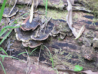
Here, once again, we failed to see a platypus or for that matter any of the aquatic life reputed to live in the creek - maybe next time. What we did see once again was an amazing array of mosses, lichens, molds and fungi an example of which is below.
I was as usual on the lookout for the local bird life, however the significant amount of undergrowth in the forest is rather conducive to hiding any number of small birds, so whilst I could hear them all around, there were few to be seen.
And so we came to the end of the walk and much to the consternation of one queasy stomach, headed once again for the hills, and those winding roads...


Moss and lichen dripping off every available
surface

12 October, 2011

Around the bend

View of the Otways from the Great Ocean Road
near Apollo Bay
And boy did we go round some bends! After saying goodbye to this part of the Barwon for now, we headed to Apollo Bay for the night, winding our way through the Otways down to sea level. In a post not too long ago, I looked at the effect of the Otways on local weather patterns along the river. As we made it to the top of the Otways the effects of the Otway rain shadow hit us head-on.
As I mentioned in my last post, the weather was mild and overcast with an occasional shower along both branches of the river. I was a little surprised then, as we topped the rise, to be confronted by a wall of fog so thick that I could barely see 20m in front of me. The rain shadow was was suddenly very real. All that moist sea air rolling in from the west was hitting the slopes of the Otways and condensing into a thick fog whilst the relatively warm, dry air moving over the top of the ranges was keeping things mild along the Barwon. And the fog really was only at these higher altitudes. By the time we completed our descent, we had left the fog behind and the weather was once again cool and mild.
Koala at Cape Otway
The following day we were headed back into the Otways, but not before we first skirted around them and headed down to have a look at the Cape Otway Light Station which is located at the tip of Cape Otway in the National Park.
It is probably worth noting that the Cape was named for Captain Albany Otway, a friend of the English naval officer who discovered it in 1801 in his vessel the Lady Nelson.
As we wound our way once again through towering eucalypt bushland towards the Cape, we rounded a bend to find a number of stationary cars pulled mostly onto the shoulders of the rather narrow road with their occupants wandering around and in some cases, standing on the roadway.
Coastline at Cape Otway
No, it was not the scene of some horrendous traffic accident, but rather, a koala colony. Having been given the word earlier by a helpful local, we drove a little ahead and pulled into a safer clearing before joining the throngs looking up. Every second tree had its own koala, so there were plenty to go round. As English-speaking tourists we found ourselves rather in the minority here and the same was true at the light station which was our next stop.
Cape Otway is the second most southerly point on mainland Australia and was the first land sighting for incoming immigrant ships during the 19th century. The coastline along this part of the country is rather dramatic and perhaps best described as rugged, so it is easy to see why so many ships came to grief here.
Cape Otway Lighthouse
In response to a public outcry at the number of these shipwrecks in Bass Straight, the government was forced to build lighthouses at various points along the coast. Between 1847 and 1848 therefore, a lighthouse was erected at Cape Otway and then, in 1859 a telegraph station was added to service a subterranian cable running between Tasmania and the mainland. However, the cable foundered after only 6 months and the telegraph station became a signalling station which passed shipping news to Melbourne.
Cape Otway Telegraph Station
Today, the restored building houses a museum whilst the lighthouse - which still serves its original purpose - is also open to visitors. We viewed the museum, climbed the 78 steps of the lighthouse, learnt a little of the indiginous heritage of the area and also took a look at 40 recently acquired paintings of ships significant to the history of Australia.
And then, having seen what there was to see, we departed, heading upwards once again into the mountains for a walk amongst the treetops.


11 October, 2011

The lady of the lake - part 2

Fungi
...and so to our adventure...
The weather was overcast but mild and an earlier shower had cleared, making conditions perfect for a trek up the track and around the lake - something we had failed to achieve on our previous visit. So off we headed.
The walk was not too difficult despite being rather damp underfoot at this time of year. In fact, it was rather damp everywhere. You got the distinct impression that anything which stood still for more than five minutes was likely to end up covered in moss, lichen or some other odd fungus. Just to make sure, we kept up a reasonable pace with me stopping here and there to snap a few photos.
Mossy rocks
The forest through which we were walking seemed to consist mainly of eucalypts and fern, unlike other parts of the Otways where Myrtle Beech trees predominate - but I am no expert on the topic. With three kids in tow I could hear but not see the birds which inhabit the trees so when we reached the foot of the lake, I let them go on ahead and was soon rewarded with some sightings of birds I'd not seen elsewhere on the river: the Eastern Yellow Robin and a single Rose Robin (which have duly been added to my Barwon Birds page).
On the lake itself I also spotted Eurasian Coots and a pair of Chestnut Teal Ducks who had certainly chosen a more spectacular part of the Barwon River system to inhabit than many of their compatriots.
Fungi and moss everywhere
By far however, the most populous birds seemed to be the Grey Fantails. They particularly liked a secluded section - almost a billabong - right at the bottom of the lake. I've never seen birds do somersaults before, but these little guys seemed to be doing just that and were happy to pose for the camera if I was quick enough, as was the Eastern Yellow Robin I spotted a little further up the track.
Of course, in addition to the bird life, there is all manner of other wildlife. I could hear - but not see - a pair of Koalas calling from opposite sides of the lake. Wallabies are reputed to live here too as of course are perhaps the lake's most famous inhabitants - a colony of platypuses. To see them and probably the wallabies too, you need to be around either at dawn or dusk and as it was neither when we were there, no photo-opportunities were to be had on this occasion. Perhaps a late afternoon paddle on the lake in one of the two canoes tied up at the little dock might be in order at some point in the future.
Eastern Yellow Robin
And so after a tangle with some rather nasty stinging nettles, the discomfort of which was relieved by some conveniently located bracken, we made our way up and around the top of the lake. From here we made our way along the conveniently placed boardwalk which presumably crosses the river at some point, although it was impossible to tell exactly where, with all the swampy growth covering the bottom of the valley floor.
From there it was back in amongst the ferns and the gum trees for the walk back to the bottom of the lake where I once again hung back to photograph the locals.
Grey Fantail
On the trek back to the car I could hear and even occasionally see the bird life in the canopy above, however with the exception of a solitary kookaburra, I didn't have much success with the camera. Aside from the foliage providing excellent cover for small birds to hide, it also reduced the light levels to such an extent that it was hard to take crisp, clear shots of anything much. Perhaps I should try for a sunnier day next time.
And so, just as a search party was issuing forth to ascertain my whereabouts, I made it back to the beginning of the track, ready for the next leg of the journey.

10 October, 2011

The lady of the lake - part 1

Or the lake which was named after a lady - perhaps even the Queen, although I can't confirm this. This week-end with the family in tow, I finally made it back to the Otways once again. After a quick detour via the West Barwon Dam, we headed over to the East Barwon and down to the bottom of the walking track which leads to Lake Elizabeth.
Lagoon at Lake Elizabeth

View from the bottom of Lake Elizabeth

Lake views
As I mentioned in a previous post, Lake Elizabeth was formed on 17th June, 1952 when a naturally occurring landslide completely obstructed the East Barwon River for a period of a couple of months before water once again broke through. Then, in August, 1953 after heavy rain, the force of the collected water caused a much larger breach in the dam wall, washing away the top 26 metres. The debris from this breach now lies in pieces along the course of the river whilst the remaining portion of the lake was reduced to about a fifth of its original size.
View from the top of Lake Elizabeth
One of the most striking features of the lake would have to be the numerous dead tree trunks which rise from the waters as a reminder that this place was once just another part of the river valley. For nearly 60 years their skeletal remains have survived drought and flood, giving the lake a rather eerie, abandoned feel.

View from above
On this occasion, the weather was quite still and peaceful, with the exception of a couple of distant peals of thunder which amounted to nothing and with the exception of a couple of walkers on their return journey, we had the place to ourselves...

06 October, 2011

Every heart beats true for the red, white and blue!

In view of the latest stunning win by Geelong in the 2011 AFL Grand Final, I thought it was time to take a look for connections between the Barwon River and Aussie rules football. Not surprisingly, it didn't take long for something to appear.Different websites give different dates for for the establishement of the Barwon Football Club (BFC) - known as the Bulldogs. The website for the current South Barwon Football & Netball Club claims a founding date of 1859, only a few months later than the original Geelong Football Club (GFC). An article appearing in the journal Sporting Traditions (May, 2008) claims an establishment date of 1874.
Both sources agree however, that members of the BFC were drawn from the working classes - the men who worked in the factories along the Barwon - with finance being provided by those who owned the companies. The GFC by contrast was backed by the establishment - the graziers and various private schools in the district. Not surprisingly, the two clubs were bitter rivals, with several games in the 1870s ending in allegations of poor sportsmanship leveled against BFC and biased umpiring favouring GFC. A final match between the two teams in September, 1878 ended in a riot which continued in the streets of Geelong later in the day.
Regardless, both teams competed well against Melbourne teams and also in the Geelong, Ballarat & Western District Challenge Cup.
In 1876, BFC adopted a guernsey with blue and white hoops, but were forced to wear pink sashes to differentiate them from the GFC who as the holders of the Challenge Cup, had priority, having adopted a similar jumper a month or so after Barwon. BFC later adopted light blue jumpers with a red and white V.
The frst Geelong Highland Gathering was held on the "plains
of South Geelong" east of Bellerine St, on or near their eventual
home - the Commun-na-Feinne Reserve, also the home
ground of Barwon Football Club
In 1877, both teams were amongst several clubs who united to form the Victorian Football Association - precursor to the Victorian Football League which formed as a break away from the VFA in 1897.  The success of the BFC and the rivalry between the two teams, forced the GFC to adopt a more professional approach to the game, resulting in significant success for the club during the 1880s, which has continued to the present day.
BFC by contrast began to struggle financially, lasting only a couple of seasons in the VFA. Early records show that they played at the Commun-na-Feinne Reserve (located between Balliang and Fyans Street in South Geelong and bordered on the west by Bellerine Street), as early as 1877 where they beat an undermanned Carlton. They were not allowed to fence the venue, meaning that they could not charge admission to their games - an important source of revenue.
 South  Barwon FC
South Barwon Football
Club jumper
By 1919, BFC emerged once more, establishing itself at Kardinia Park, where it played during the 1920s until at least 1935 as part of the Geelong District Football League/Geelong Junior Football Association. After another hiatus of several years BFC rejoined what was now known as the Geelong & District Football League in 1949 where they competed until 1978, based first at the Belmont Recreation Reserve (training at Belmont Common) and then from 1959 in Highton. In 1979 along with the rest of the 1st Division clubs, they seceded and became the Geelong Football League. By the late 1980s however, Barwon was again struggling financially, so in 1990 it merged with the Belmont Football Club and is now known as the South Barwon Football & Netball Club, based at McDonald Reserve in Belmont. 
The club colours are remeniscent of the old Barwon colours - a blue jersey with a red and a white V around the collar. From its beginnings in the 19th century as the club for those who toiled in the factories which lined the banks of the Barwon River, South Barwon today has evolved into one of the strongest teams in the GFL.