Showing posts with label Geelong Railways. Show all posts

22 June, 2013

The line that wasn't

Okay, one more post on the subject of trains then I promise I'll write about something else but this one is - or could have been - the most relevant of all to the Barwon. Following the implementation of the so called "Octopus Act" of 1884, subsequent bills were introduced to parliament including one which was due to come before parliament in the latter half of 1889 in which a further 4922 miles of track was requested.
Two in particular were of relevance to Geelong and the Barwon. The proposed lines were: Geelong-Lorne (via Barwon Heads) and Geelong-Portarlington, however, despite the mania surrounding the building of railway lines in 19th century Victoria, not every line that was proposed went ahead. Some, like the "Black Line" to Warnambool or the Geelong-Ballarat Line did proceed, but took different routes to those originally suggested. Others, such as the proposed line to Barwon Heads never proceeded, but it is interesting to consider what might have been had they done so.
By the 1880s, Barwon Heads was well established as a summer tourist destination and there were many farmers and fishermen in the area who would benefit from a rail link as would the holiday trippers heading to the coast. This was the argument of those in favour of a Barwon Heads line.
It was envisaged that such a line would be an extension of the already existing branch to the old Geelong Race Course which was located at Marshall. The new track would extend just over 9 miles to the township.

Camping at Barwon Heads in the 1880s, image held by the Victorian State Library
But that was only part of the plan, as there were those who would have seen the forests of the Otways opened up to rail traffic and one suggestion was to extend the Barwon Heads line along the coast crossing Bream and Spring Creeks to Jan Juc, Airey's Inlet and Lorne. Another particularly audacious - but financially improbable - suggestion was to extend the branch line already under construction from Birregurra to Barwon Downs (1889) and ultimately to Forrest (1891) via a tunnel under the mountains to Lorne.
NOTE: instead of these grand plans, the Otways were served by the Birregurra-Forrest branch line and a narrow-gauge line from Colac to Beech Forest. Today, the first route forms the basis of the Forrest "Tiger" Rail Trail, a 30km walking/riding track which is under construction at various points between the two towns whilst the second is now the "Old Beechy Rail Trail".
Meanwhile, back in Geelong, in March, 1890 local members J. F. Levien and Charles Andrews both agreed to support the proposal for the Barwon Heads line in parliament. It was also indicated that the line would immediately open up a limeburning trade in the Barwon Heads area which could be expected to last 50 years. On 18th June a railway construction bill was introduced which included the proposed line. Two days later it was announced that less than 800 miles of the total track applied for by various districts would be built by the government. Amongst those lines chosen was the line to Barwon Heads.
However, the decision was not without its detractors and one Mr Dixon MLA, member for Prahran put it to parliament that:
The line from Geelong to Barwon Heads would not pay for greasing the wheels of the trains either in the present or the future.
Ultimately it seems, the government agreed with him. Almost two years later, despite the initial approval, the matter was put before the number 2 sectional committee of the Parliamentary Railway Standing Committee who convened at the Coffee Palace at Barwon Heads on 22nd January, 1892.
The Coffee Palace, Barwon Heads 1898. The site of today's Barwon Heads
Hotel. Image reproduction rights held by the Victorian State Library
A little over two months later on 31st March the standing committee handed down its recommendations. It was stated that the line to Barwon Heads would be "unremunerative". It was also decided that the proposed branch line from Drysdale to Portarlington was unnecessary as the district was already sufficiently served by the existing Queenscliff line. And that it seemed was that. The issue was not mentioned again in the media and seems to have been completely abandoned.
I can find no on-line information regarding the exact route the line from Marshall to Barwon Heads was to take, but in this modern era of closed branch lines reinvented as rail trails one can only wonder what a Barwon Heads-Geelong rail trail might have been like.
Looking towards the modern seaside town of Barwon Heads
from the Bluff, December, 2012
On the other hand, it is also more than a little concerning to consider (depending on the route taken) what the environmental implications of a railway through the middle of the now internationally listed RAMSAR wetlands might have been.

13 June, 2013

Backing the Black Line

...and so...back to trains...
After the successful construction of both the Melbourne-Geelong and Geelong-Ballarat railway lines, the push was on for a line which would service the south west of the state and it was with this in mind that the line from Geelong to Winchelsea opened in 1876. In following years the line was extended as far as Port Fairy, although the section beyond Dennington is now closed and forms the newly-opened (May, 2012) Port Fairy-Warnambool Rail Trail.
First however, like the Ballarat line, a route had to be chosen. One rejected suggestion was to extend the line via an existing branch to the waterfront on to Limeburners Point, from there heading inland to cross the Barwon River at Breakwater. History shows that this option was not taken up, but in the 1850s, this was by no means certain. Letters to the local media pointed out the benefits of a rail link to Point Henry, enabling the unloading of cargo from vessels unable to cross the sandbar and enter Geelong's inner harbour, prior to the dredging of the Hopetoun Channel which was not completed until 1893.
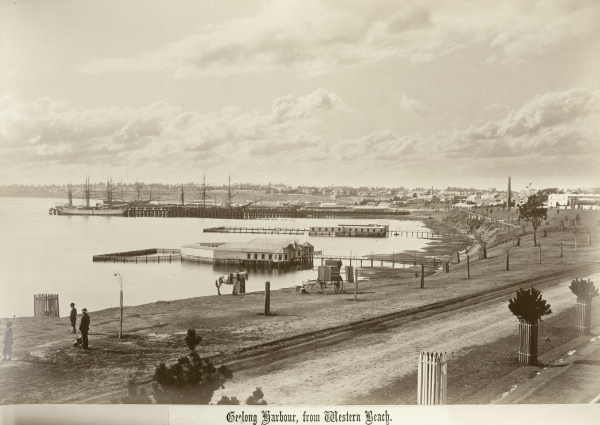
Corio Bay from Western Beach, 1880 showing the Railway Pier (Cunningham
Pier)
This was considered a matter of some importance as both Geelong and Melbourne competed for incoming trade. Routing the line to the south west via Limeburners Point - with a train or tram connection to Point Henry - made economic sense. An extension to Queenscliff where cargo for Geelong could be unloaded directly rather than via Melbourne was also discussed. In 1867 a select committee recommended that a rail line to Colac follow "Corio Terrace" (presumably branching off the existing line to the Railway Pier) as far as "Sydney Place", turn to cross the Barwon at Breakwater and continue on to Germantown (Grovedale), passing 5 miles south of Winchelsea and through Birregurra before terminating on the southern shore of Lake Colac.
By 1873, engineers' reports were being tabled in the Victorian parliament, considering three different options: known as the black line, the red line or the green line. The green line which it seems was favoured by the Commissioner of Railways did not include Geelong at all, but saw a line branch off the existing Geelong-Ballarat line at Leigh Road (now Bannockburn). Requiring only 40 miles of track to be laid but resulting in a total route which was 5 miles longer than the black, it was considered cheaper to construct.
Bannockburn (Leigh Road) Station
From the reports of the day, it seems there was fierce lobbying from all quarters, with allegations of lies, distorted estimates and vested interests claimed all round, however the proponents of the black line won out in the end. This more direct route it was argued, would bring more benefit to more people, opening up vast new landholdings in the process - exactly the claim made by advocates of the green line. The third or red line, deviated somewhat to the north of the black line but does not seem to have been seriously considered by any party.
Having chosen the black line, the major stumbling block was how the new track should leave Geelong. The idea of a rail link to Point Henry seems to have disappeared from the agenda by this stage but a report in The Argus of 9th April, 1873 spells out the various options considered:
With regard to the question of the tunnel for getting out of Geelong the first estimate of its cost was £95,000, but recent surveys showed that a line could be adopted by Fenwick-street, whereby the cost of the tunnel might be reduced to £59,000. Two other lines had also been surveyed - one by the Botanical gardens, in which the tunnel would only cost £64,000, and another by Sydney-place, crossing near the hospital, in which a tunnel would cost £74,000.
Rail tunnel from Geelong Station to McKillop Street
Another point in favour of the black line was that a branch to Queenscliff would be a simple matter if the route through Geelong was chosen. Despite debate over the need for such a line at the time, the coming of the military to Queenscliff, saw the line built only a few years later, opening in 1879
 (see previous post). In addition, a short branch line to the old Geelong racecourse from Marshall opened in 1878 (see this previous post). This would not have been possible had the green line been chosen.
History of course shows which tunnel was eventually built. Then as now, the politicians making the decision were subject to the influence of lobbyists and money but had these forces been otherwise, the landscape of the Barwon  may be very different today.
The decisions made then determined the two points at which rail bridges still cross the Barwon today: Breakwater and Winchelsea, not, as the proponent of the "single great trunk line of railway for Victoria" would have had it (see this post)  at Melville's Quarry near what is today the west end of Noble Street, or at Buckley Falls.
One detail however is not so dissimilar to that suggested in his letter of 1857 where he indicated that the line should run "50 chains" (a little over a kilometre) due south from Geelong Station. The decision to choose the Fenwick Street option saw the line travel due south for exactly that distance, however rather than a sweeping curve to the west "between Newtown Hill and the Barwon" (presumably in the vicinity of West Fyans Street) as proposed, the line as we know headed south east before making a sweeping curve to cross the Barwon at Breakwater.

Vintage Rail steam engine R707 entering the tunnel May, 2013
When all the debate was done and dusted, the first sod on the new Geelong and Colac Railway line was turned by the Mayor of Geelong at a site near Johnstone Park on 24th October, 1874. A holiday was declared, military and civil displays were held for the populace - of whom 5,000-6,000 turned out to witness the event - flags and bunting flew from ships and buildings across town and three cheers were given for the "Black Line".
At a subsequent banquet held for the dignitaries, the expected speeches were made and toasts proposed. It was clearly stated that this was only the beginning and that extension of the line to Queenscliff and Camperdown should be urgently promoted. The mayor it was noted, apologised for the absence of "the members of the ministry and a number of other gentlemen." With the whole event having the distinct air of a victory party for the Black Line, one can't help but wonder whether some of those absent gentlemen were proponents of the green line.
The original timber rail bridge over the Barwon River at Breakwater, 1937,
reproduction rights held by the State Library of Victoria
From this point, building continued apace with the complex and expensive construction of the tunnel and bridge at Breakwater being a priority which took about 12 months to complete, thereby allowing the line itself (thus connected to the existing line) to be used for the transport of materials for further construction.
The original rail bridge over the Barwon at Breakwater was a timber construction some 186m in length and only a short distance further down the line a similar but smaller bridge spanned Waurn Ponds Creek. From this point onwards, the track works were considerably simpler, but no less controversial.
Current Breakwater rail bridge built in the 1960s to replace the original
The second rail bridge across the Barwon was built at Winchelsea, however the original route surveyed for the "Black Line" saw it pass some miles south of Winchelsea, instead favouring selectors on the edge of the Cape Otway forest in the vicinity of Deans Marsh. Once again, the lobbyists were out in force with one scathing critic of the  "Winchelsea Deviation" reported thus in The Argus of 26th January, 1876:
One gentleman wanted to know what Winchelsea had done

"That the claims of the forest should be sacrificed for its aggrandisement. As a township it claimed to be a centre of population, and the father of the shire. He regretted to say it was the centre of a vast area of arid plains, only fit for a few sheep-walks, and scarcely suitable for that; that the few farmers in the neighbourhood had deserted their holdings, and the land for miles around was held in the hands of two or three individuals; and that as a township it had fallen into decay, and only existed in the form of a couple of publichouses(sic), one or two stores, and a few shingle shanties."
In spite of such opinions and perhaps even despite the original route providing a greater boost to the economy, the Winchelsea Deviation was confirmed as the passage of choice. This second section of the track past Freshwater Creek included some 40 bridges and culverts, one being the second crossing of the Barwon at Winchelsea. Like the first at Breakwater, this bridge was a timber construction, but at only 146m in length, shorter than its downstream counterpart.
VLine train from Warnambool crossing the Barwon on the present-day
Winchelsea rail bridge. The first timber bridge was replaced at some point
 by this concrete and steel girder construction
 Finally, after all the debate, significant engineering hurdles and several years of hard work, on 24th November, 1876, the much awaited first stage of the Geelong and Colac Railway was opened to Winchelsea.
A train carrying dignitaries including the Commissioner of Railways who conducted the formalities was dispatched from Melbourne and further notables were collected in Geelong before proceeding to Winchelsea where the residents of the district greeted them with the expected pageantry, speeches and of course, a banquet. The worthies then took a turn around the town before piling back onto the train and heading for home, leaving the good residents of Winchelsea to hold a ball to further mark the occasion.
The following year, the section of track to Colac was completed and - as hoped from its inception - subsequent decades saw the extension of the line to Camperdown (1883), Terang (1887), Warnambool (1890) and Port Fairy (1890). In all, one would have to say, a resounding victory for the supporters of the Black Line.
And now, almost 137 years later as I write this post, I can hear the trains still travelling along the route envisioned by such illustrious names as Levien, Johnstone, Lang, Thomson, Armitage, Sladen, Austin and many more...

04 June, 2013

Walking the line

Following on from my previous post Anticipating the Octopus Act, I thought it might be interesting to look at the route finally chosen for the Geelong-Ballarat railway line and to use some of those photos I've been saving for just such a post. So here it is:
After the opening of the rail link between Melbourne and the growing township of Geelong (population 23,352) in 1857, tenders were taken and in 1858 construction began on the Geelong-Ballarat railway line. The chosen route branching off the Melbourne-Geelong line at North Geelong did not cross the Barwon River as at least one proponent had suggested, instead, it crossed the Moorabool River by means of the  the Moorabool Viaduct  located about 1.5km west of the Geelong-Ballan Road.

The Moorabool Viaduct 1863
The line was officially opened on 10th April, 1862, following the route we know today. It remained the only rail link from Melbourne to Ballarat until 1889 when a direct line between those two cities was opened.
The 86km of line from Geelong to Ballarat was built to the highest engineering standards of the day and in addition to the viaduct, included a number of bridges crossing roads and creeks.

Rail bridge near Moorabool station
Not surprisingly given that the line passes across one of the world's largest volcanic plains, the predominant building material was bluestone, examples of which can still be seen right along the line.

Double-arched bluestone bridge carrying the Geelong-Ballarat rail line across
Cowies Creek and Bluestone Bridge Road at Lovely Banks
Stone for the construction was quarried at Lethbridge, which township the line passed en route. During construction of the Lethbridge section of the line, workers lived in tents at two camps along the line. One was located a few hundred metres north of Lethbridge station. The other, about 3km south and a little east of Lethbridge, was situated on the banks of Bruce's Creek (a tributary of the Barwon River) just to the south of a bluestone rail bridge which crossed the creek on the property owned by my grandfather (Jack Stevenson) about a century later.

Lower Camp Bridge, outside Lethbridge
Today I took a walk up the line from Lethbridge Station and snapped some photos.
The bridge was known to locals as Lower Camp Bridge, presumably after the men who built it. Rivalry between the two camps was strong, both on the sporting field of a Sunday afternoon and in their bridge-building prowess. Attention to detail can be seen in the finish of the stonework on the bridges near Lethbridge. Perhaps I'm biased, but the detail of the Lower Camp Bridge does seem somewhat greater.

Road bridge on Quarry Road, Lethbridge


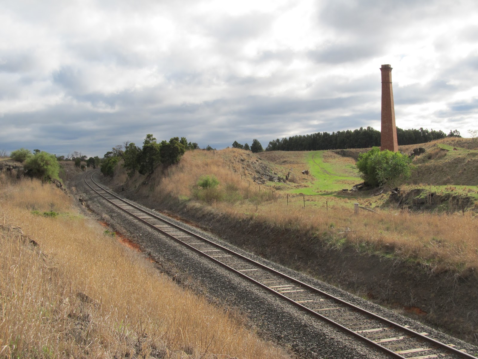
Remaining chimney at the quarry from which stone was cut for the
Geelong-Ballarat railway line (later Nash's Quarry)
Rail bridge over O'Connor Road, Lethbridge
By comparison, the bridge across Bruce's Creek on Russell Street in town is a much simpler construction. Whilst not part of the railway infrastructure, it was built by the railway to allow access to their works.
Bridge over Bruce's Creek on Russell Street, Lethbridge
Initial stations - also of bluestone - were erected along the line at Moorabool, Lethbridge, Meredith, Lal Lal and Yendon (Buninyong). Later stations were added to the line at Geringhap, Bannockburn, Elaine, Navigators and Warrenheip. The stations at Moorabool, Bannockburn, Lethbridge, Meredith and Lal Lal remain standing today:
Moorabool Station April, 2012
Bannockburn Station April, 2012

Lethbridge Station April, 2012


Meredith Station April, 2012
1The Geelong-Ballarat railway celebrated its 150th anniversary in April, 2012 with an open day and special vintage rail service. Freight traffic for Mildura continues to travel via the Geelong-Ballarat line however, passenger services were suspended in 1978. A recently concluded study looked into the feasibility of re-introducing a rail passenger service between Geelong and Ballarat, extending to Bendigo via Maryborough and Castlemaine. It was estimated that such a project would cost almost $1 billion to implement with ongoing running costs of $17 million per year and was unlikely to receive funding however, some within political circles are not quite willing to write the subject off just yet, pointing out that figures for the Geelong-Ballarat section of the line alone may be more economically viable...

Anticipating the Octopus Act

This blog post has been a while in the making - over 150 years in fact - and it begins at a time when decisions were made which created the city of Geelong and the landscape of the Barwon River as we know it today. But it could have been so much different.
On Sunday, I was alerted to the presence of a steam train in town when I heard its whistle at South Geelong Station and zipped off to snap a few pics. Over the years, I have collected snippets of information and photos of Geelong's rail heritage (some of which has already appeared on this blog), but in some cases wasn't sure of their relevance to the Barwon.
R707 City of Melbourne steam train Melbourne bound
Then, a few weeks back whilst researching a previous post, I came across a newspaper article from the Bendigo Advertiser of 1857 which gave me the excuse I needed.
This was a time when Victoria's railways were in their infancy.  By the end of the 19th century a network of train lines would sprawl across the state, their development supported by the government in the form of the so called "Octopus Act" of 1884 which legislated for the construction of 59 new railway lines. But in 1857 this was yet to come and debate raged over what form any future development should take.
The privately-funded Melbourne-Geelong railway line was about to open and there was increasing agitation from other regional centres - particularly Ballarat and the Goldfields - to have rail links of their own. But what routes would the new lines follow? After all, easy access to rail services could make or break the future of small rural towns which meant that there was some fierce lobbying before a final decision was made.
In particular, competition for trade and services between the growing urban centres of Melbourne and Geelong was strong as they vied to attract the riches flowing from the Goldfields of Ballarat and Bendigo and the wool of the Western District. Ultimately, strong influence by interested parties from Geelong, combined with a 20km shorter distance than that to Melbourne ensured that the government elected to run the line to Ballarat from Geelong. This section of track was completed in 1862 and is the subject of a subsequent post.
A photograph of an earlier depiction of the Geelong railway station by S.T. Gill
In 1857 however, this outcome was by no means assured and various different track alignments were under discussion. One of the hottest topics of the day was the idea of a single "great trunk line of railway for Victoria" which, starting in Melbourne, would then need to take in the towns of Geelong, Ballarat, Bendigo and Castlemaine - presumably with branch lines to service outlying areas.
One example of how a trunk line might run was published in the form of a letter to the editor of the Geelong Advertiser and reprinted in the Bendigo Advertiser on 11th April, 1857. The author of the letter felt that a trunk line could best be achieved in this way:
Starting point from the metropolis, Melbourne, and using the Geelong and Melbourne line from Melbourne to Geelong, which we may say is already constructed and ready for continuation. 
Starting point from Geelong, due south, 50 chains from the present station, then taking a sweep to the westward along the flat land between New Town Hill and the Barwon to the point known as Melville's quarry, crossing there, thence proceeding along the point at the foot of the Barrabool Hills, crossing the Barwon at Buckley's Falls, thus arriving on the flat plain land in the short distance of about three miles and a-half; then taking a straight direction west by north to Meredith; from Meredith west by south, half west to the course of the river Yarro Wee, better known by the name of the Leigh, crossing the same at the junction of Williamson's Creek, travelling along the level land by the side of the Creek, south of Buninyong, Green Hills, and Hard Hills, rising on the table land in the immediate neighbourhood of Winter's, going along the level land, through Sebastopol and White Horse, to a grand western station situated on the level land between the township of Ballaarat and the swamp, thus crossing the dividing ranges without any difficulty of any importance, the highest point yet attained being the station of Ballaarat; preventing extra rising to the extent of 200 feet, which is the fall from the saddle of Warrenheip to the township of Ballaarat...
The proposed site of a rail bridge across the Barwon below Queen's Park
He went on to detail the route to Castlemaine and Bendigo also suggesting locations for stations along the route as follows: a station at the second  crossing of the Barwon (Buckley Falls) would service farmers in the Barrabool Hills and Murgheboluc, a second at Lethbridge would be closest to Steiglitz and farm land along the Moorabool with a third at Meredith and a fourth on the Leigh River to the south of Buninyong to allow access to the goldfields. Subsequent stations along the line would be located at Ballarat, Coghill's Creek, Deep Creek, Lodden, Harcourt and Sandhurst. This route he claimed, would be the flattest and the cheapest, requiring less infrastructure than other proposed routes.

Looking downstream towards the site of a second rail bridge proposed for
the Barwon River in 1857. The paper mill was built at about this point in 1875
The final paragraph of the letter then addresses the previously unstated issue of competition between Geelong and Melbourne, declaring:
It cannot be anything but a want of knowledge of the country, or jealousy of the metropolis of the infant town of Geelong...[which would cause the rail route to be aligned other than as stated in his letter].
In the event, the authorities of the day did not agree entirely with this vision for the future of Victorian rail and so the line to Ballarat branched off the Melbourne-Geelong line at North Geelong, crossing the Moorabool River instead of the Barwon. Stations were located at Lethbridge and Meredith, however, rather than extend the track beyond Ballarat, a separate line was built from Melbourne to Castlemaine and Bendigo. Completed by 1862, perhaps it ensured that this trade at least passed through the port of Melbourne.
As for the Barwon, it would remain without a rail bridge for several more years.


10 November, 2011

Branching out - the viaduct

The Moorabool Viaduct
Due to the apparent success of my two previous blog posts, I thought I would continue with my Moorabool theme for a while longer yet. Apart from providing some fresh material for  my posts, the water from the Moorabool does after all, end up in the Barwon.
Yesterday, in addition to my wander along the river, I visited a location where I couldn't actually see the Moorabool. I could however, see the tree-lined course it followed and I could most certainly see the impressive historical structure which carries rolling stock across the river.
This of course is the Moorabool Viaduct - a ten span, bluestone and steel structure built as part of the Geelong to Ballarat train line which opened in April, 1862. Designed by the civil engineer George Christian Darbyshire, it measures 442 metres in length and spans the Moorabool Valley near the small township of Moorabool. The line - also designed by Darbyshire - was originally opened to provide transport for both freight and passengers to and from the goldfields of Ballarat and was also the only rail route between Melbourne and Ballarat until a direct line was opened in 1889.
Bluestone Bridge Road, Lovely Banks
In 1918, the viaduct underwent substantial strengthening works, being rebuilt with steel under the supervision of civil engineer Frederick Esling and I believe has recently undergone further minor strengthening works to allow for the re-laying of a second - standard gauge - line running initially as far as Moorabool Station, with the intention of extending to Geringhap.
In addition to the viaduct, there are some ten smaller bluestone bridges which span various roads and watercourses along the line, including the double-arched bridge over the unsurprisingly named Bluestone Bridge Road and Cowies Creek, in Lovely Banks. Like these bridges which utilised locally quarried stone, the original station buildings which line the route are also constructed from bluestone. However, with no passenger trains using the route they are now in private ownership.

03 April, 2011

Still on the rails...

Perhaps not surprisingly, disused railway lines provide excellent opportunities for councils and local communities to develop nature trails and linear parklands and as I discussed in my last post, this is the case in Geelong. Of course, the old line to the cement works is not the only linear park in the region and not even the first I discovered as a result of my perambulations.
Queenscliff Station
Nor is it alone in linking to the Barwon and the network of trails across Geelong.
A much more extensive and so far, better developed, linear park is the Bellarine Rail Trail which extends essentially from Swanston Street in South Geelong (which in turn links via the bike lane to the Barwon), all the way along the old Queenscliff line, through Drysdale to the little seaside town of Queenscliff.
The trail follows the route of the former South Geelong-Queenscliff railway line which was constructed in 1878/1879 primarily to service Fort Queenscliff. The new line enabled the movement of troops and supplies back and forth from Melbourne. The Fort was a key stronghold in the defence of the capital during times of war, being located at the narrow entry point into Port Phillip Bay.
Steam train at Queenscliff Station
At the same time, Queenscliff was - and from its establishment in 1852 - always has been a tourist destination and the railway line also serviced this industry as well as providing transport for the permanent population. Whilst it was never the busiest of lines, it was none-the-less and important link in Victoria's rail network, serving the Bellarine Peninsula through various changes in fortune until its final closure in 1976.
Almost immediately, the Geelong Steam Preservation Society stepped in and from 1979 ran the line from Queenscliff, initially to Laker's Siding and then to Drysdale as a tourist facility with their base of operations being Queenscliff. The service continues to run to the present day using steam and diesel locomotives to pull the heritage carriages between Queenscliff and Drysdale.
The Bellarine Rail Trail
near Leopold
It has been suggested that it might be possible to extend the rail service as far as Curlewis in the future, however that is a distant goal.
Interestingly, the railway has recently acquired three engines from the Puffing Billy museum. Two of these spent their working lives on the privately-run "Fyansford Cement Line" which carried limestone from the quarry below to the cement works above for storage or transport on the Fyansford branch line. Beside the Queenscliff line some distance outside of Drysdale, is a siding which stores rollingstock, including as it happens, a number of goods wagons also from the cement line.
Further information on the Bellarine Railway can be found at the following address: http://bellarinerailway.com.au/
Engine built by the Vulcan Iron Works
which worked at the Fyansford cement
works, now at the Bellarine Railway
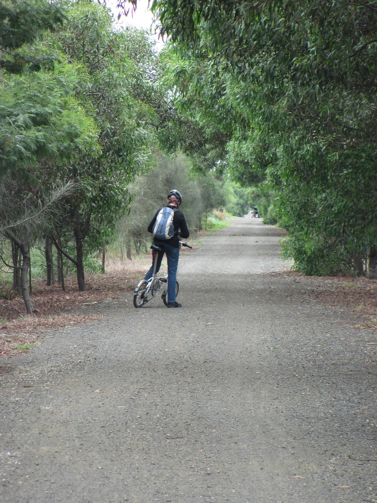
Whilst the train runs only between Drysdale and Queenscliff, for those more interested in riding, running or walking, the good news is that the Bellarine Rail Trail - as mentioned - extends the entire distance from Geelong to Queenscliff through the surrounding countryside and the outskirts of Geelong.
At one time or another I have covered all of the trail either by bike or running. I have run the trail from Queenscliff to Drysdale on three occasions in various weather conditions - including this January through mud, rain and puddles. The terrain is undulating and scenic being both coastal and rural with the usual array of bird and plant life, complemented by sheep, cattle, horses and hay bales. On each occasion I have run to Drysdale then caught the train back to Queenscliff with various family members.
A year or so ago I also ran the remainder of the trail from Drysdale to South Geelong and then home on one occasion (also in the rain as I remember) and in recent weeks have cycled the trail from the Bellarine Highway to Drysdale and back.
The trail along most of its length is a loose gravel path, however there are sections through the outskirts of Geelong, Leopold, Drysdale and the approach to Queenscliff which are surfaced with bitumen. Up to Drysdale, the trail predominantly runs along the original line of the rails, however beyond Drysdale the path runs beside the railway line, crossing back and forth at various points.
Hereford cow outside Drysdale
Whilst as I mentioned, I have covered the entire distance at one time or another, I have yet to do it continuously either riding or - a goal I have long harboured - running. The distance from the Showgrounds in South Geelong to Queenscliff Station is around 34 kilometres, about 11 kilometres further than my longest run to this point, but one of these days...
Along all sections of the trail there are road crossings, however most are small, rural roads posing no real difficulty either riding or running. The two major road crossings I believe now have traffic lights. Despite this, a "training run" which was staged annually in about September running the whole distance of the trail has in recent years been changed to an out-and-back run between Queenscliff and Drysdale; the same distance as
the original run, but without the bragging rights of the former.
Details concerning the Bellarine Rail Trail and the Friends of the Bellarine Rail Trail group can be found at the following site: http://www.fbrt.com.au/fbrt/main/home.asp


01 April, 2011

Riding the rails...

...well, the rail trails that is!
Whilst I run, walk and ride the sections of the river from Breakwater to Baum's Weir fairly regularly and have done for some years, I do occasionally venture further afield for a change of scenery. Of late, I have been riding more often and as a result of being able to cover more distance, have been looking for other tracks and trails to ride.
I have started by revisiting several of the tracks which I have run in the past: the Bellarine Rail Trail, the track to Waurn Ponds, the linear park running along the disused train line from the cement works to North Geelong, the Waterfront. All of these are - or have the scope to be - excellent community facilities for those wishing to run, walk or ride effectively from one side of Geelong to the other. 
Looking at the cement works across the junction of
the Barwon and Moorabool Rivers at Fyansford
And they all have one important feature in common: at some point, they all link, or will eventually link to the Barwon River.
So, with this in mind, yesterday's excursion stemmed from a couple of runs I'd done in the past and a desire to prove that I could run up "Cementies Hill" (the hill which runs up from Fyansford past the now decommissioned Australian Portland Cement works).
My original run in January of 2010, took in the river up to Fyansford, the hill and part of the old railway line running between the cement works and the docks. This line has not been used since the closure of the cement works, but a walking/riding track now runs beside the line. Much of the infrastructure is still present including the rails and signage.
Originally opened in 1918, the line ran from the cement works to North Geelong where it connected with the Geelong-Ballarat line, servicing the cement works and also providing a public goods service. Incidentally, Australian Portland Cement also ran their own private 3'6" gauge railway from 1926 which serviced the quarries, carrying limestone up to the works. When the line closed in 1966 the one diesel and six steam engines were preserved in various museums. Today, five of the six steam engines are in the keeping of the Bellarine Railway and some are used to pull the tourist train which runs between Queenscliff and Drysdale (see my subsequent blog).
Railway sign, Herne Hill
But now, back to my ride! From the cement works, I headed up Church Street to connect with the Waterfront to take me around to Limeburner's Point before working my way back home via East Geelong. All up, about 20km. Not quite half marathon distance. As far as runs go, it is a somewhat scrappy, disjointed route with several road crossings which make it difficult to get a decent rhythm going. From a cycling perspective it is not too bad, providing either off-road trails or on-road bike lanes the majority of the way.
What would be ideal is a complete loop for walking, running and riding linking Fyansford with the Waterfront and on the other side of town, the river to the Waterfront. I know this is under consideration by the powers that be, however it has yet to be fully implemented.
In September 2010 when the World Championship Cycling was on its way to Geelong, there was a significant amount of action around the trails. Various parts of the river trail were resurfaced, new signage was put in place and the beginnings of a shared footpath/bike track was installed on Swanston Street between the river and Fyans Street. This was a great improvement. The problem however, was the way the remainder of the link to the Waterfront was to be achieved. A Copenhagen style bike lane with a cycling lane running between the footpath and parked cars was mooted and rejected. Local residents and businesses had concerns about changes to the availability of parking which is already at a premium in the area. This idea was shelved.
Over subsequent months, an on-road bike lane was marked out as far as Kilgour Street and the necessary changes made to the footpath structure. The paint rapidly faded and nothing else happened. In recent weeks however, the paint has been re-applied and and new markings now take the lanes as far as the McKillop Street intersection. Great! But what now?
Over the last few months I have made regular use of the bike lane to the river but on Tuesday as I was riding to the Waterfront felt somewhat vulnerable without my paint barrier. I can only hope that there is enough cash in the budget to take the road markings as far as the Waterfront in the not-too-distant future. But of course, funding may not be the only issue. As far as I am aware from the local media, a decision was still to be negotiated as to exactly what form the remainder of the trail would take.
Lewis Bandt Bridge across the Moorabool Valley on the
Geelong Ring Road
At the other end of my proposed loop, things may be looking a little brighter, partly because some of the required infrastructure is already in place. An off-road track runs up the hill to the cement works. It is in good condition and connects conveniently with the river trail at the bottom and with the linear park at the top - assuming you have the lung capacity to make it up the hill, or the nerve to make it down. It is quite steep. I have heard several tales from more than one generation of those occasions when making it to the bottom didn't quite go as planned. Having said that, there is seating at the halfway point for those who need it, and the view is panoramic, taking in the nearby quarry and parts of the Moorabool Valley, including the newly-built Lewis Bandt Bridge on the Geelong Ring Road which pays tribute to the Geelong inventor of that iconic Australian vehicle known as the "ute". The following link provides an interesting description of how the ute came into existence: http://www.fastlane.com.au/Features/First_ute.htm
After making it to the top by whatever means, the linear park begins just a short distance across McCurdy Road. This section of the old railway line extends to the Church Street intersection where a road crossing is required. Its name acknowledges the achievements of Barcelona Olympian walker and local girl Gabrielle Blythe. This, incidentally, is only a short step from the new track which was built alongside the Ring Road. I have yet to investigate this track but when I do, it will probably form part of a future blog.
For now, let's continue with the linear park. The entire path is bitumen-sealed and follows along beside the rails which are still present, however a recent article in the Geelong Times informs me that this is not to be the case for long as the sleepers and rails are to be removed within months. What then happens to the land does not seem to have been clearly decided.
Tom McKean Linear Park
We can only hope that the plan is to continue the already substantial planting and perhaps undertake an upgrade of the track which is suffering from root-damage in some places. In general, the path passes behind houses in the suburbs of Herne Hill and Hamlyn Heights and after reaching Church Street becomes the Tom McKean Linear Park (another Geelong notable citizen whom I believe was a teacher), passing across the Midland Highway and stopping at Thompson Road.
This crossing is the busiest of the three and would be well served if the nearby pedestrian crossing were to be moved to the same location as the path. By now, we are in North Geelong and the scenery is significantly less residential and proportionally more industrial. There is less in the way of tree plantings, but this could be rectified.
It also occurred to me that a lengthy concrete wall could provide an interesting opportunity for a sizeable mural presenting a topic or topics relevant to the area and to the park itself. Also present along the course of the track was the usual array of bird life found in the urban woodland areas of Geelong which could no doubt be encouraged by further native plantings.
Unfortunately at this point, the trail comes to an abrupt halt at Douro Street in North Geelong and it is here that things become complicated. As the crow flies, we are no more than one kilometre from Corio Bay or a little under two kilometers from the end of the bollard walk around the Waterfront at Rippleside Park. However, between Douro Street and the Waterfront is a significant obstacle in the shape of the Geelong to Melbourne railway line, the Princes Highway and some fairly heavy duty industry. How exactly a walking/cycling path would pass through such an area remains to be seen. The present on-road option is to use the bike lane on Church Street, however this is not exactly a scenic, low-traffic alternative.
I have read of various potential plans including developing the track which extends around the coastline to Limeburner's Bay and beyond to Lara. I'm not sure if any of these options approached the issue of a connection to the linear park, however such an option would be a tremendous boon to the community and to the tourist industry generally.
Corio Bay
In the case of my most recent ride, I turned around at Douro Street and headed back the way I had come, however, having reached Corio Bay by whatever means and wanting to continue the loop, the cyclist, jogger or pedestrian can follow the path which runs around Corio Bay, passing the CBD and a variety of cafes and restaurants suitable for a leisurely lunch or a coffee and taking in the renowned bollards along the way. At Eastern Beach you can stop for a swim at the beautifully preserved art deco bathing facility before following the trail around to the Eastern and Botanical Gardens or, to complete our loop, rejoining Swanston Street and heading back to the river.
In the shape of the Barwon and the Waterfront, Geelong has two recreational facilities of international standard. Connecting them via nature trails of benefit to both locals and tourists alike would be of inestimal value to our city.